

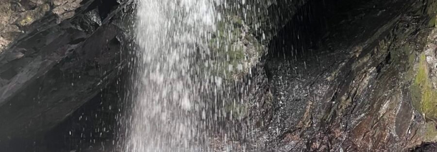
Water falls through a circular hole in the rock and drops into a pool below. That’s it. That’s the whole thing. It’s one of the stranger waterfalls in Utah and one of the easiest to reach. Donut Falls sits in Big Cottonwood Canyon about 9 miles up from the canyon entrance, inside the Uinta-Wasatch-Cache National Forest. The trail is 1.5 miles round trip with 300 feet of gain through aspen and pine forest along a creek. The waterfall itself is the main draw, a natural circular opening in the rock that frames the water as it drops. The effect is exactly what the name suggests. The final approach involves a short scramble over wet rocks that makes this slightly more interesting than a standard boardwalk nature walk. I’ve taken first-time Utah visitors here before pushing them toward bigger canyon hikes. It delivers on a short timeline and it’s genuinely memorable. Here’s everything you need to hike Donut Falls.
Quick Facts
| Trail Name | Donut Falls Trail |
| Location | Big Cottonwood Canyon, Uinta-Wasatch-Cache NF, Salt Lake City, Utah |
| Coordinates | 40.6476, -111.6481 |
| Distance | 1.5 miles (round trip) |
| Elevation Gain | 300 feet |
| Difficulty | Easy |
| Time | 1-2 hours |
| Dogs Allowed | No (protected watershed) |
| Fee | None |
| View on Alltrails | |
How to Get There
From Salt Lake City, take I-215 south to exit 6 (6200 South). Head east on 6200 South, which becomes Wasatch Boulevard. Follow Wasatch Boulevard to the Big Cottonwood Canyon entrance and continue up Big Cottonwood Canyon Road (UT-190) for approximately 9 miles. The trailhead parking area is on the left side of the road just past the Jordan Pines Picnic Area. Look for the Donut Falls Trailhead signage. Drive time from downtown Salt Lake City is about 35 to 45 minutes.
Parking Information
The Donut Falls trailhead has a designated parking lot that’s larger than most canyon trailheads. It still fills on summer weekends, particularly midday. Arriving before 9 a.m. or after 3 p.m. usually secures a spot. Portable restrooms are available at the trailhead, which is a notable amenity for a canyon trail. Overflow parking runs along the canyon road but follow posted restrictions carefully. 
Cell Service and Navigation
Cell service in Big Cottonwood Canyon is unreliable by 9 miles up the road. Download your map offline through AllTrails before leaving the valley. The trail is well-marked and the creek is a consistent navigation reference. The main concern is the scramble section near the falls where the footing demands full attention and having a GPS track confirms you’re on the right line. Check the weather before heading in. The canyon trail involves creek crossings and wet rock near the falls that deteriorate significantly in rain.
What to Expect on Donut Falls Trail
The Forest Trail
The trail starts at the parking lot and follows Mill B South Fork creek through a dense forest of aspen and pine. The path is well-maintained and the creek runs alongside or nearby for most of the approach, audible throughout. The forest canopy keeps the trail cool even on warm summer days. The ascent is gentle through the forest section. Wildflowers line the trail margins in late spring and early summer. Wildlife is active in here early in the morning.
The Falls Scramble and Donut Falls
The final approach to the falls requires scrambling over boulders and creek rocks. Wet rock is slippery and the scramble section is where most people who slip actually slip. Wear shoes with grip. The falls appear at the end of the scramble. Water drops through a natural circular hole in the rock face, creating the donut effect that gives the trail its name. The opening is wide enough to walk behind the falls and look out through it, which is the obvious move. The pool below is cold and clear. The surrounding rock walls are moss-covered and the canyon narrows here in a way that makes the whole scene feel enclosed and dramatic despite the short approach. 
Trail Difficulty and Length
Donut Falls is 1.5 miles roundtrip with 300 feet of elevation gain. The easy rating is accurate for the forest trail section. The rock scramble near the falls bumps the difficulty slightly for anyone not comfortable on wet, uneven terrain. Families with young children should assess the scramble before committing. Budget 1 to 2 hours. The falls are worth sitting at for a while before the return.
Dog Friendly?
No. Big Cottonwood Canyon is a protected municipal watershed. Dogs are prohibited throughout to protect water quality. Millcreek Canyon, one canyon north, allows dogs on odd-numbered calendar days with a leash requirement and has solid trail options at multiple difficulty levels.
What to Bring
Trail shoes with grip for the rock scramble near the falls. This is not a sandals trail, particularly if the rocks are wet. At least 1.5 liters of water per person despite the short distance. A light layer for the shaded canyon and the cool air near the falls. A camera because the donut hole framing of the water is genuinely unusual and worth photographing. A wide-angle lens captures the full rock opening and the water through it. The wet environment near the falls means a waterproof bag or case for electronics is smart. Microspikes in winter when the scramble section ices over. 
Best Time to Hike Donut Falls
Late spring (May through June) and summer are the primary windows. Snowmelt from May through early June gives the falls their strongest flow, which makes the donut effect most dramatic. Summer is warm in the valley but the canyon stays cool and the trail is busy with good reason. Fall turns the aspen gold in late September and early October. The trail is technically accessible in winter but the scramble section ices over and the creek crossings become significantly more hazardous without microspikes and careful footing. For photography, the falls photograph best with a wide-angle lens positioned at the base of the donut opening to capture the circular frame and the water dropping through it. Morning light works best before the canyon shadow shifts. A neutral density filter gives you a long exposure to smooth the water. Overcast days are actually excellent here because the diffused light eliminates harsh shadows on the moss-covered rock walls surrounding the falls.
Rules and Regulations
Donut Falls is in the Uinta-Wasatch-Cache National Forest inside the Big Cottonwood Canyon watershed. No dogs, no swimming or wading in the creek or pool, no fee. Leave No Trace fully applies. The scramble area near the falls sees heavy foot traffic and the rock and surrounding vegetation are more fragile than they look. Stay on established rock lines and don’t trample the streamside vegetation. Check the Wasatch-Cache National Forest site for current conditions and any closures before heading out, particularly after significant rain events.
Where to Stay Near Big Cottonwood Canyon
Sandy and Cottonwood Heights have chain lodging within 20 to 30 minutes of the canyon entrance. Salt Lake City has the broadest inventory. For hotel points check Marriott Bonvoy, IHG Rewards, and Hilton Honors. Brighton and Solitude resort lodging at the top of the canyon puts you 9 miles from the Donut Falls trailhead and eliminates canyon traffic on summer mornings.
Camping Nearby
Redman Campground in Big Cottonwood Canyon is the primary established option, reservable through Recreation.gov and about 5 miles above the Donut Falls trailhead. Jordan Pines Picnic Area, immediately adjacent to the Donut Falls trailhead, has day-use picnic facilities. Dispersed camping is not permitted in the watershed canyon. For camping closer to the city, check Big Cottonwood Canyon established sites through recreation.gov.
Nearby Adventures
Big Cottonwood Canyon has serious hiking above and around Donut Falls. Lake Blanche is the marquee objective, a 6.2-mile round trip with roughly 2,800 feet of gain to one of the most scenic alpine lakes in the Wasatch with Sundial Peak rising directly above. Twin Lakes Trail connects to a scenic overlook of the Twin Lakes Reservoir for a moderate extension. Willow Heights Trail offers a shorter forest loop with mountain views. At the top of the canyon, Silver Lake Loop is a flat 0.9-mile boardwalk around a mountain lake at Brighton that pairs naturally with Donut Falls for a full canyon day. The Lake Mary, Martha, and Catherine loop extends the Brighton area into a longer alpine lake route. One canyon south in Little Cottonwood Canyon, Cecret Lake (2.0 mi / 400 ft) at Albion Basin delivers an alpine lake and wildflower meadow experience at a similar easy-to-moderate effort level. Lisa Falls in Little Cottonwood Canyon is a 0.2-mile stop at a granite waterfall worth stacking onto a canyon day.
Plan This Hike
AllTrails has Donut Falls with a downloadable map and recent user conditions. Checking recent reports is particularly useful for understanding current water levels and scramble conditions, which vary significantly by season and recent weather. View on Alltrails AllTrails Pro is worth it for offline maps in Big Cottonwood Canyon where cell signal is unreliable. Download maps before you lose signal near the canyon entrance.
Chase the Quiet
Water through a hole in a rock. It sounds like a novelty and it is, but it’s also genuinely beautiful in a way that photographs don’t fully capture. The rock around the opening is covered in moss, the pool below is cold and clear, and when you duck behind the falls and look out through the circle, the world outside it frames itself like something intentional. Donut Falls is one of the few hikes you can do with someone who doesn’t hike and have them legitimately glad they went.
Support the Adventure
To make your walls less boring, check out my photography portfolio and bring a piece of the wild and my story into your home. If you’d like to fuel future adventures, you can donate a coffee on Ko-Fi. Every cup keeps me chasing sunrises and stories. When you shop using my affiliate links, every click helps support this blog at no extra cost to you. It’s a small way to keep Unicorn Adventure alive and kicking while I keep exploring. Subscribe to my mailing list for future updates, new stories, and behind-the-scenes adventures. Stay connected with me on Instagram and Facebook for more photos and daily inspiration. Thanks for being part of the journey, Unicorn Squadron!

Theo Maynard is a landscape photographer and adventure blogger based in Salt Lake City. He chases remote desert and mountain light across the American West, documents it all solo, and shares the journey through Unicorn Adventure. He’s on the autism spectrum, and that’s not a footnote, it’s the whole story. He creates to inspire others to get outside, chase what lights them up, and live their best possible life. Unapologetically himself.