

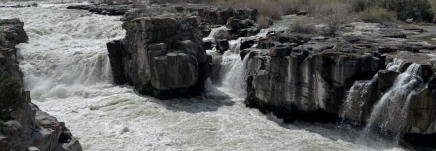
Cauldron Linn is a site on the Snake River in Jerome County, Idaho, where the river narrows and crashes through a basalt gorge to create the churning whirlpool effect the name describes. The access involves a short walk from a gravel road parking area to the canyon viewpoint.
This is an Oregon Trail historical site: the Wilson Price Hunt party of the Astorian Expedition passed through here in 1811 and several members of the party were lost in the churning falls. The canyon’s name references that event. The historical context is as distinctive as the geological spectacle at the site, and it’s worth developing for readers who are passing through the Jerome County / Hagerman Valley corridor.
Quick Facts
|
Site Name |
Cauldron Linn (also spelled Cauldron Lynn) |
|
Location |
Jerome County, southern Idaho |
|
Coordinates |
|
|
Distance |
Less than 1 mile roundtrip |
|
Elevation Gain |
~25 feet |
|
Difficulty |
Easy |
|
Time |
20-45 minutes |
|
Dogs Allowed |
Yes, on leash |
|
Fee |
Free |
How to Get There
From Hazelton, Idaho (on I-84 at Exit 194, about 20 miles east of Twin Falls), take ID-25 east to 1500 E Road. Turn right and head south. Follow the rural roads toward E 3700 N, which transitions to 1700 E leading to the parking area near the canyon. The road is gravel but generally accessible to standard vehicles in dry conditions. Drive slowly on the gravel approach.
From Twin Falls: take I-84 east approximately 20 miles to Exit 194 (Hazelton/Eden) and follow the directions above. The total drive from Twin Falls is about 30-40 minutes. From Boise: I-84 east about 2.5 hours. Cell coverage is limited in this rural area; have the GPS coordinates loaded before leaving paved road.
Parking Information
Small gravel parking area near the trailhead. No fee. No facilities. No amenities nearby. The site is remote; bring everything you need including water, snacks, and emergency supplies before leaving the main road. Let someone know where you’re going before visiting a site this isolated.

Cell Service and Navigation
Cell coverage is limited in Jerome County’s rural eastern areas. Load the GPS coordinates and AllTrails offline map before leaving Twin Falls or the I-84 corridor. The gravel road approach has turns that benefit from GPS confirmation; the printed coordinates should be in hand before you lose coverage. Download AllTrails offline before departing.
What to Expect at Cauldron Linn
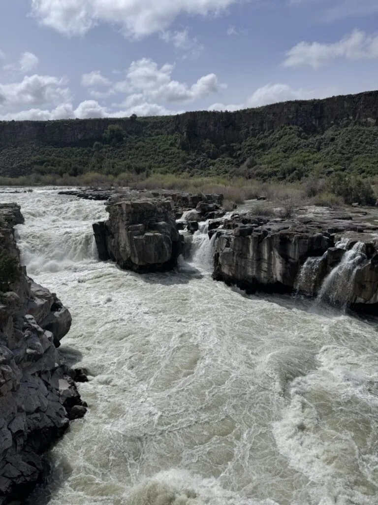
The short walk from the parking area leads to the canyon overlook where the Snake River narrows dramatically and crashes through a constricted basalt gorge. The ‘cauldron’ effect, the churning, swirling vortex the water creates as it forces through the narrow rock, is most dramatic in spring during high water following snowmelt. In late summer and fall, the irrigation draw on the Snake River reduces the volume significantly.
The canyon walls are basalt, the same volcanic rock that characterizes the entire Snake River Plain. The contrast between the flat sagebrush plateau you approach across and the sudden deep gorge below the rim is the visual signature of this landscape throughout Jerome County.
The historical weight of the site is present if you know it. The 1811 Astorian Expedition under Wilson Price Hunt attempted to navigate the Snake River here. Several men drowned in the falls. The expedition abandoned river navigation after Cauldron Linn and continued overland. The site is one of the documented encounters between American explorers and the landscape that defines the Snake River Plain today.
For photography: the canyon is most dramatic in morning light from the east, which illuminates the gorge and the churning water below the rim. Spring high-water visits produce the most powerful water motion. Wide-angle for the full canyon and water context, mid-range for the gorge wall and water detail.

Trail Difficulty and Length
Easy is accurate; the terrain is flat to the canyon rim with no technical challenges. The rocky and sometimes slippery conditions near the water’s edge require care but no special equipment.
Dog Friendly?
Yes. Dogs are welcome on leash. The terrain is comfortable for most dogs. Keep dogs away from the canyon edge and the water’s edge where the current is dangerous. No swimming. Bring water for dogs.
What to Bring
Water: the site has no facilities and the river water is not safe for drinking without treatment. Sun protection for the open sagebrush approach. Comfortable shoes. Emergency communication device (Garmin inReach or equivalent) given the remote location and limited cell coverage. Camera with wide-angle and mid-range capability.
Best Time to Visit
Spring (April through June) for the most dramatic water volume and the most powerful cauldron effect. Summer is accessible but the water volume decreases as irrigation draws on the Snake River. Fall is the best temperature window for the approach and provides the reduced-crowd experience this remote site always has. Winter is possible but the gravel access road can become muddy or icy.
Rules and Regulations
No designated trail authority manages this site as prominently as a state or national park. Standard Leave No Trace principles apply. No swimming in the canyon; the current is dangerous and the rocky conditions make swimming a serious hazard. Pack out all trash. Dogs on leash. No fee.
Where to Stay Near Jerome County
Twin Falls has full chain hotel infrastructure on the US-93 / Blue Lakes Boulevard corridor. For points travelers, check available Marriott Bonvoy properties, IHG Rewards hotels, and Hilton Honors options in Twin Falls.
Nearby Adventures
The Twin Falls / Thousand Springs catalog is 30-40 miles west: Snake River Canyon Rim Trail, Shoshone Falls, Dierkes Lake, Perrine Coulee Falls, Auger Falls, Box Canyon Springs, Malad Gorge, Ritter Island, and Niagara Springs. Cauldron Linn as a morning stop on the way to or from the Thousand Springs area gives the Jerome County corridor a bookend to the Twin Falls canyon country.
Hagerman Fossil Beds National Monument is about 30 miles west in the Hagerman Valley: NPS land with the Hagerman Horse type fossil site. The historical travel corridor that Lewis and Clark, the Astorians, and the Oregon Trail emigrants used to cross this part of Idaho is visible in the geography between Cauldron Linn and Hagerman.
Chase the Quiet
The Wilson Price Hunt party reached Cauldron Linn in October 1811 and realized they couldn’t navigate the falls. They’d been counting on the Snake River to carry them west. At Cauldron Linn, the river said no. They abandoned the canoes, split the party, and walked. Some of them didn’t make it. What you’re standing above when you’re at the canyon rim is the specific place that ended one plan and forced a different one. The Snake River looked the same then. That’s the particular weight of landscape that has its own history: the geography hasn’t changed, and neither has what it demands of the people who try to move through it.
Support the Adventure
To make your walls less boring, check out my photography portfolio and bring a piece of the wild and my story into your home.
If you’d like to fuel future adventures, you can donate a coffee on Ko-Fi. Every cup keeps me chasing sunrises and stories.
When you shop using my affiliate links, every click helps support this blog at no extra cost to you. It’s a small way to keep Unicorn Adventure alive and kicking while I keep exploring.
Subscribe to my mailing list for future updates, new stories, and behind-the-scenes adventures.
Stay connected with me on Instagram and Facebook for more photos and daily inspiration.
Thanks for being part of the journey, Unicorn Squadron!

Theo Maynard is a landscape photographer and adventure blogger based in Salt Lake City. He chases remote desert and mountain light across the American West, documents it all solo, and shares the journey through Unicorn Adventure. He’s on the autism spectrum, and that’s not a footnote, it’s the whole story. He creates to inspire others to get outside, chase what lights them up, and live their best possible life. Unapologetically himself.