

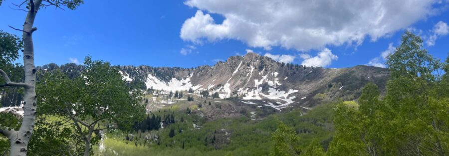
Mount Olympus sits right on the edge of the Salt Lake Valley like it’s daring you to try. From the valley floor you can see the summit every clear day. Getting there is a different matter. The Mount Olympus Trail covers 6.9 miles round trip with 4,000 feet of gain through the Mount Olympus Wilderness near Cottonwood Heights. It’s one of the most demanding day hikes along the Wasatch Front and one of the most rewarding. The summit scramble is real. The views from the top stretch across the Salt Lake Valley in every direction. The kind of sustained physical effort this trail demands is genuinely useful. By the time I get to the top, whatever was loud is quiet. Every time. Here’s everything you need to hike Mount Olympus.
Quick Facts
| Trail Name | Mount Olympus Trail |
| Location | Mount Olympus Wilderness, Cottonwood Heights, Utah |
| Coordinates | 40.6527, -111.8063 |
| Distance | 6.9 miles (round trip) |
| Elevation Gain | 4,000 feet |
| Difficulty | Strenuous |
| Time | 5-7 hours |
| Dogs Allowed | Yes (on leash, prepared dogs only) |
| Fee | None |
| View on Alltrails | |
How to Get There
From Salt Lake City, take I-215 south to exit 6 (6200 South). Head east on 6200 South, then turn south onto Wasatch Boulevard. Continue to approximately 5800 South and the trailhead is on the east side of Wasatch Boulevard. It’s clearly signed. The drive from downtown Salt Lake is about 20 minutes. From the south end of the valley, take Wasatch Boulevard north. The trailhead is easy to find. Parking is the challenge.
Parking Information
The trailhead parking lot is small and fills fast, especially on weekends from spring through fall. On busy weekend mornings the lot is full by 7 a.m. Overflow parking runs along Wasatch Boulevard, but watch posted restrictions carefully. The city issues parking citations in this area. Arriving before 7 a.m. on weekends is the practical solution. Weekday mornings are significantly more relaxed. No restrooms at the trailhead. The nearest facilities are back toward the commercial areas on 6200 South. 
Cell Service and Navigation
Cell service is generally reliable in the lower sections of the trail given the proximity to Salt Lake City. It weakens as you gain elevation and near the summit the signal can be spotty. Download your map offline as a backup. The trail is well-marked on the lower sections. The upper terrain and summit scramble area are more rugged and a GPS track helps when the route becomes less obvious on rock. Weather changes fast on exposed ridgelines. Check the forecast before you go and watch for afternoon thunderstorms in summer.
What to Expect on Mount Olympus Trail
The Lower Trail
The trail starts steep and doesn’t let up for long. The lower sections wind through scrub oak and juniper on a series of switchbacks that gain elevation fast. The vegetation is dense early, which provides some shade in morning hours. Views start opening up as you climb above the oak line, with the Salt Lake Valley spreading out below you in both directions. The trail is well-defined through this section and the footing is solid on packed dirt and occasional rock.
The Upper Trail and Summit Scramble
Above the tree line the character of the hike changes. The vegetation thins, the exposure increases, and the trail transitions to rocky terrain with increasing scramble moves. The final push to the summit requires hands-on rock scrambling, nothing technical but enough to demand full attention on foot placement. The summit is a collection of rocky outcrops with no single obvious high point. Scramble to the highest rock you’re comfortable with. The 360-degree view from the top spans the entire Salt Lake Valley, the Great Salt Lake, and the surrounding Wasatch peaks. On a clear day you can see for 100 miles. 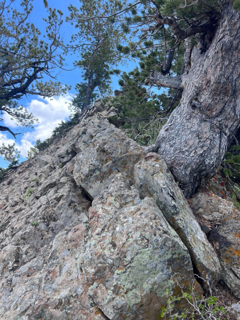
Trail Difficulty and Length
Mount Olympus is 6.9 miles round trip with 4,000 feet of elevation gain. It’s rated strenuous, and that rating is accurate. The gain is relentless. There are no flat recovery sections worth mentioning. The trail demands cardiovascular fitness and leg strength in equal measure. Add in the summit scramble and the exposed descent on tired legs and you have a full-commitment day hike. Budget 5 to 7 hours and don’t underestimate the return. The descent on steep rocky terrain is harder on the knees than it sounds at the trailhead. Start early.
Dog Friendly?
Yes, dogs are allowed on leash. The upper trail and summit scramble are challenging for dogs. Large, fit, trail-experienced dogs handle it. Small dogs and out-of-shape dogs will struggle on the rocky upper sections. The summit scramble requires scrambling moves that can be genuinely difficult for dogs to navigate safely. Know your dog before committing. Bring more water than you think they need. There’s no reliable water source on trail and the exposed upper sections heat up fast. In summer, an early start protects both of you from the worst of the heat. 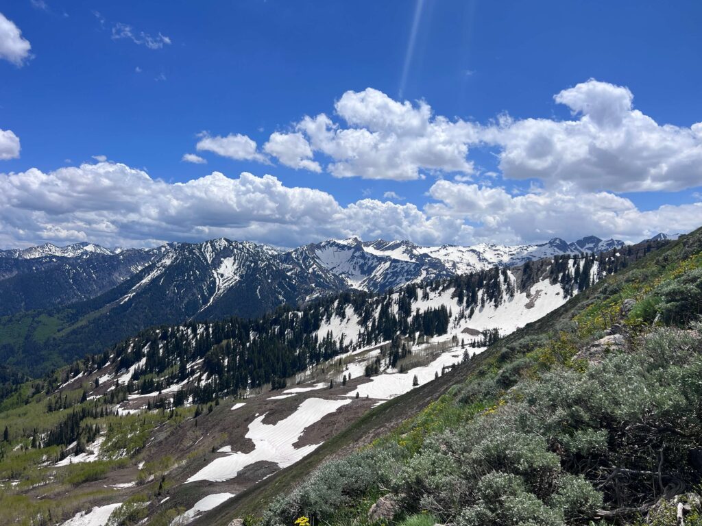
What to Bring
Water is the priority. At least 2 to 3 liters, more in summer. The trail is long, exposed on the upper sections, and the gain will drain you faster than a flat trail of the same distance. Sunscreen and a hat for the exposed ridgeline sections. Solid trail shoes or hiking boots with ankle support and good grip for the rocky upper terrain. Trekking poles make the descent on tired legs significantly more manageable. A light layer for the summit because wind at elevation can be cold even on warm valley days. Snacks and a real lunch because you’ll be out 5 to 7 hours. In winter add microspikes or crampons and check avalanche conditions for the surrounding canyons.
Best Time to Hike Mount Olympus
Late spring (May through June) and fall (September through October) are the best windows. Temperatures are manageable and the trail is fully clear of snow. Summer is doable but the exposed upper sections heat up significantly by midday. Start by 6 a.m. in summer to reach the summit before the heat and the afternoon thunderstorm window. Winter brings snow to the upper trail and ice to the scramble section. Microspikes are mandatory in winter conditions, crampons for harder ice. Check avalanche forecasts for Big and Little Cottonwood Canyons before winter hikes in this area. For photography, early morning is the strongest window. The Salt Lake Valley is at its clearest in the first few hours of the day before haze builds. The summit views photograph best when the valley is sharp and the light is low. A 24-70mm lens covers the full range from valley-wide panoramas to closer detail on the Wasatch peaks. Golden hour on the descent, with the valley lit below you, is as good as it gets.
Rules and Regulations
Mount Olympus is part of the Mount Olympus Wilderness, administered by the Wasatch-Cache National Forest. No fee required. Wilderness rules apply: no motorized equipment, no bikes, dogs on leash. Leave No Trace fully. Stay on trail to prevent erosion on the steep lower sections and avoid shortcutting switchbacks. The summit scramble area sees regular traffic and the rock is fragile in spots. Don’t loosen or displace rocks above other hikers. Check the Wasatch-Cache National Forest website for any current closures or fire restrictions before heading out.
Where to Stay Near Salt Lake City
Salt Lake City has a full range of lodging options. For hotel points, the city has strong inventory across all major programs. Check Marriott Bonvoy, IHG Rewards, and Hilton Honors for redemptions. Cottonwood Heights and Murray have options that put you closer to the trailhead and avoid downtown traffic on early morning starts.
Camping Nearby
Dispersed camping is not available in the Mount Olympus Wilderness. The Big and Little Cottonwood Canyon corridor has established campgrounds including Redman Campground and Albion Basin Campground (seasonal, high elevation). Both book through recreation.gov and fill fast in summer. Salt Lake City’s proximity means most people do Mount Olympus as a day hike rather than a camping trip, which is practical.
Nearby Adventures
The Wasatch Front has no shortage of next-level hikes in every direction from Mount Olympus. Lake Blanche in Big Cottonwood Canyon is one of the most stunning alpine lake hikes in the state. Bell’s Canyon in Little Cottonwood is a full-day waterfall and scramble route. The Living Room Trail in the Foothills Natural Area is a shorter, accessible option with excellent valley views that works as a warm-up or rest-day hike. Neff’s Canyon provides a quieter Wasatch hike with forest terrain and elevation that builds to serious heights without the crowds of the main canyons. Off the trail, Salt Lake City has genuine cultural depth. The Natural History Museum of Utah at the University of Utah is world-class for geology and paleontology. Temple Square is architecturally and historically significant regardless of your background. The Utah Museum of Fine Arts and the Granary District gallery scene are worth an evening. The city’s restaurant scene has improved dramatically in recent years, particularly the local independent spots in neighborhoods like 9th and 9th and Sugar House.
Plan This Hike
AllTrails has the full Mount Olympus Trail with downloadable map, recent user conditions, and notes on current summit scramble conditions from other hikers. Checking recent reports is useful for understanding snow levels in spring and fall when the summit can hold ice longer than the lower trail suggests. View on Alltrails AllTrails Pro is worth it for the offline maps and GPS tracking. Even on a well-marked trail close to the city, having a track on your phone on the rocky upper sections removes any uncertainty about your line to the summit.
Chase the Quiet
There’s a specific feeling at the top of Mount Olympus that I don’t get anywhere else. The valley you live in, spread out 4,000 feet below you, looks entirely different from up there. The grid of streets and buildings and traffic that fills every day shrinks to something you could cover with your hand. Whatever problem felt too big at the trailhead looks smaller from the summit. That’s not nothing. That’s the whole point of going up.
Support the Adventure
To make your walls less boring, check out my photography portfolio and bring a piece of the wild and my story into your home. If you’d like to fuel future adventures, you can donate a coffee on Ko-Fi. Every cup keeps me chasing sunrises and stories. When you shop using my affiliate links, every click helps support this blog at no extra cost to you. It’s a small way to keep Unicorn Adventure alive and kicking while I keep exploring. Subscribe to my mailing list for future updates, new stories, and behind-the-scenes adventures. Stay connected with me on Instagram and Facebook for more photos and daily inspiration. Thanks for being part of the journey, Unicorn Squadron!

Theo Maynard is a landscape photographer and adventure blogger based in Salt Lake City. He chases remote desert and mountain light across the American West, documents it all solo, and shares the journey through Unicorn Adventure. He’s on the autism spectrum, and that’s not a footnote, it’s the whole story. He creates to inspire others to get outside, chase what lights them up, and live their best possible life. Unapologetically himself.