

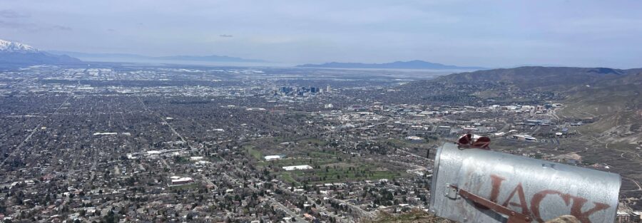
1,300 feet of gain in 1.25 miles. Salt Lake City is right below you the whole way up. Jack’s Mountain doesn’t waste anyone’s time. Jack’s Mountain sits in the Foothills Natural Area above the Avenues neighborhood, about 10 minutes from downtown Salt Lake City. The trail is 2.5 miles round trip and climbs hard, gaining elevation at a rate that separates it from the gentler foothill trails nearby. The payoff is a summit with full panoramic views of the valley, the Great Salt Lake, and the Wasatch peaks. No technical skills required, just legs and lungs. It’s one of the best views per mile on the front. A trail that demands full physical attention for an hour leaves no bandwidth for anything else. Jack’s Mountain delivers that consistently. Here’s everything you need to hike Jack’s Mountain.
Quick Facts
| Location | Foothills Natural Area, Salt Lake City, Utah |
| Coordinates | 40.7291, -111.8062 |
| Distance | 2.5 miles (round trip) |
| Elevation Gain | 1,300 feet |
| Difficulty | Strenuous |
| Time | 1.5-2.5 hours |
| Dogs Allowed | Yes (on leash) |
| Fee | None |
| View on Alltrails | |
How to Get There
From downtown Salt Lake City, take I-80 east to exit 126 (1300 East). Head north on 1300 East and turn right onto South Temple. Follow South Temple as it transitions to Virginia Street, then to 18th Avenue. Follow 18th Avenue to Terrace Hills Drive. The trailhead is at the end of Terrace Hills Drive. The drive from downtown takes 10 to 15 minutes.
Parking Information
Parking is street parking only along Terrace Hills Drive near the trailhead. Free, but limited. On busy weekend mornings the street fills and you’ll need to walk in from nearby blocks. Arrive before 7 a.m. on weekends to guarantee a spot close to the trailhead. Respect the neighborhood: don’t block driveways, mailboxes, or posted no-parking zones. No restrooms at the trailhead. 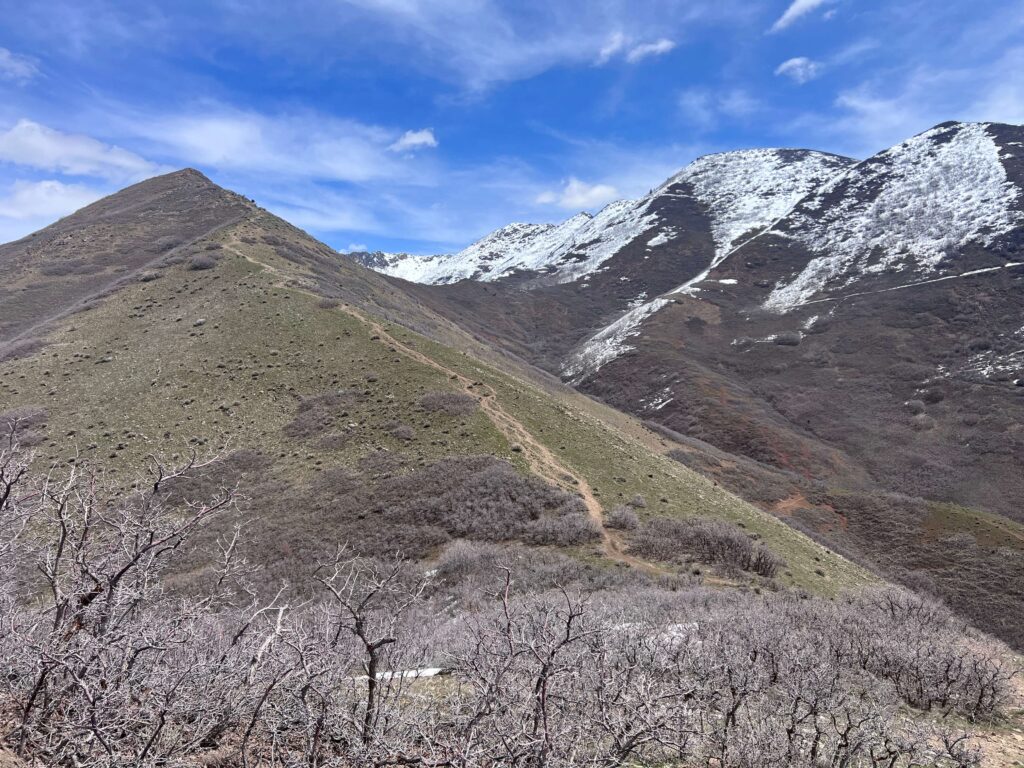
Cell Service and Navigation
Cell service is solid at the trailhead and reliable through most of the hike given the proximity to the city. Signal can weaken on the upper exposed ridge sections depending on your carrier. The trail is well-marked. Download your map offline through AllTrails as a backup and load the trailhead coordinates before leaving since the Avenues streets can be confusing. Weather can build fast on the exposed upper sections. Check the forecast before heading out, especially in spring and fall when afternoon storms move quickly.
What to Expect on Jack’s Mountain
The Lower Trail
The trail starts at the end of Terrace Hills Drive and climbs immediately through open meadow and scrub oak. The lower section is steep from the start. Views of the Salt Lake Valley and the city grid open up almost immediately and improve with every switchback. The trail is exposed, which means full sun in summer and wind in the colder months. There’s no warm-up flat section. You’re climbing from step one.
The Upper Trail and Summit
The trail steepens further as you gain elevation and the terrain transitions to rockier footing. Sagebrush and scattered wildflowers line the route in spring and early summer. The summit comes up when you’re already earning it, and the view from the top is the full Salt Lake Valley reward. Downtown Salt Lake City, the Great Salt Lake, the Oquirrh Mountains to the west, and the full Wasatch arc to the east. On a clear day you can see across the entire valley floor to the far shore of the lake. Find a rock on the summit, eat your snack, and take your time before the descent. 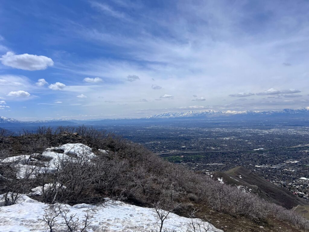
Trail Difficulty and Length
Jack’s Mountain is 2.5 miles roundtrip with 1,300 feet of elevation gain. Strenuous is the accurate rating. The gain-to-distance ratio makes this a strenuous outing despite the short mileage. One thousand three hundred feet of gain in 1.25 miles is not a casual foothill walk. Budget 1.5 to 2.5 hours depending on fitness and pace. The descent on rocky exposed terrain with tired legs requires the same foot care as the ascent. Don’t rush it down.
Dog Friendly?
Yes. Dogs are welcome on leash throughout the Foothills Natural Area. The trail’s exposed nature and steep terrain heat up fast in summer, and there are no water sources on route. Bring significantly more water than you think your dog needs and start early to beat peak heat. The rocky upper sections require some navigation for dogs with less trail experience. Know your dog before committing to the full summit push.
What to Bring
At least 1.5 to 2 liters of water per person despite the short distance. The exposed climb drains you faster than the mileage suggests. Sunscreen and a hat for the fully exposed trail. Trail shoes or hiking boots with good grip for the rocky upper sections. A wind layer for the summit even on warm days because the ridge runs exposed and exposed ridges push cold air. Trekking poles help on the descent and on the steepest switchbacks. A camera for the summit views, which are worth the carry even for a short trail.
Best Time to Hike Jack’s Mountain
Spring (April through June) and fall (September through October) are the strongest windows. Wildflowers hit the lower meadow in spring. Fall turns the scrub oak and hillside vegetation orange and the air is crisp enough to make the climb comfortable. Summer works but the exposed trail amplifies the heat. Start before 7 a.m. in summer without exception. Winter brings ice to the steeper sections and the exposed upper trail can be dangerous without microspikes. Check conditions before heading out in cold months. For photography, Jack’s Mountain is one of the better sunrise spots on the Wasatch Front without requiring a 10-mile approach. The city spread below in early morning light with the Oquirrhs catching the first color to the west is genuinely excellent. A wide-angle lens handles the full valley panorama. Golden hour on the descent, with the city lit from the west, is a strong close to a morning hike.
Rules and Regulations
Jack’s Mountain is in the Salt Lake City Foothills Natural Area, managed by Salt Lake City. No permit, no fee. Stay on designated trails to prevent erosion on the fragile foothill ecosystem. Shortcutting switchbacks is one of the primary causes of hillside damage in this area and is prohibited. Dogs on leash at all times. Pack out everything. Check the Salt Lake City Public Lands website for any current trail closures, which do happen after significant weather events or during fire conditions.
Where to Stay Near Salt Lake City
Salt Lake City has a full range of downtown and suburban lodging within 10 to 15 minutes of the Jack’s Mountain trailhead. For hotel points check Marriott Bonvoy, IHG Rewards, and Hilton Honors. The Avenues neighborhood has boutique lodging options within walking distance of the trailhead if you want to skip the drive entirely.
Camping Nearby
There’s no camping in the Foothills Natural Area. Big and Little Cottonwood Canyons, about 20 to 30 minutes south, have established campgrounds including Redman Campground in Big Cottonwood. Both book through recreation.gov and fill fast in summer. Dispersed camping on Wasatch-Cache National Forest land is available further afield in the Uinta foothills east of the valley.
Nearby Adventures
The Foothills Natural Area has more to explore above and around Jack’s Mountain. The Living Room Trail is the most popular foothill route in Salt Lake City, a shorter and slightly gentler option with excellent city views and a distinctive rock formation at the top. The Bonneville Shoreline Trail runs north and south along the ancient Lake Bonneville shoreline with multiple access points and options for extended mileage. Ensign Peak is a quick 1-mile walk with a panoramic summit view that works as a rest-day stop or a warm-up. Moving into the canyon system, Mount Olympus in the Mount Olympus Wilderness is the step-up option: 6.9 miles and 4,000 feet of gain to one of the most iconic summit views along the Wasatch Front. Big Cottonwood Canyon’s Lake Blanche trail (6.2 mi / 2,800 ft) and Little Cottonwood Canyon’s Red Pine Lake (7.5 mi / 2,109 ft) are full-day alpine lake hikes within 30 minutes of downtown. Off the trail, Temple Square and the Utah State Capitol are both within 15 minutes of the trailhead. The Natural History Museum of Utah at the University of Utah is one of the best natural history museums in the West. The 9th and 9th neighborhood has good independent restaurants and coffee for a post-hike recovery stop close to the trailhead.
Plan This Hike
AllTrails has Jack’s Mountain with a downloadable map and recent user conditions. Checking recent reports for current trail conditions is useful in winter and early spring when ice can linger on the steeper upper sections well after the lower trail looks clear. View on Alltrails AllTrails Pro gives you offline maps and GPS tracking. For a city-edge foothill trail it’s less critical than remote backcountry routes, but the ability to track your elevation gain in real time is useful on a climb this steep.
Chase the Quiet
The thing about Jack’s Mountain is that the city is visible the entire way up. You can see where you came from at every step. Most of my favorite hikes involve driving somewhere remote and leaving the ordinary world behind. Jack’s does the opposite. It keeps the city in frame and lifts you above it until it looks small. That perspective shift is something. Salt Lake is a good city.
Support the Adventure
To make your walls less boring, check out my photography portfolio and bring a piece of the wild and my story into your home. If you’d like to fuel future adventures, you can donate a coffee on Ko-Fi. Every cup keeps me chasing sunrises and stories. When you shop using my affiliate links, every click helps support this blog at no extra cost to you. It’s a small way to keep Unicorn Adventure alive and kicking while I keep exploring. Subscribe to my mailing list for future updates, new stories, and behind-the-scenes adventures. Stay connected with me on Instagram and Facebook for more photos and daily inspiration. Thanks for being part of the journey, Unicorn Squadron!

Theo Maynard is a landscape photographer and adventure blogger based in Salt Lake City. He chases remote desert and mountain light across the American West, documents it all solo, and shares the journey through Unicorn Adventure. He’s on the autism spectrum, and that’s not a footnote, it’s the whole story. He creates to inspire others to get outside, chase what lights them up, and live their best possible life. Unapologetically himself.