

The Navajo Loop and Queen’s Garden combination is the standard day hike at Bryce Canyon National Park and it’s standard for a reason. Three miles from Sunset Point down through the Wall Street switchbacks into the canyon, across the canyon floor through the hoodoos, and up the Queen’s Garden route back to the rim earns Bryce Canyon’s specific visual in a way that driving the rim road doesn’t. The hoodoos are different from inside the canyon than from above it. The red, orange, and white rock spires at eye level and above are a different experience from the overlook perspective.
This route runs 3.0 miles with 652 feet of gain. The Wall Street, Queen’s Garden, and Peekaboo Loop at 6.3 miles / 1,499 feet is the longer Bryce Canyon option for days when more is appropriate.
Quick Facts
| Location | Bryce Canyon National Park, Utah |
| Coordinates | 37.6238 N, 112.1667 W (Sunset Point) |
| Distance | 3.0 miles (loop) |
| Elevation Gain | 652 feet |
| Difficulty | Moderate |
| Time | 2-3 hours |
| Dogs Allowed | No |
| Fee | $35 per vehicle (7-day pass); America the Beautiful Pass accepted. Free shuttle available April–October. |
| View on AllTrails | |
How to Get There
Bryce Canyon National Park is in southwestern Utah, accessible primarily via UT-63 south off UT-12. The park is about 270 miles from Salt Lake City, 260 miles from Las Vegas, and 85 miles east of Zion National Park.
From Salt Lake City: I-15 south to UT-20 east, then US-89 south, then UT-12 east to UT-63 south into the park. Plan about 4.5-5 hours.
From Las Vegas: I-15 north to UT-20 east, US-89 north, UT-12 east, UT-63 south. Plan about 4-4.5 hours.
From Zion National Park: UT-9 east to US-89 north, UT-12 east, UT-63 south. Plan about 1.5 hours.
For the Navajo Loop and Queen’s Garden trailhead, park at or use the shuttle to Sunset Point. The trailhead is at Sunset Point on the canyon rim.
Parking and Shuttle Information
Parking at Sunset Point fills quickly, particularly in summer and on spring and fall weekends. Arrive before 8 a.m. or use the free park shuttle, which runs from April through October from the main visitor center area to all major trailheads including Sunset Point. The shuttle eliminates parking stress and lets you hike point-to-point rather than returning to the same trailhead if you want to vary your route.
The park entry fee is $35 per vehicle for a 7-day pass. America the Beautiful Annual Pass covers Bryce Canyon entry. A timed entry reservation may be required during peak season; check nps.gov/brca before your visit.

Cell Service and Navigation
Cell coverage is limited within Bryce Canyon National Park, particularly in the canyon below the rim. Download AllTrails offline before entering the park. The Navajo Loop and Queen’s Garden route is well-signed throughout; navigation is not a challenge. Having the trail map is useful for confirming the junction between the Navajo Loop and Queen’s Garden trails on the canyon floor.
What to Expect on the Navajo Loop and Queen’s Garden
Descent via the Navajo Loop: Wall Street
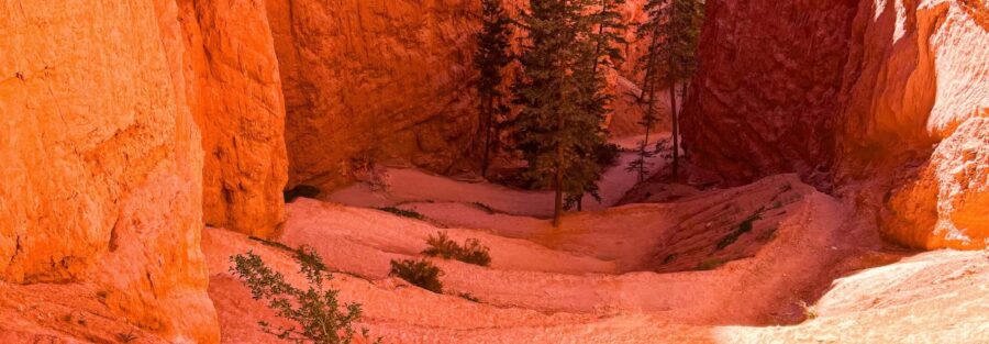
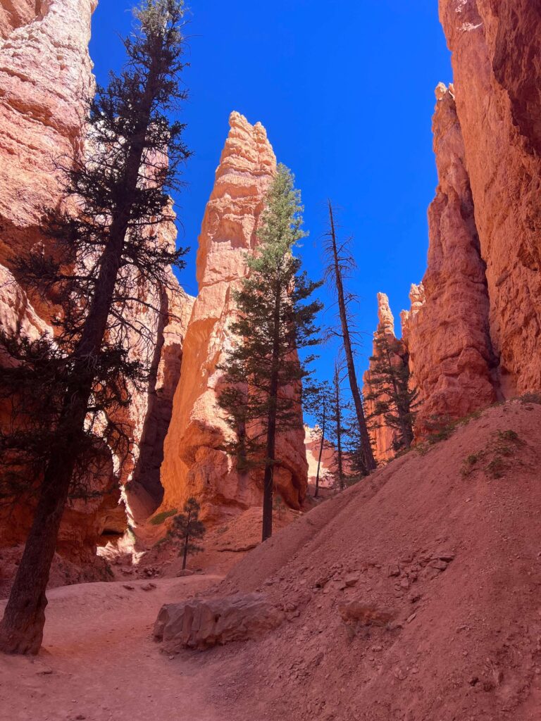
The hike starts at Sunset Point on the rim with the canyon dropping in front of you. The Navajo Loop descends via switchbacks into the canyon, with the most distinctive section being Wall Street: a narrow slot between tall hoodoos where the canyon walls close in on both sides as the switchbacks work their way down to the canyon floor. The hoodoos are at eye level and above rather than far below as they appear from the rim. That’s the visual shift that makes hiking into Bryce Canyon different from driving the overlooks: scale and proximity.
The Canyon Floor and Hoodoo Field
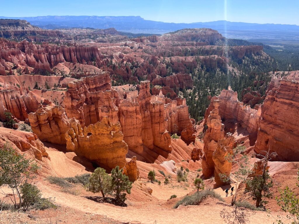
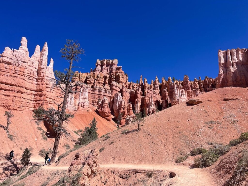
At the canyon floor, the route connects to the Queen’s Garden trail through the hoodoo field. The hoodoos here are dense enough that the landscape reads as a forest of rock rather than scattered formations. The color range, deep red at the iron-rich base transitioning to orange and white at the calcium carbonate layers above, is visible in the individual formations as you walk alongside them. The Queen Victoria formation is the named landmark on the Queen’s Garden trail, a hoodoo cluster whose shape resembles the Victorian monarch well enough to be recognized.
The Return via Queen’s Garden
The Queen’s Garden trail climbs back to the rim via Sunrise Point, which requires the combined route to start at Sunset and end at Sunrise (or vice versa). Plan your return to your vehicle or the shuttle pickup accordingly. The climb back to the rim via Queen’s Garden is gradual compared to the Wall Street descent but sustained. By the time you’re back at the rim, the 652 feet of gain is noticeable in the legs.
For photography: the canyon interior is best lit in the morning when the sun is still low enough to illuminate the hoodoos without creating harsh overhead shadows. The Wall Street section in particular benefits from the angled morning light that doesn’t reach the canyon floor at midday. Sunrise Point at golden hour with the hoodoos below is the classic Bryce Canyon composition.
Trail Difficulty and Length
This route is 3.0 miles with 652 feet of gain. Moderate is accurate: the 652-foot descent and recovery is sustained but not extreme, and the well-maintained switchbacks make the Wall Street section manageable for most hikers. The high elevation of Bryce Canyon (the rim sits around 8,000 feet) affects exertion for visitors coming from lower elevations; budget more time than the mileage suggests if you’re not acclimatized to elevation.
No Dogs Allowed
Dogs are not permitted on the Navajo Loop, Queen’s Garden, or most other Bryce Canyon trails. The paved Rim Trail between Sunset and Sunrise Points is the dog-permitted exception where leashed dogs can accompany visitors along the rim. Leave dogs at accommodations outside the park for canyon floor hikes.
What to Bring
Water: 2 liters minimum for a 3-mile moderate hike at 8,000 feet. The elevation and the climb back to the rim dehydrate faster than equivalent hikes at lower elevation. Sun protection for the exposed canyon sections. Layers for the morning: Bryce Canyon mornings even in summer are cold at 8,000 feet and the canyon floor is cooler than the rim. Sturdy trail runners or hiking boots for the switchback descents and rocky canyon floor terrain.
Winter visits: microspikes or traction devices are required for the icy switchbacks when snow is present. The park rents microspikes at the visitor center.
Best Time to Hike Navajo Loop and Queen’s Garden
Late April through October is the reliable window with the most comfortable conditions. Bryce Canyon’s high elevation means summer temperatures stay mild (highs in the 70s-80s°F on the rim) while most of Utah is hitting triple digits. This makes Bryce Canyon one of the better summer hiking destinations in the American Southwest from a temperature management standpoint.
The downside of summer is crowds: July and August are peak season at Bryce and the Navajo Loop trail has significant foot traffic. Early morning starts (on trail by 7 a.m.) give you the best canyon light for photography and the fewest people in the canyon simultaneously.
Winter is genuinely beautiful at Bryce Canyon: snow on the hoodoos creates a visual that the summer experience doesn’t deliver. The switchbacks become icy and require traction devices, and some sections may be closed in heavy snow conditions. Check nps.gov/brca for current winter trail status. Weekday winter visits are among the least crowded Bryce Canyon experiences available.
Rules and Regulations
Stay on designated trails. No dogs on canyon trails. No drones. Pack out all trash. The park’s hoodoo formations are fragile; do not touch or climb on them. Timed entry reservations may be required during peak season; check nps.gov/brca before visiting. $35 vehicle fee or America the Beautiful Pass.
Where to Stay Near Bryce Canyon
The town of Bryce and the Bryce Canyon City area along UT-12 have lodging within the park’s immediate vicinity. Escalante, Utah, is about 50 miles east on UT-12 with small town lodging. Kanab, Utah, is about 80 miles south on US-89 with more developed lodging infrastructure. For points travelers, check available Marriott Bonvoy properties near Bryce Canyon, IHG Rewards hotels near Bryce, and Hilton Honors options near Kanab.
Camping Nearby
Bryce Canyon Campground (North and Sunset Campgrounds) are inside the park, operated by the NPS with reservations through recreation.gov during peak season. Staying inside the park gives access to the park before the day visitors arrive and enables early morning trailhead access without driving from Kanab or Escalante.
Nearby Adventures
The Wall Street, Queen’s Garden, and Peekaboo Loop at 6.3 miles / 1,499 feet is the longer Bryce Canyon option. For anyone who completes the Navajo Loop and Queen’s Garden and has energy for more, the Peekaboo Loop extends the canyon floor experience deeper into the amphitheater. Adding Peekaboo roughly doubles both the distance and the elevation gain.
UT-12 between Bryce Canyon and Escalante is consistently listed among the most scenic highways in the American West. Driving it with stops at the Escalante River bridge, the Grand Staircase overlooks, and the Grand Canyonlands vista points delivers a full day of southwest landscape photography from a car.
Plan This Hike
AllTrails has the Navajo Loop and Queen’s Garden mapped with offline capability, current trail conditions, and the shuttle stop locations. Download before entering the park. Plan your hike on AllTrails and pull the offline map while you’ve got signal.
Chase the Quiet
Bryce Canyon is genuinely more crowded than it should be and genuinely more beautiful than the crowds suggest it can be. The hoodoos don’t diminish with company. The Wall Street switchbacks don’t get less dramatic when you share them with a hundred other hikers. What changes is the pace: if you get there early enough, the canyon is quiet, the light is right, and the experience is private in the way that the rim overlooks with tour buses behind you never are. That version of Bryce Canyon exists. It requires the alarm clock. It’s worth it.
Support the Adventure
To make your walls less boring, check out my photography portfolio and bring a piece of the wild and my story into your home.
If you’d like to fuel future adventures, you can donate a coffee on Ko-Fi. Every cup keeps me chasing sunrises and stories.
When you shop using my affiliate links, every click helps support this blog at no extra cost to you. It’s a small way to keep Unicorn Adventure alive and kicking while I keep exploring.
Subscribe to my mailing list for future updates, new stories, and behind-the-scenes adventures.
Stay connected with me on Instagram and Facebook for more photos and daily inspiration.
Thanks for being part of the journey, Unicorn Squadron!

Theo Maynard is a landscape photographer and adventure blogger based in Salt Lake City. He chases remote desert and mountain light across the American West, documents it all solo, and shares the journey through Unicorn Adventure. He’s on the autism spectrum, and that’s not a footnote, it’s the whole story. He creates to inspire others to get outside, chase what lights them up, and live their best possible life. Unapologetically himself.