

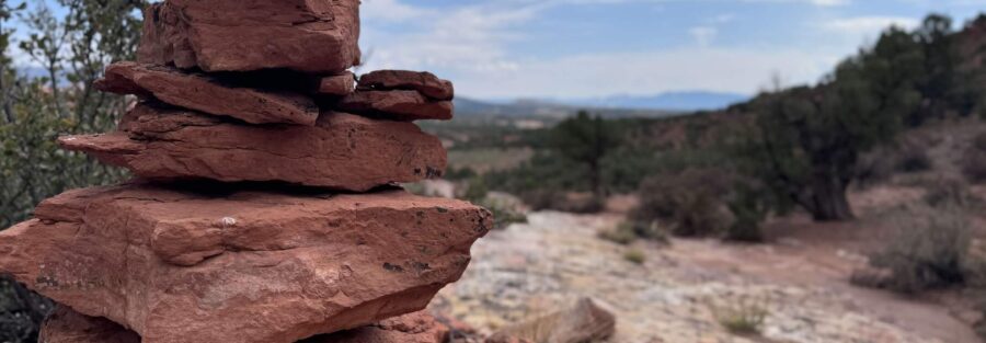
Red Fleet State Park sits 20 miles north of Vernal in the Uinta Basin, a place most people only pass through on the way to Dinosaur National Monument. That’s a mistake. The park holds Red Fleet Reservoir, one of the most striking blue-water-in-red-rock landscapes in Utah, and the Battleship Loop Trail traces the reservoir’s edge and the surrounding slickrock country for 2.5 miles. The loop takes its name from the massive sandstone formation rising above the trail that looks exactly like what it’s called.
Quick Facts
| Trail Name | Battleship Loop Trail |
| Location | Red Fleet State Park, near Vernal, Utah |
| Coordinates | 40.5956, -109.4361 |
| Distance | 2.5 miles (loop) |
| Elevation Gain | 416 ft |
| Difficulty | Moderate |
| Time | 1.5–2 hours |
| Dogs Allowed | Yes, on leash |
| Fee | $10/vehicle state park entrance fee |
| AllTrails | Plan This Hike on AllTrails |
How to Get There
Red Fleet State Park sits about 20 miles north of Vernal on US-191. From downtown Vernal, head north on US-191 for roughly 15 miles and watch for the Red Fleet State Park signs on the right. The turn-off leads to the park entrance on a well-paved road appropriate for all vehicles. The trailhead is near the park entrance and clearly marked from the parking area.
Parking Information
A large parking lot serves the Battleship Loop Trailhead near the Red Fleet State Park visitor center. State park entrance is $10 per vehicle. No America the Beautiful Pass coverage at state parks. Pay at the entrance station. The lot is spacious and rarely fills completely outside of peak summer holiday weekends. Restrooms are available at the visitor center near the trailhead. 
Cell Service and Navigation
Cell coverage at Red Fleet State Park is limited. Verizon holds better than AT&T in the Uinta Basin generally, but service is unreliable once you leave the US-191 corridor. Download your offline map before leaving Vernal. AllTrails has the Battleship Loop documented with GPS track. The loop is well-marked and easy to follow, but having a track running is good practice any time you’re in limited-service desert terrain.
What to Expect on the Battleship Loop Trail
The Slickrock and Desert Terrain
The trail moves through classic Uinta Basin desert from the first step. Red sandstone slickrock, sandy washes, and scrub desert with the canyon walls of the reservoir basin building around you. The footing alternates between packed dirt and exposed rock, with a few sections that require attention on the slickrock surface, especially if damp. The loop is well-worn and easy to follow throughout. The terrain has the same layered geological character as Dinosaur National Monument nearby, red and tan sandstone stacked in visible formation bands that date back hundreds of millions of years.
The Battleship Formation
The namesake formation dominates the skyline on the eastern section of the loop. The sandstone mass rises from the desert floor in a profile that genuinely resembles a naval vessel, hull and superstructure visible from the trail below. It’s one of the better natural rock formation names in Utah because it actually holds up at every angle. The best photography views of the Battleship are from the southern section of the loop in the morning when the formation catches direct light from the east.
Red Fleet Reservoir
The reservoir is the visual centerpiece of the park. Deep blue water against red sandstone cliffs, with the Uinta Mountains visible on the northern horizon on clear days. The trail gives you elevated views of the reservoir from the canyon rim sections and comes close to the water’s edge at lower points on the loop. The contrast between the water and the surrounding desert is one of the better photography compositions in the Vernal area. Come in the morning when the light is on the red rock faces above the waterline. 
Trail Difficulty and Length
The Battleship Loop is 2.5 miles with 416 feet of elevation gain. The moderate rating is earned from the combination of slickrock sections, sandy trail, and a few short steep pitches rather than any single sustained climb. The loop is accessible for most fitness levels and appropriate for families with children comfortable on uneven terrain. Trail shoes with solid grip handle the slickrock sections well. Bring trekking poles if you prefer extra stability on the rock surfaces. The exposed terrain has minimal shade, so water and sun protection matter regardless of the short distance.
Dog Friendly?
Dogs are welcome on the Battleship Loop Trail on leash. The varied terrain is manageable for most dogs. The slickrock sections can be rough on paws and the desert surface heats up quickly in summer. Bring water for your dog and start early on hot days. The reservoir access points along the loop give dogs a chance to cool off if conditions allow. Pack out all waste. 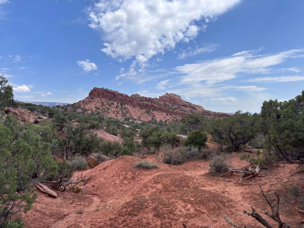
What to Bring
At least 1.5 liters of water per person. More in summer. Sunscreen and a hat for the fully exposed loop. Trail shoes with good grip for the slickrock sections. A camera, the Battleship formation and reservoir views both reward a wide lens and the morning light on the red sandstone is worth planning around.
Best Time to Hike the Battleship Loop Trail
Spring (April through June) and fall (September through November) are the best seasons. Mild temperatures, stable trail surfaces, and the desert light at its most dramatic. Spring occasionally brings wildflowers through the sandy sections of the loop. Summer is workable with an early start. The fully exposed trail bakes by 10 a.m. in July and August. Get on trail by 7 a.m. in summer. Winter is possible when the trail is clear of snow and ice, but the slickrock sections become significantly more hazardous with any ice coverage. Check conditions with the park before going in cold weather.
Rules and Regulations
The Battleship Loop Trail is within Red Fleet State Park. Stay on the designated trail. The desert vegetation and biological soil crust surrounding the slickrock sections are fragile. No shortcutting switchbacks or stepping off-trail onto unmarked surfaces. No campfires on trail. No fossil or rock collection. Practice Leave No Trace throughout. State park entrance fee is required for all visitors. Pack out all waste including dog waste.
Where to Stay Near Vernal and Red Fleet State Park
Vernal is the gateway city, 20 miles south of the park with a full range of lodging. The Flaming Gorge Resort in Dutch John, Utah is about an hour north and a solid base for combining Red Fleet with a Flaming Gorge NRA visit. For points travelers, check available Marriott Bonvoy properties in Vernal, IHG Rewards hotels in Vernal, and Hilton Honors options in the area.
Camping Nearby
Red Fleet State Park has a developed campground near the reservoir with hookup sites and basic facilities, the most convenient base for an early morning start on the Battleship Loop. The campground is popular in summer and reservations are recommended. For free options, the Ashley National Forest north of Vernal and the BLM land surrounding the Uinta Basin offer dispersed camping with a 14-day limit and no services. The Flaming Gorge Resort area also has established campgrounds along the reservoir with more amenities.
Nearby Adventures
The Red Fleet Dinosaur Trackway is the most unique attraction in the immediate area, actual dinosaur footprints embedded in the sandstone near the reservoir shore, accessible by a short trail or by water from the boat ramp. The Green River Trail in Dinosaur National Monument is 30 minutes south at 2.7 miles and 341 feet of gain, the best riverside canyon hike near Vernal. The Harpers Corner Trail is the monument’s best canyon overlook at 2.3 miles and 347 feet of gain above the Green and Yampa River confluence. The Moonshine Arch Trail is a 1.4-mile hike near Vernal to a large natural sandstone arch in BLM desert. The Utah Field House of Natural History State Park Museum in downtown Vernal covers the Uinta Basin’s prehistoric geology and indigenous history in depth and is worth a few hours on any Vernal trip.
Plan This Hike
AllTrails has the Battleship Loop Trail documented with GPS tracking, current conditions, and user notes on the slickrock sections. Download the offline map before leaving Vernal. The Red Fleet State Park visitor center also provides current trail conditions and a park map at the entrance station. Plan your hike on AllTrails.
Chase the Quiet
The best moment on the Battleship Loop is the section where the trail comes out above the reservoir on the western rim with the Battleship formation behind you and the blue water below. The Uinta Mountains are on the horizon to the north, red rock walls dropping to the water on both sides. Nobody else in the frame. The Uinta Basin doesn’t get the foot traffic of the canyon country parks to the south, and at Red Fleet that works in your favor every single time.
Support the Adventure
To make your walls less boring, check out my photography portfolio and bring a piece of the wild and my story into your home. If you’d like to fuel future adventures, you can donate a coffee on Ko-Fi. Every cup keeps me chasing sunrises and stories. When you shop using my affiliate links, every click helps support this blog at no extra cost to you. It’s a small way to keep Unicorn Adventure alive and kicking while I keep exploring. Subscribe to my mailing list for future updates, new stories, and behind-the-scenes adventures. Stay connected with me on Instagram and Facebook for more photos and daily inspiration. Thanks for being part of the journey, Unicorn Squadron!

Theo Maynard is a landscape photographer and adventure blogger based in Salt Lake City. He chases remote desert and mountain light across the American West, documents it all solo, and shares the journey through Unicorn Adventure. He’s on the autism spectrum, and that’s not a footnote, it’s the whole story. He creates to inspire others to get outside, chase what lights them up, and live their best possible life. Unapologetically himself.