Quick Facts:
Location: Vernal, Utah
Coordinates: 40.55145261627072, -109.54168764681955
Length: 1.5 Miles
Difficulty: Easy
Elevation Gain: 250 Feet
Dog Friendly: Yes
Introduction:
If you’re looking for a hidden gem near Vernal, Utah, the hike to Moonshine Arch is a must. This stunning sandstone formation offers an easy to moderate trek with breathtaking views of Utah’s desert landscape. Far from the crowded trails of national parks, Moonshine Arch provides a peaceful escape with a short hike to one of the area’s most spectacular natural wonders. Here’s your complete guide to making the most of your visit to Moonshine Arch.
How to Get to Moonshine Arch:
Moonshine Arch is located just 8 miles north of Vernal, Utah. Getting there is easy. From downtown Vernal, head north on US-191 for about 6 miles until you see a small brown sign pointing to Moonshine Arch. Turn right onto the dirt road and follow it for approximately 2 more miles to the trailhead. The dirt road can be a bit rough, particularly after rain, but most vehicles will be able to handle it with care.
Parking Information:
There’s a small dirt clearing at the trailhead where you can park for free. While it’s not an official parking lot, it’s spacious enough for several vehicles. No permits or fees are required to park or hike here, making it a hassle free destination. Be sure to park responsibly and avoid blocking the path for other vehicles.
The parking area can get muddy after rain, so it’s a good idea to check the weather and the condition of the road before heading out.

Description of the Landscape:
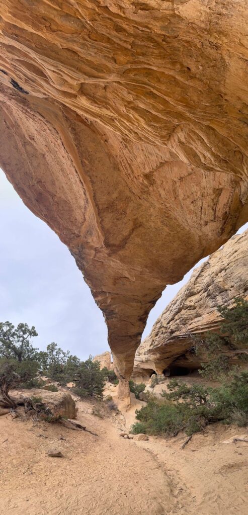
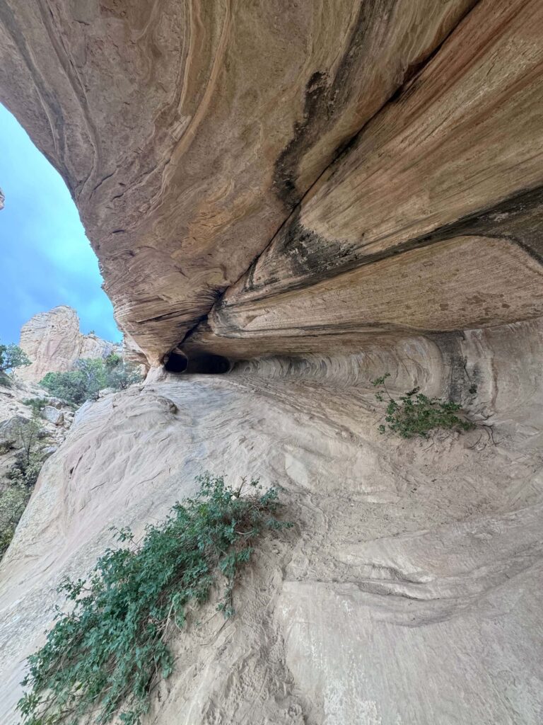
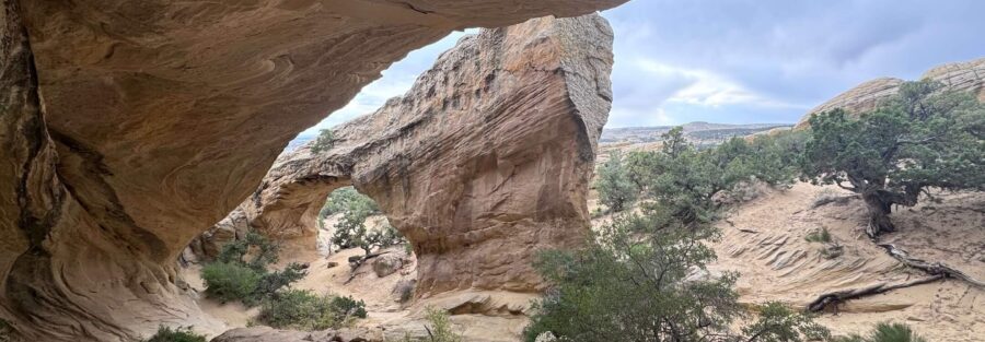
Moonshine Arch is a striking sandstone arch that rises over 40 feet tall and stretches more than 85 feet wide, making it one of the most impressive natural arches in the area. As you approach the arch, you’ll be surrounded by a mix of desert scrub, juniper trees, and large sandstone formations. The open landscape allows for stunning views in every direction, especially as you get closer to the arch.
The arch itself provides shade and a perfect spot to rest, have a picnic, and take in the surroundings. This remote location also gives you a sense of peace and solitude, far from the busier trails in Utah’s more popular hiking spots. The lighting in the late afternoon adds an extra layer of beauty, casting shadows and highlighting the red and orange hues of the rock.
Trail Difficulty and Length:
The hike to Moonshine Arch is considered moderate, with a round trip of 1.5 miles from the trailhead. While the distance is relatively short, parts of the trail can be rocky and sandy, requiring a bit of careful navigation. The trail crosses slickrock in some areas, where the path can be hard to follow, so keep an eye out for cairns (small rock piles) that mark the way.
Is It Dog-Friendly?
Yes, Moonshine Arch is a dog-friendly trail, making it a great choice for visitors traveling with their four-legged companions. Dogs must be kept on a leash to protect the surrounding wildlife and ensure the safety of other hikers. Be sure to bring water for your dog, as the desert heat can be intense, especially in the summer months, and there are no water sources along the trail.

Local Regulations and Tips:
When hiking to Moonshine Arch, it’s important to follow Leave No Trace principles. Pack out all trash, avoid disturbing wildlife, and stay on the trail as much as possible to help preserve the natural beauty of the area.
While the trail is on public land, it does cross private property in some areas. Be sure to respect any posted signs and stay on the marked trail to avoid trespassing. The hike is free, and no permits are required, but always be mindful of local regulations to protect the environment and wildlife.
Be sure to wear sunscreen, a hat, and sturdy hiking shoes. The trail is mostly exposed to the sun, and the desert can get very hot during the day. The best times to hike are in the cooler hours of the morning or late afternoon, especially during the summer.
Other Hiking Trails Nearby:
If you’re looking to explore more of the area after your visit to Moonshine Arch, there are several great hiking options near Vernal.
Red Fleet State Park offers the Dinosaur Trackway Trail, a fun and educational hike that takes you past preserved dinosaur footprints. This hike is about 3 miles round trip and offers beautiful views of Red Fleet Reservoir.
The Sound of Silence Trail in Dinosaur National Monument is a scenic 3 mile round trip hike through the desert.

Non-Hiking Attractions Nearby:
In addition to hiking, Vernal and the surrounding area are full of non-hiking attractions that are worth exploring. A must visit is the Utah Field House of Natural History State Park Museum, located in downtown Vernal. This museum offers fascinating exhibits on dinosaurs, fossils, and the geological history of the region.
Another top attraction is Dinosaur National Monument, located just a short drive from Vernal. Here, you can visit the famous Dinosaur Quarry Exhibit Hall, where hundreds of dinosaur fossils are still embedded in the rock for you to view up close.
For those who enjoy water activities, Red Fleet State Park is a fantastic spot for boating, fishing, and swimming in a scenic desert reservoir. It’s the perfect place to cool off after a hike.
Accommodations: Where To Set Up Basecamp
SpringHill Suites by Marriott Vernal
If you’re looking for space, comfort, and modern style without breaking the bank, SpringHill Suites is a winner in Vernal. With roomy suites, comfy beds, and a hearty breakfast to fuel your adventures, this hotel makes exploring Dinosaur National Monument and the Utah backcountry easy. Families love the layout, and solo travelers appreciate the extra touches of convenience.
👉Book your stay at SpringHill Suites Vernal today and lock in the best rates.
For a stay that blends small town charm with big time hospitality, Dinosaur Inn & Suites stands out. They have a welcoming staff, spotless rooms, and a breakfast that’s way more than your standard grab and go. It’s the perfect basecamp for exploring the land of dinosaurs while enjoying comfort and service that feels personal.
👉Reserve your spot at Dinosaur Inn & Suites now and experience Vernal’s top-rated hotel.
Best Time to Visit Moonshine Arch:
The best time to hike Moonshine Arch is during the spring (April to June) and fall (September to November). During these months, temperatures are mild, making the hike more enjoyable. Summer in Vernal can be extremely hot, with temperatures often exceeding 90°F, so if you plan to visit in the summer, it’s best to start your hike early in the morning or late in the evening to avoid the heat.
Winter is also an option, but be prepared for colder temperatures, especially at higher elevations. Snow and ice can occasionally make the trail more challenging during the winter months, so dress accordingly and check trail conditions beforehand.
Support the Adventure
To make your walls less boring, check out my photography portfolio and bring a piece of the wild and my story into your home.
If you’d like to fuel future adventures, you can donate a coffee on Ko-Fi. Every cup keeps me chasing sunrises and stories.
When you shop using my affiliate links, every click helps support this blog at no extra cost to you. It’s a small way to keep Unicorn Adventure alive and kicking while I keep exploring.
Subscribe to my mailing list for future updates, new stories, and behind-the-scenes adventures.
Stay connected with me on Instagram and Facebook for more photos and daily inspiration.
Thanks for being part of the journey, Unicorn Squadron!


