

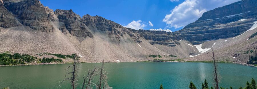
Amethyst Lake sits 6.5 miles from the Christmas Meadows Trailhead in the High Uintas Wilderness, beneath Ostler Peak and Spread Eagle Peak at around 10,700 feet. Getting there requires 13 miles roundtrip and 2,326 feet of elevation gain through the Stillwater Fork drainage, which is one of the more scenic river valleys in the Uintas: dense conifer forest giving way to open meadow, the creek beside you most of the way, the mountain walls closing in as you gain the upper basin. It’s a full day. It’s worth the full day. The Uintas are the range where I come when I want the version of Utah that isn’t desert. This trail is the version of that: sustained mountain hiking through forest and meadow to a remote lake that most people haven’t seen. The Stillwater Fork drainage has a strong sensory identity. The creek sound follows you for miles. The smell of the forest at 9,000 feet. The abrupt shift when the trees thin and the upper basin opens. Amethyst Lake at the end of it is exactly what that kind of approach earns. This guide covers the Amethyst Lake Trail via Stillwater from the Christmas Meadows Trailhead: stats, what the three distinct terrain zones of the route involve, and how to plan a hard day in the High Uintas.
Quick Facts
| Trail Name | Amethyst Lake Trail via Stillwater and Amethyst Lake Trails |
| Location | High Uintas Wilderness, near Kamas, Utah |
| Coordinates | 40.8233° N, 110.8012° W (Christmas Meadows Trailhead) |
| Distance | 13.0 miles roundtrip |
| Elevation Gain | 2,326 feet |
| Difficulty | Hard |
| Time | 7-9 hours |
| Dogs Allowed | Yes, on leash |
| Fee | Mirror Lake Highway pass: $10 (1-3 day) or $20 (7-day); America the Beautiful Pass accepted |
| AllTrails | View on AllTrails |
How to Get There
From Kamas, take Mirror Lake Highway (UT-150) east for approximately 25 miles. Watch for the signed turnoff for Christmas Meadows Road on the left. This is a maintained dirt road; follow it 4 miles to the Christmas Meadows Trailhead at its end. The road is passable for most vehicles in dry conditions but benefits from higher clearance after wet weather. From Salt Lake City, plan about 1.5-1.75 hours: I-80 east to US-40 east to Heber City, then UT-248 east to Kamas, then Mirror Lake Highway east. From Park City, Kamas is about 20 minutes south on UT-32. Mirror Lake Highway closes November 1st and typically reopens around Memorial Day weekend. The Christmas Meadows Trailhead is inaccessible during the winter months. Even after the highway opens, the upper Stillwater Fork drainage can carry significant snow into July in heavy snow years. Check recent AllTrails condition reports before planning a June visit to this trailhead.
Parking Information
The Christmas Meadows Trailhead has a large parking area with restrooms and information kiosks. It serves multiple trails including the Amethyst Lake route and extensions toward Ryder and Kermsuh Lakes. Summer weekends fill the lot; arrive before 7 a.m. on peak days. Weekday visits are significantly less congested. Mirror Lake Highway pass required: $10 for 1-3 days or $20 for 7 days. America the Beautiful Annual Pass accepted. Pay at self-serve kiosks on the highway before the Christmas Meadows Road turnoff. 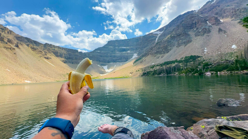
Cell Service and Navigation
Cell coverage is absent on the Mirror Lake Highway above the valley floor and completely gone at the Christmas Meadows Trailhead and on the trail. Download AllTrails offline and have it ready before leaving Kamas. The Amethyst Lake Trail is well-maintained and signed through the lower canyon section. The upper basin approach requires more attention to the route as the trail crosses open terrain above tree line. The route uses both the Stillwater and the Amethyst Lake Trails: the Stillwater Fork drainage on the approach and potentially a different trail back section. Confirm the exact loop or out-and-back configuration with AllTrails before your visit.
What to Expect on the Amethyst Lake Trail
The Lower Canyon: Stillwater Fork
The trail from the Christmas Meadows Trailhead follows the Stillwater Fork of the Bear River upstream through forest. This is the most sustained and shaded section of the hike, the creek audible beside the trail, the canyon walls gradually rising as you gain elevation. Multiple wooden bridges cross the creek on the lower section. The forest here is dense conifer and the sound environment is primarily water and wind in trees. This section sets the rhythm for the day. The grade is steady but manageable, the footing is well-maintained, and the miles accumulate without feeling like they’re being extracted from you. If you’re doing well at mile 3, you’re positioned well for the upper section. If you’re laboring at mile 3, the upper miles are worth reconsidering.
The Meadows and Middle Section
The canyon opens at various points into the Christmas Meadows area and the broader Stillwater drainage meadows. Wildflowers through July and early August, creek crossings, and increasingly open views of the surrounding ridgeline as you gain elevation characterize this middle section. The grade remains consistent and the trail continues to be well-marked. This is where the Uintas’ particular quality becomes most apparent: the combination of open meadow with the surrounding mountain wall, the creek beside you, and the sky overhead. It’s a specific kind of beautiful that’s different from the desert canyon country and different from the glaciated alpine of the Rockies. The Uintas are their own thing.
The Upper Basin and Amethyst Lake
The trail steepens in the final miles as it gains the upper basin below Amethyst Lake. The vegetation thins, the terrain becomes rockier, and the views open to the surrounding high peaks. Ostler Peak and Spread Eagle Peak frame the lake from above, their cliff faces reflected in the water on calm mornings. Amethyst Lake is a genuine destination lake: large enough to provide real shoreline access, clear enough to see the bottom in the shallows, and enclosed by high terrain on three sides that creates the contained alpine atmosphere that a long approach earns. Fishing in the lake requires a Utah license; Amethyst has historically held brook and cutthroat trout. Allow yourself real time at the lake rather than immediately turning around. The approach took most of a day and the lake deserves more than 10 minutes.
Trail Difficulty and Length
Hard is the correct rating. This is a genuine full-day commitment that demands appropriate preparation: good fitness, adequate water, food for a 7-9 hour day, weather-appropriate layers, and an early start. The difficulty is not technical. The trail is maintained and signed. The challenge is sustained: 13 miles at elevation with 2,326 feet of climbing requires real aerobic fitness and the willingness to pace conservatively enough on the outbound leg that you have energy for the return. The return is 6.5 miles back the way you came, and it’s easier to underestimate the return than the approach.
Dog Friendly?
Yes. High Uintas Wilderness allows leashed dogs throughout. The 13-mile roundtrip is a significant day for dogs as well as humans. Assess your dog’s fitness honestly before committing them to this distance and elevation. The creek alongside the lower trail provides water opportunities throughout the outbound leg. Bring at least 1 liter of water for dogs in addition to their creek access. The wooden bridges on the lower section can be slippery for dogs. The rocky upper basin terrain requires confident footwork. Large, fit, trail-experienced dogs handle this route well. Less athletic or older dogs may find the upper section and the sustained distance more than they want to commit to. 
What to Bring
Water: 3-4 liters per person for a 7-9 hour day at elevation. The creek in the lower canyon and at the lake provides refill opportunities with treatment or filtration, but the upper section above tree line has limited water access. Carry enough to get to the lake without depending on trail sources. Food: a full day’s calories. High elevation hiking burns more than flat equivalents and the Uintas air at 10,000-plus feet is drier than lower elevations. Eat regularly rather than waiting until you feel depleted. Layers: mornings at the Christmas Meadows Trailhead can be cold even in July. The upper basin above tree line is exposed to wind. A down or synthetic mid-layer and a waterproof shell are the minimum. Afternoon thunderstorms over the Uintas are the primary safety variable in summer; the exposed upper basin is a lightning exposure zone. Start early and plan to be descending before noon on storm-likely days. Hiking boots with ankle support for the upper rocky sections. Trekking poles for the creek crossings and the descents. Sun protection for the exposed upper terrain. A fishing rod and Utah license if you want to fish Amethyst Lake. Best Time to Hike Amethyst Lake Trail For photography: morning at Amethyst Lake before the wind picks up is the reflective water window. The lake faces east into the basin, so the light on the surrounding peaks is excellent in the first hours after sunrise. Getting there by 9 a.m. requires a very early start and a faster-than-sightseeing pace on the approach.
Rules and Regulations
Leave No Trace principles apply throughout the High Uintas Wilderness. Pack out everything including food scraps and waste. Camp at least 200 feet from water sources. No fires above 10,000 feet in most Uintas Wilderness areas; check current fire restrictions before your trip. Overnight camping requires a self-registration permit at the trailhead. Stay on the designated trail in the lower canyon and meadow sections where the established path is clear. In the upper basin, walk on rock surfaces where possible to minimize soil and vegetation impact. Dogs on leash at all times. Fishing with a valid Utah license. No drones without a special use permit.
Where to Stay Near Kamas
Kamas is about 25 miles west on Mirror Lake Highway plus 4 miles on Christmas Meadows Road from the trailhead, roughly 40-45 minutes. The town has limited lodging. Park City, 20 minutes south of Kamas on UT-32, has full resort infrastructure. For points travelers, check available Marriott Bonvoy properties, IHG Rewards hotels, and Hilton Honors options in Park City and Salt Lake.
Camping Nearby
The Christmas Meadows area has dispersed backcountry camping in the High Uintas Wilderness for overnight trips. Self-registration at the trailhead. Camp at least 200 feet from the creek and any water sources. Standard wilderness rules apply. Mirror Lake Campground on the Mirror Lake Highway is the nearest developed campground, about 5 miles back toward Kamas on the highway. Reservations through recreation.gov during peak season. Sites at Mirror Lake fill fast for summer weekends. For a 13-mile day hike, camping at the Christmas Meadows area the night before sets up an ideal early start.
Nearby Adventures
The Christmas Meadows Trailhead also provides access to Ryder Lake and Kermsuh Lake, both in the upper Stillwater Fork drainage, and can be combined with the Amethyst Lake approach for multi-day backpacking trips or for hikers who want additional lake destinations beyond Amethyst. Bald Mountain Trail on the Mirror Lake Highway is the accessible summit option in this corridor: 2.8 miles roundtrip to 11,943 feet. It’s the efficient alternative for days when a 13-mile approach isn’t the plan but a mountain experience still is. Bald Mountain in the morning and Upper Provo River Falls on the drive back makes a solid half-day Uintas combination. 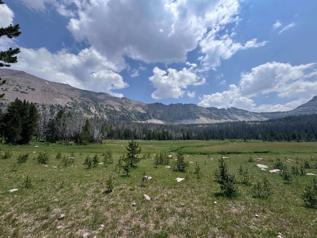
Plan This Hike
AllTrails has the Amethyst Lake Trail mapped with offline capability and condition reports from recent hikers. Download before you lose signal on the Mirror Lake Highway turnoff. Plan your hike on AllTrails and pull the offline map while you’ve still got signal in Kamas.
Chase the Quiet
The creek follows you for most of the approach to Amethyst Lake. Six and a half miles of the Stillwater Fork beside the trail, its sound changing as the canyon widens and narrows around it. By the time you reach the lake, you’ve been in the presence of moving water for most of the day. The lake at the end is still instead of moving, and that stillness is a different kind of the same thing. High Uintas Wilderness, 13 miles from the trailhead, has a particular quality of distance that isn’t about the miles. It’s about having left everything else further behind than a parking lot can accomplish.
Support the Adventure
To make your walls less boring, check out my photography portfolio and bring a piece of the wild and my story into your home. If you’d like to fuel future adventures, you can donate a coffee on Ko-Fi. Every cup keeps me chasing sunrises and stories. When you shop using my affiliate links, every click helps support this blog at no extra cost to you. It’s a small way to keep Unicorn Adventure alive and kicking while I keep exploring. Subscribe to my mailing list for future updates, new stories, and behind-the-scenes adventures. Stay connected with me on Instagram and Facebook for more photos and daily inspiration. Thanks for being part of the journey, Unicorn Squadron!

Theo Maynard is a landscape photographer and adventure blogger based in Salt Lake City. He chases remote desert and mountain light across the American West, documents it all solo, and shares the journey through Unicorn Adventure. He’s on the autism spectrum, and that’s not a footnote, it’s the whole story. He creates to inspire others to get outside, chase what lights them up, and live their best possible life. Unapologetically himself.