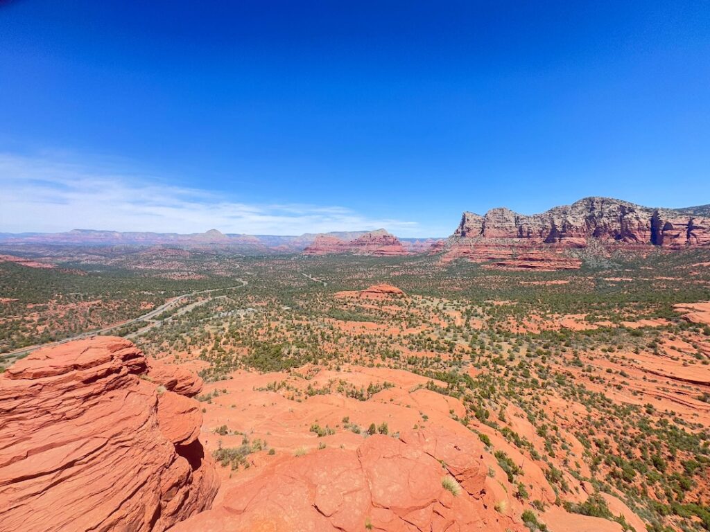
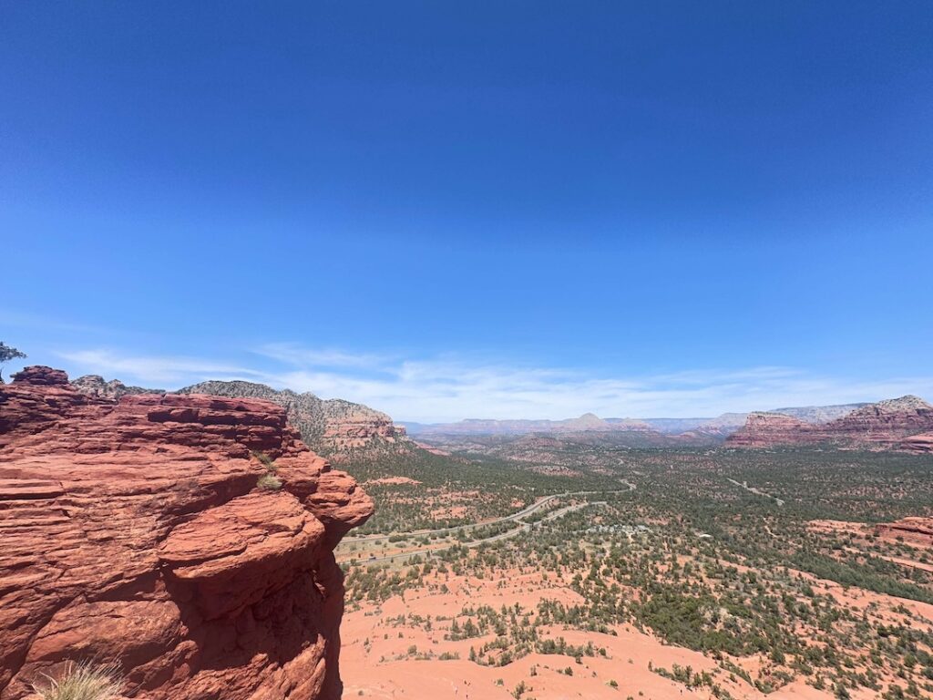
Bell Rock is the most recognizable formation on the Sedona skyline south of town. It rises from the desert floor in a perfect bell shape off AZ-179, visible from the highway, unmistakable from every angle. The base loop is a short 0.8-mile walk around the formation with wide views of Courthouse Butte and the Verde Valley. But Bell Rock rewards the people who go further. The sandstone face invites scrambling, and the higher you climb, the more the whole basin opens up around you.
Quick Facts
Location | Coconino National Forest, Sedona, Arizona |
Coordinates | |
Distance | 0.8 miles (base loop); extended scramble adds significant mileage |
Elevation Gain | 203 ft (base loop) |
Difficulty | Easy to Moderate (scramble sections push toward strenuous) |
Time | 30 min to 2+ hours depending on how high you climb |
Dogs Allowed | Yes, on leash |
Fee | Red Rock Pass required ($5/day or $15/week); America the Beautiful Pass accepted |
How to Get There
Bell Rock Trailhead is on AZ-179, five miles south of Sedona’s main corridor. From Sedona, drive south on AZ-179 and watch for the Bell Rock Vista parking area on your right. It’s well-signed and easy to spot. Coming from I-17, take Exit 298 north toward Sedona. The Bell Rock area is one of the first major trailheads you reach on AZ-179 heading into town. The road is fully paved and the trailhead is one of the best-marked in Sedona.
Parking Information
Bell Rock Vista parking requires a Red Rock Pass: $5 for a day pass or $15 weekly. The America the Beautiful Pass covers entry here. Kiosk in the lot for in-person purchase or buy online in advance. The lot is one of the larger trailhead lots on the AZ-179 corridor but still fills by mid-morning on weekends. Arrive before 8 a.m. or plan for overflow at the Courthouse Vista Trailhead nearby, which adds a short walk to the Bell Rock trail connection.
Cell Service and Navigation
Coverage at Bell Rock is reliable across all major carriers. You’re close to Sedona proper and the open desert terrain keeps signal strong throughout the base loop and most of the scramble. Download the AllTrails map before you go regardless, the upper scramble sections have multiple route options and having a GPS track running helps you navigate back down the same way you came up. Descending a different line than you ascended on sandstone scrambling is how people get cliffed out.
What to Expect on Bell Rock Trail
The Base Loop
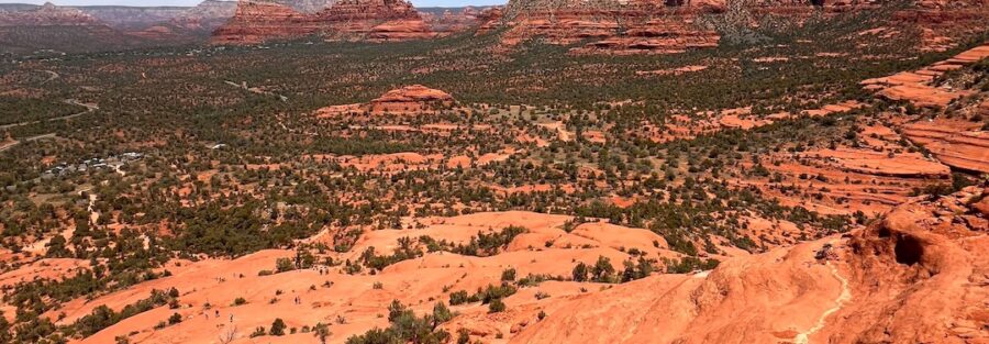
The base trail circles the foot of Bell Rock on a wide, well-maintained path through red rock desert. Packed dirt and sandy sections, minimal elevation change, easy footing throughout. The formation rises above you the entire loop, changing shape and character as you move around it. Courthouse Butte sits directly to the northeast and fills the view on that section of the loop. The base loop is 0.8 miles and accessible for hikers of every level. It works well as a standalone walk or as the warmup before going higher.
The Scramble
Bell Rock’s real appeal is the sandstone face itself. The rock is covered in ledges, ramps, and natural features that invite climbing, and most hikers start making their way up the face well before completing the base loop. There is no defined summit trail. You pick your line based on comfort and ability. The lower sections are easy scrambling, hands-on but not exposed. The middle sections get steeper and require more careful route-finding. The upper reaches are technical enough that turning around is the right call for most hikers without scrambling experience. Grip soles are essential throughout. Wet sandstone after rain is significantly more dangerous.
The Vortex
Bell Rock is one of Sedona’s most visited vortex sites, believed to emit an upward-spiraling energy field associated with clarity and spiritual strength. Whether or not that resonates with you, the location has a quality to it that is worth acknowledging. The rock draws people who come specifically to sit, meditate, and spend extended time there. That culture is part of what Bell Rock is. The base and lower scramble sections see enough traffic that you’re rarely alone, but find a quiet ledge 50 feet up the east face and you can carve out your own space.
Trail Difficulty and Length
The Bell Rock base loop is 0.8 miles with 203 feet of elevation gain, solidly easy and appropriate for all fitness levels. The scramble ascent adds significant mileage and elevation depending on how high you go. The lower scramble sections are moderate. Higher up, the route becomes more demanding with exposed moves and poor descent visibility. Sturdy hiking boots or trail shoes with real grip are worth it even for the base loop since the sandstone surface is smooth in spots. For the scramble, ankle support and aggressive tread are non-negotiable. Trekking poles slow you down on the rock face. Leave them at the base.
Dog Friendly?
Dogs are allowed on leash throughout Bell Rock Trail. The base loop is manageable for most dogs. The scramble sections are rougher on four-legged animals, the steep sandstone and smooth rock moves are awkward for dogs and the exposure on higher sections is a real risk. Assess your dog’s agility honestly. Bring water from home. No sources on the trail. Packed-out waste is non-negotiable at a trailhead this busy.
What to Bring
At least a liter of water per person for the base loop. More if you plan to scramble. Sunscreen and a hat, the trail has minimal shade. Grippy hiking boots or trail shoes for anything beyond the base loop. A camera. Bell Rock is one of the most photogenic formations in Sedona at golden hour and the panoramic views from the scramble sections reward a wide lens.
Best Time to Hike Bell Rock Trail
Spring (March through April) and fall (October through November) give you the best conditions, mild temperatures and the red rock light at its most dramatic. Summer is workable at the base loop with an early start, but the sandstone face radiates heat by 9 a.m. and the scramble becomes unpleasant quickly. Winter is quiet and clear in Sedona most years, with excellent light and thin crowds on weekdays. Sunrise is exceptional at Bell Rock. The formation faces east and catches the first direct light of the day while the western valley is still in shadow. Plan to be at the base 20 minutes before sunrise and start your scramble as the light hits. Sunset from the upper scramble ledges looking west over the Verde Valley is the other unmissable window.
Rules and Regulations
Bell Rock sits in Coconino National Forest. Stay on marked trails for the base loop. The scramble is technically off-trail use on the rock face itself, which is permitted at Bell Rock but creates an obligation to minimize your impact. Do not create new paths or move off the established scramble lines onto fragile desert vegetation around the base. No campfires. No camping. No drones. No rock, plant, or artifact collection. Pack out all waste. Leave No Trace applies at one of Sedona’s highest-traffic destinations more than anywhere else in the red rock corridor.
Where to Stay Near Sedona
The Bell Rock Trailhead is in the Village of Oak Creek, about five miles south of Sedona proper. Several lodging options sit directly in the Village or within a short drive. For points travelers, Marriott Bonvoy covers properties in Sedona and the Verde Valley. IHG Rewards has options in the region. Hilton Honors covers Sedona-area properties including options near the AZ-179 corridor. Staying in the Village of Oak Creek puts you closest to Bell Rock, Courthouse Butte, and Cathedral Rock without fighting the Uptown Sedona crowds.
Camping Nearby
Dispersed camping on Schnebly Hill Road is the closest free option, about 10 minutes north of Bell Rock on the Sedona side. Fox Borough pull-offs and roadside platforms are free on Coconino National Forest land with a 14-day limit. The Nolan Tank site and Edge of the World are additional dispersed options in the broader Sedona area. No water or services at any dispersed site. Munds Park and Cave Springs Campground along Oak Creek are established developed campgrounds with more amenities closer to the AZ-179 corridor.
Nearby Adventures
Munds Wagon, Cow Pies, and Hangover Loop is the most demanding nearby hike at 8.2 miles and 1,181 feet of gain, with Hangover Trail’s cliffside ledges delivering the best views in the Sedona canyon system. Devil’s Bridge Trail is 3.9 miles and 521 feet of gain to the largest natural sandstone arch in the area and the most photographed single destination in Sedona. Fay Canyon Trail is a short easy option at 2.4 miles and 298 feet of gain with a hidden arch. Cathedral Rock is a short drive from Bell Rock and offers a popular moderate scramble hike with one of the most iconic silhouettes in Sedona. For non-hiking, Tlaquepaque Arts and Shopping Village is the best post-trail stop for local art and food. The Amitabha Stupa and Peace Park fits well with the spiritual dimension of a Bell Rock visit if you want a quieter, more contemplative follow-up.
Plan This Hike
AllTrails has Bell Rock Trail documented with the base loop, scramble routes, and user-submitted route variations for different levels of ambition. Current condition reports from recent hikers flag wet rock conditions after rain, which matters significantly on the scramble sections. Download the offline map before you go. Plan your hike on AllTrails here.
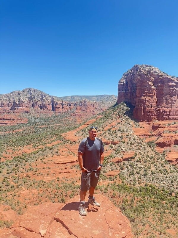
Chase the Quiet
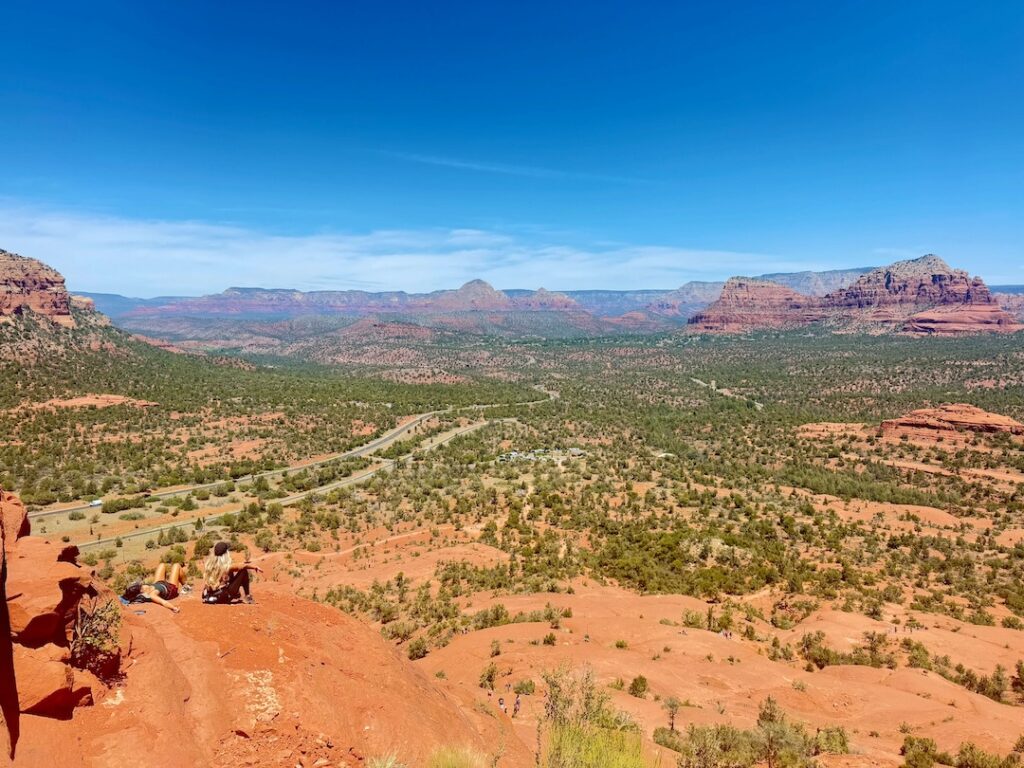
I found a ledge on the east face about 80 feet up on a Tuesday evening when the day hikers were clearing out. Courthouse Butte glowing across the flats, the Verde Valley going bronze in the last light, Bell Rock’s sandstone warm under my hands from a full day in the sun. The vortex crowd, the Jeep tour groups, the selfie queue at the base, they’re all gone by 5 p.m. on a weekday. What’s left is just the rock and the light and the view. That’s worth the drive down AZ-179.
Support the Adventure
To make your walls less boring, check out my photography portfolio and bring a piece of the wild and my story into your home.
If you’d like to fuel future adventures, you can donate a coffee on Ko-Fi. Every cup keeps me chasing sunrises and stories.
When you shop using my affiliate links, every click helps support this blog at no extra cost to you. It’s a small way to keep Unicorn Adventure alive and kicking while I keep exploring.
Subscribe to my mailing list for future updates, new stories, and behind-the-scenes adventures.
Stay connected with me on Instagram and Facebook for more photos and daily inspiration.
Thanks for being part of the journey, Unicorn Squadron!

Theo Maynard is a landscape photographer and adventure blogger based in Salt Lake City. He chases remote desert and mountain light across the American West, documents it all solo, and shares the journey through Unicorn Adventure. He’s on the autism spectrum, and that’s not a footnote, it’s the whole story. He creates to inspire others to get outside, chase what lights them up, and live their best possible life. Unapologetically himself.