Quick Facts:
Location: High Uintas Wilderness
Coordinates: 40.72214263841237, -110.8644077565055
Length: 3.5 Miles
Difficulty: Hard
Elevation Gain: 2,100 Feet
Dog Friendly: Yes
Introduction:
Hayden Peak, located in the High Uintas Wilderness near Kamas, Utah, is one of the most iconic and challenging hikes in the Uinta Mountains. Standing tall at 12,479 feet, this prominent peak offers breathtaking views of the surrounding wilderness and is a must do for experienced hikers seeking a rewarding adventure. The trail to Hayden Peak takes you through rugged terrain, past alpine lakes, and offers a true wilderness experience that showcases the rugged beauty of the Uintas.
How to Get There:
To reach the trailhead for Hayden Peak, head east from Kamas, Utah, on UT-150, also known as the Mirror Lake Highway. This scenic drive will take you deep into the Uinta Mountains, offering stunning views along the way. After approximately 33 miles, you’ll reach Hayden Pass, which is the most common starting point for the ascent to Hayden Peak. The trailhead is located just off the highway, and the peak is visible from the parking area. Mirror Lake Highway closes November 1st and typically reopens Memorial Day weekend, depending on the snow levels. Making this trail inaccessible during the winter months.
Parking Information:
Parking is available at the Hayden Pass Trailhead, where you’ll find a large, well-maintained parking lot. This area is popular with hikers, especially during the summer months, so it’s a good idea to arrive early to secure a spot. There is a $10 one-three day pass or a $20 seven day pass to access this trail. The trailhead also offers restrooms and information kiosks, making it a convenient place to start your hike.

Landscape Description:
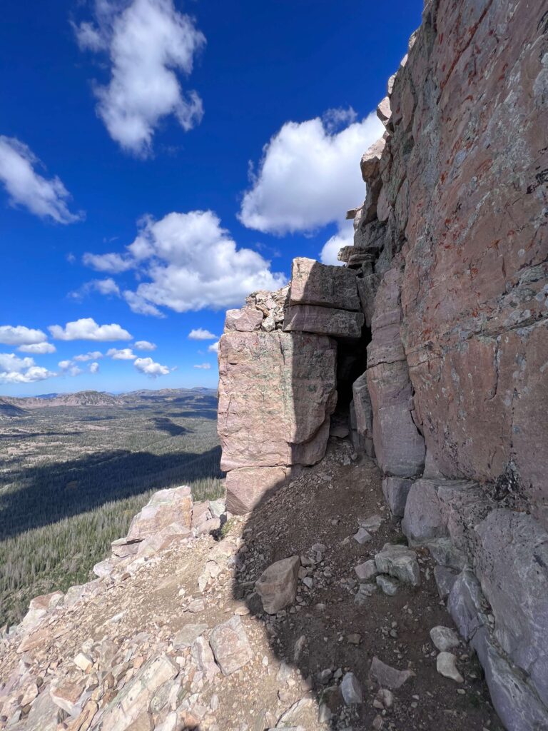
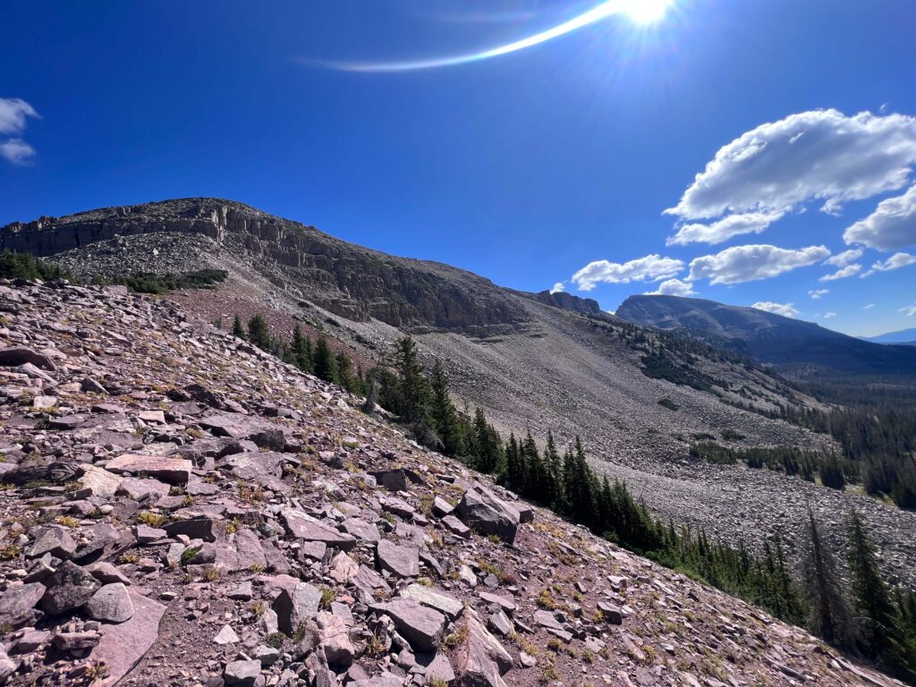
The hike to Hayden Peak takes you through a diverse and stunning landscape that exemplifies the beauty of the High Uintas Wilderness. The trail begins by winding through dense forests of pine and fir, with occasional clearings that offer glimpses of the towering peaks ahead. As you ascend, the trees begin to thin out, giving way to rocky terrain and expansive views of the surrounding mountains. Along the way, you’ll pass several alpine lakes, including Mirror Lake and the smaller Scudder Lake, which offer peaceful spots to rest and take in the scenery. The final ascent to Hayden Peak is steep and challenging, with rugged, rocky terrain that requires careful footing. However, the effort is well worth it, as the summit provides panoramic views of the Uinta Mountain Range, with endless peaks and valleys stretching out in every direction.
Trail Difficulty and Length:
The hike to Hayden Peak is considered difficult and is best suited for experienced hikers. The trail is approximately 3.5 miles round trip, with a significant elevation gain of over 2,000 feet. The final ascent is steep and involves some scrambling over loose rock, so proper footwear and caution are essential. Due to the challenging nature of the hike, it’s important to be prepared with plenty of water, snacks, and appropriate gear.

Is It Dog Friendly?
Yes, the trail to Hayden Peak is dog-friendly, but the difficulty of the hike means it’s best suited for dogs that are experienced with rough terrain and long distances. Dogs must be kept on a leash at all times to protect the local wildlife and ensure the safety of all hikers. Be sure to bring plenty of water for both you and your dog, as there are no reliable water sources on the final ascent. It’s also important to be mindful of your dog’s ability to navigate the rocky terrain and to clean up after your pet to keep the trail pristine for others.
Local Regulations:
When hiking in the High Uintas Wilderness, it’s important to follow Leave No Trace principles. This includes packing out all trash, staying on designated trails, and respecting the natural environment. Campfires are only allowed in designated areas, and it’s crucial to check for any fire restrictions before your visit. Fishing is permitted in the lakes along the trail, but be sure to follow local regulations and obtain the necessary permits if you plan to fish. As this is a wilderness area, permits are required for overnight camping, but day hikes do not require a permit.

Other Trails Nearby:
If you’re interested in exploring more of the High Uintas Wilderness, several other trails nearby offer a variety of hiking experiences. The Bald Mountain Trail is a shorter and less challenging hike that offers panoramic views from the summit. The Highline Trail, accessible from nearby trailheads, provides a longer, multi-day backpacking experience through some of the most remote areas of the Uintas. The 20 Lakes Loop is another great option, taking you past several beautiful alpine lakes with stunning views of the surrounding peaks.
Non-Hiking Attractions Nearby:
After your hike, consider exploring the town of Kamas, known as the “Gateway to the Uintas.” Here, you can find local cafes and shops that offer a taste of small-town Utah. The Mirror Lake Scenic Byway, which you’ll travel to reach the trailhead, is an attraction in itself, offering numerous pullouts where you can stop and enjoy the views. Additionally, the nearby Uinta-Wasatch-Cache National Forest provides opportunities for fishing, camping, and wildlife viewing.

Best Time to Visit:
The best time to hike Hayden Peak is during the summer and early fall, from July to September. During this time, the snow has melted, and the weather is generally mild, making for safer hiking conditions. The summer months bring wildflowers in full bloom and warm, sunny days, while early fall offers cooler temperatures and vibrant autumn colors. Due to the high elevation, the trail can be snow-covered well into June, so it’s important to check trail conditions before your hike. Winter hiking is not recommended due to the extreme weather and avalanche risk.
Support the Adventure
To make your walls less boring, check out my photography portfolio and bring a piece of the wild and my story into your home.
If you’d like to fuel future adventures, you can donate a coffee on Ko-Fi. Every cup keeps me chasing sunrises and stories.
When you shop using my affiliate links, every click helps support this blog at no extra cost to you. It’s a small way to keep Unicorn Adventure alive and kicking while I keep exploring.
Subscribe to my mailing list for future updates, new stories, and behind-the-scenes adventures.
Stay connected with me on Instagram and Facebook for more photos and daily inspiration.
Thanks for being part of the journey, Unicorn Squadron!


