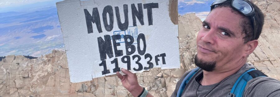
Mount Nebo is the highest peak in the Wasatch Range at 11,933 feet, which is the first thing worth knowing about it. The second thing worth knowing is that the most common day-hike approach from the North Trailhead is 8.5 miles roundtrip with 3,500 feet of elevation gain, which puts it in the serious range even among hard Wasatch Front hikes. The drive to the trailhead via the Nebo Loop Scenic Byway is itself a legitimate experience: 28-plus miles of mountain road connecting Payson to Nephi through the Mount Nebo Wilderness, offering views that start good and get better as the road climbs.
Mount Nebo and Grotto Falls Trail share the Nebo Loop corridor. The approach via the Nebo Loop puts you at the trailhead with the full byway drive as a natural component of the day, which is worth building in rather than rushing. This guide covers the North Trailhead standard route to the summit.
Quick Facts
|
Trail Name |
Mount Nebo Trail (North Trailhead) |
|
Location |
Uinta-Wasatch-Cache National Forest, near Santaquin, Utah |
|
Coordinates |
|
|
Distance |
8.5 miles roundtrip (North Trailhead) |
|
Elevation Gain |
~3,500 feet |
|
Difficulty |
Hard |
|
Time |
6-9 hours |
|
Dogs Allowed |
Yes, on leash |
|
Fee |
Free |
How to Get There
From Salt Lake City or Provo, take I-15 south to Exit 254 (Payson/Salem). Follow signs toward Payson and pick up the Nebo Loop Road (Payson Canyon Road heading east). The Loop connects Payson on the north end to Nephi on the south, running approximately 38 miles through the Mount Nebo Wilderness. The North Trailhead for Nebo is about 28 miles from Payson along the Nebo Loop.
From Provo, plan about 1.5 hours total to the trailhead. From Salt Lake City, about 1.75-2 hours. The Nebo Loop Road is the scenic byway route; give it time rather than rushing.
Nebo Loop Road closes approximately November 1st and reopens around Memorial Day weekend depending on snowpack. The Mount Nebo summit can hold significant snow into June and the upper trail involves real exposure. Check current conditions before planning any visit before July. Even in summer, remnant snow patches can persist on the north-facing sections of the summit ridge.
Parking Information
The North Trailhead near the terminus of the Nebo Loop Road has parking facilities for multiple vehicles. It fills on summer weekends, particularly in July and August when Nebo sees its peak visitor traffic. Arrive by 6 a.m. on summer weekends to secure a spot. The South Trailhead on the south end of the Loop is a less-used alternative access point for those approaching from Nephi on I-15.
No entry fee. Check current road and trailhead status at the USFS Uinta-Wasatch-Cache website before any Nebo Loop visit.

Cell Service and Navigation
Cell coverage is limited on the Nebo Loop Road above the valley and absent at the North Trailhead and on the upper trail. Download AllTrails offline with the GPS track before leaving Salt Lake City or Provo. The trail is marked but the upper ridge sections require attention to route. The summit is visible from much of the upper climb, which provides a visual anchor, but having GPS active is important on the approach and the descent.
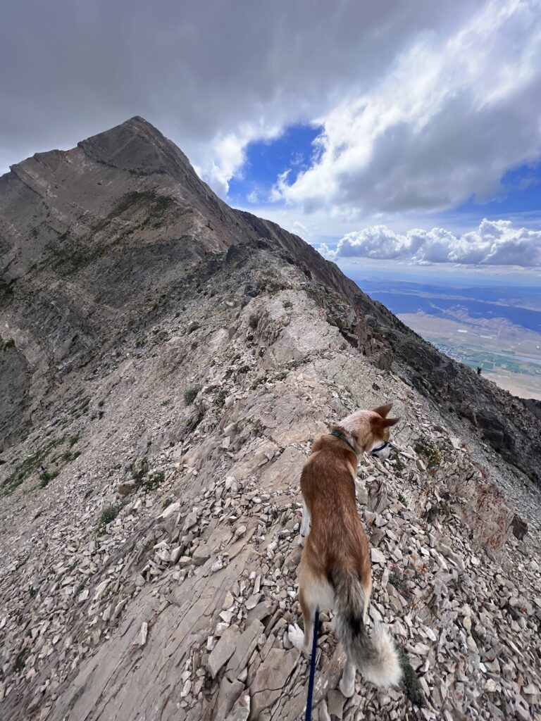
The summit has two distinct high points; the true summit is the southern peak. Confirm on AllTrails which objective is the marked high point before you start, and have the GPS track loaded to distinguish between the two peaks in summit conditions when clouds can obscure the view.
What to Expect on the Mount Nebo Trail
The Nebo Loop Drive
The drive to the North Trailhead on the Nebo Loop Scenic Byway is part of the experience and worth treating as such. The road climbs from the Payson Valley through Payson Canyon, passes through multiple vegetation zones, and provides views of Mount Nebo’s west face that get progressively more dramatic as you approach the trailhead area. Pull-offs are positioned at scenic vantage points along the drive. Budget 45-60 minutes for the byway drive itself at a touring pace.
The Climb to the Summit
The North Trailhead approach to Nebo’s summit climbs through subalpine forest before breaking into exposed ridge terrain on the upper sections. The trail gains elevation steadily and the steepest sections are concentrated in the upper half of the climb, particularly on the final ridge approach to the summit. The rocky terrain on the upper ridge requires careful footwork and the exposure is real when the ridge narrows.
The views expand dramatically as you gain the upper ridge. Utah Valley to the north, the Great Basin to the west, the Juab Valley to the south, and the full sweep of the Wasatch Range in both directions. At 11,933 feet, Nebo stands above most of the Wasatch peaks visible from its summit, which creates a perspective on the range that isn’t available from lower summits within it.
The final push to the summit involves the most exposed and rocky terrain of the route. Take it steady. The summit cairn marks the high point.
Trail Difficulty and Length
Hard is accurate without qualification. Budget 6-9 hours for the full roundtrip; the 8.5-mile distance combined with 3,500 feet of gain at high elevation is a genuine all-day effort for most hikers.
Start no later than 6 a.m. An early start matters on Nebo specifically because afternoon thunderstorms over the Wasatch are common in summer and the fully exposed summit and upper ridge are serious lightning exposure zones. Plan to be off the summit by noon on any day when afternoon storm development is possible.
Dog Friendly?
Yes. Leashed dogs permitted throughout. The upper ridge terrain with steep and rocky sections requires dogs that are confident on exposed, uneven ground. Assess your dog’s fitness and comfort with this kind of terrain honestly. Water is not available on the upper trail; bring at least a liter for dogs in addition to your own supply.

What to Bring
Water: 4 liters minimum for a 6-9 hour hard day at high elevation. The upper summit environment is dry and exposed. Layers are mandatory: a down or synthetic mid-layer and a waterproof shell. Even in summer, the 11,933-foot summit can see wind and cold that don’t register in the morning forecast at the trailhead. Sturdy hiking boots with ankle support for the rocky upper ridge.
Trekking poles for the summit ridge and the descent. Snacks for a full day. Sun protection for the open upper sections.
Lightning contingency: know your descent route and how long it takes to clear the exposed ridge from various points near the summit. If you hear thunder or see a developing anvil cloud over the range, start descending immediately regardless of summit proximity.
Best Time to Hike Mount Nebo
July through September is the reliable snow-free window. Snow often persists on the north-facing summit ridge sections into late June even after the Nebo Loop Road opens. Check recent AllTrails condition reports before planning any visit in June or after early-September storms.
July brings wildflowers to the lower and middle sections and the highest afternoon thunderstorm frequency. August is similar. Plan all summer visits for early morning starts with a noon summit target or noon descent rule.
September is the best overall month. Storm frequency drops, the aspen color on the Nebo Loop approaches its fall peak in late September, and the summit clarity in September mornings is some of the best of the year. The combination of a drive up the Nebo Loop in fall color and a summit day is a specific Utah experience worth timing a trip around.
Rules and Regulations
Leave No Trace principles apply throughout the Mount Nebo Wilderness. Pack out everything. No fires in the Wilderness area. Stay on the designated trail on the lower sections; on the upper rocky ridge, stay on the most-used line. Dogs on leash. No permit required for day hiking.

Where to Stay Near Santaquin
Santaquin and Payson on I-15 are the nearest towns. Provo, about 30-35 minutes north on I-15, has full city infrastructure. Nephi, about 25 miles south on I-15, is the southern access base. For points travelers, check available Marriott Bonvoy properties in Provo, IHG Rewards hotels in Provo, and Hilton Honors options in Provo. Camping at Payson Lakes Campground on the Nebo Loop eliminates the morning drive to the trailhead.
Camping Nearby
Payson Lakes Campground is the main developed campground on the Nebo Loop, with tent and RV sites and facilities, reservable through recreation.gov. Camping here puts you on the Loop the night before a Nebo summit day, which means a zero-drive morning to the trailhead rather than a 1.5-2 hour pre-dawn drive from the valley. Strongly recommended for a serious Nebo attempt.
Nearby Adventures
Grotto Falls Trail is the companion stop on the Nebo Loop at 0.6 miles with 200 feet of gain: the easy waterfall hike in the same corridor. Worth stopping at on the drive in or out of the Nebo Loop if you have the time and energy after the summit. The contrast between the full-day summit effort and a 30-minute waterfall walk is a natural way to end a Nebo day.
The Nebo Loop Scenic Byway is worth driving end-to-end from Payson to Nephi when the road is open. The full loop takes 2-3 hours at a touring pace and can be driven without hiking for anyone who wants the visual experience of the Mount Nebo Wilderness without the summit commitment.
Plan This Hike
AllTrails has Mount Nebo Trail mapped with offline GPS tracking, condition reports including current summit snow and upper trail status, and the route to the true summit. Download before you lose coverage on the Nebo Loop. Plan your hike on AllTrails and pull the offline map while you’ve still got signal in Payson.
Chase the Quiet
The Wasatch Range is 160 miles long and Mount Nebo is the high end of it. Standing on Nebo’s summit puts you above the rest of the range in a way that changes the geometry of everything visible. The Great Basin to the west, Utah Valley to the north, the Wasatch spine extending in both directions. That’s the specific value of going to the highest point: not the view from within the range but the view from above it. That view costs 3,500 feet and 8.5 miles. The math is clear and it’s worth it.

Support the Adventure
To make your walls less boring, check out my photography portfolio and bring a piece of the wild and my story into your home.
If you’d like to fuel future adventures, you can donate a coffee on Ko-Fi. Every cup keeps me chasing sunrises and stories.
When you shop using my affiliate links, every click helps support this blog at no extra cost to you. It’s a small way to keep Unicorn Adventure alive and kicking while I keep exploring.
Subscribe to my mailing list for future updates, new stories, and behind-the-scenes adventures.
Stay connected with me on Instagram and Facebook for more photos and daily inspiration.
Thanks for being part of the journey, Unicorn Squadron!

Theo Maynard is a landscape photographer and adventure blogger based in Salt Lake City. He chases remote desert and mountain light across the American West, documents it all solo, and shares the journey through Unicorn Adventure. He’s on the autism spectrum, and that’s not a footnote, it’s the whole story. He creates to inspire others to get outside, chase what lights them up, and live their best possible life. Unapologetically himself.