


Frary Peak is the highest point on Antelope Island at 6,596 feet, and the trail to reach it is 7 miles roundtrip with 2,300 feet of gain from the Frary Peak Trailhead. That’s a real summit hike on an island in the middle of the Great Salt Lake, which makes the summit view one of the more geographically unusual ones accessible from Utah’s Wasatch Front corridor. The lake is visible in every direction from the top, the Wasatch Range rises to the east across the water, and the island’s terrain drops away below you in all directions.
Antelope Island has three main trails: Frary Peak, Buffalo Point, and Lady Finger. Frary Peak is the hard option: 7 miles and 2,300 feet versus Buffalo Point’s 1 mile and 250 feet. The island has a progression of difficulty built into its trail system, from a short walk to a panoramic overlook to a full summit ascent.
Quick Facts
| Trail Name | Frary Peak Trail |
| Location | Antelope Island State Park, near Syracuse, Utah |
| Coordinates | 40.9939° N, 112.2026° W (Frary Peak Trailhead) |
| Distance | 7 miles roundtrip |
| Elevation Gain | ~2,300 feet |
| Difficulty | Hard |
| Summit Elevation | 6,596 feet |
| Time | 4-6 hours |
| Dogs Allowed | No (dogs not permitted on Frary Peak Trail) |
| Fee | $15 per vehicle to enter Antelope Island State Park |
| AllTrails | View on AllTrails |
How to Get There
From Salt Lake City or Ogden, take I-15 to Syracuse and exit onto Antelope Drive (UT-127) heading west. Cross the Great Salt Lake causeway (7 miles across the lake) to Antelope Island. Follow the park road south to the Frary Peak Trailhead. The Frary Peak Trailhead is further south on the island than the Buffalo Point area; follow park signs.
From Salt Lake City, plan about 40-50 minutes to the causeway, then about 20-25 minutes on the island to the Frary Peak Trailhead. From Ogden, about 30 minutes to the causeway. $15 per vehicle entry fee at the causeway entrance. America the Beautiful Pass does not cover Utah State Parks entry.
Parking Information
Large designated lot at the Frary Peak Trailhead. It fills on spring and fall weekend mornings when the island sees peak visitation. Arrive before 8 a.m. on busy days.
Cell Service and Navigation
Cell coverage is present at the Frary Peak Trailhead given the proximity to the Wasatch Front urban area. Coverage may decrease on the upper trail as you gain the island’s ridgeline. Download AllTrails offline before heading out. The trail is well-marked; navigation isn’t a challenge, but having the GPS track active is useful on the upper sections where the route crosses exposed rocky terrain.
What to Expect on the Frary Peak Trail
The Climb
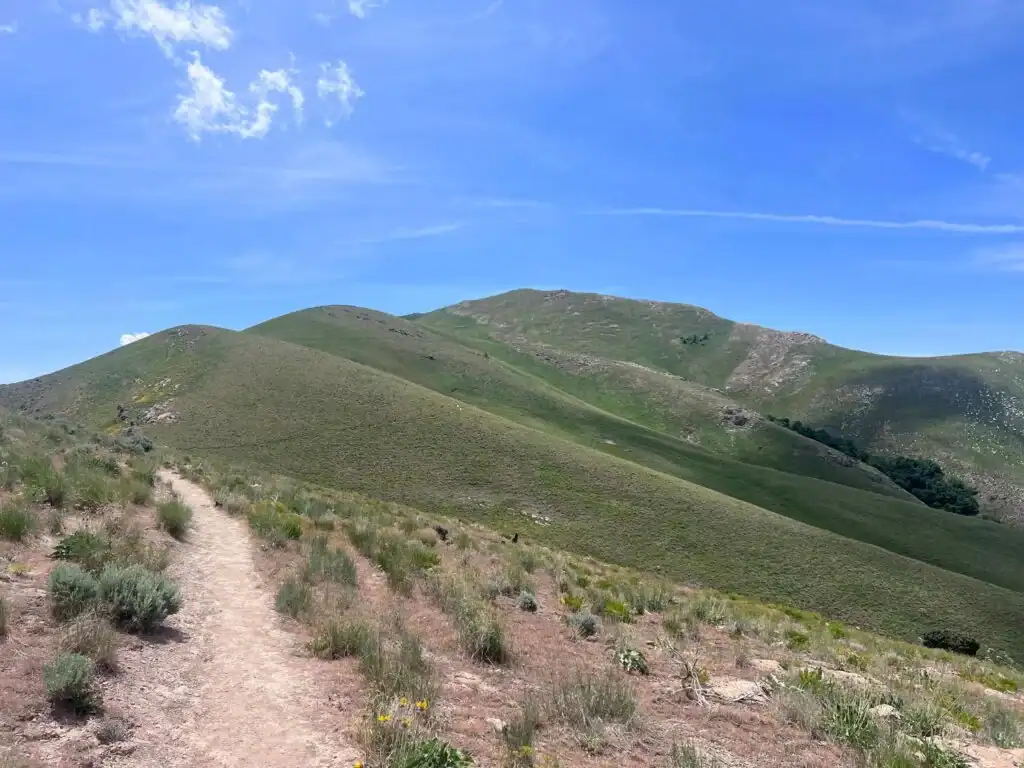
The trail begins in Antelope Island’s arid lowlands: sagebrush, grasses, and the lake visible below as you gain the first elevation. The island’s unique position in the Great Salt Lake means the climate and vegetation are influenced by the lake’s moderating effect and the hypersaline environment, giving Antelope Island a character distinct from the surrounding Wasatch and Oquirrh mountain terrain.
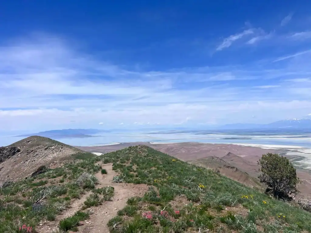
As you climb, the terrain shifts to rocky outcrops and juniper trees on the upper slopes. The gain is sustained: 2,300 feet over 3.5 miles one-way is a consistent climbing gradient that earns the hard rating. The rocky sections on the upper trail require attention to footing. Trekking poles are useful for the rocky descent.
Bighorn Sheep
Frary Peak Trail is in bighorn sheep territory, which is the primary reason dogs are not permitted on this specific trail. The island’s bighorn sheep population is a conservation success story and the sheep use the rocky upper terrain on the trail route regularly. Bighorn sheep are more skittish than bison and can be displaced by dogs even at distance. The no-dog restriction protects their use of the habitat.
Watch for bighorn sheep on the rocky faces above the trail in the upper sections. They’re more reliably visible in the morning and late afternoon. Binoculars are useful for scanning the rocky faces above the trail.
The Summit at 6,596 Feet
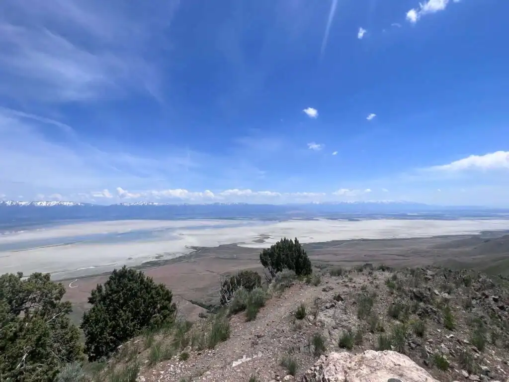
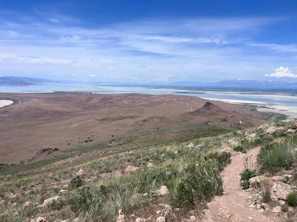
The Frary Peak summit is the highest point on Antelope Island at 6,596 feet. The view from the summit is defined by the position: standing on a high point on an island in the middle of a closed inland sea. The Great Salt Lake extends in all directions. The Wasatch Range rises across the water to the east. The Oquirrh Mountains frame the south. The island’s terrain drops in all directions. On clear days, the visibility extends far beyond the immediate lake basin to the surrounding ranges and desert.
The summit view also provides a visual of the lake’s hydrological division: the Union Pacific Railroad causeway divides the lake into north and south sections with different salinity concentrations, which produces different algae communities and different water colors. From the summit, the color contrast between the lake sections is sometimes visible as a distinct line across the water surface.
For photography: the summit is exposed and the wind is present in most conditions. Wide-angle for the panorama, mid-range for the lake surface and the island terrain detail. Sunrise arrivals produce the most dramatic light on the Wasatch Range across the water; sunset lights the western sky over the lake. Getting to the summit for sunrise requires a very early start or island camping.
Trail Difficulty and Length
Frary Peak Trail is 7 miles with about 2,300 feet of gain. Hard is the accurate rating. The gain-to-distance ratio and the sustained climbing make this equivalent in difficulty to many hard Wasatch Front summit hikes, with the added variables of island heat and the exposed summit. Budget 4-6 hours for the roundtrip at a comfortable pace with time on the summit.
No Dogs Allowed
Dogs are not permitted on Frary Peak Trail. This is a specific restriction within Antelope Island State Park to protect the bighorn sheep population on the trail corridor. Buffalo Point Trail is the dog-permitted alternative on the island.
What to Bring
Water: 3-4 liters minimum for a hard 7-mile summit hike. The island environment in summer is hot and exposed; hydration requirements are higher than comparable elevation gain on forested Wasatch Front trails. Food for a 4-6 hour day. Sturdy hiking boots with ankle support for the rocky upper terrain. Trekking poles for the descent. Sun protection for the exposed ridgeline. Layers for the summit where wind is typically present.
Binoculars for bighorn sheep and bison. Telephoto for wildlife photography at safe distances from both species.
Best Time to Hike Frary Peak
Spring (April through June) and fall (September through November) are the best windows. Spring brings wildflowers to the island’s lower slopes and milder temperatures for the long climb. Fall brings cooler temperatures, fewer visitors, and the lake color change as brine shrimp concentrations peak in late summer and early fall.
Summer hikes require early morning starts (before 7 a.m.) to avoid the midday heat on the exposed upper trail. Winter hikes are possible with snow on the upper slopes requiring microspikes or snowshoes in some years. Check current conditions before any winter visit.
Rules and Regulations
Antelope Island State Park rules apply. No dogs on Frary Peak Trail. Stay on designated trails. Maintain safe distance from all wildlife including bison (25 yards minimum) and bighorn sheep (100 yards recommended). Pack out all trash. Leave No Trace principles throughout. $15 per vehicle entry fee.
Where to Stay Near Antelope Island
Syracuse, Layton, and Ogden are the nearest towns with lodging. Salt Lake City, about 35-40 minutes south on I-15, is the large metro base. For points travelers, check available Marriott Bonvoy properties in Ogden, IHG Rewards hotels in Salt Lake City, and Hilton Honors options in Salt Lake City.
Camping Nearby
Bridger Bay Campground on the island’s north end is the developed camping option, reservable through reserveamerica.com. Island camping enables an early start from the island itself rather than driving the causeway pre-dawn. For a Frary Peak sunrise attempt, camping on the island the night before is the practical approach.
Nearby Adventures
Buffalo Point Trail is the short easy companion from the same island: 1 mile / 250 feet to a Great Salt Lake viewpoint, dog-permitted, accessible to everyone. The two Antelope Island trails together, Buffalo Point easy and Frary Peak hard, cover the full difficulty range the island offers from the same $15 entry fee.
Lady Finger Trail is another option on Antelope Island, a different character trail worth knowing about for visitors who want to explore beyond the two primary options.
Plan This Hike
AllTrails has Frary Peak Trail mapped with offline GPS tracking and condition reports. Plan your hike on AllTrails and download before heading to the causeway.
Chase the Quiet
The Great Salt Lake is the largest saltwater lake in the Western Hemisphere and Antelope Island is the largest island in it. Standing on Frary Peak’s summit, both of those facts become visible in the landscape below you. The lake extends to every horizon. The island’s bison are somewhere in the grasslands far below. The Wasatch Range is across the water. That’s what the 2,300 feet and 7 miles delivers: the view from the top of an island in a closed inland sea, which is a specific and not-easily-described thing. The only way to understand it is to climb to it.
Support the Adventure
To make your walls less boring, check out my photography portfolio and bring a piece of the wild and my story into your home.
If you’d like to fuel future adventures, you can donate a coffee on Ko-Fi. Every cup keeps me chasing sunrises and stories.
When you shop using my affiliate links, every click helps support this blog at no extra cost to you. It’s a small way to keep Unicorn Adventure alive and kicking while I keep exploring.
Subscribe to my mailing list for future updates, new stories, and behind-the-scenes adventures.
Stay connected with me on Instagram and Facebook for more photos and daily inspiration.
Thanks for being part of the journey, Unicorn Squadron!

Theo Maynard is a landscape photographer and adventure blogger based in Salt Lake City. He chases remote desert and mountain light across the American West, documents it all solo, and shares the journey through Unicorn Adventure. He’s on the autism spectrum, and that’s not a footnote, it’s the whole story. He creates to inspire others to get outside, chase what lights them up, and live their best possible life. Unapologetically himself.