

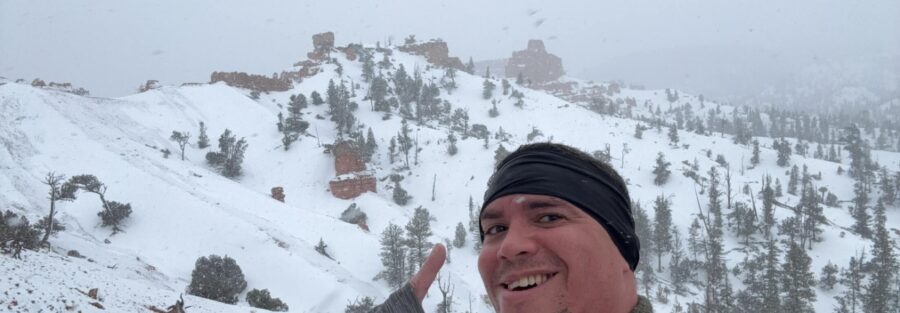
Red Canyon is on UT-12 between Panguitch and Bryce Canyon National Park, and it has the same Navajo Sandstone hoodoo geology as Bryce, the same red and orange color palette, and zero entry fee. The Golden Wall/Buckhorn Loop is 4.7 miles with 1,056 feet of gain through red rock formations, forested ridgelines, and canyon panoramas. Most visitors drive past it on the way to Bryce’s more famous overlooks. Their loss.
This trail runs 4.7 miles with 1,056 feet of gain. The area also has the Red Canyon Rim Trail at 9.3 miles / 800 feet for days when more mileage is the plan, but the Golden Wall/Buckhorn is the headliner. Red Canyon delivers on its promise without requiring the management infrastructure of a national park to do it.
Quick Facts
| Trail Name | Golden Wall/Buckhorn Loop |
| Location | Red Canyon, Dixie National Forest, near Panguitch, Utah |
| Coordinates | 37.7471 N, 112.3201 W |
| Distance | 4.7 miles (loop) |
| Elevation Gain | 1,056 feet |
| Difficulty | Moderate |
| Time | 2.5-4 hours |
| Dogs Allowed | Yes, on leash |
| Fee | None |
| View on AllTrails | |
How to Get There
From Panguitch, Utah, head east on UT-12 for approximately 12 miles. The Red Canyon Visitor Center is on the left (north) side of the highway and serves as the primary access point for the area’s trails including the Golden Wall/Buckhorn Loop. The trailhead is just past the visitor center with clear signage.
From Bryce Canyon National Park, head west on UT-12 approximately 10-12 miles. Red Canyon is between Bryce and Panguitch on the same highway. If you’re doing both Bryce and Red Canyon in the same trip, Red Canyon works as a morning stop before Bryce or as an afternoon add-on after leaving the national park.
From Salt Lake City: I-15 south to US-89 south to UT-12 east. Plan about 4-4.5 hours. From Las Vegas: I-15 north to UT-20 east to US-89 south to UT-12. Plan about 4 hours.
Parking Information
The Red Canyon Visitor Center has a large free parking lot with restrooms and informational exhibits. Red Canyon sees significantly less traffic than Bryce Canyon, so parking is rarely an issue even on peak days. The visitor center is worth a brief stop for the geology exhibits before the hike.
Cell Service and Navigation
Cell coverage is present on UT-12 and at the Red Canyon Visitor Center. It decreases on the upper sections of the loop. Download AllTrails offline before arriving. The loop is well-marked throughout; navigation is manageable with the trail signs and the map. Having GPS active is useful for confirming your position at the junction between the Golden Wall and Buckhorn sections.
What to Expect on the Golden Wall/Buckhorn Loop
The Golden Wall Section
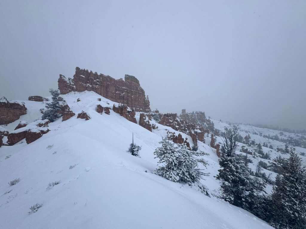
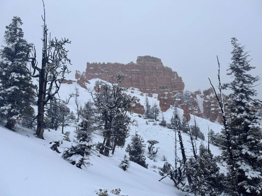
The Golden Wall trail climbs from the trailhead into the red rock formation area, offering views of the canyon and the vibrant red and orange rock that gives Red Canyon its name. The Golden Wall refers to the expansive cliff face visible from the high points on this section of the loop: a broad wall of Claron limestone and Navajo Sandstone in the warm reds and oranges characteristic of this formation. The views from the ridgeline sections are wide open to the south toward Bryce Canyon’s general direction and north across the forested canyon country.
The steep climbs on this section of the loop earn the moderate rating. There are narrow ridgeline sections with exposure that require careful footing, particularly in wet or windy conditions. The trail is well-maintained but the surface is rocky in the upper sections.
The Buckhorn Section
The Buckhorn Trail wraps through forested terrain with a different character from the open red rock of the Golden Wall section. The ponderosa pine and mixed conifer forest provides shade and the enclosed forest environment contrasts with the open canyon views of the Golden Wall portion. The junction between the two sections is clearly signed, and the Buckhorn descent closes the loop back toward the trailhead.
For photography: the Golden Wall ridgeline sections provide the best views of the canyon and the red rock formations. Morning light illuminates the east-facing canyon walls; late afternoon light catches the western-facing Golden Wall directly. The loop’s length means you can time your position on the trail for the best light with some planning. Arriving at the Golden Wall viewpoint sections between 8-10 a.m. or in the late afternoon gives the most saturated rock color.

Trail Difficulty and Length
This trail is 4.7 miles with 1,056 feet of gain. Moderate is accurate: the steep climbs and narrow ridgeline sections require attention, but the well-maintained loop trail is manageable for experienced hikers. Budget 2.5-4 hours for the full loop at a comfortable pace with time at the viewpoints.
Dog Friendly?
Yes. Red Canyon is on Dixie National Forest land where dogs are welcome on leash. The loop terrain is suitable for trail-fit dogs; the steep sections require dogs that are comfortable with uneven rocky terrain. No entry fee at Red Canyon means this is one of the better free dog-friendly hoodoo hike options in southern Utah given that Bryce Canyon prohibits dogs on most trails. Bring water; the forested sections provide shade but the open red rock sections get warm.
What to Bring
Water: 2 liters for a 4.7-mile moderate loop. The exposed ridgeline sections can get warm in afternoon summer sun. Layers for the forested Buckhorn sections and the exposed ridgeline wind. Sturdy hiking boots or trail runners with grip for the rocky ridgeline terrain. Sun protection for the open Golden Wall sections.
For photography: wide-angle for the canyon panorama and the Golden Wall cliff face, mid-range for the hoodoo detail and rock texture, late afternoon timing for the most direct light on the Golden Wall.
Best Time to Hike Golden Wall/Buckhorn
May through October is the reliable window. Spring and fall are the most comfortable temperatures: April through June and September through October give mild hiking conditions. Summer is workable with an early morning start; the ridgeline sections get warm by 10-11 a.m. in July and August. Winter is possible but the steep sections can be icy; microspikes or traction devices are useful after snow.
Red Canyon’s position on UT-12 between Panguitch and Bryce Canyon makes it a natural add-on to either destination. If you’re headed to Bryce, stopping at Red Canyon on the way in for a morning hike and then spending the afternoon on Bryce’s rim is a full canyon country day without backtracking.
Rules and Regulations
Dixie National Forest rules apply. Leave No Trace principles throughout. Stay on designated trails. Dogs on leash. No fee, no permit required for day hiking. No drones without a special use permit.
Where to Stay Near Red Canyon
Panguitch, Utah, is about 12 miles west on UT-12: a small town with lodging and basic services. Bryce Canyon area lodging is available from the east on UT-12. For points travelers, check available Marriott Bonvoy properties near Bryce Canyon, IHG Rewards hotels near Panguitch, and Hilton Honors options near Kanab.
Camping Nearby
Red Canyon Campground in the Dixie National Forest is directly adjacent to the trail system: developed sites through recreation.gov with facilities. Staying at Red Canyon campground makes a sunrise start on the Golden Wall section possible without driving from Panguitch or Bryce. There are also primitive Dixie National Forest dispersed camping options in the surrounding area.
Nearby Adventures
The Red Canyon Rim Trail is the longer Red Canyon option at 9.3 miles / 800 feet of gain, a full effort for days when more mileage is the plan. Different terrain character from the Golden Wall/Buckhorn Loop with more rim walking and less steep climbing.
Bryce Canyon National Park is 10-12 miles east on UT-12. The Navajo Loop and Queen’s Garden Trail (3 miles / 652 ft) is the standard Bryce day hike that provides the comparison between the national park and Red Canyon’s equivalent geology. Both are worth doing on a multi-day Bryce Canyon area trip: Red Canyon for the free no-crowds version, Bryce for the classic rim overlooks and developed trail infrastructure.
UT-12 is the scenic highway connecting Bryce Canyon to Boulder and Escalante through some of the most dramatic landscape in southern Utah. The full drive with stops is worth treating as a destination rather than just a transit route.
Plan This Hike
AllTrails has the Golden Wall/Buckhorn Loop mapped with offline capability and condition reports. Download before leaving the visitor center area. Plan your hike on AllTrails and pull the offline map while you’ve got signal at the visitor center.
Chase the Quiet
Red Canyon doesn’t have Bryce Canyon’s reputation and it doesn’t have Bryce Canyon’s crowds. It has the same geology, the same red rock hoodoos, the same pink and orange cliff faces, and no entry fee. Most people drive past it on the way to Bryce. That’s their math and your advantage. The Golden Wall ridgeline on a quiet Tuesday morning has the same view it would have if it were a national park attraction. The rock doesn’t know the difference.
Support the Adventure
To make your walls less boring, check out my photography portfolio and bring a piece of the wild and my story into your home.
If you’d like to fuel future adventures, you can donate a coffee on Ko-Fi. Every cup keeps me chasing sunrises and stories.
When you shop using my affiliate links, every click helps support this blog at no extra cost to you. It’s a small way to keep Unicorn Adventure alive and kicking while I keep exploring.
Subscribe to my mailing list for future updates, new stories, and behind-the-scenes adventures.
Stay connected with me on Instagram and Facebook for more photos and daily inspiration.
Thanks for being part of the journey, Unicorn Squadron!

Theo Maynard is a landscape photographer and adventure blogger based in Salt Lake City. He chases remote desert and mountain light across the American West, documents it all solo, and shares the journey through Unicorn Adventure. He’s on the autism spectrum, and that’s not a footnote, it’s the whole story. He creates to inspire others to get outside, chase what lights them up, and live their best possible life. Unapologetically himself.