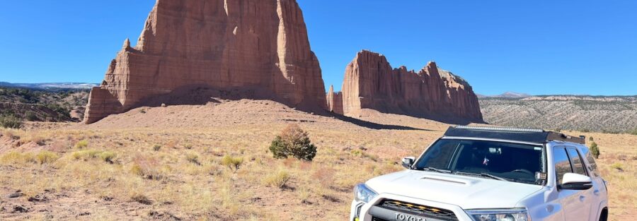
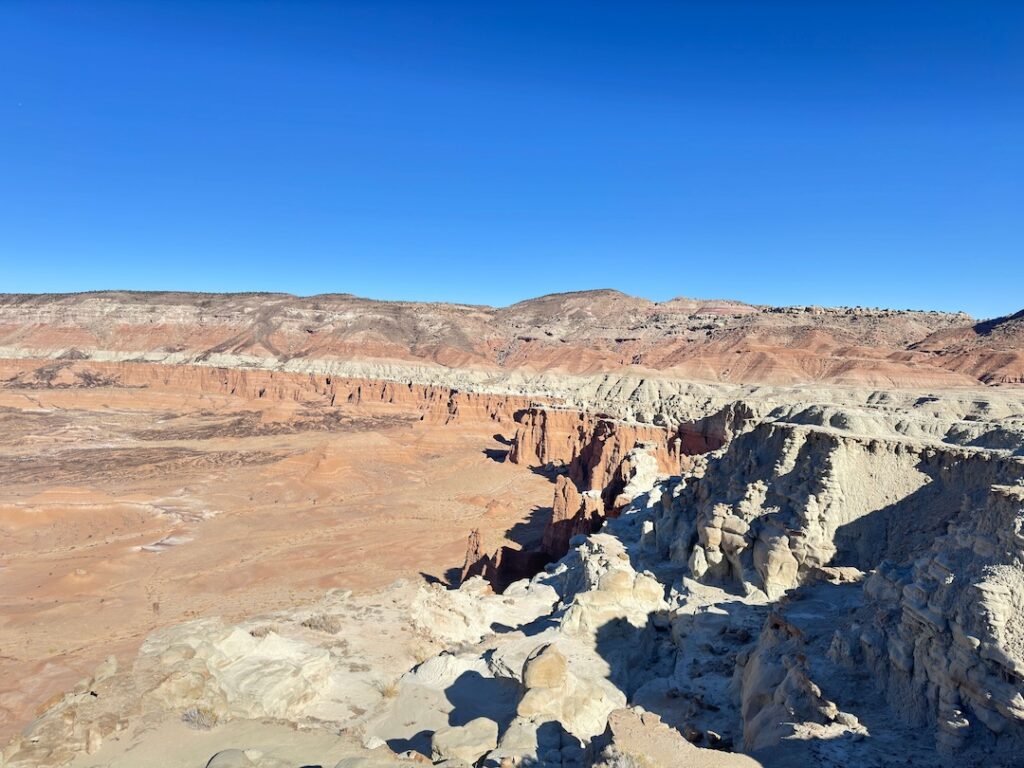
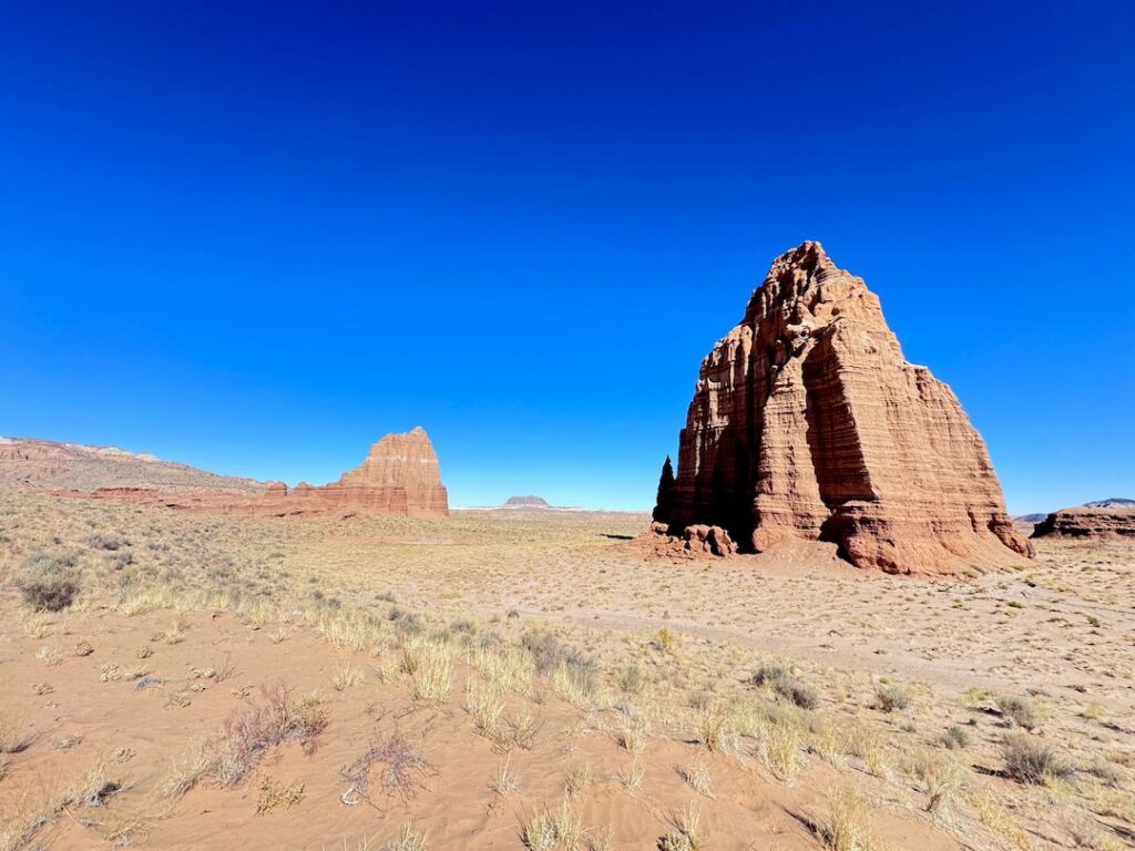
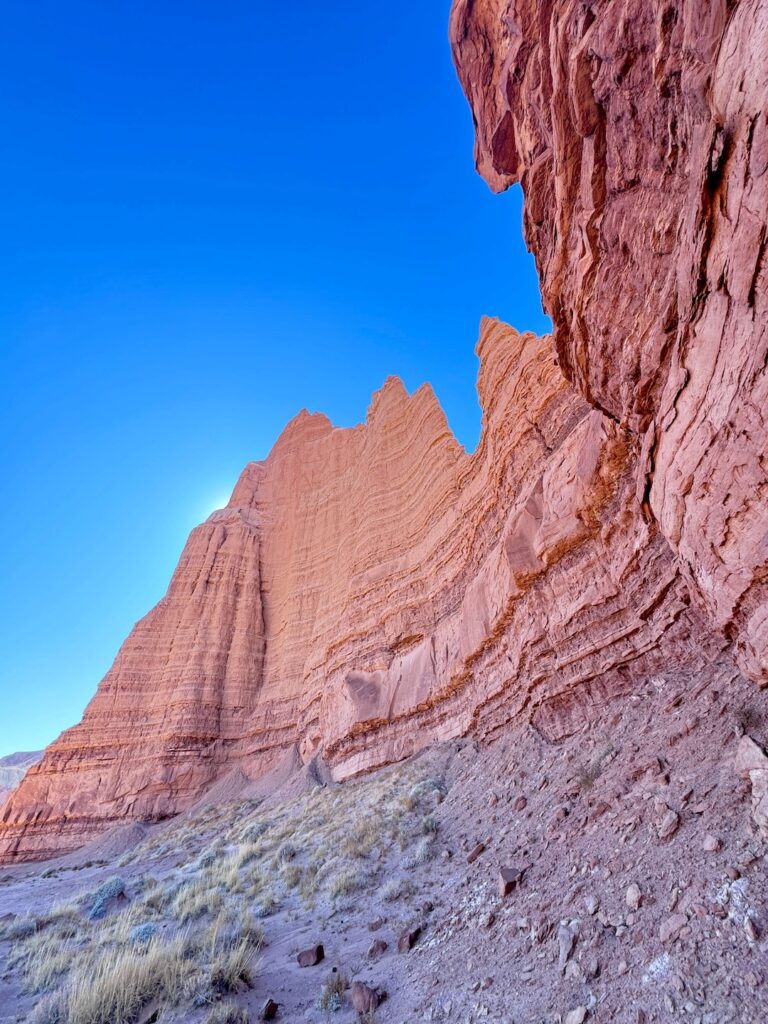
Cathedral Valley is the remote northern section of Capitol Reef National Park, accessible via a 70-mile dirt and sand loop from UT-24 that most visitors never reach. The route passes through some of the most visually distinctive terrain in the Colorado Plateau: the Temples of the Sun and Moon (massive sandstone monoliths standing alone in a flat desert valley), Glass Mountain (a gypsum crystal formation), and the Bentonite Hills (striped in purple, red, and green).
The loop begins at Hartnet Road off UT-24 east of the visitor center and returns via Caineville Wash Road. The Fremont River crossing at the route’s start is the most variable element: river depth changes with weather and season and can make the route impassable when too high. Check current water levels at the Capitol Reef visitor center before committing to the loop.
Quick Facts
|
Route Name |
Cathedral Valley Loop |
|
Location |
Capitol Reef National Park, near Torrey, Utah |
|
Coordinates |
|
|
Distance |
~70 miles (loop) |
|
Elevation Gain |
~4,400 feet total over the route |
|
Drive Difficulty |
Moderate (high-clearance 4WD required; Fremont River ford, soft sand, muddy bentonite when wet) |
|
Time |
5-8 hours for the full loop at a careful pace with stops |
|
Fee |
$20 per vehicle (7-day Capitol Reef pass); America the Beautiful Pass accepted; no additional permit required |
|
AllTrails |
How to Get There
From Torrey, Utah, drive east on UT-24 approximately 11 miles to the Capitol Reef visitor center area. Continue east on UT-24 to the Hartnet Road turnoff on the north side of the highway (the western starting point for the loop). The loop can also be accessed from the east via Caineville Wash Road off UT-24 further east, but most drivers start at Hartnet Road for the most logical loop direction.
Stop at the Capitol Reef visitor center before the loop. Check current road conditions with a ranger, get current Fremont River crossing depth, and confirm any road closures. The visitor center reports are more current than any online source for a remote 70-mile dirt route.

Vehicle Requirements
High-clearance 4WD is required for Cathedral Valley Loop. The terrain is not the most technically demanding OHV driving in Utah, but several variables can stop underprepared vehicles: the Fremont River ford requires high clearance and confident water crossing technique, soft sand sections require aired-down tires and momentum management, and the Bentonite Hills sections become extremely slippery mud that can immobilize any vehicle when wet.
Air down tires to 20-25 PSI before the sandy sections. Recovery gear: tow straps, traction boards, shovel, full-size spare, tire repair kit. A satellite communicator (Garmin inReach or equivalent) is the right call for a 70-mile remote national park loop with no cell coverage and limited access for external rescue vehicles.
Bentonite note: The Bentonite Hills section is impassable when wet. Wet bentonite becomes slick clay that provides no traction for any vehicle regardless of 4WD capability. Do not drive bentonite in rain or in the hours immediately following rain. If in doubt, do not attempt the loop after any precipitation.
Cell Service and Navigation
Cell coverage is absent throughout Cathedral Valley. Download AllTrails offline and a GPS track for the full 70-mile loop before leaving Torrey. The route has junctions where the correct turn matters; have the GPS track active throughout. A paper map of the Capitol Reef backcountry is a useful backup.
What to Expect on the Cathedral Valley Loop
The Fremont River Ford
The loop begins with a Fremont River crossing at the Hartnet Road access. The crossing depth varies by season and recent weather: winter and spring snowmelt raise the level; dry late-summer conditions lower it. The visitor center has current depth information. The standard recommendation is to not cross if water is above your vehicle’s axle hubs. Wade through before driving to check the bottom and confirm the depth.
Temples of the Sun and Moon
The Temples of the Sun and Moon are the loop’s defining landmarks: two massive sandstone monoliths standing alone in a flat desert valley. The Temples are 700 to 1,000 feet tall, isolated from the canyon walls and mesas around them by erosion, rising from the valley floor with nothing to scale them against except the flat desert and the sky. The Cathedral Valley name comes from the way these formations read as natural cathedrals when seen from the valley floor, vertical scale, isolated presence, the specific quality of open desert light in the afternoon on stone this color.
For photography: the Temples at golden hour (both sunrise and sunset) are the priority timing. The Temple of the Sun faces east and catches the first morning light; the Temple of the Moon faces west and catches the last evening light. Both formations work at wide-angle for the full scale and mid-range for the wall texture detail. The flat desert valley around the Temples creates clean, uncluttered compositions.
Glass Mountain and Bentonite Hills
Glass Mountain is a gypsum selenite mound that catches the light differently from the surrounding sandstone, with a crystalline shimmer visible in direct sun. The Bentonite Hills provide the landscape’s most unusual color: the bentonite clay soil appears in striped bands of purple, red, and green, creating a landscape that reads as painted rather than natural. Both are visible from the loop road and worth stopping for.
Cohan Canyon Trailhead Access
Cohan Canyon Trail (3.0 miles / 793 ft) is accessible from the Cathedral Valley area. For drivers doing the Cathedral Valley Loop, it’s a natural hiking add-on from within the loop’s remote area. Confirm current trail access at the visitor center before the loop.

Route Difficulty and Length
The loop is approximately 70 miles with 4,400 feet of cumulative gain. Moderate is the appropriate drive difficulty for a high-clearance 4WD vehicle in dry conditions. The route becomes hard in wet conditions due to the bentonite hazard, and the Fremont River ford adds a specific technical element not present on most Utah OHV routes. Budget 5-8 hours for the full loop at a careful pace with stops at the Temples, Glass Mountain, and the Bentonite Hills.
What to Bring
Recovery gear (tow straps, traction boards, shovel, full-size spare, tire repair kit). Satellite communicator. Water: 4+ liters per person for a 5-8 hour remote loop with no services. Food and snacks for the duration plus emergency supplies. Sun protection for the exposed desert valley. A headlamp in case the loop extends into darkness. Let someone know your plans before entering the backcountry.
Camping at Cathedral Valley
Cathedral Valley Campground is a primitive NPS campground within the loop, accessible partway through the route. First-come first-served, no reservations, no water, no facilities. Five sites for tents and small vehicles. This campground is the way to get sunrise light on the Temples of the Sun: drive in the previous afternoon, set up camp, and be positioned for the morning light before driving out. The remote desert night sky at Cathedral Valley, away from all light pollution, is one of the better dark sky experiences in the American Southwest.
Best Time to Drive Cathedral Valley Loop
Spring (April through June) and fall (September through October) are the most comfortable windows. Spring wildflowers add color to the desert valley context. Fall provides cooler temperatures and the least flash flood risk of any season outside winter.
Summer is technically possible but temperatures exceed 100°F in Cathedral Valley with no shade; a very early start (before 7 a.m.) and a strict turnaround time before midday is the summer approach. Monsoon season (July through September) brings the highest flash flood and bentonite mud risk.
Winter access depends on recent conditions. The Fremont River crossing level varies, snow can close sections of the route, and cold nights require full winter camping preparation for overnight stays.
Rules and Regulations
Capitol Reef National Park rules apply throughout. Stay on designated routes. No off-road driving outside the established loop. Leave No Trace throughout the backcountry. Pack in everything, pack out everything. No campfires outside designated fire rings. No collecting rocks, plants, or artifacts. Check in at the visitor center and follow all posted road condition guidance. No fee beyond the $20 park entry.
Where to Stay Near Capitol Reef
Torrey is the primary gateway. Moab, about 2.5 hours east, has full resort town lodging. For points travelers, check available Marriott Bonvoy properties, IHG Rewards hotels, and Hilton Honors options in Salt Lake City, Moab, or Cedar City along your route.
Nearby Adventures
Cohan Canyon Trail (3.0 miles / 793 ft) is accessible from within the Cathedral Valley Loop for hiking add-ons. The Capitol Reef trail catalog from the more accessible UT-24 corridor: Goosenecks and Sunset Point, Grand Wash Trail, Chimney Rock Loop, Cassidy Arch, Hickman Bridge, Capitol Gorge to Tanks (2.2 miles / 396 ft), Rim Overlook (4.1 miles / 1,053 ft), and Fremont River (2.1 miles / 410 ft). Each warrants a standalone post.
Plan This Drive
AllTrails has the Cathedral Valley Loop mapped with GPS track and offline capability. Download the full 70-mile track before leaving Torrey. Plan your drive on AllTrails and check the current condition reports for Fremont River depth and road status.
Chase the Quiet
Cathedral Valley is the part of Capitol Reef that most park visitors never see. The Temples of the Sun and Moon are less well known than Delicate Arch or the Narrows or any of Zion’s primary formations, and they’re more isolated, more compositionally stark, and arguably more visually striking because there’s nothing around them to provide scale or distraction. The flat desert valley reads as empty until the Temples appear in it, and then the valley reads as enormous. That specific visual experience requires the 70-mile dirt road to reach it. That’s the right trade.
Support the Adventure
To make your walls less boring, check out my photography portfolio and bring a piece of the wild and my story into your home.
If you’d like to fuel future adventures, you can donate a coffee on Ko-Fi. Every cup keeps me chasing sunrises and stories.
When you shop using my affiliate links, every click helps support this blog at no extra cost to you. It’s a small way to keep Unicorn Adventure alive and kicking while I keep exploring.
Subscribe to my mailing list for future updates, new stories, and behind-the-scenes adventures.
Stay connected with me on Instagram and Facebook for more photos and daily inspiration.
Thanks for being part of the journey, Unicorn Squadron!

Theo Maynard is a landscape photographer and adventure blogger based in Salt Lake City. He chases remote desert and mountain light across the American West, documents it all solo, and shares the journey through Unicorn Adventure. He’s on the autism spectrum, and that’s not a footnote, it’s the whole story. He creates to inspire others to get outside, chase what lights them up, and live their best possible life. Unapologetically himself.