

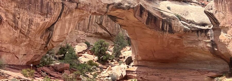
Hickman Bridge is a natural stone arch spanning 133 feet and standing 125 feet tall, reached via a 1.8-mile roundtrip trail in Capitol Reef National Park. The trail climbs 400 feet through juniper and pinyon pine terrain above the Fremont River, passing Fremont petroglyphs on the canyon wall below the arch, before arriving at the arch itself. Capitol Reef’s position at the Waterpocket Fold, nearly 100 miles of exposed geological cross-section, puts the arch in context: it’s one carved feature in a landscape full of them, but it’s among the most immediately accessible and most visually distinctive in the park.
Quick Facts
| Trail Name | Hickman Bridge Trail |
| Location | Capitol Reef National Park, near Torrey, Utah |
| Coordinates | 38.2889° N, 111.2273° W |
| Distance | 1.8 miles roundtrip |
| Elevation Gain | ~400 feet |
| Difficulty | Moderate |
| Time | 1.5-2.5 hours |
| Dogs Allowed | No |
| Fee | $20 per vehicle (7-day pass); America the Beautiful Pass accepted |
| AllTrails | View on AllTrails |
How to Get There
Capitol Reef National Park is on UT-24, approximately 11 miles east of Torrey, Utah. The Hickman Bridge Trailhead is a short drive from the visitor center on UT-24. It’s one of the most accessible trailheads in the park: no Scenic Drive fee required, just the standard $20 park entry. The trailhead is signed from UT-24.
From Salt Lake City: I-15 south to US-50 east to UT-24 east into the park. Plan 3.5 hours. From Moab: US-191 north to UT-24 west. Plan 2.5 hours. From Bryce Canyon: UT-12 east to Torrey, UT-24 east. Plan 1.5-2 hours.
Parking Information
Small dedicated parking area at the Hickman Bridge Trailhead on UT-24. It fills quickly during peak spring and fall morning hours. Arrive before 8 a.m. on busy days. Additional parking is available further down UT-24 with a short walk back to the trailhead if the primary lot is full. No Scenic Drive access fee applies here; standard $20 park entry is the only cost.
Cell Service and Navigation
Cell coverage is limited in Capitol Reef. Download AllTrails offline before leaving Torrey. The Hickman Bridge Trail is well-marked throughout. Navigation is not a challenge; the route to the arch and back is clear and signed.
What to Expect on the Hickman Bridge Trail
The Approach: Fremont Petroglyphs
Before the trail climbs toward the arch, the route passes below a panel of Fremont Culture petroglyphs incised into the canyon wall face. The Fremont people occupied this part of central Utah from roughly 700 to 1300 CE, and their rock art is concentrated throughout the Capitol Reef area along the Fremont River corridor. The petroglyph panel near the Hickman Bridge trailhead is one of the most accessible examples in the park. These figures have been here for hundreds of years, surviving the desert environment on the same sandstone that surrounds them. Worth spending time at before continuing the climb.
The Climb
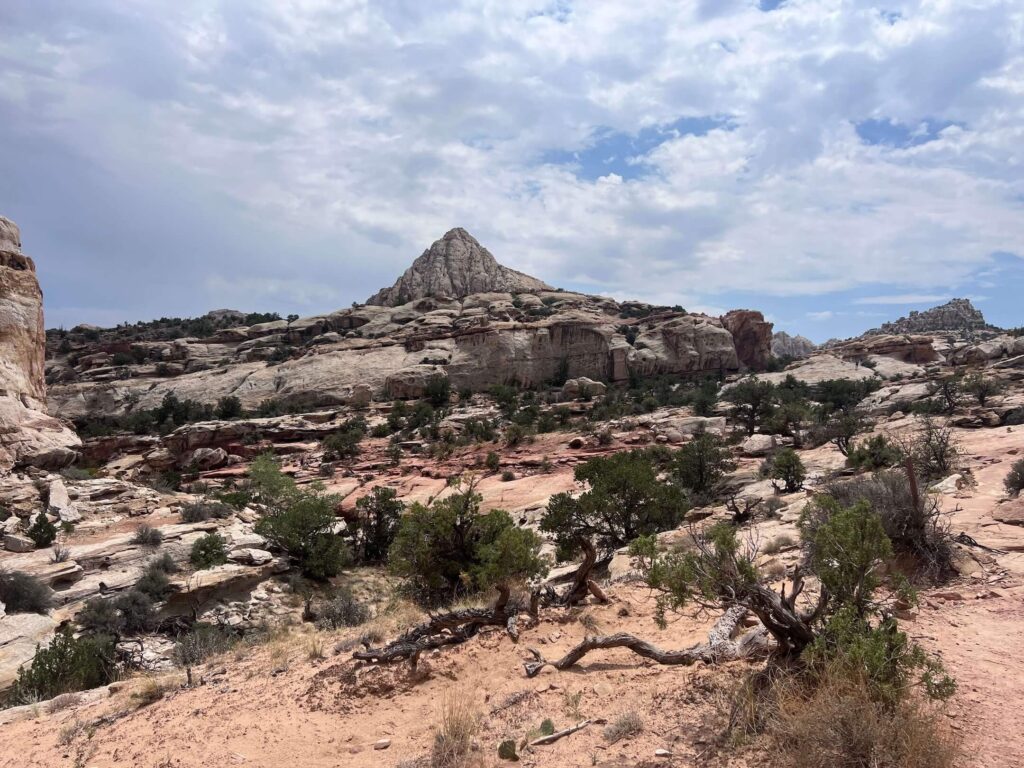
After the petroglyph panel, the trail climbs through juniper and pinyon pine terrain above the Fremont River valley. The 400-foot gain is the moderate element: consistent but not extreme, with some steeper sections on the approach to the arch. The surrounding Capitol Reef geology, the Waterpocket Fold’s layered sandstone visible on the valley walls, the Fremont River below, the canyon country extending in every direction, is visible from the upper sections before the arch comes into view.
Hickman Bridge
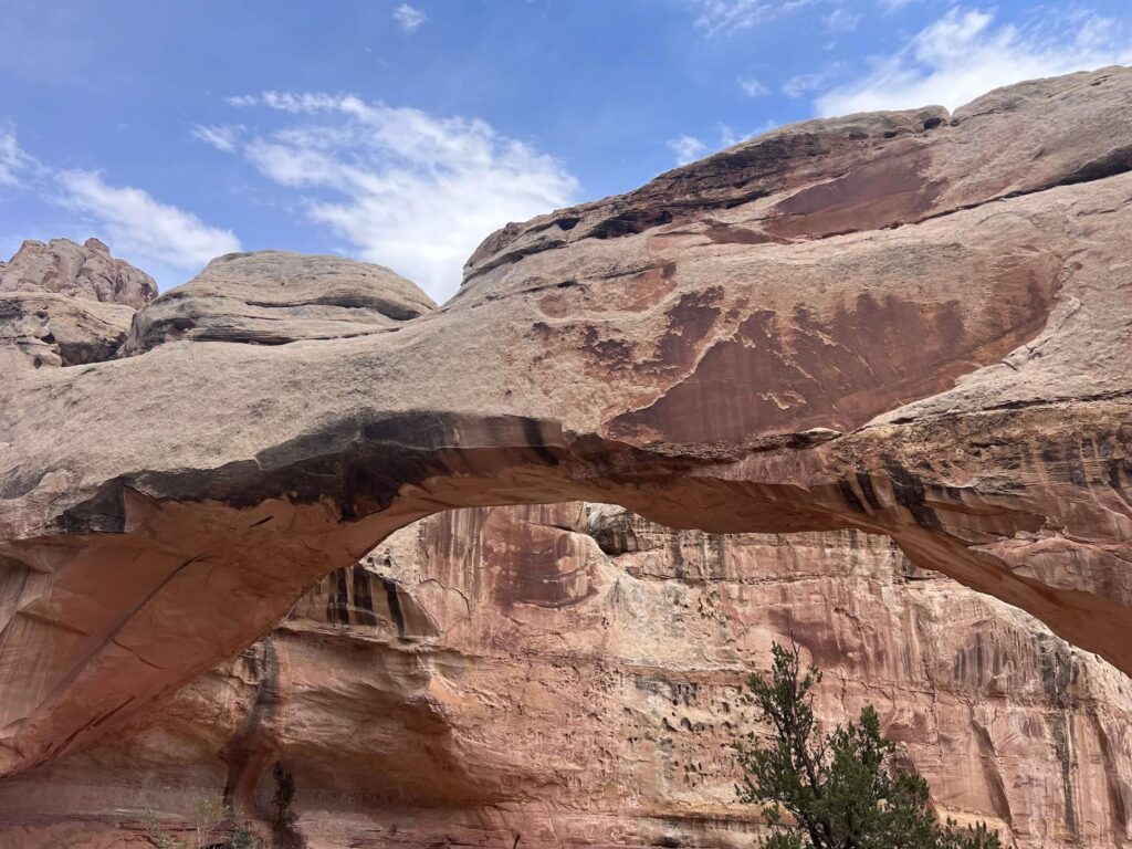
Hickman Bridge spans 133 feet and stands 125 feet tall. The arch formed through the same erosional process as other Colorado Plateau arches: differential erosion of sandstone through water, wind, and freeze-thaw cycles that wore away the weaker rock while leaving the stronger arch intact. The scale becomes apparent when you stand beneath or beside it: 133 feet is roughly the span of a 13-story building laid on its side.
The Fremont River and the valley below are visible from the arch area. Looking back the way you came, the Waterpocket Fold’s cliff face provides the backdrop that makes Hickman Bridge distinctive from arches visible in more open terrain: the arch exists in the context of the monocline behind it.
For photography: the arch is most dramatically lit in the morning when the sun comes from the east and illuminates the arch opening and the terrain visible through it. Wide-angle for the full arch span and the canyon context below, mid-range for the arch keystone detail. The sandstone coloring under the arch versus the sky visible through it is the characteristic Capitol Reef arch composition.
Trail Difficulty and Length
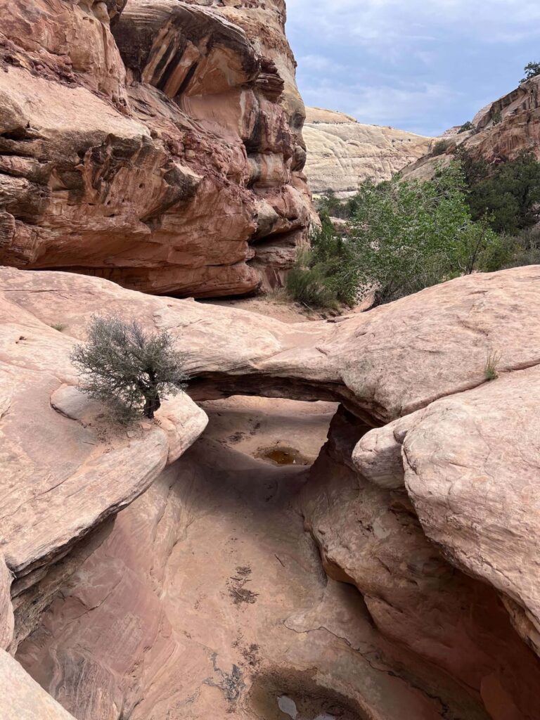
1.8 miles roundtrip with 400 feet of gain. Moderate is accurate: the climb to the arch on a warm day is a genuine effort, and the steeper sections require steady footing. Budget 1.5-2.5 hours for the full roundtrip with time at the petroglyphs and the arch.
No Dogs Allowed
Dogs are not permitted on the Hickman Bridge Trail. Standard Capitol Reef policy for unpaved trails. The UT-24 roadside corridor near the visitor center allows pets; the trails themselves do not.
What to Bring
Water: 2 liters for a 1.8-mile moderate hike in desert conditions. Sun protection for the exposed upper trail sections. Sturdy trail shoes or hiking boots for the steeper rocky sections. Camera with wide-angle and mid-range capability for the arch and the petroglyph panel.
Best Time to Hike Hickman Bridge
Spring (April through June) and fall (September through October) are the most comfortable windows. Morning timing earns the best arch light and the least crowded experience at the petroglyph panel and the arch. Summer is workable with early morning starts; by midday in July and August the exposed sections of the trail are hot. Winter visits are quiet with possible snow on the trail; ice on the steeper sections requires microspikes.
Rules and Regulations
No dogs. Stay on designated trails. Do not touch or disturb the petroglyphs. Leave No Trace principles throughout. $20 park entry fee or America the Beautiful Pass. Capitol Reef is an International Dark Sky Park; minimize artificial light if staying overnight.
Where to Stay Near Capitol Reef
Torrey, Utah, is the primary gateway 11 miles west. Moab, about 2.5 hours east, has full resort town lodging. For points travelers, check available Marriott Bonvoy properties, IHG Rewards hotels, and Hilton Honors options in Salt Lake City, Moab, or Cedar City along your route.
Camping Nearby
Fruita Campground inside Capitol Reef on the main park road: first-come first-served with some reservable sites through recreation.gov. Inside-the-park camping enables early Hickman Bridge starts before the small parking lot fills.
Nearby Adventures
Grand Wash Trail (4.5 miles) is the canyon floor companion to the Hickman Bridge arch hike: both start near UT-24 and can be combined for a full day of Capitol Reef accessible trail experience without the Scenic Drive fee. Cassidy Arch Trail (Scenic Drive trailhead) is the other arch option in the Capitol Reef catalog.
Goosenecks and Sunset Point, Chimney Rock Loop, Cohan Canyon (3.0 miles / 793 ft), Capitol Gorge to Tanks (2.2 miles / 396 ft), Rim Overlook (4.1 miles / 1,053 ft), and Fremont River (2.1 miles / 410 ft).
The Fruita Historic District and Gifford Homestead within the park add cultural history to the natural arch experience. Fresh orchard fruit in season and homemade pies at the Gifford Homestead are genuinely worth the stop after the Hickman Bridge hike.
Plan This Hike
AllTrails has the Hickman Bridge Trail mapped with offline capability and condition reports. Download before entering the park. Plan your hike on AllTrails and pull the offline map while you’ve got signal in Torrey.
Chase the Quiet
The Fremont petroglyphs on the approach to Hickman Bridge were made by people who occupied this canyon for roughly six centuries before the Waterpocket Fold eroded any further and before the arch above them was the feature it is now. They marked the rock face and moved on. The arch is there because the sandstone that didn’t erode held the shape. Both things, the human marks and the natural arch, are consequences of the same landscape processes, separated by time but not by geography. You see both on the same short hike. That’s what Capitol Reef keeps offering: geology and human history in the same frame, across the same trail.
Support the Adventure
To make your walls less boring, check out my photography portfolio and bring a piece of the wild and my story into your home.
If you’d like to fuel future adventures, you can donate a coffee on Ko-Fi. Every cup keeps me chasing sunrises and stories.
When you shop using my affiliate links, every click helps support this blog at no extra cost to you. It’s a small way to keep Unicorn Adventure alive and kicking while I keep exploring.
Subscribe to my mailing list for future updates, new stories, and behind-the-scenes adventures.
Stay connected with me on Instagram and Facebook for more photos and daily inspiration.
Thanks for being part of the journey, Unicorn Squadron!

Theo Maynard is a landscape photographer and adventure blogger based in Salt Lake City. He chases remote desert and mountain light across the American West, documents it all solo, and shares the journey through Unicorn Adventure. He’s on the autism spectrum, and that’s not a footnote, it’s the whole story. He creates to inspire others to get outside, chase what lights them up, and live their best possible life. Unapologetically himself.
1 Comment
Long Dong Silver Utah: Hiking Guide to Unique Rock Formation
[…] hikes in Hanksville and my Hanksville travel guide. Capitol Reef sits just west with classics like Hickman Bridge and Cassidy […]