


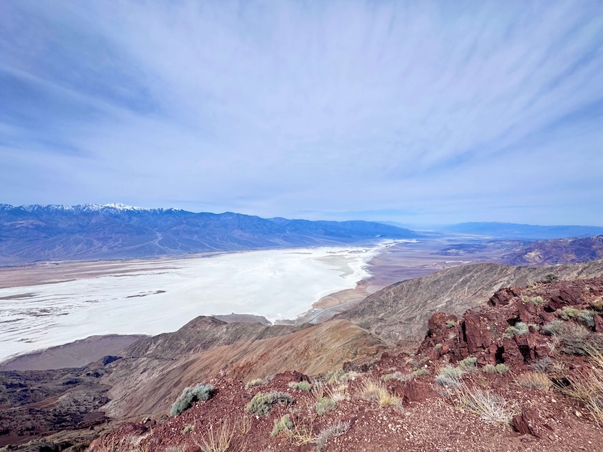
Dante’s View does not ease you into it. You wind up 13 miles of switchbacks, step out of the car, walk ten feet, and the whole valley opens up below you all at once. Badwater Basin, 282 feet below sea level, sits directly underneath your feet. The Panamint Range fills the western horizon. On a clear day, you can pick out Mount Whitney, the highest point in the contiguous U.S., from the same viewpoint. The spread of elevation visible from one spot is almost comically large.
Quick Facts
| Trail Name | Dante’s View Trail (Ridgeline) |
| Location | Death Valley National Park, California |
| Coordinates | 36.2206° N, 116.7266° W |
| Distance | 1.0 mile (out and back along ridgeline) |
| Elevation Gain | 219 ft |
| Difficulty | Easy |
| Time | 30–60 minutes (plus time at overlook) |
| Dogs Allowed | No (pets not permitted on park trails) |
| Fee | $35 per vehicle (7-day pass) or America the Beautiful Pass |
| AllTrails | View on Alltrails |
How to Get There
From Furnace Creek, take CA-190 east toward Death Valley Junction. After about 11 miles, turn right onto Dante’s View Road and follow it 13 miles up into the Black Mountains. The road is paved the entire way and in good condition, but it’s steep with tight switchbacks near the top.
Larger RVs and vehicles with trailers are not permitted past a cutoff point about 2 miles before the summit. There’s a turnaround and small parking area there for oversized vehicles. Standard passenger vehicles, trucks, and smaller camper vans handle the full road without issue. Estes made it up without a second thought.
Death Valley National Park charges $35 per vehicle for a 7-day pass. The America the Beautiful Annual Pass covers entry. Pay at the entrance stations or in advance through recreation.gov.
Parking Information
The parking lot at Dante’s View sits right at the overlook and holds a reasonable number of vehicles. It’s not a crowded trailhead by Death Valley standards, and outside of holiday weekends you’ll generally find space without trouble.
Restrooms are available at the parking area. No water available at the top, bring everything you need from below. The lot is exposed and windy. Have a jacket accessible before you get out of the car, especially in the morning.
For sunrise, arrive before first light. The drive up in the dark is fine on a clear night, just go slow on the switchbacks. Parking in pre-dawn quiet with no other vehicles is one of the better ways to start a morning in Death Valley.
Cell Service and Navigation
Cell service on the drive up Dante’s View Road and at the overlook is unreliable. Most carriers show one bar or none. Don’t count on data or navigation once you leave CA-190.
The road to Dante’s View is straightforward, one road in, same road out, so navigation isn’t a real concern. Download offline maps for the Death Valley area before you enter the park. For the ridgeline hike, the route is obvious and well-worn, but having the AllTrails map downloaded is good practice.
GPS satellite signal is reliable at the overlook and along the ridgeline regardless of cell coverage.
What to Expect at Dante’s View
The main overlook is paved, flat, and right at the parking lot. Most visitors walk from the car to the railing, take it all in, take some photos, and leave. That’s a completely valid way to experience Dante’s View, and the view from that spot alone justifies the drive.
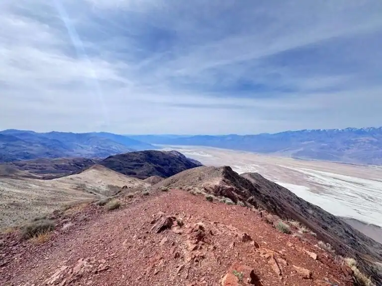
Badwater Basin sits almost directly below, the white salt flat visible as a bright smear on the valley floor nearly 5,800 feet below where you’re standing. The Black Mountains drop away in front of you. The Panamint Range rises to the west across the full width of the valley. On a clear winter day, the Sierra Nevada is visible on the far horizon, with Mount Whitney identifiable if you know where to look.
The scale is hard to process at first. Your brain keeps trying to find reference points and the distances keep defeating it. Spend a few minutes before you reach for your camera. Let the view land.
If you want to move, the ridgeline trail extends north from the parking area along the crest of the Black Mountains. It’s 1.0 mile out and back with 219 feet of elevation gain, mostly in short steep pushes between flatter stretches. The footing is rocky and uneven. Sturdy shoes matter here, the trail surface is loose in sections and there are steep drop-offs on the valley side.
The further you get from the parking lot, the fewer people you’ll encounter. By a quarter mile out, you’re typically alone. The views shift as you move along the ridge, different angles on the valley, deeper looks into the canyon systems below, wider perspectives on the Panamint Range. It’s worth the effort beyond the overlook.
The trail continues beyond 1.0 mile for those who want more. Extended ridgeline hiking toward Mount Perry is a full-day objective at roughly 9 miles round trip. That requires real preparation and is a different kind of undertaking than the overlook visit.
Sunrise at Dante’s View is one of the best light shows in the American West. The overlook faces west across the valley, which means you’re watching the light hit the Panamint Range directly while the shadow line retreats across Badwater Basin below. The salt flat goes from flat white to gold to pink as the sun climbs. The whole sequence runs maybe 30 minutes from first color to full light. Don’t miss it.
Sunset is also excellent. The overlook faces the mountains catching the last light, and the valley floor below goes into shadow while the peaks stay lit. The color sequence runs in reverse, and the valley feels like it’s darkening underneath you in real time.
Night at Dante’s View is worth planning around if you can stay late or arrive early. At 5,475 feet with no city light interference and a wide open sky, the Milky Way at full darkness is legitimately stunning. Bring a red light headlamp, dress for cold temperatures, and go.

Trail Difficulty and Length
The Dante’s View ridgeline trail is 1.0 mile out and back with 219 feet of elevation gain. It’s rated easy in terms of distance and technical difficulty, but the footing is uneven and the drop-offs on the valley side are real. Pay attention to where you’re walking, especially if you’re absorbed in the views, which you will be.
The overlook area itself is flat and paved and accessible to anyone who can get out of a vehicle. The ridgeline trail adds a short physical component to what is otherwise a drive-to destination.
Budget at least an hour at Dante’s View regardless of whether you hike the ridge. Shorter if you’re just stopping for photos, longer if you’re watching sunrise or sunset from start to finish.
Dog Friendly?
No. Dogs are not permitted on the Dante’s View trail or at most areas within Death Valley National Park.
The exposed ridgeline, wind, and temperature extremes also make this a genuinely uncomfortable environment for dogs. Leave them somewhere safe and cool.
What to Bring
Dante’s View is cooler than the valley floor but not immune to Death Valley’s conditions. Pack for the elevation and the exposure.
Layers are essential. The overlook is windy and cold in the morning, even in spring and fall. Start with a jacket you can shed as the temperature climbs.
Water, even for a short visit. The dry air at elevation dehydrates you without obvious sweating. Carry at least a liter per person.
Sun protection for the overlook and trail. No shade anywhere at Dante’s View. Sunscreen, hat, and sunglasses from the moment you step out of the car.
For photography: a wide-angle lens for the full valley panorama and a telephoto for compressing the Panamint Range or isolating Badwater Basin. A tripod for sunrise and sunset work. Extra batteries, cold mornings drain them fast. Bring more memory cards than you think you’ll need.

Best Time to Visit Dante’s View
Dante’s View is one of the few places in Death Valley that’s tolerable in summer, thanks to the elevation. But the best visits happen October through April, when temperatures at the overlook stay comfortable and the valley below is at its most photogenic.
Sunrise is the prime time. Plan to arrive 20 to 30 minutes before first light and position yourself on the ridgeline or at the overlook railing before the show starts. The sequence from pre-dawn blue to full golden light runs fast and you don’t want to be fumbling with gear when it’s happening.
Sunset is equally worth planning around. The valley goes into shadow before the peaks do, creating a layered light effect that’s unique to the topography here.
Clear winter days produce the best visibility for the long-distance views, including the Sierra Nevada. Summer haze reduces visibility considerably even at this elevation.
Night visits for stargazing are best planned around the new moon. Full darkness here is exceptional and the overlook is a legitimately world-class spot for astrophotography.
Rules and Regulations
Death Valley National Park rules apply at Dante’s View and along the ridgeline trail.
Stay on established trails. The ridgeline terrain is fragile and the drop-offs are dangerous. Don’t approach cliff edges carelessly.
Leave No Trace. Pack out everything you pack in. No trash cans on the trail.
Larger vehicles and RVs are restricted from the upper 2 miles of Dante’s View Road. Check the posted signage at the cutoff point.
Where to Stay Near Dante’s View
Furnace Creek is the closest base, about 25 miles northwest. The Inn at Death Valley and the Ranch at Death Valley are both there. The Inn is a historic property at a higher price point; the Ranch is more casual and family-oriented.
For loyalty points, Marriott Bonvoy and Hilton Honors cover gateway properties in Las Vegas, roughly 2 hours east, and Ridgecrest, roughly 2 hours west. IHG Rewards has options in the same corridors. Both cities are common staging points for Death Valley multi-day trips.
Camping Nearby
Furnace Creek Campground is the main developed campground near this part of the park, with hookup and non-hookup sites. Reserve well in advance through Recreation.gov for the November to March window.
Texas Spring Campground is a smaller, quieter option near Furnace Creek at a slightly higher elevation. Tent and vehicle camping available, no hookups. Good option if Furnace Creek is booked.
Death Valley allows dispersed backcountry camping in designated undeveloped areas at least 1 mile from paved roads, 100 yards from water sources and trails, with a free permit. Check current restrictions with the park before planning a dispersed site near the Dante’s View Road corridor.
Nearby Adventures
Dante’s View sits in the southern end of the park and is a natural anchor for a full day of Death Valley highlights.
Badwater Basin is about 20 miles west at the base of the Black Mountains. Standing at the lowest point in North America, directly below where you just stood, is a satisfying loop of perspective.
Zabriskie Point is about 4 miles northwest of the Dante’s View Road turnoff on CA-190. It’s a short walk to a overlook of golden badlands and eroded canyon systems, best at sunrise and photogenic at almost any hour. An easy add-on if you’re already making the Dante’s View drive.
Golden Canyon and Gower Gulch Loop via Zabriskie Point is the park’s best full-day hike, 6.4 miles with 1,082 feet of gain. It connects several of the badlands formations visible from Zabriskie Point into one continuous route. Read my Golden Canyon guide for the full breakdown.
Artist’s Palette is a scenic drive loop about 9 miles south of Furnace Creek through hills stained by oxidized minerals. Late afternoon light is the move. My Artist’s Palette guide covers the details.
Mosaic Canyon Trail at Stovepipe Wells, about 40 miles northwest, is the park’s best slot canyon hike. Polished marble walls, tight narrows, and real geological drama. See my Mosaic Canyon guide for everything you need.
Plan This Hike
AllTrails has Dante’s View mapped with the ridgeline trail, user-reported conditions, and an offline map download. For sunrise visits when you’re navigating in the dark, having the map pre-loaded is worth the 30 seconds it takes to download.
Check Death Valley National Park’s website for current road conditions on Dante’s View Road before heading up, especially after storms or in winter when ice is possible on the upper switchbacks. View on Alltrails.
Chase the Quiet
Standing at 5,475 feet with Badwater Basin almost a mile below you, watching a shadow line move across 200 square miles of desert floor as the sun comes up, you get a very clear sense of your own scale. It’s not a small feeling. It’s actually the opposite. Something about understanding how large the world is makes your own life feel less squeezed. That’s the thing Dante’s View does that most overlooks don
Support the Adventure
To make your walls less boring, check out my photography portfolio and bring a piece of the wild and my story into your home.
If you’d like to fuel future adventures, you can donate a coffee on Ko-Fi. Every cup keeps me chasing sunrises and stories.
When you shop using my affiliate links, every click helps support this blog at no extra cost to you. It’s a small way to keep Unicorn Adventure alive and kicking while I keep exploring.
Subscribe to my mailing list for future updates, new stories, and behind-the-scenes adventures.
Stay connected with me on Instagram and Facebook for more photos and daily inspiration.
Thanks for being part of the journey, Unicorn Squadron!

Theo Maynard is a landscape photographer and adventure blogger based in Salt Lake City. He chases remote desert and mountain light across the American West, documents it all solo, and shares the journey through Unicorn Adventure. He’s on the autism spectrum, and that’s not a footnote, it’s the whole story. He creates to inspire others to get outside, chase what lights them up, and live their best possible life. Unapologetically himself.