

The first time I hiked the Tower Bridge Trail, I was alone, three hours from Salt Lake City, and absolutely certain I’d chosen wrong. Bryce Canyon draws crowds to the Navajo Loop, the Queen’s Garden, the Rim Trail. I drove Estes in, passed the packed lots at Sunset Point, and kept going. Sunrise Point. Quieter. Better. I was right.
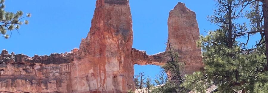
What followed was one of those hikes that rewires you a little. The canyon opens up gradually, hoodoos crowding in from every angle, the light doing things with red and orange that no filter can replicate. Then you round a bend and the Tower Bridge formation stops you cold. A natural rock arch that looks like it belongs in a medieval fortress, sitting out there in the middle of Bryce Canyon like it always knew you were coming.
This is your complete guide. Real talk about difficulty and everything you need to plan a clean run at this trail.
Quick Facts
| Trail Name | Tower Bridge Trail |
| Location | Bryce Canyon National Park, Utah |
| Coordinates | 37.6321 N, 112.1623 W |
| Distance | 3.6 miles (out-and-back) |
| Elevation Gain | 839 feet |
| Difficulty | Moderate |
| Time | 3 hours |
| Dogs Allowed | No |
| Fee | National park entrance fee required (America the Beautiful pass accepted) |
| View on Alltrails | |
How to Get There
Bryce Canyon National Park sits in southern Utah, roughly four to five hours from Salt Lake City and two and a half hours from Las Vegas.
From Salt Lake City: Head south on I-15 to UT-20 East, then south on US-89. Pick up UT-12 East near Panguitch and follow it to UT-63 South, which drops you into the park. The drive is stunning in its own right, especially the stretch along UT-12.
From Las Vegas: Take I-15 North to UT-20 East, then US-89 South to UT-12 East. Follow UT-63 South into the park.
From Zion National Park: Head east on UT-9 to US-89 North, then connect to UT-12 East and UT-63 South. About an hour and a half depending on where you’re starting in Zion.
Parking Information
Park at the Sunrise Point parking lot off the main park road. It fills fast in summer, especially after 9 a.m. Get there early or you’re circling. The trailhead drops in from Sunrise Point itself, clearly signed.
Bryce Canyon runs a free shuttle from approximately April through October. It stops at Sunrise Point and most major overlooks. If you’re visiting during peak season, the shuttle genuinely saves your sanity. Check the NPS website for current hours and route details before you go.
Cell Service and Navigation
Cell service in Bryce Canyon is unreliable. Some carriers get a bar or two near the visitor center, but deeper in the park and especially down in the canyon, you’re on your own. Don’t count on real-time navigation once you’re hiking.
Download the trail offline before you leave. AllTrails works well for this. A dedicated GPS unit is never a bad call in national parks. The trail itself is well-marked, so navigation isn’t the concern so much as having weather alerts and emergency contact ability if things go sideways.
What to Expect on Tower Bridge Trail
The Trail
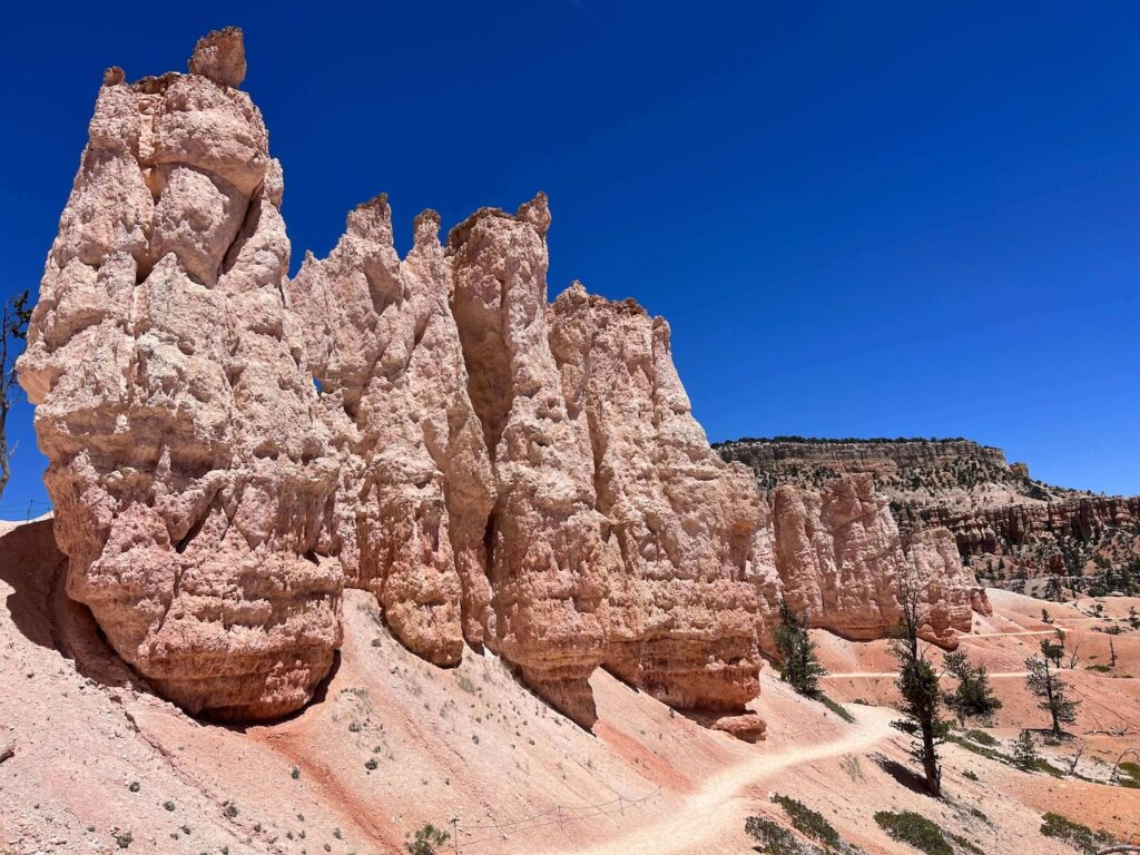
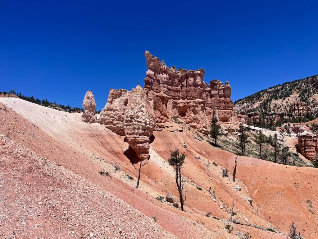
The hike starts at Sunrise Point and heads immediately down into the canyon. The descent is steady, switchbacking through hoodoos that crowd in closer the lower you go. You move through a mix of open exposed sections and ponderosa pine forest, the trail alternating between soft red dirt and packed clay.
The route follows the upper section of the Fairyland Loop trail for the first stretch, then branches toward the Tower Bridge formation. Signs are clear. The trail is well-maintained and easy to follow throughout.
On the way back, the climb out is the honest part of this hike. The elevation gain happens mostly on the return, and if you’re doing it in summer heat, you’ll feel it. Pace yourself on the way down so you have something left for the ascent.
The Formation
Tower Bridge is a natural double-arch formation that earned its name for obvious reasons. It looks like a stone bridge tower, arching between two hoodoo columns in a way that feels architectural rather than geological. The scale of it doesn’t register until you’re standing in front of it.
The color palette here is exceptional for photography. The reds and oranges of the rock against the blue sky, with the white calcium carbonate capping some of the hoodoos, creates contrast that almost does the work for you. Shoot it in morning light if you can. The soft directional light makes the textures pop without the blown-out harshness of midday.
Trail Difficulty and Length
The Tower Bridge Trail runs 3.6 miles out-and-back with 839 feet of elevation gain. Rated moderate. That rating fits.
The trail is accessible for most reasonably active hikers. The footing is good, the trail is clear, and there are no technical sections. The challenge is the climb back out, which is sustained and exposes you to full sun on the upper switchbacks. Anyone with knee issues should expect some impact on the descent. Trekking poles are useful here.
Plan for two to three hours. Longer if you’re photographing seriously or taking your time at the formation.

Dog Friendly?
No. Dogs are not permitted on the Tower Bridge Trail or anywhere on Bryce Canyon’s backcountry or front-country trails. Park policy restricts pets to paved surfaces and the Rim Trail between Sunrise and Sunset Points, where they must be on a leash no longer than six feet.
If you’re traveling with a dog, plan for them to wait at camp or in the vehicle while you hike. Not ideal, but it’s the rule.
What to Bring
Bryce Canyon sits above 8,000 feet. The elevation affects everything, heat, cold, and how hard you breathe. Pack accordingly.
Water is the non-negotiable. Carry at least two liters per person. The park has no water sources on trail. Sun protection matters at this elevation, hat, sunscreen, and UV-blocking layers are standard. Bring a light wind layer even in summer, the canyon can funnel cold air fast.
Download your maps offline before you leave. AllTrails Pro makes this easy, and it’s worth it for trips where cell service is uncertain.
Best Time to Hike Tower Bridge Trail
Late spring through early fall is the primary window. May and June offer mild temps and good trail conditions. September and October are exceptional, cooler, less crowded, and the afternoon light goes amber in ways that make every frame worth shooting.
Summer hiking is manageable if you start early. On the trail by 7 a.m. and back before noon keeps you ahead of the midday heat. Afternoon thunderstorms are common in July and August; always check the forecast before dropping into the canyon.
Winter hiking is possible with the right gear. The trail gets icy and snow-packed, and microspikes are often necessary from November through March. Snow on the hoodoos is genuinely spectacular to photograph, but know what you’re getting into before you descend.
For photography, golden hour at Sunrise Point before you drop into the canyon is worth setting an alarm for. The formation itself catches good directional light in the morning. Afternoon shoots work too, but the light gets harsh fast in summer.
Rules and Regulations
Bryce Canyon National Park requires a valid entrance pass. The $35 per-vehicle fee covers a seven-day window. If you visit multiple national parks, the America the Beautiful Annual Pass pays for itself fast.
Stay on designated trails. The hoodoos and surrounding terrain are fragile. Stepping off-trail compacts soil and damages cryptobiotic crust that took decades to form.
Pack out everything you pack in. Leave No Trace applies. Drones are prohibited throughout the park. Fires are restricted to designated areas only, and campfire restrictions tighten during fire season.
Respect wildlife. Feeding animals is illegal and harmful to both the animals and future visitors. Keep distance from mule deer, prairie dogs, and any other wildlife you encounter.
Where to Stay Near Bryce Canyon
Bryce Canyon City sits just outside the park boundary and has several lodging options close to the entrance. For a wider range, Panguitch to the north and Kanab to the south both have solid options about an hour out.
For Marriott stays, search Marriott Bonvoy properties in Cedar City, about an hour northwest. It’s the closest metro with reliable chain hotel inventory and is worth considering if you’re combining Bryce with Cedar Breaks or Zion.
IHG Rewards members can check IHG properties in the Panguitch or Cedar City area for points redemption options.
Hilton Honors travelers should search Hilton properties near St. George, Utah for the best selection, about two hours southwest of Bryce. Pairs well with a Zion leg on the same trip.
The Lodge at Bryce Canyon is inside the park and worth booking early if you want the closest possible access. It books out months in advance for summer.
Camping Nearby
Bryce Canyon National Park operates two campgrounds inside the park: North Campground near the visitor center and Sunset Campground further south. Both are heavily used in summer. Reservations through Recreation.gov are strongly recommended and open months in advance. Walk-up sites exist but are gone early.
North Campground is open year-round. Sunset Campground closes in winter. Neither has hookups, but North Campground has a dump station. Sites accommodate tents and smaller RVs.
For dispersed camping and more flexibility, BLM land surrounds the park on multiple sides. The Dixie National Forest, which borders Bryce Canyon to the north and west, allows dispersed camping outside designated campground areas. Check with the Escalante Interagency Visitor Center or the Dixie National Forest office for current conditions and restrictions before heading out.
Nearby Adventures
The Fairyland Loop Trail is the full-length version of the terrain Tower Bridge samples. At 7.9 miles and 1,555 feet of gain, it’s a serious day out but delivers some of the best sustained hoodoo scenery in the park.
The Navajo Loop and Queens Garden Trail is the classic Bryce pairing, 3.0 miles through the densest hoodoo formations in the park. Worth doing on the same trip if your legs have anything left.
Outside the park, Kodachrome Basin State Park is about 45 minutes southeast and offers a completely different geological experience. Sandstone chimneys and open desert terrain in a much quieter setting.
Bryce Canyon City has limited but functional food options. Ruby’s Inn just outside the entrance has a general store, a diner, and all the logistics support you need for a multi-day trip. The town of Tropic, a few miles east on UT-12, has a couple of good local restaurants worth the short drive.
Bryce Canyon is one of the best dark sky locations in the lower 48. The park offers ranger-led astronomy programs through summer. If you’re there overnight, stay up. It’s worth it.
Plan This Hike
Get turn-by-turn directions, trail conditions, user reviews, and downloadable offline maps on AllTrails: View on Alltrails.
AllTrails is the tool I use for every hike I plan. The Pro version lets you download maps offline, which is essential anywhere cell service gets thin, and Bryce Canyon qualifies. The trail review system gives you real-time condition updates from hikers who’ve been out in the last few days. Worth every penny of the subscription.
Chase the Quiet
I’ve stood in front of a lot of remarkable things in the American West. The Tower Bridge formation stopped me in a way that’s hard to explain. It’s not the biggest thing I’ve seen. It’s not the most dramatic. But there’s something about finding it at the end of a trail most people skip, in a canyon that rewards the extra mile, that lands differently. You earn that view. Nobody drove up to it.
Support the Adventure
To make your walls less boring, check out my photography portfolio and bring a piece of the wild and my story into your home.
If you’d like to fuel future adventures, you can donate a coffee on Ko-Fi. Every cup keeps me chasing sunrises and stories.
When you shop using my affiliate links, every click helps support this blog at no extra cost to you. It’s a small way to keep Unicorn Adventure alive and kicking while I keep exploring.
Subscribe to my mailing list for future updates, new stories, and behind-the-scenes adventures.
Stay connected with me on Instagram and Facebook for more photos and daily inspiration.
Thanks for being part of the journey, Unicorn Squadron!

Theo Maynard is a landscape photographer and adventure blogger based in Salt Lake City. He chases remote desert and mountain light across the American West, documents it all solo, and shares the journey through Unicorn Adventure. He’s on the autism spectrum, and that’s not a footnote, it’s the whole story. He creates to inspire others to get outside, chase what lights them up, and live their best possible life. Unapologetically himself.