

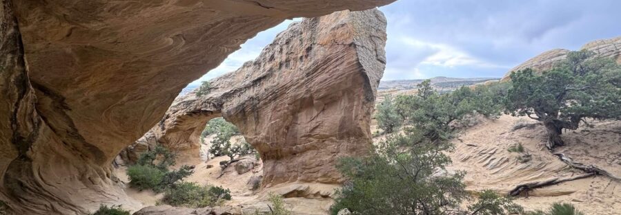
Eight miles north of Vernal, a dirt road branches off US-191 and runs two miles through BLM desert to a small clearing that most people drive past without noticing. At the end of that road, a 1.4-mile trail climbs through sandstone terrain to Moonshine Arch, a 40-foot natural sandstone span stretching more than 85 feet across the canyon wall. No fee. No permit. No national park crowds. Just the arch, the desert, and however much time you want to spend there.
Quick Facts
| Trail Name | Moonshine Arch Trail |
| Location | BLM land north of Vernal, Utah |
| Coordinates | 40.5515, -109.5417 |
| Distance | 1.4 miles (out and back) |
| Elevation Gain | 252 ft |
| Difficulty | Easy to Moderate |
| Time | 45 min–1.5 hours |
| Dogs Allowed | Yes, on leash |
| Fee | Free. No permit required. |
| AllTrails | Plan This Hike on AllTrails |
How to Get There
From downtown Vernal, head north on US-191 for about 6 miles. Watch for a small brown sign on the right pointing toward Moonshine Arch. Turn right onto the dirt road and follow it approximately 2 miles to the trailhead clearing. The dirt road is unmaintained and gets rough after rain. A high-clearance vehicle handles it more comfortably, but most standard vehicles can navigate the road carefully in dry conditions. Avoid it after significant rain when it turns to mud. The trailhead has no formal sign for Moonshine Arch specifically. Load the AllTrails GPS track or drop a pin on the coordinates before leaving Vernal. Having the route active before you turn onto the dirt road makes the approach straightforward.
Parking Information
Parking is a small dirt clearing at the trailhead. No fee, no permit, no kiosk. Space for several vehicles. Park responsibly and do not block the access road for other users. The clearing can become soft and muddy after rain, which is worth checking before making the 2-mile dirt road approach. If the road is muddy, it’s better to wait for it to dry than to risk getting stuck on BLM land with no services nearby. 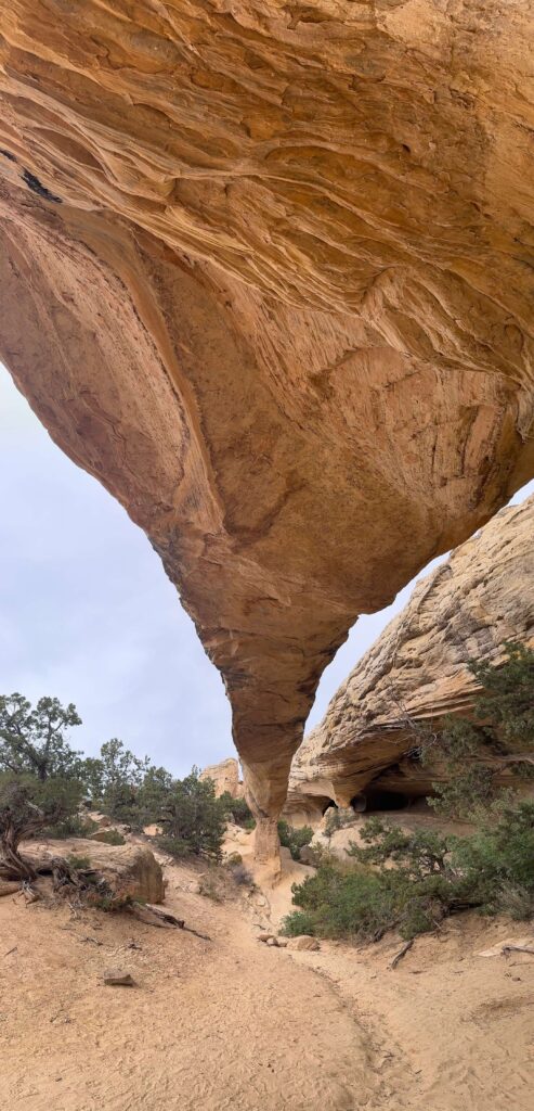
Cell Service and Navigation
Cell coverage is limited north of Vernal on US-191 and drops out on the dirt road approach. Download the AllTrails GPS track before leaving Vernal. The trail crosses slickrock in sections where the path becomes less defined and cairns mark the route. Having the track running is the most reliable way to stay on the correct line through the slickrock sections. The arch is not visible from the trailhead, so navigation matters more here than on trails with an obvious landmark in view from the start.
What to Expect on Moonshine Arch Trail
The Approach
The trail starts in open BLM desert with juniper scrub and sandstone formations building from the first step. The terrain is a mix of packed dirt, sandy sections, and slickrock slabs. The grade is moderate throughout with no single steep pitch, gaining elevation gradually toward the canyon wall where the arch sits. The slickrock sections require attention, the path narrows and cairns mark the route across the bare rock surface. Follow the cairns and your GPS track rather than guessing the line.
The Arch
Moonshine Arch appears suddenly as you round the final approach. The span measures over 85 feet across and stands roughly 40 feet tall, one of the larger natural arches in the Uinta Basin. The sandstone is classic Uinta red-orange, deep color in morning and afternoon light, washed out at midday. The arch provides shade underneath and a natural frame looking back across the desert to the south. The best photography position is from beneath the arch looking out, or from the rock outcropping to the east that puts the full span in profile against the sky.
The Quiet
Moonshine Arch sees a fraction of the traffic that comparable arches in Arches National Park or Zion receive. On most weekday mornings, you will have it to yourself. The BLM location, the rough dirt road approach, and the absence of any major publication covering it in depth all work as natural filters. The arch is not smaller or less spectacular than arches that draw thousands of visitors a day. It’s just harder to find. That’s the whole appeal. 
Trail Difficulty and Length
Moonshine Arch Trail is 1.4 miles out and back with 252 feet of elevation gain. The easy-to-moderate rating reflects the slickrock navigation rather than any sustained physical demand. The trail is short and the elevation gain is gradual. Solid trail shoes with grip handle the slickrock sections adequately. Trekking poles are optional but useful for balance on the bare rock. The main challenge is route-finding, not fitness. Bring the GPS track.
Dog Friendly?
Dogs are allowed on leash at Moonshine Arch. The BLM land designation means fewer restrictions than national park trails. The slickrock sections are manageable for most dogs. Bring water since there are no sources on trail, and the desert surface heats up fast in summer. Check paws after the slickrock sections for abrasion. Pack out all waste.
What to Bring
At least a liter of water per person. Sunscreen and a hat for the exposed approach. Trail shoes with grip for the slickrock. A camera. The arch in morning or late afternoon light is worth setting up for. Wide angle for the full span, closer focal lengths for the rock texture and interior. Download the AllTrails GPS track before you leave Vernal. 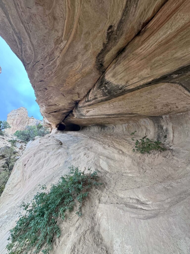
Best Time to Hike Moonshine Arch
Spring (April through June) and fall (September through November) are the most comfortable seasons. Mild temperatures and good desert light at both ends of the day. The arch faces generally south, so morning light from the east catches the canyon wall behind it and afternoon light from the west illuminates the underside and the desert below the span. Both windows are worth planning around. Summer is workable with an early start, on trail before 7 a.m. and off before the surface heats up past comfortable. Winter is possible when the dirt road is clear of snow and mud, and the quiet is exceptional in cold weather when almost nobody else makes the drive.
Rules and Regulations
Moonshine Arch sits on BLM land. Standard BLM regulations apply. Stay on the established trail and the marked slickrock route. Do not build new cairns or move existing ones. No campfires at the trailhead or on the trail corridor. The trail may cross private property boundaries in sections, respect any posted signs and stay on the marked route. No fossil, rock, or artifact collection. Pack out all waste. No fee, no permit, and no services. You are self-supported out here.
Where to Stay Near Vernal
Vernal is the gateway city, 8 miles south of the Moonshine Arch turnoff on US-191. Full lodging range from chains to local properties. For points travelers, check available Marriott Bonvoy properties in Vernal, IHG Rewards hotels in Vernal, and Hilton Honors options in the area.
Camping Nearby
Dispersed camping on the BLM land surrounding the Moonshine Arch area is free with a 14-day limit. No services, no hookups. The dirt road approach to the trailhead has pull-offs suitable for tent camping and small rigs. Red Fleet State Park, 12 miles east, has a developed campground with hookup sites and reservoir access. The Flaming Gorge area north of Vernal has both developed campgrounds and dispersed options along the reservoir corridor.
Nearby Adventures
Battleship Loop Trail at Red Fleet State Park is a 2.5-mile moderate loop with reservoir views and slickrock terrain, 12 miles east of Moonshine Arch. The Red Fleet Dinosaur Trackway is an educational side trip from the same park, preserved dinosaur footprints in the sandstone near the reservoir shore. The Green River Trail in Dinosaur National Monument is 30 minutes south at 2.7 miles and 341 feet of gain, the area’s best riverside canyon hike. The Harpers Corner Trail is the monument’s best canyon overlook at 2.3 miles and 347 feet of gain above the Green and Yampa River confluence. The Utah Field House of Natural History State Park Museum in downtown Vernal is worth a few hours for anyone interested in the prehistoric geology of the Uinta Basin.
Plan This Hike
AllTrails has Moonshine Arch documented with a GPS track that is essential for navigating the slickrock sections. Download the offline map before leaving Vernal. The trailhead is unmarked and cell service is unavailable on the approach road, so having the track active before you turn onto the dirt road is the practical move. Plan your hike on AllTrails.
Chase the Quiet
Standing under Moonshine Arch alone at 8 a.m. with the desert light coming in low from the east and the span throwing shadow across the canyon below. Eighty-five feet of sandstone overhead, carved by water and time into something that takes your breath away even when you’re expecting it. This arch would be famous if it were in a national park. It’s not. It’s on a dirt road north of Vernal on BLM land with a small brown sign and a muddy approach. That’s exactly why it’s worth finding.
Support the Adventure
To make your walls less boring, check out my photography portfolio and bring a piece of the wild and my story into your home. If you’d like to fuel future adventures, you can donate a coffee on Ko-Fi. Every cup keeps me chasing sunrises and stories. When you shop using my affiliate links, every click helps support this blog at no extra cost to you. It’s a small way to keep Unicorn Adventure alive and kicking while I keep exploring. Subscribe to my mailing list for future updates, new stories, and behind-the-scenes adventures. Stay connected with me on Instagram and Facebook for more photos and daily inspiration. Thanks for being part of the journey, Unicorn Squadron!

Theo Maynard is a landscape photographer and adventure blogger based in Salt Lake City. He chases remote desert and mountain light across the American West, documents it all solo, and shares the journey through Unicorn Adventure. He’s on the autism spectrum, and that’s not a footnote, it’s the whole story. He creates to inspire others to get outside, chase what lights them up, and live their best possible life. Unapologetically himself.