

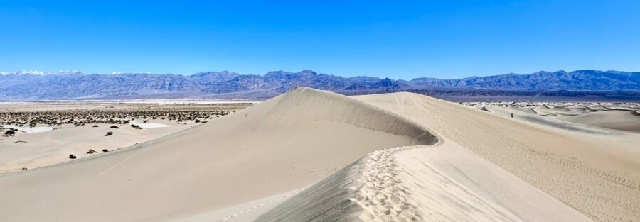
There are no trails at Mesquite Flat Sand Dunes. No signs, no marked route, no defined path. Just 2.3 miles of open sand, wind-sculpted ridges, and the overwhelming quiet of Death Valley stretched out around you. You pick your line and walk.
Here’s your full guide to hiking the Mesquite Flat Sand Dunes.
Quick Facts
| Route Name | Mesquite Flat Sand Dunes |
| Location | Death Valley National Park, California |
| Coordinates | 36.6060° N, 117.1159° W |
| Distance | 2.3 miles (no set trail, route varies) |
| Elevation Gain | 154 ft |
| Difficulty | Easy to Moderate (sand is deceptive) |
| Time | 1–2 hours |
| Dogs Allowed | No (pets not permitted on park trails) |
| Fee | $35 per vehicle (7-day pass) or America the Beautiful Pass |
| AllTrails | View on Alltrails |
How to Get There
The Mesquite Flat Sand Dunes sit right off CA-190 near Stovepipe Wells Village. They’re visible from the highway, so you’re not going to drive past them.
From Furnace Creek, head west on CA-190 for about 23 miles. The dunes appear on your right just before Stovepipe Wells. From Stovepipe Wells Village, they’re about 2 miles east on CA-190.
Death Valley National Park charges $35 per vehicle for a 7-day pass. The America the Beautiful Annual Pass covers it. Pay at the entrance stations or online through recreation.gov before arrival.
Parking Information
The trailhead parking lot is large, paved, and rarely fills to capacity outside of peak holiday weekends. It has restrooms, but no water, no shade, and no services. Everything you need, you’re bringing with you.
For sunrise photography, arrive before first light. The lot is safe to access in the dark, and having your gear ready at the dune base as the light breaks is worth the early alarm. Estes was the only vehicle there on my November visit.
Cell Service and Navigation
Cell service in Death Valley is largely nonexistent. Don’t count on data, navigation, or communication once you’re inside the park.
The dunes themselves are straightforward, you can see the parking lot from anywhere on the route, so getting disoriented isn’t a real concern. That said, download offline maps for the broader Death Valley area before you leave. For anything deeper in the park, a dedicated GPS device is worth carrying.
Emergency communication in Death Valley is genuinely limited. Let someone know your itinerary before you go.
What to Expect at Mesquite Flat Sand Dunes
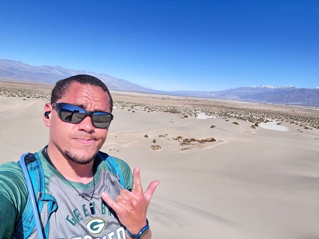
There is no official trail. You start at the parking lot and walk into the dunes in whatever direction interests you. The tallest dune, the one most people aim for, sits roughly in the center of the field and tops out around 100 feet above the desert floor. Total distance depends entirely on your route, but most people cover 2 to 2.5 miles round trip getting there and back.
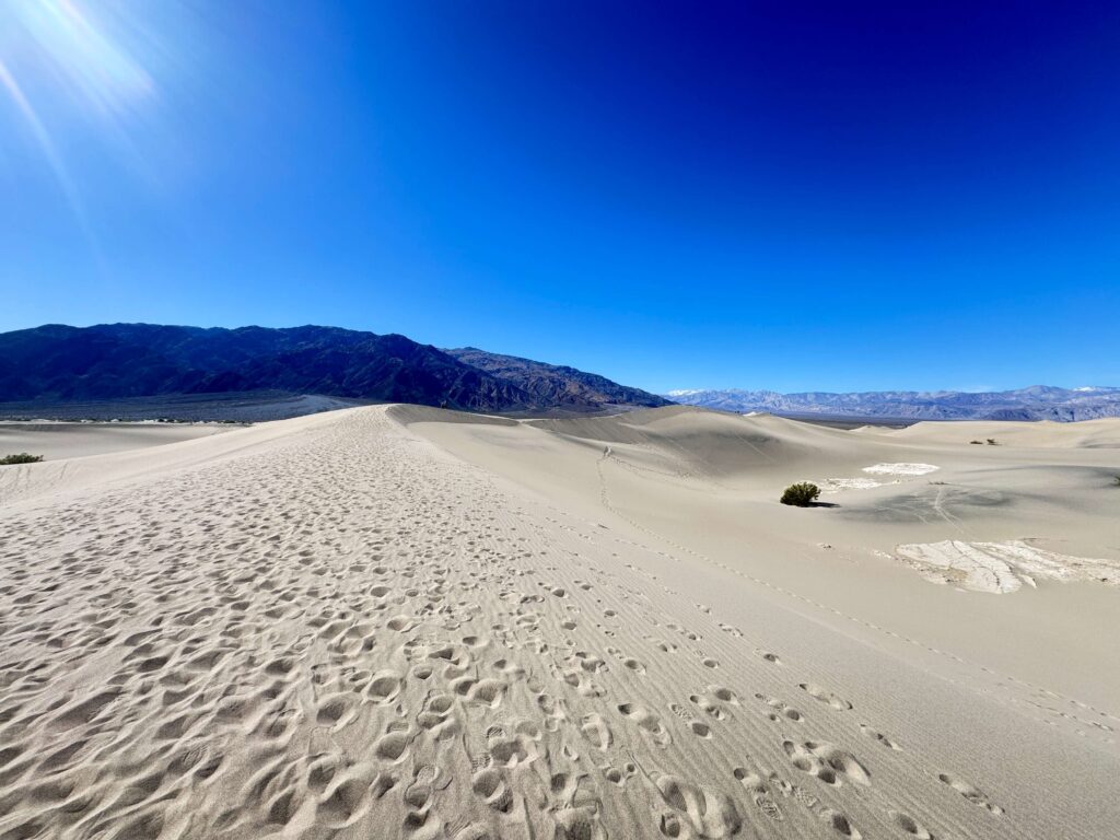
Walking on sand is significantly harder than walking on packed trail. Every step sinks slightly. Your legs work harder, your pace slows, and the 154 feet of elevation gain feels like more than the number suggests. Factor that into your planning and don’t underestimate the physical effort on a hot day.
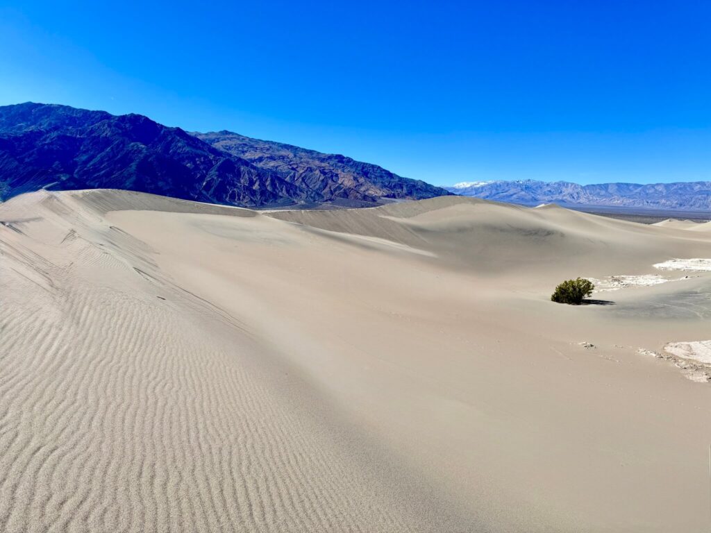
The dunes are surrounded by mesquite trees at the edges and open to the massive Death Valley basin on all sides. It’s a disorienting and wonderful kind of landscape. Nothing looks the same in any direction.
The sand at Mesquite Flat is fine-grained and constantly moving. Wind reshapes the dunes daily, which means the ridgelines and shadow patterns you see are unique to your exact visit. Photographs taken here are difficult to replicate because the dunes literally look different every time.
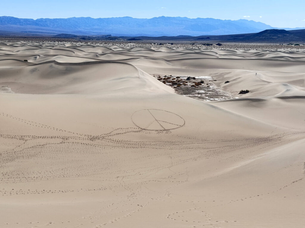
Watch for wildlife tracks in the morning. Kangaroo rats, lizards, and sidewinder rattlesnakes all move through the dunes at night. The tracks they leave in undisturbed sand are one of the subtle pleasures of an early start. By midday, foot traffic erases them.
The sharp ridgelines that form along the dune crests are fragile. Walking along them collapses the edge. If you’re shooting photography, consider your positioning relative to ridgelines you want to preserve in the frame.
Golden hour here is ridiculous. The low-angle morning and evening light hits the dune crests from the side, throwing the ridges into sharp relief and turning the sand deep amber and orange. Every texture becomes a shadow. Midday is beautiful in a different way, high contrast and almost monochrome, but it’s not the light you came for.
A full moon hike is worth considering if your visit aligns with the lunar calendar. The dunes under moonlight in Death Valley is a sensory experience that’s hard to describe and easy to remember. Bring a red light headlamp and go slow.
Trail Difficulty and Length
The Mesquite Flat Sand Dunes cover approximately 2.3 miles with 154 feet of elevation gain, but those numbers underrepresent the actual effort. Sand hiking is taxing in a way that packed dirt isn’t. Your legs work harder per step, your ankles flex constantly, and the heat compounds everything.
It’s rated easy in terms of technical difficulty, there’s no exposure, no scrambling, no navigation challenge. But in summer or midday heat, this route becomes dangerous fast. The sand surface temperature can exceed 200°F in summer. People underestimate Death Valley every year. Don’t be one of them.
In the right season and conditions, most people finish a full out-and-back to the highest dune in 1 to 2 hours. Slow down, look around, and don’t rush the return.
Dog Friendly?
No. Dogs are not permitted on the Mesquite Flat Sand Dunes or most trails within Death Valley National Park.
Even if regulations allowed it, the sand surface temperatures in Death Valley make this genuinely dangerous for dogs during most of the year. Leave your dog somewhere safe and cool.
What to Bring
Death Valley does not forgive underprepared visitors. Gear up seriously even for a short route like this.
Water is the priority. Carry at least 1 liter per hour you plan to be out, more in warm weather. A daypack with a hydration reservoir is the easiest way to manage this.
Sun protection is non-negotiable. High-SPF sunscreen, a wide-brim hat, UV-blocking sunglasses, and sun-protective clothing. The desert UV in Death Valley is intense year-round.
Snacks for energy. Electrolyte packets or tablets are worth carrying, especially in warm weather when you’re losing more than you realize.
For photography: a wide-angle lens for the big dune compositions, a telephoto for compressing the distant mountain ranges behind the dunes, and a polarizing filter to cut sand glare and deepen the blue sky. Bring a lens cloth, sand gets into everything.
Gaiters or trail gaiters keep sand out of your shoes. Not essential, but appreciated by mile two when the sand has worked its way into every layer.
Best Time to Hike Mesquite Flat Sand Dunes
November through March is the window. Death Valley summer is not survivable on foot without extreme preparation, and even spring can be brutal by April. Temperatures in summer regularly exceed 120°F. The sand surface temperature reaches well above that.
Within the right season, sunrise and sunset are the best times to be on the dunes, for temperature, for light, and for the experience of having the place nearly to yourself before the tour buses arrive.
A full moon night in winter is the sleeper recommendation. Cold, quiet, and lit by moonlight bright enough to cast shadows. It’s a genuinely unusual experience in one of the most unusual landscapes in North America.
Avoid holiday weekends if crowds bother you. Death Valley sees significant visitation over Thanksgiving, Christmas, and the New Year holiday period, all of which fall within the ideal weather window.
Rules and Regulations
Death Valley National Park rules apply throughout the dunes.
Pack out everything you pack in. Leave No Trace is non-negotiable in a desert ecosystem that shows every disturbance. There are no trash cans at the trailhead.
Do not disturb wildlife. The kangaroo rats, lizards, and snakes you’ll see signs of are protected species in a national park. Give them space.
Sandboarding and sledding on the dunes are not permitted. The dunes are a protected geological feature.
Drones require a permit inside Death Valley National Park. Don’t fly without one.
Where to Stay Near Death Valley
Stovepipe Wells Village is the closest accommodation option, literally within sight of the dunes. The resort has hotel rooms and an RV campground. It’s basic but well-located for a dunes sunrise.
Furnace Creek, about 23 miles east, is the park’s main hub and has more options, including the historic Inn at Death Valley. For loyalty points, Marriott Bonvoy has properties in the gateway communities outside the park. Hilton Honors and IHG Rewards cover options in Las Vegas (about 2 hours east) and Ridgecrest (about 2 hours west), both common staging points for Death Valley trips.
Camping Nearby
Mesquite Spring Campground is the closest developed campground to the dunes, about 5 miles north near Scotty’s Castle Road. It operates on a first-come, first-served basis and is one of the quieter campgrounds in the park.
Stovepipe Wells Campground is adjacent to Stovepipe Wells Village, about 2 miles from the dunes. It’s a large campground with hookup options. Reservations are available through Recreation.gov and fill fast in peak season.
Death Valley also allows dispersed camping in undeveloped areas, at least 1 mile from paved roads and 100 yards from water sources, with a free permit. Check current conditions and restrictions with the park before planning a dispersed site.
Nearby Adventures
Death Valley packs an enormous amount into one park. The dunes are one stop on a much bigger itinerary.
Badwater Basin is about 40 miles south of the dunes at Furnace Creek. It’s the lowest point in North America at 282 feet below sea level, and the salt flat walk is a genuinely strange experience.
Mosaic Canyon is a slot canyon hike about 2 miles west of Stovepipe Wells Village. The polished marble walls and tight narrows are visually striking and it’s one of the more accessible canyon hikes in the park. See my Mosaic Canyon guide for details.
Artist’s Palette is a short drive loop near Furnace Creek where oxidized minerals paint the hillsides in green, yellow, pink, and purple. Late afternoon light is the move. My Artist’s Palette guide has the full breakdown.
Dante’s View is a 5,575-foot overlook above Furnace Creek with a view of the entire Death Valley basin. No hiking required, it’s a paved pullout. The view is one of the best in the American West. See my Dante’s View guide for timing and photography tips.
Golden Canyon and Gower Gulch Loop via Zabriskie Point is the park’s best full-day hike at 6.4 miles with 1,082 feet of gain. If you’re here for more than a day, this one is mandatory.
Plan This Hike
AllTrails has the Mesquite Flat Sand Dunes mapped with user-reported conditions, recent reviews, and an offline map download. Since there’s no official trail, the community notes are especially useful for knowing what conditions look like before you arrive.
Download the offline map, read the recent reviews, and check for any park closures or road conditions through the Death Valley National Park website before you leave. View on Alltrails.
Chase the Quiet
Standing on the crest of the highest dune at Mesquite Flat as the sun breaks the Amargosa Range, with the whole valley floor spread out below you and nothing moving except the wind off the sand, is one of those moments that recalibrates something. Death Valley is extreme by nature. But on a quiet November morning on those dunes, it’s just still.
Support the Adventure
To make your walls less boring, check out my photography portfolio and bring a piece of the wild and my story into your home.
If you’d like to fuel future adventures, you can donate a coffee on Ko-Fi. Every cup keeps me chasing sunrises and stories.
When you shop using my affiliate links, every click helps support this blog at no extra cost to you. It’s a small way to keep Unicorn Adventure alive and kicking while I keep exploring.
Subscribe to my mailing list for future updates, new stories, and behind-the-scenes adventures.
Stay connected with me on Instagram and Facebook for more photos and daily inspiration.
Thanks for being part of the journey, Unicorn Squadron!

Theo Maynard is a landscape photographer and adventure blogger based in Salt Lake City. He chases remote desert and mountain light across the American West, documents it all solo, and shares the journey through Unicorn Adventure. He’s on the autism spectrum, and that’s not a footnote, it’s the whole story. He creates to inspire others to get outside, chase what lights them up, and live their best possible life. Unapologetically himself.