

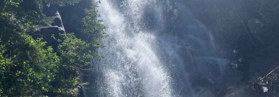
Bell Canyon Trail starts on Wasatch Boulevard in Sandy, climbs to a reservoir with a mountain backdrop, pushes into canyon terrain, and finishes at a waterfall tumbling over granite boulders. That’s 4.8 miles and 1,600 feet and a full morning worth of effort right at the edge of the valley. The Bell Canyon Trail sits at the foot of the Wasatch Range in Sandy, one of the more accessible serious hikes on the front. The trail earns its gain through a mix of open sections and shaded canyon terrain, passing the Bell Canyon Reservoir before pushing deeper into the canyon to the Lower Falls. The canyon narrows as you climb and the waterfall at the end, dropping over large granite boulders in a shaded alcove, is a legitimate payoff for the effort. The Wasatch puts up walls like this all along the front and most people drive past them every day without going in. Here’s what you need to hike Bell Canyon Trail to Lower Falls.
Quick Facts
| Trail Name | Bell Canyon Trail to Lower Falls |
| Location | Uinta-Wasatch-Cache National Forest, Sandy, Utah |
| Coordinates | 40.5654, -111.8037 |
| Distance | 4.8 miles (round trip) |
| Elevation Gain | 1,600 feet |
| Difficulty | Moderate to Strenuous |
| Time | 3-5 hours |
| Dogs Allowed | No (dogs prohibited throughout) |
| Fee | None |
| View on Alltrails | |
How to Get There
From Sandy, head east on 9400 South to Wasatch Boulevard. Turn right on Wasatch Boulevard and continue about 0.4 miles south. The trailhead parking lot is on the left side of the road, just before the Little Cottonwood Canyon Road intersection. From Salt Lake City, take I-215 south to the 6200 South exit, head east to Wasatch Boulevard, and turn right. The trailhead is clearly signed and easy to find from Wasatch Boulevard. Drive time from downtown Salt Lake City is about 25 to 30 minutes.
Parking Information
The trailhead has a small designated parking lot that fills fast on weekend mornings, particularly in spring and fall. Arrive before 8 a.m. on busy weekends. Overflow runs along Wasatch Boulevard, but watch posted restrictions carefully. No restroom facilities at the trailhead. Handle that at commercial areas along 9400 South before driving to the trailhead. 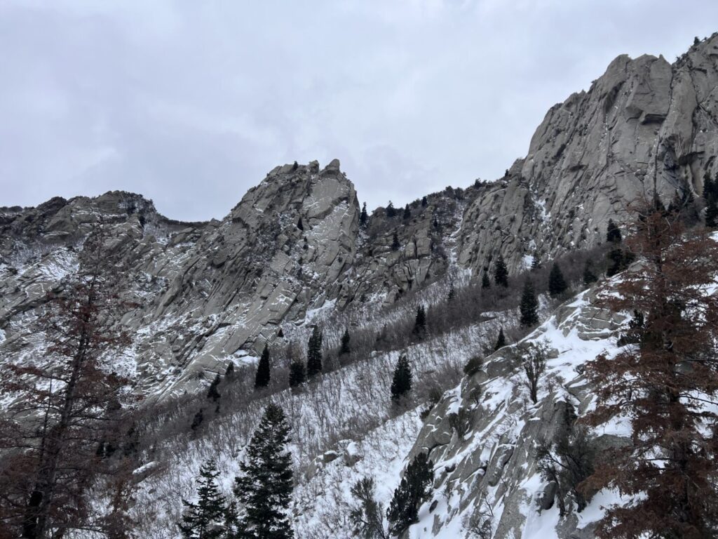
Cell Service and Navigation
Cell service is generally reliable at the trailhead and lower trail sections given proximity to the Sandy corridor. It weakens in the upper canyon as you push further from the valley. Download your map offline through AllTrails as a backup. The trail is well-marked through the lower sections. The upper canyon is more rugged and having a GPS track is useful at the rocky sections near the falls. Weather can build fast on the Wasatch front. Check the forecast and watch for afternoon thunderstorm development in summer.
What to Expect on Bell Canyon Trail to Lower Falls
The Reservoir
The trail begins at the trailhead on Wasatch Boulevard and climbs steeply to start. The initial ascent is the hardest single pitch of the hike. Once you gain the ridge, the trail moderates as it approaches Bell Canyon Reservoir. The reservoir is a natural stopping point with views of the surrounding peaks and the Wasatch ridgeline above. Oak, maple, and pine line the trail and the reservoir area provides some shade. It’s a solid turnaround point for hikers who want a shorter day.
The Canyon and Lower Falls
Past the reservoir the trail enters Bell Canyon proper. The terrain gets rockier, the canyon walls rise, and the trail demands more attention on footing. The forest cover increases as you push deeper. The Lower Falls appears at the end of the canyon push, water cascading over large granite boulders in a shaded, enclosed alcove. The setting is cool even on warm days. The falls run strongest in spring and early summer on snowmelt. The Upper Falls are accessible from here for hikers who want additional mileage and elevation beyond the main objective. 
Trail Difficulty and Length
Bell Canyon Trail to Lower Falls is 4.8 miles roundtrip with 1,600 feet of elevation gain. Moderate to strenuous is the accurate rating for this profile. The initial climb to the reservoir is steep and unrelenting. The canyon section is rocky and demands solid footing. It’s not a casual walk. Budget 3 to 5 hours. The descent on the steep initial pitch with tired legs requires the same care as the ascent. Bring trekking poles if your knees are a concern.
Dog Friendly?
No dogs. The trail runs through Bell Canyon HOA land before entering the Uinta-Wasatch-Cache National Forest and dogs are not permitted on the route. If you want to hike with a dog in the area, Millcreek Canyon allows dogs on odd-numbered calendar days with a leash requirement and has solid trail options at multiple difficulty levels. 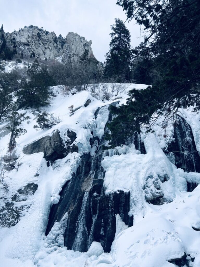
What to Bring
At least 2 to 3 liters of water per person. The initial climb drains you fast and the exposed lower sections heat up in summer. Trail shoes or hiking boots with solid grip for the rocky canyon and falls sections. Sunscreen and a hat for the open lower trail. A light layer for the shaded upper canyon, which stays noticeably cooler. Trekking poles help significantly on the steep initial descent and on the rocky canyon footing. A camera for the falls and the reservoir views. The granite waterfall and canyon walls photograph well with a wide-angle lens.
Best Time to Hike Bell Canyon Trail
Spring (April through June) and fall (September through October) are the strongest windows. Spring snowmelt gives the Lower Falls their best flow and the canyon vegetation is vivid green. Fall turns the oak and maple on the lower trail orange and red. Summer is hot on the exposed lower sections. Start before 7 a.m. in summer without exception. Winter keeps the trail accessible in milder years but ice on the steep initial pitch and the rocky canyon sections requires microspikes for safe footing. For photography, early morning light hits the canyon walls from the east before it shifts overhead. The Lower Falls photograph best in a shaded alcove with diffused light, which means overcast conditions or early morning before direct sun reaches the canyon floor. A neutral density filter gives you a long exposure on the moving water. The reservoir view is best in morning light with the peaks reflected on a calm surface. 
Rules and Regulations
Bell Canyon Trail accesses the Uinta-Wasatch-Cache National Forest through the Bell Canyon community area. Follow Leave No Trace fully: pack out everything, stay on established trails, and don’t shortcut the steep sections which causes serious erosion on this terrain. Dogs are not permitted on this trail. Check the Wasatch-Cache National Forest site for any current closures or fire restrictions. The reservoir area may have additional posted regulations. Respect any community signage on the approach to the national forest boundary.
Where to Stay Near Sandy
Sandy has a full range of chain lodging along the 9400 South corridor and I-15. For hotel points check Marriott Bonvoy, IHG Rewards, and Hilton Honors. Salt Lake City is 20 minutes north with significantly more inventory and better access to the broader range of Wasatch Front trails.
Camping Nearby
No camping in the Bell Canyon immediate area. Big Cottonwood Canyon, about 10 minutes north on Wasatch Boulevard, has Redman Campground reservable through recreation.gov. Little Cottonwood Canyon, accessible from the same Wasatch Boulevard corridor, has the Albion Basin Campground at Brighton for high-elevation camping near the Cecret Lake area. Both fill fast in summer.
Nearby Adventures
The Bell Canyon Trail continues past the Lower Falls to the Upper Falls for hikers who want additional elevation and a more remote waterfall experience. The Hidden Valley Trail from the same general area provides canyon views at a different angle. Lone Peak, accessible from trails in the Lone Peak Wilderness to the south, is one of the hardest summits on the Wasatch Front at roughly 10,000 feet gain from the valley. One canyon north in Little Cottonwood Canyon, Lisa Falls is a quick 0.2-mile granite waterfall stop that pairs well as a warm-up or cooldown. Cecret Lake at Albion Basin (2.0 mi / 400 ft) is the easy alpine lake option for the same canyon system. Further up Little Cottonwood, Red Pine Lake (7.5 mi / 2,109 ft) is the full-day alpine lake commitment. The Loveland Living Planet Aquarium in Sandy is a solid family option within 10 minutes of the trailhead. Draper’s Corner Canyon trail system is a short drive south for mountain biking and additional foothills hiking.
Plan This Hike
AllTrails has Bell Canyon Trail to Lower Falls with a downloadable map, recent user conditions, and notes on current trail state from other hikers. Checking recent reports is useful for understanding current water levels at the falls and scramble conditions near the waterfall. View on Alltrails AllTrails Pro is worth it for offline maps and GPS tracking on the rocky upper canyon sections where the trail demands more attention than the lower approach.
Chase the Quiet
The Wasatch Range runs right along the eastern edge of the Salt Lake Valley for the entire length of the metro area. Bell Canyon is one of dozens of drainages cutting into those mountains that most people who live in the valley never go into. The Lower Falls are shaded, cold, and loud with water in a canyon that’s completely quiet in every other way. That combination is worth 4.8 miles and 1,600 feet every time.
Support the Adventure
To make your walls less boring, check out my photography portfolio and bring a piece of the wild and my story into your home. If you’d like to fuel future adventures, you can donate a coffee on Ko-Fi. Every cup keeps me chasing sunrises and stories. When you shop using my affiliate links, every click helps support this blog at no extra cost to you. It’s a small way to keep Unicorn Adventure alive and kicking while I keep exploring. Subscribe to my mailing list for future updates, new stories, and behind-the-scenes adventures. Stay connected with me on Instagram and Facebook for more photos and daily inspiration. Thanks for being part of the journey, Unicorn Squadron!

Theo Maynard is a landscape photographer and adventure blogger based in Salt Lake City. He chases remote desert and mountain light across the American West, documents it all solo, and shares the journey through Unicorn Adventure. He’s on the autism spectrum, and that’s not a footnote, it’s the whole story. He creates to inspire others to get outside, chase what lights them up, and live their best possible life. Unapologetically himself.