

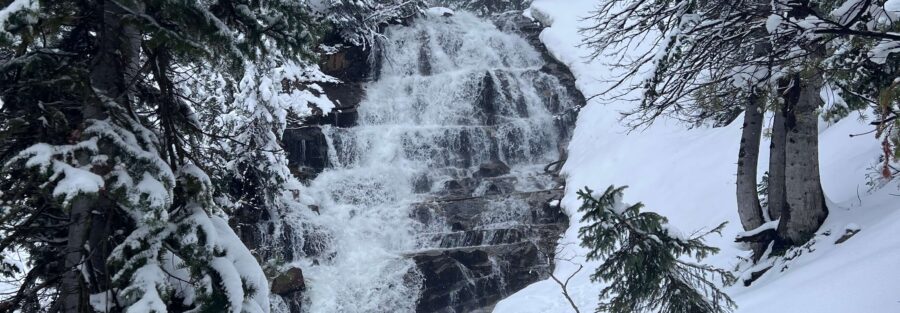
Gloria Falls is the waterfall in Little Cottonwood Canyon that most people drive past without knowing it exists. That’s exactly why it’s worth finding. Gloria Falls is a 2.2-mile round trip hike accessed from the White Pine Trailhead in Little Cottonwood Canyon, about 6 miles up from the canyon entrance. The trail branches off the main White Pine Lake route and pushes through narrower, rougher terrain to a waterfall that drops down a rocky cliff face into a pool surrounded by lush canyon vegetation. It’s one of the shorter waterfall hikes accessible from Salt Lake City and one of the less crowded, which is the main advantage over nearby trails that funnel everyone to the same destinations. The forest section is shaded and quiet. The falls run strongest in spring and early summer on snowmelt. The whole thing is done in under two hours if you move at a reasonable pace. Here’s what you need to hike Gloria Falls.
Quick Facts
| Trail Name | Gloria Falls Trail |
| Location | Little Cottonwood Canyon, Uinta-Wasatch-Cache NF, Sandy, Utah |
| Coordinates | 40.5755, -111.6809 |
| Distance | 2.2 miles (round trip) |
| Elevation Gain | 500 feet |
| Difficulty | Moderate |
| Time | 1.5-2 hours |
| Dogs Allowed | No (protected watershed) |
| Fee | None |
| View on Alltrails | |
How to Get There
From Salt Lake City, take I-215 to exit 6 (6200 South). Head east on 6200 South to Wasatch Boulevard. Turn right (south) on Wasatch Boulevard and continue to Little Cottonwood Canyon Road (UT-210). Turn left onto UT-210 and drive approximately 6 miles up Little Cottonwood Canyon. The White Pine Trailhead is on the right side of the road. This is the shared trailhead for White Pine Lake, Red Pine Lake, and Gloria Falls. Drive time from downtown Salt Lake City is about 30 to 40 minutes.
Parking Information
The White Pine Trailhead has a maintained parking area shared with the popular White Pine Lake and Red Pine Lake trails. It fills fast on summer and fall weekends. Arrive before 8 a.m. to guarantee a spot. Restrooms are available at the trailhead, which makes this one of the better-equipped Little Cottonwood starting points. No fee for parking.
Cell Service and Navigation
Cell service in Little Cottonwood Canyon is unreliable from about 3 miles up and effectively gone by the White Pine Trailhead. Download your map offline through AllTrails before leaving Sandy or Salt Lake City. The initial trail follows the White Pine Lake route and the Gloria Falls junction is not prominently marked. A GPS track loaded in advance removes the guesswork at the junction. The canyon weather can change fast. Check the forecast before heading in. 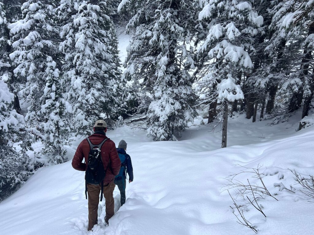
What to Expect on Gloria Falls Trail
The White Pine Approach
The trail starts at the White Pine Trailhead and follows the well-traveled White Pine Lake Trail for approximately a mile. The path climbs through tall pines, aspens, and dense undergrowth with Little Cottonwood Creek audible nearby. The forest canopy keeps the trail shaded and cool. The main trail sees significant traffic from hikers heading to both White Pine and Red Pine lakes, so the lower section is busy on peak weekends.
The Gloria Falls Branch and Falls
At the trail junction roughly a mile in, a smaller trail branches left toward Gloria Falls. The junction isn’t prominent, so watch your GPS track or AllTrails map carefully at this point. The trail narrows after the junction and the terrain gets rockier. The crowd thins immediately. The forest begins to open as you approach the falls and the sound of the water arrives before the view. Gloria Falls drops down a rocky cliff face into a pool surrounded by wildflowers and canyon greenery. The falls are at their most dramatic in May and June on snowmelt. By late summer the flow is lighter but the setting is still excellent for photography and a rest stop. 
Trail Difficulty and Length
Gloria Falls is 2.2 miles round trip with 500 feet of elevation gain. The moderate rating is accurate. The first mile on the White Pine Trail is well-graded. The final approach after the junction gets rockier and requires more footing attention. Good trail shoes are the practical footwear choice. Budget 1.5 to 2 hours at a comfortable pace with time at the falls. The short distance makes this a natural add-on to a White Pine or Red Pine Lake day or a standalone option for families with younger kids.
Dog Friendly?
No. Little Cottonwood Canyon is a protected municipal watershed. Dogs are prohibited throughout the canyon on all trails. No exceptions. Millcreek Canyon allows dogs on odd-numbered calendar days with a leash requirement and has multiple trail options at various difficulty levels if you need a dog-friendly canyon alternative.
What to Bring
At least 1.5 liters of water per person. Trail shoes with grip for the rocky approach to the falls. Sun protection for the exposed lower trail sections. A light layer for the shaded upper canyon sections that stay cool even on warm days. A camera for the falls, which photograph best with a wide-angle lens from the pool base. A neutral density filter for a long-exposure shot on the falling water. A tripod if you want to execute the long exposure properly. Bug spray in July and August when the creek-side vegetation gets active. 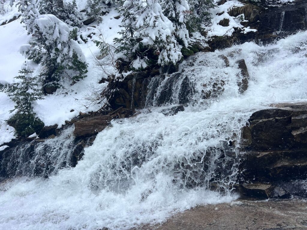
Best Time to Hike Gloria Falls
Late spring (May through June) is the strongest window. Snowmelt from the surrounding peaks pushes the most water through the falls and the canyon wildflowers are at peak in this period. Summer is solid through August with the forest canopy providing shade on the approach. Fall brings aspen color to the lower trail sections in late September and early October. Winter access is limited and the rocky approach to the falls can be icy. The White Pine Trailhead road is typically clear in winter but the upper trail sections require microspikes for safety. For photography, overcast days are best at the falls. Diffused light eliminates harsh shadows in the canyon and renders the water and surrounding greenery evenly. On clear days, early morning before the sun clears the canyon walls gives you the best light without direct glare. The falls area faces generally west, so the light is better in the morning than the afternoon on clear days.
Rules and Regulations
Gloria Falls is in the Uinta-Wasatch-Cache National Forest inside the Little Cottonwood Canyon watershed. No dogs, no swimming or wading in the creek or pool, no fee. Leave No Trace applies fully. The junction trail to Gloria Falls is less maintained than the White Pine route. Stay on the established line and don’t widen the path through the rocky sections. Check the Wasatch-Cache National Forest site for current trail conditions and any closures before heading out, particularly in early season when snow can linger on the approach.
Where to Stay Near Little Cottonwood Canyon
Sandy and Cottonwood Heights have chain lodging within 20 to 30 minutes of the White Pine Trailhead. Alta and Snowbird lodges put you in the canyon itself. For hotel points check Marriott Bonvoy, IHG Rewards, and Hilton Honors. Staying in the canyon puts you at the trailhead before the White Pine lot fills on summer weekends.
Camping Nearby
Camping is not permitted in Little Cottonwood Canyon due to watershed restrictions. Albion Basin Campground at the top of the canyon near Alta is the high-elevation established option, reservable through recreation.gov. It fills fast during peak wildflower season in late July and August. Big Cottonwood Canyon, one canyon north, has Redman Campground as a nearby alternative.
Nearby Adventures
The White Pine Trailhead is a hub for some of the better day hikes in Little Cottonwood Canyon. White Pine Lake (10.7 mi / 2,716 ft) and Red Pine Lake (7.5 mi / 2,109 ft) both start here and offer full-day alpine lake objectives for hikers ready to step up from Gloria Falls. Red Pine continues to the Pfeifferhorn, one of the most iconic Wasatch summits, for committed hikers. Further up the canyon at Albion Basin, Cecret Lake (2.0 mi / 400 ft) is the accessible alpine lake loop with exceptional wildflower meadows. Lisa Falls is a quick 0.2-mile stop at a granite waterfall lower in the canyon, worth a stop on the way in or out. Snowbird Resort operates summer activities including the aerial tram to Hidden Peak at 11,000 feet, a zip line, and an alpine slide. The tram gives you high-elevation views without the gain and connects to hiking terrain above the resort.
Plan This Hike
AllTrails has Gloria Falls with a downloadable map and recent user conditions. Given the unmarked junction from the White Pine Trail, the AllTrails GPS track is particularly useful here. Downloading it before you lose signal in the canyon is worth the extra step. View on Alltrails AllTrails Pro is worth it for Little Cottonwood Canyon trips where you may want offline maps for multiple trails from the same trailhead. Download White Pine, Red Pine, and Gloria Falls in one session before leaving the valley.
Chase the Quiet
The White Pine Lake Trail is one of the most trafficked routes in Little Cottonwood Canyon. Peel off at the Gloria Falls junction and you’re immediately in a different canyon. Narrower, quieter, rougher underfoot, and at the end of it a waterfall that most people never bother to find. That combination is worth a two-mile detour from the main trail every time.
Support the Adventure
To make your walls less boring, check out my photography portfolio and bring a piece of the wild and my story into your home. If you’d like to fuel future adventures, you can donate a coffee on Ko-Fi. Every cup keeps me chasing sunrises and stories. When you shop using my affiliate links, every click helps support this blog at no extra cost to you. It’s a small way to keep Unicorn Adventure alive and kicking while I keep exploring. Subscribe to my mailing list for future updates, new stories, and behind-the-scenes adventures. Stay connected with me on Instagram and Facebook for more photos and daily inspiration. Thanks for being part of the journey, Unicorn Squadron!

Theo Maynard is a landscape photographer and adventure blogger based in Salt Lake City. He chases remote desert and mountain light across the American West, documents it all solo, and shares the journey through Unicorn Adventure. He’s on the autism spectrum, and that’s not a footnote, it’s the whole story. He creates to inspire others to get outside, chase what lights them up, and live their best possible life. Unapologetically himself.