

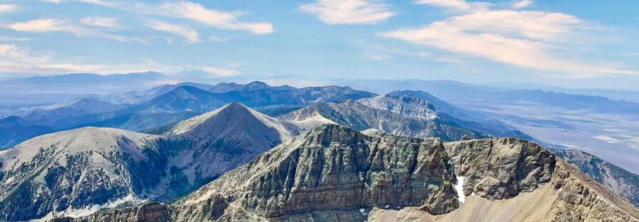
Wheeler Peak and Baker, Nevada: A Day I Nearly Got Blown Off a 13,063-Foot Ridge
I had Wheeler Peak on my radar for a while. The plan was summer 2023, but my car had different ideas and self-destructed over the Fourth of July weekend. When you’re thinking about driving to one of the most remote national parks in the continental US, mechanical reliability isn’t optional. I postponed until Estes was sorted out and I could make the trip without spending it stranded somewhere on US-50.
Great Basin National Park sits near Baker, Nevada, population somewhere between 20 and 40 depending on the day. Baker is the kind of town that exists because someone decided to stay. It’s 60 miles from Ely on US-50, which locals call the Loneliest Road in America without irony. No cell service that matters. Spotty Wi-Fi at the inn. No grocery store selling bananas. I’ll come back to the bananas.
I combined the Wheeler Peak Trail via Stella Lake Trail with the Bristlecone and Alpine Lakes Loop into one long day.
Two serious hikes. One day. Baker, Nevada as the base. Here’s what happened.
Baker, Nevada: Five Blocks and No Bananas
Baker has one main road, a handful of businesses, and the kind of quiet that doesn’t feel performative because it’s not trying to be anything. It’s just remote. The Star Gazer Inn is the lodging situation in town and it delivers on the dark sky promise the name makes: Great Basin is designated as an International Dark Sky Park, and from Baker on a clear night with no moon, the Milky Way is visible without a telescope. That’s not a thing you say about many places in the American West anymore.
The Great Basin Cafe handles food in town. Sandra’s Mexican Food is the other option. Between them, you’re covered for a pre-hike breakfast and a post-hike dinner. Don’t expect more than that and you won’t be disappointed.
About the bananas. I was craving one at the summit and went to the only store in town before the hike. They didn’t carry them. The nearest place to get a banana was an hour away. I ended up with yogurt and an apple, which worked fine, but the banana thing is a useful data point for Baker trip logistics: bring your own specific snack requirements from somewhere with a real grocery section. Ely has one. Stock up there.
Staying in a town that spans five blocks does something to you. No social media because there’s no signal. No noise because there’s no traffic. You end up outside looking at the mountains because there’s nothing else competing for attention. I was outside looking at the mountains. I don’t regret that.
The Bristlecone and Alpine Lakes Loop
I started with the Bristlecone and Alpine Lakes Loop at the Summit Trailhead near Wheeler Peak Campground, up Wheeler Peak Scenic Drive from the park entrance. The trailhead sits at around 10,000 feet, and I felt that elevation from the first steps: the air has less oxygen than I’m used to, even coming from Salt Lake City. The body notices.
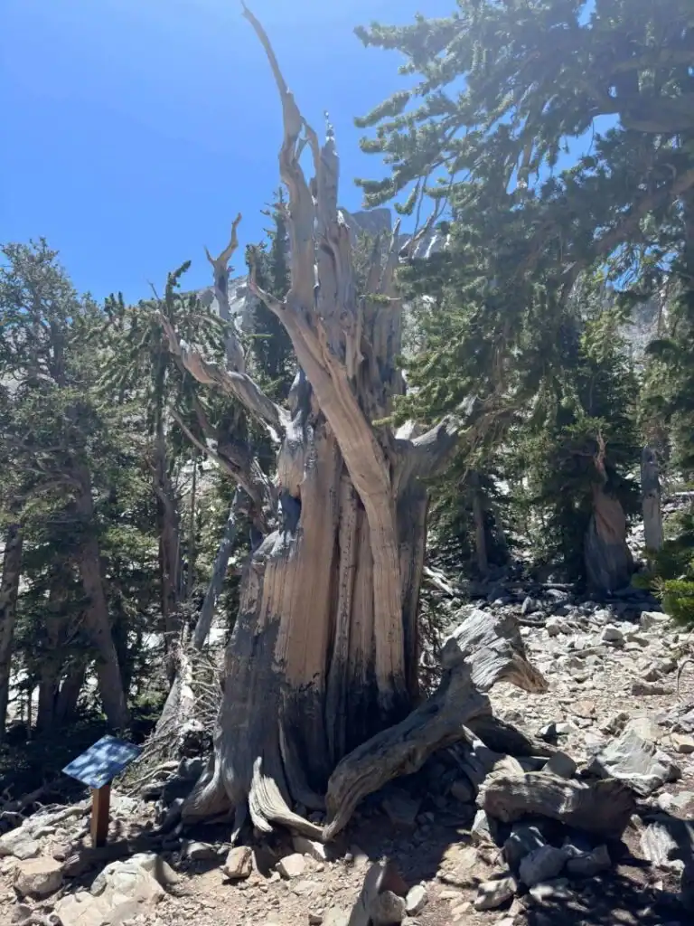
The first mile and a half moves through pine and aspen forest, the trail gentle and meandering, the kind of hiking that builds false confidence. Then the bristlecone pines arrive. Some of these trees are over 4,000 years old. That’s not a typo. Four thousand years. The oldest ones predate Rome. Standing next to them and knowing that specific number changes how you look at them. The gnarled bark, the dense twisted grain that resists decay and insects, the branches that look like they’ve been shaped by time rather than grown, all of it makes more sense when you know how long they’ve been doing it. I spent more time in the grove than my schedule had allocated. Worth it.
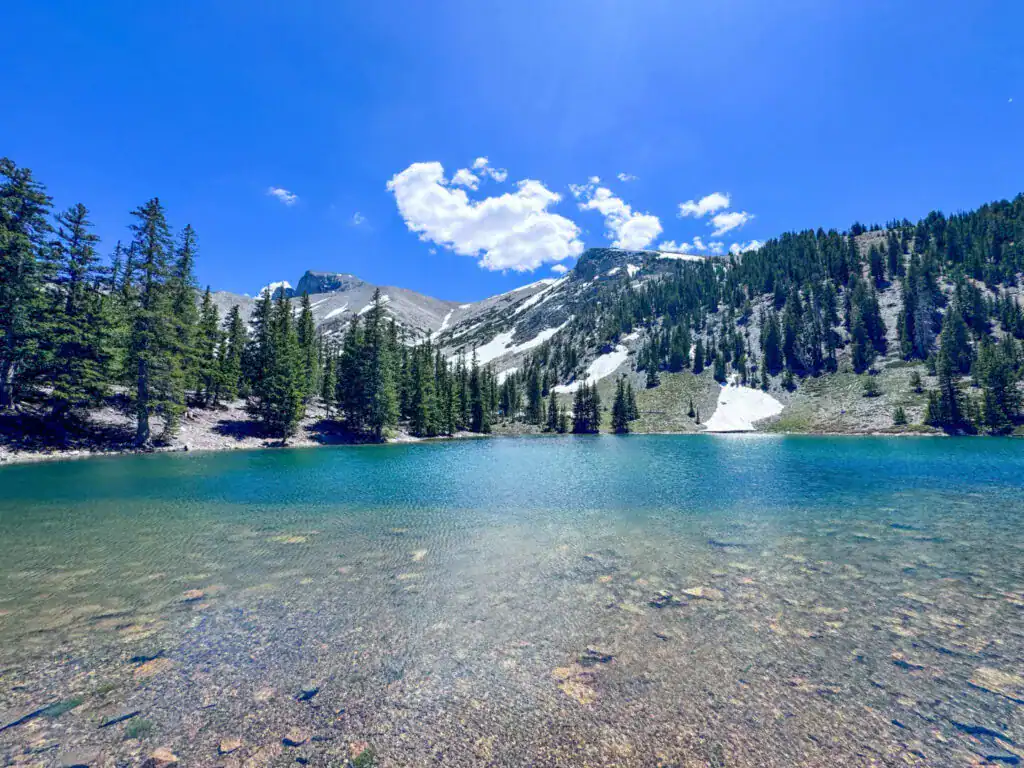
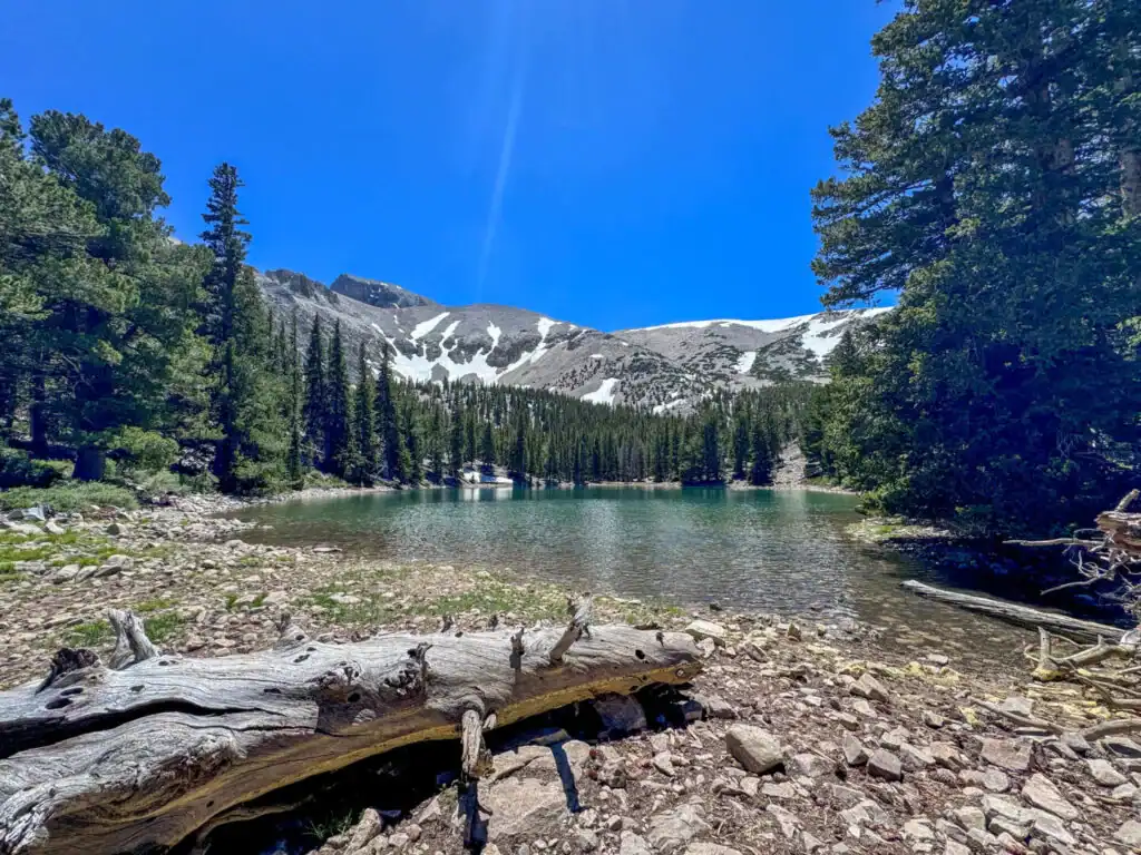
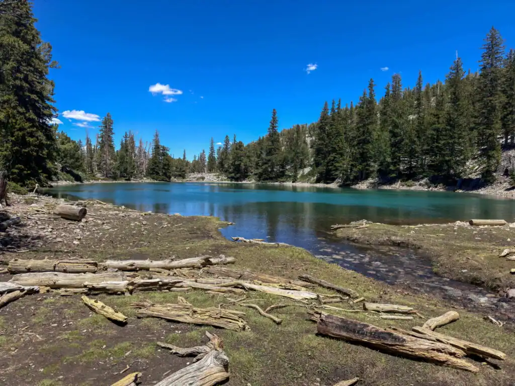
Teresa Lake appears first on the loop: crystal-clear, calm, reflecting the peaks above it perfectly in the morning before the wind picks up. There was a guy sitting at the shore playing harmonica when I came through. Not performing, just playing for himself. It fit the place exactly. I kept moving.
Stella Lake is the higher of the two, smaller and more enclosed, sitting right below the Wheeler Peak ridgeline. Quieter. More purposeful, somehow. This is also where the Wheeler Peak Trail branches upward if you’re combining the routes, which I was.
Full guide: Bristlecone and Alpine Lakes Loop
Wheeler Peak: Why Trails Like This Should Be Illegal
The Wheeler Peak Trail lulls you for the first two miles. The grade is manageable, the terrain is reasonable, and the bristlecone section gives you something to look at while your lungs calibrate to elevation. Then the trail decides it’s done being polite.
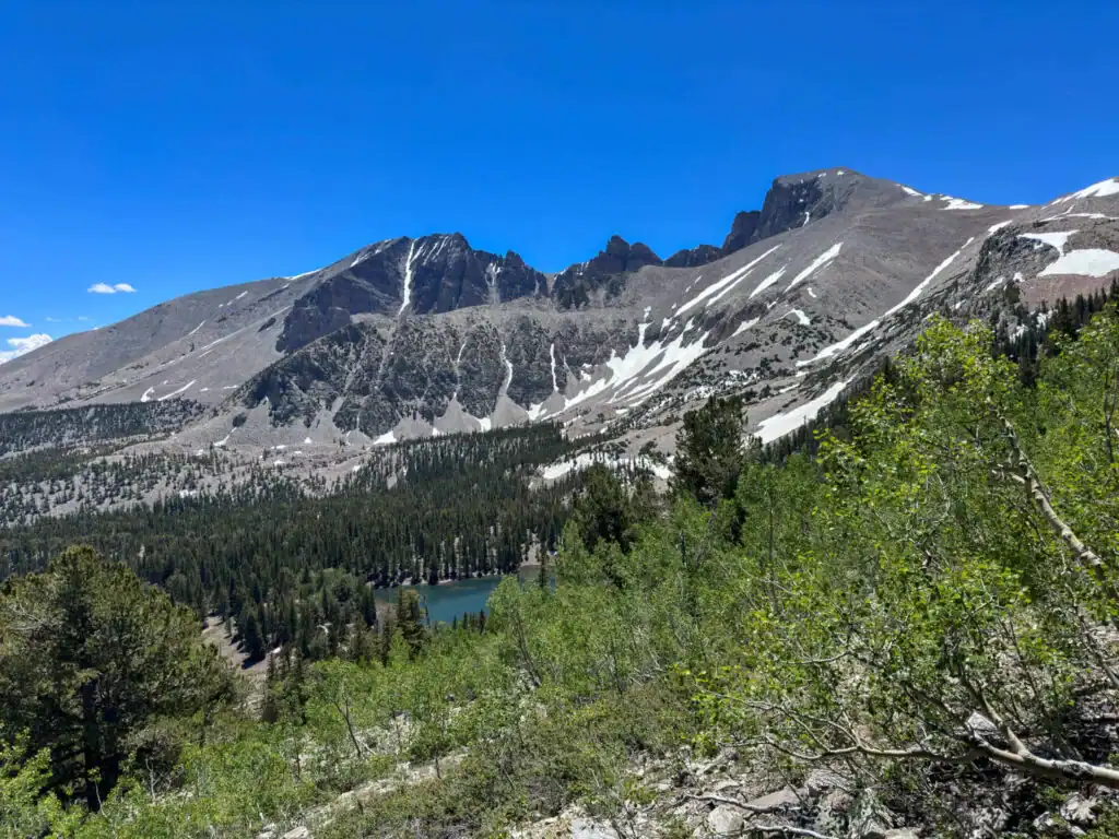
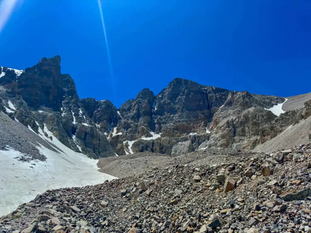
The upper section above Stella Lake gains over 2,000 feet in roughly two miles. The terrain shifts to loose talus and scree, the kind of footing that demands full attention on every step. The grade steepens. The treeline retreats. And the wind arrives. Nevada’s Snake Range funnels wind across the summit ridge in a way that turns a challenging climb into an active test of stability. I was nearly knocked off my feet approaching the ridge. Not a figure of speech.
Some thoughtful hikers had built rock wind shelters just below the summit, low walls of stacked stone that cut the worst of it. I sat behind one, eating the apple (still no banana), and thought through the math. The summit was close. The weather was clear but the wind was real. The risk calculation at 13,000 feet in a remote national park is different from the same calculation at 9,000 feet near a trailhead. I weighed it and made the push.
Welcome to 13,063 feet above sea level.
The summit view from Wheeler Peak looks out over the Great Basin in all directions. On a clear day it carries across parts of Nevada and into Utah. The Snake Range drops away beneath you and the basin floor is so far below that the geological structure of the whole region becomes legible from up there. The ranges running north-south like ridges on a washboard, the valleys flat and pale between them. Nevada looks different from this height. It looks intentional.
Full guide: Wheeler Peak Trail
Planning Your Wheeler Peak Day
A few practical notes from the actual experience.
Start early. The first two miles of the Wheeler Peak Trail are deceptively easy and invite a relaxed pace that eats into your weather window. Be at the trailhead no later than 6 a.m. for a summit attempt. Afternoon thunderstorms on the Snake Range ridgeline are a serious lightning hazard. The rule is simple: if you’re not at or past the summit before noon and the sky is building, turn around. No exceptions.
Bring the food and water you want specifically. Don’t rely on Baker having it. 3 liters of water minimum. Real food, not just bars. Layers for the wind and cold at the summit: I’m not exaggerating about the wind. A rain shell is mandatory even on a clear morning forecast.
No entry fee at Great Basin National Park. No timed entry reservation. Free to visit with no advance booking required for day hiking. The Wheeler Peak Scenic Drive is the access road and takes 30-40 minutes from the park entrance to the Summit Trailhead.
Cell service is absent from the upper sections of the scenic drive and throughout the trail. Download AllTrails or another navigation app before you leave Ely.
Where to Stay in Baker
Star Gazer Inn in Baker is the logical base. The dark sky situation is genuine and worth staying for: Great Basin has some of the darkest measurable skies in the continental US and the Star Gazer Inn has grounds set up for stargazing. It’s not a luxury hotel. It doesn’t pretend to be. It’s a place to sleep in a remote national park town and then wake up and hike a 13,000-foot mountain, which is the correct use of a hotel in Baker, Nevada.
Camping at Wheeler Peak
Wheeler Peak Campground at 9,886 feet is the best option for a summit attempt. Being at the trailhead the night before allows a pre-dawn start, which puts you past the summit before any afternoon weather builds. Reserve at recreation.gov well in advance for summer weekends. Sites fill fast and the campground is small.
Lower Lehman Creek and Upper Lehman Creek Campgrounds sit lower on the scenic drive and offer a more moderate elevation for your first night if you’re acclimatizing before the summit. All Great Basin campgrounds are seasonal and reservation-based during peak months.
More to Do in Great Basin National Park
Lehman Caves is the park’s most unique non-hiking attraction. A guided tour takes you into a limestone cave with formations, shield speleothems, and passages that most accessible caves in the American West don’t offer. It runs year-round. Book in advance through recreation.gov for summer visits.
The Bristlecone and Alpine Lakes Loop is worth doing as a dedicated trip if you’re not combining it with the summit. At 5.3 miles and 1,020 feet of gain, it’s a moderate commitment that delivers the bristlecone grove, Teresa Lake, and Stella Lake without the summit push.
Baker Lake Trail is a 3.6-mile roundtrip with 872 feet of gain to a backcountry lake on the south side of the park. A quieter route than the Summit Trailhead options with a different character.
The night sky. If you’re there for two nights, spend one hiking and one stargazing. Great Basin’s dark sky designation isn’t marketing. On a new moon night, the Milky Way is overhead. That’s a reason to stay.
Chase the Quiet
The wind shelter at the Wheeler Peak summit ridge is built from rocks that other hikers carried up and stacked. Nobody asked them to. Nobody compensated them. They did it because being in that place long enough makes you want to leave something useful for whoever comes next. I sat behind one of those shelters and ate an apple at 13,000 feet and thought about that for a while. That’s the version of the American West I keep looking for: the places remote enough that the people who make it there tend to be the kind who build wind shelters for strangers.
Support the Adventure
To make your walls less boring, check out my photography portfolio and bring a piece of the wild and my story into your home.
If you’d like to fuel future adventures, you can donate a coffee on Ko-Fi. Every cup keeps me chasing sunrises and stories.
When you shop using my affiliate links, every click helps support this blog at no extra cost to you. It’s a small way to keep Unicorn Adventure alive and kicking while I keep exploring.
Subscribe to my mailing list for future updates, new stories, and behind-the-scenes adventures.
Stay connected with me on Instagram and Facebook for more photos and daily inspiration.
Thanks for being part of the journey, Unicorn Squadron!
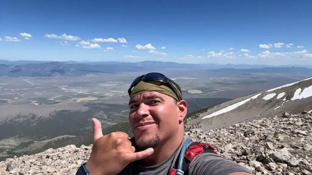

Theo Maynard is a landscape photographer and adventure blogger based in Salt Lake City. He chases remote desert and mountain light across the American West, documents it all solo, and shares the journey through Unicorn Adventure. He’s on the autism spectrum, and that’s not a footnote, it’s the whole story. He creates to inspire others to get outside, chase what lights them up, and live their best possible life. Unapologetically himself.