


Monkey Rock is 2.5 miles from the Tunnel Creek trailhead above Incline Village, climbing 500 feet through Jeffrey pine and granite country to a formation that does genuinely resemble what it’s named for. The view from the rock over Lake Tahoe’s north shore is one of the better short-hike panoramas on the Nevada side, looking south across the full lake basin with the Sierra Nevada filling the distant skyline. It is a solid half-morning hike that most visitors to Incline Village walk right past on the way to Sand Harbor. The Incline Village trailhead cluster on the northeastern shore is one of the least crowded entry points in the whole basin. Monkey Rock benefits from that. The trail sees a fraction of the traffic the California-side trailheads absorb, which means you often have the formation and the view to yourself even on a summer weekend morning.
Quick Facts
| Trail Name | Monkey Rock Trail |
| Location | Lake Tahoe Nevada State Park, Incline Village, Nevada |
| Coordinates | 39.2350, -119.9300 (Tunnel Creek Trailhead area) |
| Distance | 2.5 miles (out and back) |
| Elevation Gain | 500 ft |
| Difficulty | Moderate |
| Time | 1.5–2 hours |
| Dogs Allowed | Yes, on leash |
| Fee | Parking fee at Tunnel Creek Cafe lot (verify current rate) |
| Plan This Hike on AllTrails | |
How to Get There
The Monkey Rock trailhead is accessed from Tunnel Creek Road in Incline Village on the northeastern shore of Lake Tahoe. From Nevada Route 28, turn onto Tunnel Creek Road just past the intersection of Route 28 and Country Club Drive in Incline Village. The Tunnel Creek Cafe serves as the primary landmark. The trailhead for Monkey Rock is clearly marked from the parking area near the cafe. From South Lake Tahoe, follow US-50 east to Nevada Route 28 north along the Nevada shore. From Reno, take I-580 south to US-395 south and follow signs to Nevada Route 28 west into Incline Village.
Parking Information
Parking is available in the lot at Tunnel Creek Cafe near the trailhead. A fee applies, verify the current rate at the parking area when you arrive. Street parking along Highway 28 is sometimes available but check posted signage carefully. The lot is modest in size and fills on summer weekends. Arrive before 9 a.m. for the best chance of easy parking. No permit required for the hike itself. 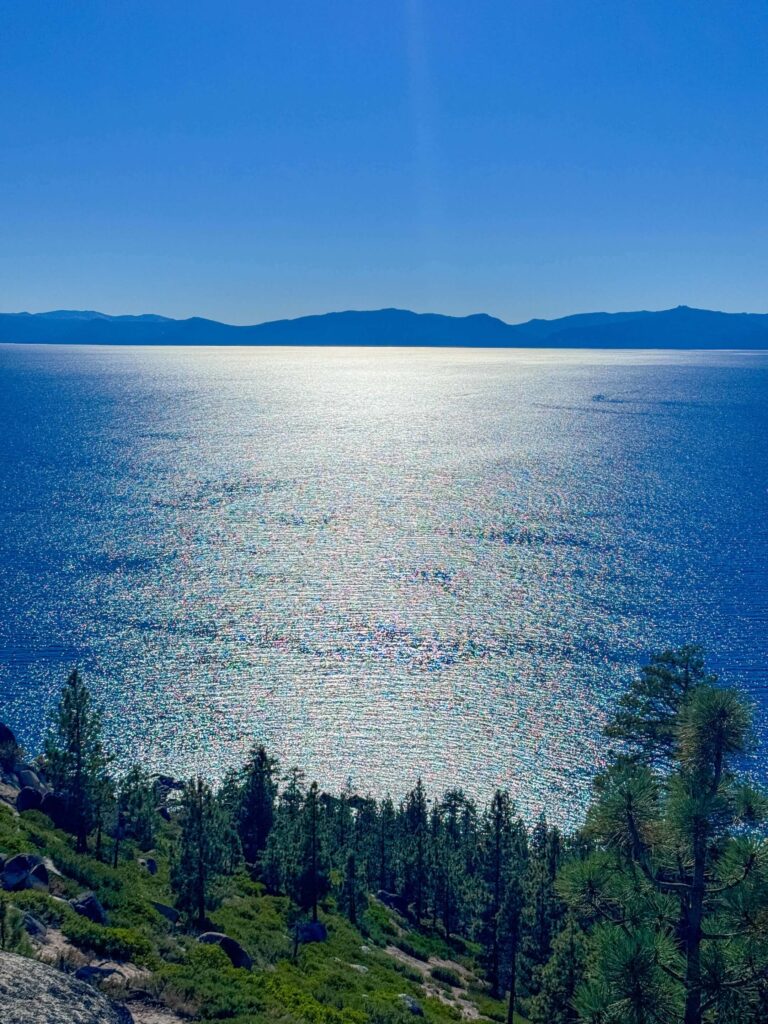
Cell Service and Navigation
Cell coverage is generally solid in Incline Village and holds reasonably on the lower trail given the proximity to the resort town. Signal can drop on the upper sections above treeline. Download the AllTrails map before leaving. The trail is well-marked and clear throughout, no significant navigation challenge. The GPS track is most useful for confirming the Monkey Rock spur off the main Tunnel Creek Trail, which is the junction most first-time visitors miss.
What to Expect on Monkey Rock Trail
The Trail
The trail begins from the Tunnel Creek trailhead and climbs steadily through Jeffrey pine forest and open granite terrain. The grade is moderate and consistent, gaining elevation at a manageable pace through the trees. Granite boulders appear with increasing frequency as you gain elevation, and the forest thins to give opening views of Lake Tahoe’s north shore through the pines. The trail surface shifts between packed dirt and loose rock, requiring attention on the rocky sections. Follow the trail markers to the Monkey Rock spur, which branches from the main Tunnel Creek Trail.
Monkey Rock
The formation itself is a rounded granite outcrop that, from the right angle, does resemble the head of a primate looking south over the lake. The resemblance is most apparent from the south-facing approach. The rock is large enough to scramble around and on, offering different vantage points over Lake Tahoe’s north shore. The view from the formation extends south across the full lake basin with the Sierra Nevada visible in the distance on a clear day. Crystal Bay is directly below, Sand Harbor visible to the south, and the Nevada shoreline running toward South Lake Tahoe in the far distance.
The View
The north shore perspective from Monkey Rock is different from the views available from the California-side trails and overlooks. Looking south from the Nevada high ground, you see the lake’s full length with the western shoreline’s forested ridgelines on the left and the Nevada desert terrain to the right. The water color shifts with depth and angle across the field of view. Morning light from the east catches the Sierra Nevada peaks on the far shore first and works across the basin as the sun rises. Late afternoon brings warm light from the west across the formation face. 
Trail Difficulty and Length
Monkey Rock is 2.5 miles out and back with 500 feet of elevation gain. The moderate rating is accurate. The sustained climb through the forest is the main physical demand. The rocky sections require attention but no scrambling. Sturdy trail shoes or light hikers handle the surface well. The round trip is manageable in 1.5 to 2 hours at a comfortable pace with time at the formation. Suitable for families with children comfortable on uneven terrain.
Dog Friendly?
Dogs are welcome on leash throughout Monkey Rock Trail and Lake Tahoe Nevada State Park. The trail is manageable for most dogs. No water sources on trail, bring water for your dog. The granite sections near the formation require more attention for dog footing. Pack out all waste. 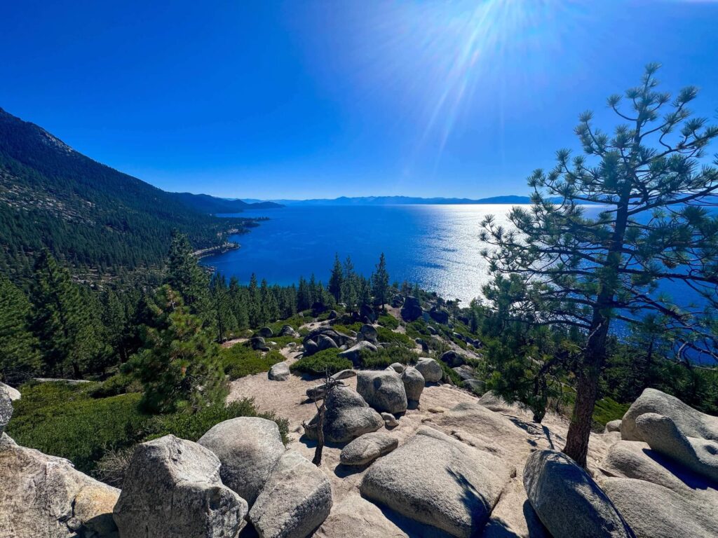
What to Bring
At least a liter of water per person. Sunscreen and a hat for the open granite sections near the formation. Trail shoes with grip for the rocky trail surface. A camera. The Lake Tahoe panorama from Monkey Rock rewards a wide lens for the full north-to-south lake view. The formation itself makes a strong foreground element in the late afternoon when the light comes from the west.
Best Time to Hike Monkey Rock
Late spring through fall, typically May through October, is the accessible window. Snow covers the upper trail from late fall through spring. Summer is the most popular season on the north shore but Monkey Rock sees thin crowds compared to Sand Harbor and the California-side trailheads. Weekday mornings in summer are the best combination of good weather and empty trail. Fall adds color to the forest sections and the Nevada shore light deepens in October. Check snow conditions before late May or October visits when the upper granite can still be icy. 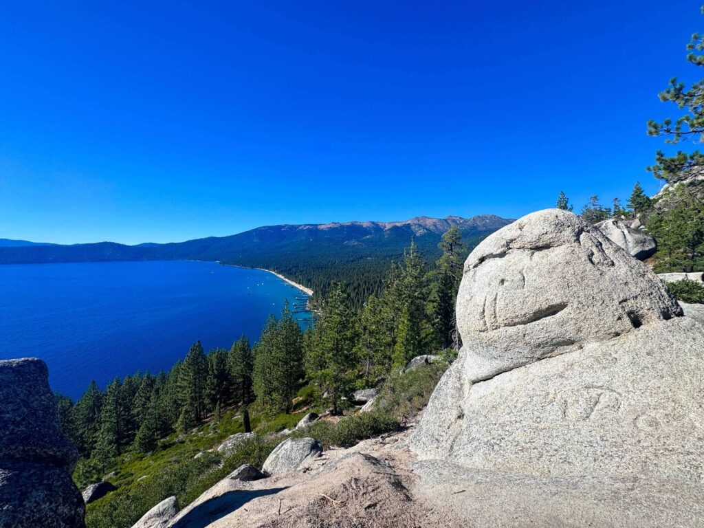
Rules and Regulations
Monkey Rock Trail is within Lake Tahoe Nevada State Park. Stay on designated trails. No campfires. Seasonal fire restrictions apply, check current Nevada State Parks advisories before visiting in late summer. Dogs on leash at all times. Pack out all waste. Leave No Trace throughout. Respect the park infrastructure at the Tunnel Creek Cafe trailhead, it is a shared commercial and public access point.
Where to Stay Near Incline Village
Incline Village has resort lodging, vacation rentals, and smaller properties directly on the northeastern shore. Marriott Bonvoy covers the Lake Tahoe basin including north shore properties. Hilton Honors has options around the lake. Crystal Bay casino properties on the Nevada state line are a few minutes from the trailhead for those who want the full Nevada experience after the hike.
Camping Nearby
Lake Tahoe Nevada State Park has backcountry camping with a permit. Contact the park directly for current permit procedures and designated areas. Nevada Beach Campground on the Nevada south shore is the closest developed camping in the state park system accessible via Nevada Route 28. For the north shore area, D.L. Bliss State Park on the California side about 40 minutes south has developed camping with beach access. Reserve all developed sites through recreation.gov for summer visits.
Nearby Adventures
The Tunnel Creek Trail continues past Monkey Rock toward Marlette Lake, extending the route to a 6-mile moderate hike at 1,600 feet of gain to the park’s signature alpine lake destination. The Flume Trail, accessible from the same Tunnel Creek area, is the premier hike-to-bike route on the Nevada shore with dramatic cliffside lake views. The Sand Harbor Clear Kayak Tour at Sand Harbor is 10 minutes south on Nevada Route 28, the best guided water experience on the Nevada shore. Sand Harbor Beach itself is the finest beach on the Nevada side for swimming, picnicking, and the Lake Tahoe Shakespeare Festival in summer. The Cave Rock Trail is 25 minutes south on Highway 50, a short sacred site hike with north-facing lake panorama views different from the south-facing view at Monkey Rock.
Plan This Hike
AllTrails has Monkey Rock documented with GPS track including the spur junction off the main Tunnel Creek Trail. Download the offline map before leaving Incline Village. The spur junction is the one route-finding moment worth having the track active for on a first visit. Plan your hike on AllTrails here.
Chase the Quiet
Monkey Rock on a Wednesday morning with the north shore spread south below the formation and nobody else on the trail in either direction. Lake Tahoe at its full length visible from one viewpoint, the Nevada desert east, the Sierra Nevada west, the formation warm granite under your hands. Two and a half miles and 500 feet of elevation. The north shore gives these up without any crowds if you know where to look. Monkey Rock is one of the places to look.
Support the Adventure
To make your walls less boring, check out my photography portfolio and bring a piece of the wild and my story into your home. If you’d like to fuel future adventures, you can donate a coffee on Ko-Fi. Every cup keeps me chasing sunrises and stories. When you shop using my affiliate links, every click helps support this blog at no extra cost to you. It’s a small way to keep Unicorn Adventure alive and kicking while I keep exploring. Subscribe to my mailing list for future updates, new stories, and behind-the-scenes adventures. Stay connected with me on Instagram and Facebook for more photos and daily inspiration. Thanks for being part of the journey, Unicorn Squadron!

Theo Maynard is a landscape photographer and adventure blogger based in Salt Lake City. He chases remote desert and mountain light across the American West, documents it all solo, and shares the journey through Unicorn Adventure. He’s on the autism spectrum, and that’s not a footnote, it’s the whole story. He creates to inspire others to get outside, chase what lights them up, and live their best possible life. Unapologetically himself.