

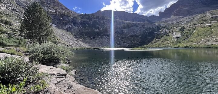
The Ruby Mountains near Elko, Nevada, hold two alpine lakes reachable from the same trailhead at the end of Lamoille Canyon Road. Island Lake is the shorter route. At 3.5 miles roundtrip with 900 feet of gain, it’s a half-day hike that deposits you at a pristine granite-rimmed lake well above the canyon floor, with the kind of views and quiet that make Nevada’s reputation for flat desert seem like a category error. I drove Lamoille Canyon on a trip that included the longer Liberty Lake route, and Island Lake is the one I’d point a first-timer toward if they wanted the alpine experience without committing to a full day. I spend a lot of time comparing routes for what they actually deliver versus what the effort cost to get there. Island Lake delivers. It’s efficient in the best possible way: short trail, genuine alpine destination, accessible to hikers who aren’t logging big miles regularly. This guide covers Island Lake Trail from the Lamoille Canyon trailhead to the lake: what the terrain involves, how the approach splits from the Liberty Lake route, and how to plan the day from Elko.
Quick Facts
| Trail Name | Island Lake Trail |
| Location | Lamoille Canyon, Ruby Mountains, Elko, Nevada |
| Coordinates | 40.6043° N, 115.3755° W |
| Distance | 3.5 miles roundtrip |
| Elevation Gain | ~900 feet |
| Difficulty | Moderate |
| Time | 2.5–3.5 hours |
| Dogs Allowed | Yes, on leash |
| Fee | None (National Forest land) |
| AllTrails | View on AllTrails |
How to Get There
From Elko, head south on NV-227 for about 20 miles toward Lamoille. At Lamoille, turn right onto Lamoille Canyon Road (Forest Road 660) and follow it approximately 12 miles through the canyon to the large parking area at the road’s end. The Island Lake Trail and the Liberty Lake Trail share this trailhead and split shortly after the start. The Lamoille Canyon Scenic Byway on the drive in is worth taking slowly. The canyon walls rise dramatically as you gain elevation and the road passes picnic areas, viewpoints, and the transition from high desert to true mountain terrain. Give yourself 30 extra minutes on the drive in if you haven’t seen it before. From Salt Lake City, Elko is roughly 3 hours west on I-80. From Reno, about 5 hours east. The trailhead is 30 miles and 40 minutes from downtown Elko. No entry fee, no permit required for day hiking.
Parking Information
The end-of-road parking area at Lamoille Canyon is large and free. It serves multiple trails including both Island Lake and Liberty Lake, so summer weekend mornings can fill the lot. Arrive before 8 a.m. on weekends to be safe. Weekday mornings are significantly quieter. Restrooms are available at the trailhead. No potable water at the parking area. Fill your water bottles in Elko before making the drive. The creek in the canyon and the lake are water sources requiring treatment or filtration. 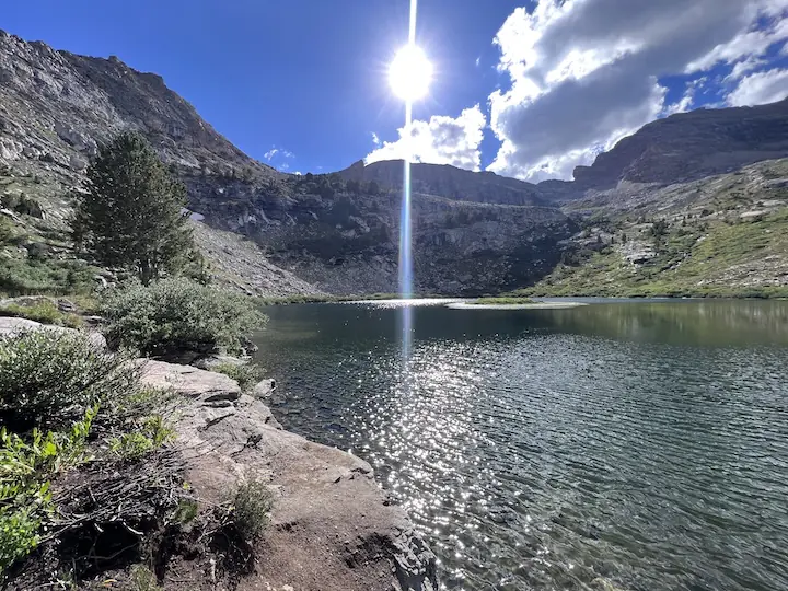
Cell Service and Navigation
Cell coverage drops on NV-227 south of Elko and is absent in Lamoille Canyon and at the trailhead. Download AllTrails or another offline navigation app before leaving Elko. The Island Lake and Liberty Lake trails share the same initial section before splitting at a signed junction. Pay attention at that junction and confirm you’re heading left toward Island Lake. The trails are signed but the junction is easy to blow past if you’re moving fast. Having the GPS map active is useful through the mid-section where the route crosses open rocky terrain above the forest line.
What to Expect on the Island Lake Trail
The Trail
The trail starts at the parking area and enters forest immediately, climbing through aspens and conifers alongside a creek drainage. The lower section is shaded and moderate, a good warm-up before the terrain gets steeper. Wildflowers line the trail through the meadow sections in July and early August. At the signed junction, bear left for Island Lake. The Liberty Lake route continues right. From the junction, the Island Lake trail continues climbing through open terrain with the lake basin becoming visible above. The upper section has some rocky patches requiring attention but nothing requiring scrambling beyond basic trail hiking. The approach to Island Lake is gentler than the Liberty Lake push: no steep talus section, no sudden final climb to a rim. The lake simply appears at the end of the trail as the terrain levels into the basin. That approachability is part of what makes this the better route for hikers less experienced on mountain terrain. The lake sits in a granite cirque with cliff walls rising on the back and side walls and open meadow terrain on the approach side. It’s smaller and somewhat more enclosed than Liberty Lake, which gives it an intimate quality that the larger lake doesn’t have. The feeling of being held inside the cirque rather than perched at its edge is a real difference between the two destinations. The lake water is clear and cold. Flat rock sections around the shoreline make good sitting spots for lunch, photography, and the extended stay that these lakes tend to produce when you finally arrive. Wildflowers bloom at the lake’s inlet areas through mid-summer. For photography, morning is the priority. The granite walls catch eastern light in the first hours after sunrise and the lake surface reflects when there’s no wind. The enclosed cirque character means the light window is somewhat shorter than at more exposed locations, so arriving early matters more here. 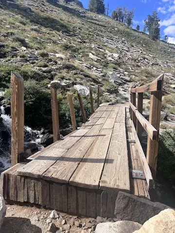
Trail Difficulty and Length
Moderate is accurate. The 3.5-mile roundtrip is short enough to complete comfortably in a half-day, and the 900 feet of gain is distributed reasonably across the route without a single punishing section. Compared to the Liberty Lake Trail, this is the more accessible of the two Lamoille Canyon lakes for hikers who are less experienced on mountain terrain or simply want a shorter day. Plan 2.5-3.5 hours for the round trip with time at the lake. The trailhead sits around 8,800 feet elevation and the lake is near 9,800 feet. Hikers not acclimatized to elevation may find the upper section takes longer than expected. Don’t rush the ascent. Trail runners work on the lower section. Sturdy hiking boots or shoes with real grip are the better call for the rocky sections above the forest line. Trekking poles help on both the ascent and the rocky descent.
Dog Friendly?
Yes. Island Lake Trail is on National Forest land and dogs are welcome on leash. The terrain is more consistently manageable for dogs than the Liberty Lake route, with no significant talus scrambling required. The lake provides water access for dogs, and the meadow sections below give plenty of opportunity to stop and let a dog stretch without leaving the trail. Bring at least a liter of water per dog for the approach. Keep dogs leashed near the lake shoreline and away from the immediate inlet streams. Pack out waste throughout. 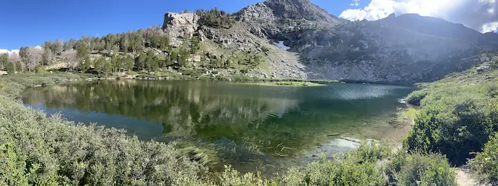
What to Bring
Water from Elko: 2-3 liters per person minimum. A filter or purification tablets if you want to supplement from the lake. Food for a half-day hike plus extra for lake time. Layers. The trailhead is near 9,000 feet and mornings are cold even in July. Afternoon thunderstorms build quickly in the Ruby Mountains in July and August. Bring a rain shell and a mid-layer regardless of the morning forecast. Hiking boots or trail runners with grip for the rocky sections. Sun protection for the exposed upper terrain.
Best Time to Hike Island Lake Trail
Late June through September is the reliable window. Snow clears from the lower sections earlier, but the lake basin can hold snow through late June in most years. Check trail conditions with the Humboldt-Toiyabe National Forest Ruby Mountains Ranger District before going in June or early July. July brings peak wildflower season in the meadow sections and the lake’s inlet areas. It also brings the highest traffic and afternoon thunderstorm frequency. Start by 7 a.m. and plan to be off the exposed upper terrain before noon if storms are in the forecast. September is the best month overall. Cooler temperatures, fewer people, the aspens in Lamoille Canyon turning gold by mid-month, and reduced afternoon storm risk. The fall color on the drive in through the canyon is worth timing a trip around specifically. For photography: morning at any season. The cirque catches light early and loses it relatively fast compared to more exposed lake basins. Be at the lake by 9 a.m. for the best reflection and cliff light conditions.
Rules and Regulations
No campfires in the Ruby Mountains Wilderness area and along the Island Lake Trail corridor. Pack a stove if you’re cooking. Pack out all trash and dog waste. Stay on the trail in the lower meadow and forest sections to protect alpine vegetation. On the rocky sections above tree line, walk on rock surfaces where possible rather than soil or plant communities. The lake is a water source. Camp at least 200 feet from the shoreline if backpacking. Day hikers: leave the flat rock sections around the shore available for others and keep your footprint on the lake perimeter minimal.
Where to Stay Near Elko
Elko is the base for Island Lake Trail, about 30 miles and 40 minutes from the trailhead. The town has solid lodging across multiple price points and is a natural overnight stop on the I-80 corridor between Salt Lake City and Reno. For points travelers, check available Marriott Bonvoy properties in Elko, IHG Rewards hotels near Elko, and Hilton Honors options in Elko. Elko fills during the National Cowboy Poetry Gathering in January and during summer weekends when the Ruby Mountains draw outdoor visitors.
Camping Nearby
Thomas Canyon Campground in Lamoille Canyon is the closest developed option, operated by Humboldt-Toiyabe National Forest. It typically runs from late May through September with tent and RV sites. Reservations through recreation.gov during peak season. The location partway up Lamoille Canyon Road puts you closer to the trailhead than Elko and gives you the option of an early start without the drive. Dispersed camping is allowed in some areas of National Forest land outside the Wilderness boundary. Check current regulations with the Ruby Mountains Ranger District before planning an overnight.
Nearby Adventures
The Liberty Lake Trail shares this trailhead and represents the longer, more ambitious version of the same alpine lake experience. Liberty Lake Trail is 6 miles roundtrip with 1,500 feet of gain and includes a steeper final push to a larger lake in a more exposed cirque. Running both lakes in a single day is doable for fit hikers but makes for a long day. Most visitors choose one and return for the other on a separate trip. The Ruby Crest Trail is a multi-day backpacking route traversing the range crest for roughly 40 miles. It’s one of the best long routes in Nevada and can be accessed from the Lamoille Canyon area. Day hikers can sample sections of the crest without committing to the full traverse. Lamoille Canyon itself has shorter interpretive trails and picnic areas at lower elevations that work for any fitness level. The canyon road as an evening scenic drive from Elko is worth doing even without a specific trail objective. In Elko: the Northeastern Nevada Museum covers local history and wildlife. The Western Folklife Center documents cowboy and ranching culture of the Great Basin. The Star Hotel has been a fixture of Elko’s Basque community since the early 1900s and is the most distinctive dining option in town.
Plan This Hike
AllTrails has Island Lake Trail mapped with offline capability and condition reports from recent hikers. Download before you lose signal on NV-227 south of Elko. The app is also useful for checking Liberty Lake trail conditions if you’re deciding between the two routes from the same trailhead. Plan your hike on AllTrails and pull the offline map while you’ve still got signal in Elko.
Chase the Quiet
Island Lake is the easier route to reach but it doesn’t feel like a consolation prize when you’re sitting at the shoreline. The cirque walls close in on three sides and the water reflects whatever light the morning is offering and the only sound is whatever the wind is doing with the trees below the basin. Nevada doesn’t owe you a mountain lake this good. It just has them, tucked into the Ruby Mountains 30 miles south of a city most people drive through on I-80 without stopping. Worth stopping.
Support the Adventure
To make your walls less boring, check out my photography portfolio and bring a piece of the wild and my story into your home. If you’d like to fuel future adventures, you can donate a coffee on Ko-Fi. Every cup keeps me chasing sunrises and stories. When you shop using my affiliate links, every click helps support this blog at no extra cost to you. It’s a small way to keep Unicorn Adventure alive and kicking while I keep exploring. Subscribe to my mailing list for future updates, new stories, and behind-the-scenes adventures. Stay connected with me on Instagram and Facebook for more photos and daily inspiration. Thanks for being part of the journey, Unicorn Squadron!

Theo Maynard is a landscape photographer and adventure blogger based in Salt Lake City. He chases remote desert and mountain light across the American West, documents it all solo, and shares the journey through Unicorn Adventure. He’s on the autism spectrum, and that’s not a footnote, it’s the whole story. He creates to inspire others to get outside, chase what lights them up, and live their best possible life. Unapologetically himself.