

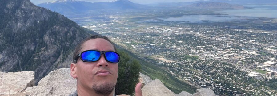
Kyhv Peak is a 7-mile roundtrip with 2,800 feet of elevation gain accessed via Rock Canyon Park at the eastern edge of Provo, in the Uinta-Wasatch-Cache National Forest above the city. The summit offers views of Utah Valley, the surrounding Wasatch Range, and the entire Provo-Orem urban corridor from above. At 2,800 feet of gain, this is one of the harder summit hikes accessible directly from Provo without a long drive, and it’s the kind of local hard route that earns a place in a trail running and hiking training cycle for Wasatch Front residents. The standard Provo approach is through Rock Canyon Park from the city’s eastern canyon edge.
Quick Facts
| Trail Name | Kyhv Peak Trail via Rock Canyon Park |
| Location | Uinta-Wasatch-Cache National Forest, near Provo, Utah |
| Coordinates | 40.2647 N, 111.6305 W |
| Distance | ~7.5 miles roundtrip |
| Elevation Gain | ~2,800 feet |
| Difficulty | Hard |
| Time | 4-6 hours |
| Dogs Allowed | Yes, on leash |
| Fee | Free |
| View on AllTrails | |
How to Get There
The Rock Canyon Park access is the standard Provo trailhead for Kyhv Peak. From downtown Provo, head east on 820 North (Canyon Road), which leads into Rock Canyon. The Rock Canyon Trailhead and parking area are at the canyon mouth. Follow the trail through Rock Canyon and up the ridge to Kyhv Peak from there. From Salt Lake City, Provo is about 45-50 minutes south on I-15. Rock Canyon Park is on the east side of Provo directly accessible from the city without a highway canyon drive. From Orem, about 15-20 minutes south on I-15 to Provo.
Parking Information
Rock Canyon Park has a parking area at the canyon mouth off Canyon Road. The lot fills early on weekends from May through October. Arrive before 7:30 a.m. on peak summer days to secure a spot. Overflow street parking is available along Canyon Road. No restrooms, no fee. 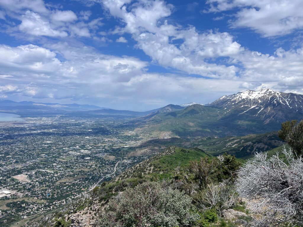
Cell Service and Navigation
Cell coverage is available at the Rock Canyon trailhead and holds through the lower canyon sections. It drops as you gain elevation in the Wasatch above the canyon. Download AllTrails offline before heading out. The trail is well-marked through the lower canyon but route-finding can be less obvious on the upper ridge sections approaching the summit. Having the GPS track active is useful for the upper half of the climb.
What to Expect on the Kyhv Peak Trail
Rock Canyon
The trail from Rock Canyon Park follows the canyon drainage upstream through a mix of oak, maple, and mountain scrub vegetation that’s characteristic of the Wasatch Front foothills. The lower canyon is accessible and popular for casual recreation; trail runners, dog walkers, and casual hikers all use the lower sections. The character of the trail shifts as you leave the canyon floor and begin climbing the ridge toward Kyhv Peak.
The Ridge Climb
The substantial portion of the 2,800 feet of gain comes on the ridge climb above the canyon. The trail transitions from the shaded canyon environment to open ridgeline terrain with increasingly expansive views as you gain elevation. The rocky terrain on the upper ridge requires careful footing and the exposure is real on sections where the trail runs along the ridge edge. The views open progressively as you climb. Utah Valley and the Provo-Orem urban corridor become visible below and to the west. The Wasatch Range ridgeline extends north and south at roughly the same elevation as you approach the summit. Mount Timpanogos to the north is the dominant visual landmark from the upper sections of the climb.
Kyhv Peak Summit
The Kyhv Peak summit delivers the panoramic view the hard rating earns. Utah Valley in its full extent, Utah Lake to the southwest, the Wasatch Range extending in both directions, and the basin-and-range country to the west visible on clear days. The summit position above the valley is one of the more complete Utah Valley views accessible from a Wasatch Front day hike. For photography: the summit faces west and offers afternoon light on Utah Valley. Early morning visits catch the best light on the Wasatch peaks to the east and north. Wide-angle for the full panorama, mid-range for the ridge and canyon terrain detail. Fall color in the Wasatch Front foothills below the summit in late September adds warm tones to the valley view composition.
Trail Difficulty and Length
Hard is accurate. 2,800 feet over 7.5 miles is sustained gain, and the ridge exposure on the upper sections adds a physical commitment beyond what the numbers alone suggest. Budget 4-6 hours for the full roundtrip at a comfortable pace with time on the summit. The descent requires care on the rocky ridge sections. Tired legs on loose downhill terrain is the primary injury risk; don’t rush the return.
Dog Friendly?
Yes. Leashed dogs permitted throughout. The Rock Canyon lower section is comfortable for most trail-fit dogs. The rocky upper ridge sections require dogs confident on uneven exposed terrain. No reliable water sources on the upper trail; bring at least a liter for dogs in addition to your own supply. The lower canyon creek provides water access in early season but may not be reliable by late summer. 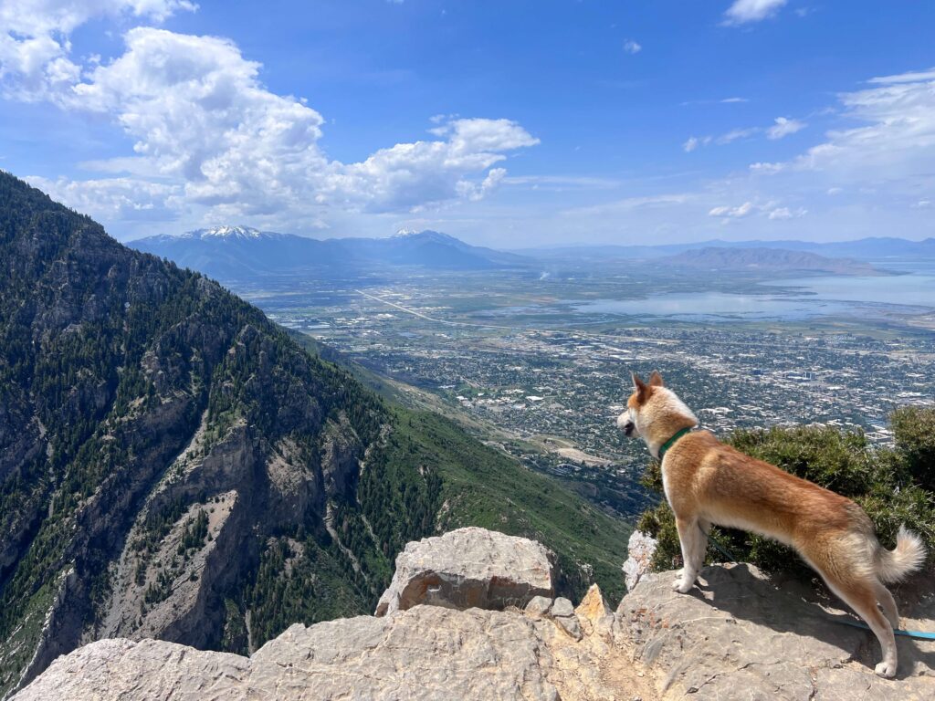
What to Bring
Water: 3 liters minimum for a hard 7-mile day. The 2,800 feet of gain at altitude dehydrates faster than flat terrain at the same distance. Layers for the exposed summit where wind is present in most conditions even in summer. Sturdy hiking boots with ankle support for the rocky upper ridge. Sun protection for the open ridge sections above the canyon. Trekking poles for the descent on the rocky ridge. Snacks for a 4-6 hour day.
Best Time to Hike Kyhv Peak
Late May through October. Snow covers the upper ridge from approximately November through April. Check current conditions before early-spring or late-fall visits; the upper sections can hold snow and ice well after the lower canyon is clear. June and July bring wildflower color to the canyon and lower ridge sections. September is the best overall month for the summit experience: cooler temperatures for a hard 7-mile climb, fall color in the foothills below, and the Wasatch Range’s characteristic fall clarity for photography. Afternoon thunderstorms develop over the Wasatch in July and August. Start by 6-7 a.m. and have a hard turnaround time that gets you off the exposed summit ridge before noon on storm-likely days. The open ridge is a significant lightning exposure zone. 
Rules and Regulations
Leave No Trace principles apply. Stay on designated trails. No campfires due to fire restrictions in the Uinta-Wasatch-Cache National Forest; check current restrictions. Dogs on leash. Pack out all trash.
Where to Stay Near Provo
Provo has full city hotel infrastructure with options across all price points on University Avenue and near the freeway exits. For points travelers, check available Marriott Bonvoy properties in Provo, IHG Rewards hotels in Provo, and Hilton Honors options in Provo. Salt Lake City, 45 minutes north on I-15, is the large metro base.
Camping Nearby
American Fork Canyon, accessible from UT-92 a short drive north, has developed campgrounds through recreation.gov. Provo Canyon also has campgrounds along US-189. Dispersed camping on National Forest land is available with standard rules above the developed campground zones.
Nearby Adventures
Buffalo Peak Trail from Provo at 0.9 miles / 275 feet of gain is the short, easy Provo-adjacent hike at the accessible end of the local difficulty spectrum. Good to know about for recovery days or family days from a Provo base. Bridal Veil Falls in Provo Canyon is the waterfall companion to the Provo-area trail catalog, accessible from US-189 about 10 miles northeast of Provo. An easy 1.5-mile roundtrip to a 607-foot double falls. Horsetail Falls in Lone Peak Wilderness near Alpine is the comparable hard summit option to the north at 4.2 miles / 1,600 feet. Kyhv Peak and Horsetail Falls together represent the hard day-hike options accessible from the southern Wasatch Front without driving south toward the Nebo Loop or north into the Cottonwood canyons.
Plan This Hike
AllTrails has Kyhv Peak Trail mapped with offline GPS tracking and condition reports. Particularly useful for checking current summit snow in shoulder season. Plan your hike on AllTrails and download the offline map before heading up Rock Canyon.
Chase the Quiet
Kyhv Peak is above the city you live in, or close enough to drive to from Salt Lake City in an hour. It requires 2,800 feet of effort to reach and it puts you in a position where the entire urban valley is visible below you at once. That particular relationship between effort and altitude and where you started is one of the specific things the Wasatch Front offers that almost nowhere else in the American West does: a genuine mountain summit within a morning’s drive and hike of a major metro. Worth using regularly.
Support the Adventure
To make your walls less boring, check out my photography portfolio and bring a piece of the wild and my story into your home. If you’d like to fuel future adventures, you can donate a coffee on Ko-Fi. Every cup keeps me chasing sunrises and stories. When you shop using my affiliate links, every click helps support this blog at no extra cost to you. It’s a small way to keep Unicorn Adventure alive and kicking while I keep exploring. Subscribe to my mailing list for future updates, new stories, and behind-the-scenes adventures. Stay connected with me on Instagram and Facebook for more photos and daily inspiration. Thanks for being part of the journey, Unicorn Squadron!

Theo Maynard is a landscape photographer and adventure blogger based in Salt Lake City. He chases remote desert and mountain light across the American West, documents it all solo, and shares the journey through Unicorn Adventure. He’s on the autism spectrum, and that’s not a footnote, it’s the whole story. He creates to inspire others to get outside, chase what lights them up, and live their best possible life. Unapologetically himself.