

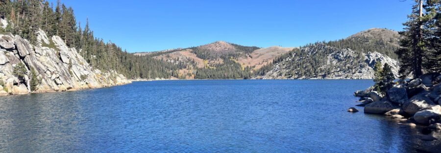
Marlette Lake sits above Lake Tahoe on the Nevada side, accessible from either Chimney Beach on Nevada Route 28 or from the Spooner Lake Trailhead at the junction of US-50 and Nevada Route 28. Six miles round trip, 1,600 feet of gain through pine forest and open meadow, and the lake itself is everything the approach builds toward: crystal-clear water, forested ridgelines on three sides, and a quiet that the crowded California-side trailheads almost never deliver. Fall is the best season here, when the aspens around the lake turn gold and the basin light goes deep. The Nevada State Park trails in the Tahoe Basin are some of my most reliably productive hikes for the combination of low traffic and high scenery. Marlette Lake is the best of them. The distance keeps the casual visitor count down and the lake rewards the full investment.
Quick Facts
| Trail Name | Marlette Lake Trail |
| Location | Lake Tahoe Nevada State Park, Nevada (north of Zephyr Cove) |
| Coordinates | 39.1676, -119.9267 (Marlette Lake) |
| Distance | ~6 miles (round trip via Chimney Beach or Spooner Lake Trailhead) |
| Elevation Gain | ~1,600 ft |
| Difficulty | Moderate |
| Time | 5 hours |
| Dogs Allowed | Yes, on leash |
| Fee | ~$10 day-use parking fee (verify current rate at kiosk) |
| Plan This Hike on AllTrails | |
How to Get There
Two trailhead options access Marlette Lake. The Spooner Lake Trailhead at the US-50 and Nevada Route 28 junction is the most commonly used starting point, with a parking area and direct trail access to Marlette Lake via the North Canyon Road and Marlette Lake Trail. The Chimney Beach Trailhead on Nevada Route 28, about 2.5 miles south of the Spooner junction, offers an alternative approach that ascends more steeply from the lake level. Verify which trailhead matches the route you’ve downloaded before you go, as the two approaches differ in grade and mileage. From South Lake Tahoe, take US-50 east to the Nevada Route 28 junction. From Carson City, take US-50 west to the same junction.
Parking Information
Parking is available at both the Spooner Lake Trailhead and Chimney Beach lots within Lake Tahoe Nevada State Park. A day-use fee of approximately $10 per vehicle applies at both locations. Verify the current rate at the kiosk when you arrive. The Spooner Lake lot is larger and less likely to fill on weekdays. Chimney Beach fills faster on summer weekends given its beach access. Arrive before 9 a.m. on peak summer days for either lot. 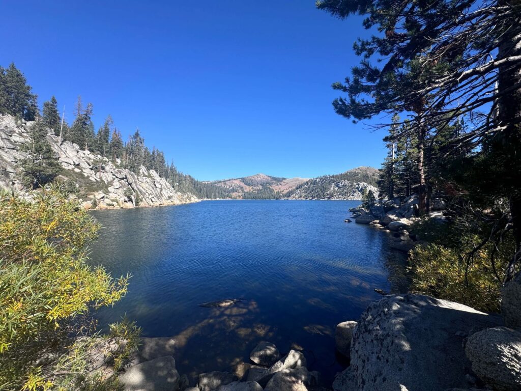
Cell Service and Navigation
Cell coverage is limited on Nevada Route 28 and drops off as you gain elevation on the Marlette Lake Trail. Download the AllTrails map before leaving South Lake Tahoe or Carson City. The trail is well-maintained and well-marked but the upper sections through open meadow terrain benefit from having a GPS track running. The Marlette Lake destination is clear from the trail markings, but junctions with the Flume Trail and Tahoe Rim Trail branches are worth having marked on your downloaded map.
What to Expect on Marlette Lake Trail
The Climb
The trail climbs steadily from the trailhead through dense pine forest, gaining elevation at a consistent moderate grade. Early sections provide intermittent views back toward Lake Tahoe as the elevation increases, the deep blue of the main lake visible through the trees on clear days. The forest shifts in character as you climb, mixing pine species with patches of aspen that are the trail’s most dramatic seasonal feature. The grade is manageable throughout, with no single punishing pitch, making the 1,600 feet of gain accumulate gradually rather than all at once.
Marlette Lake
Marlette Lake arrives at the top of the sustained climb, a reservoir-sized alpine lake set in a forested bowl above the Tahoe Basin. The lake is significantly larger than the alpine lakes accessible from the California-side short trails, with a longer shoreline and deeper basin. The water is clear and cold year-round. The forested ridgelines surrounding the lake on three sides create a contained, quiet atmosphere unlike the open granite bowls of Desolation Wilderness across the basin. The lake is catch-and-release fishing water, and you’ll often see anglers working the shoreline on weekend visits.
Fall Color
Marlette Lake is the best fall destination on the Nevada side of Lake Tahoe. The aspen groves around the lake and along the approach trail turn gold in October, typically peaking in the first two weeks of the month. The combination of golden aspens, deep blue lake water, and the fall light at lower angles than summer makes this one of the stronger photography windows in the entire Tahoe Basin. Plan a fall visit specifically for this. It changes the character of the trail completely from the summer experience. 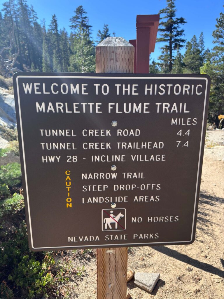
Trail Difficulty and Length
The Marlette Lake Trail is approximately 6 miles round trip with 1,600 feet of elevation gain. The moderate rating is accurate for experienced hikers. The distance and cumulative elevation gain make it a committed half-day hike. Bring more water than you expect to need. Solid trail shoes or hiking boots with grip are appropriate. The trail surface is well-maintained packed dirt with some rocky sections. Allow 3 to 5 hours for the full round trip at a comfortable pace with time at the lake.
Dog Friendly?
Dogs are allowed on leash at Marlette Lake and throughout Lake Tahoe Nevada State Park. The 6-mile distance is worth assessing against your dog’s conditioning. The sustained climb and exposed sections on warm days require enough water for the full round trip plus some buffer. Marlette Lake offers several good spots for dogs to cool off at the shore. Pack out all waste.
What to Bring
At least 2 liters of water per person for the 6-mile round trip. More in summer. A water filter if you plan to refill at the lake. Sunscreen and a hat for the exposed meadow sections on the upper trail. Hiking boots with ankle support for the sustained climb. Trekking poles help on the descent. Snacks for the lake shore. A camera. Fall visits benefit from a wide lens for the aspen panoramas and a telephoto for isolating color detail against the lake. 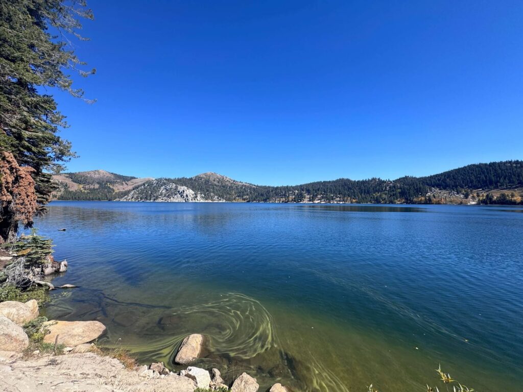
Best Time to Hike Marlette Lake
Late spring through fall is the accessible window, typically June through October. Snow covers the upper trail and the lake area from November through May in most years. Summer is the most popular season with the longest days and warmest swimming conditions at the lake. Fall is the best single season, particularly late September through mid-October when the aspens peak. The combination of fall color, lower visitor counts, and cool temperatures for the sustained climb makes this the strongest overall experience the trail offers. Check current snow conditions in late May and late October before planning trips at the seasonal margins.
Rules and Regulations
Marlette Lake is within Lake Tahoe Nevada State Park under Nevada State Parks management. Stay on designated trails. Day-use fee required for parking. No campfires in the park. Backcountry camping is allowed with an overnight permit from the park. Fishing at Marlette Lake is catch-and-release only, artificial lures only, check current Nevada fishing regulations before bringing gear. Dogs on leash at all times. Pack out all waste. Leave No Trace throughout.
Where to Stay Near Lake Tahoe Nevada State Park
Incline Village, about 15 minutes north on Nevada Route 28, has lodging and services closest to the Chimney Beach approach. Zephyr Cove Resort, about 10 minutes south on US-50, has lakefront lodging near the Spooner Lake Trailhead access. South Lake Tahoe is about 20 minutes from the trailhead with the broadest lodging range. Marriott Bonvoy covers the Lake Tahoe area. Hilton Honors has options around the basin.
Camping Nearby
Lake Tahoe Nevada State Park allows backcountry camping with a permit. Contact the park directly for current permit procedures and designated camping areas. Nevada Beach Campground on the Nevada lakeshore is the closest developed camping to the Chimney Beach and Spooner Lake Trailheads, book through recreation.gov. Zephyr Cove Resort has campground sites directly on the Nevada lake shore about 10 minutes south.
Nearby Adventures
The Flume Trail is the most celebrated hike-to-bike route in the Tahoe Basin, running along the historic flume path above the Nevada shore with dramatic cliffside lake views, accessible from the Marlette Lake area. The Tahoe Rim Trail intersects the Marlette Lake Trail and offers extended hiking in both directions with consistent lake panoramas. The Sand Harbor Clear Kayak Tour is about 15 minutes north on Nevada Route 28, the best guided water experience on the Nevada shore. The Cave Rock Trail is 20 minutes south on Highway 50, a short hike to a volcanic sacred site with lake panorama views. Spooner Lake at the Spooner Lake Trailhead is worth 20 minutes of its own for wildlife viewing and picnicking before or after the Marlette hike.
Plan This Hike
AllTrails has Marlette Lake documented with GPS track and current condition notes from recent hikers including fall color timing reports. Download the offline map before leaving cell coverage range. Confirm your trailhead choice (Chimney Beach or Spooner Lake) against the route you’ve downloaded before starting. Plan your hike on AllTrails here.
Chase the Quiet
Marlette Lake on a Tuesday in early October with the aspens fully turned. Nobody else on the north shore. The gold and the deep blue and the ridgeline pines behind everything. Six miles and 1,600 feet of gain to get there, and the lake sitting completely still, the whole basin reflected in the water. The Nevada State Park trails don’t have the same name recognition as the California side. That’s exactly why they’re worth knowing.
Support the Adventure
To make your walls less boring, check out my photography portfolio and bring a piece of the wild and my story into your home. If you’d like to fuel future adventures, you can donate a coffee on Ko-Fi. Every cup keeps me chasing sunrises and stories. When you shop using my affiliate links, every click helps support this blog at no extra cost to you. It’s a small way to keep Unicorn Adventure alive and kicking while I keep exploring. Subscribe to my mailing list for future updates, new stories, and behind-the-scenes adventures. Stay connected with me on Instagram and Facebook for more photos and daily inspiration. Thanks for being part of the journey, Unicorn Squadron!

Theo Maynard is a landscape photographer and adventure blogger based in Salt Lake City. He chases remote desert and mountain light across the American West, documents it all solo, and shares the journey through Unicorn Adventure. He’s on the autism spectrum, and that’s not a footnote, it’s the whole story. He creates to inspire others to get outside, chase what lights them up, and live their best possible life. Unapologetically himself.