

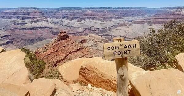
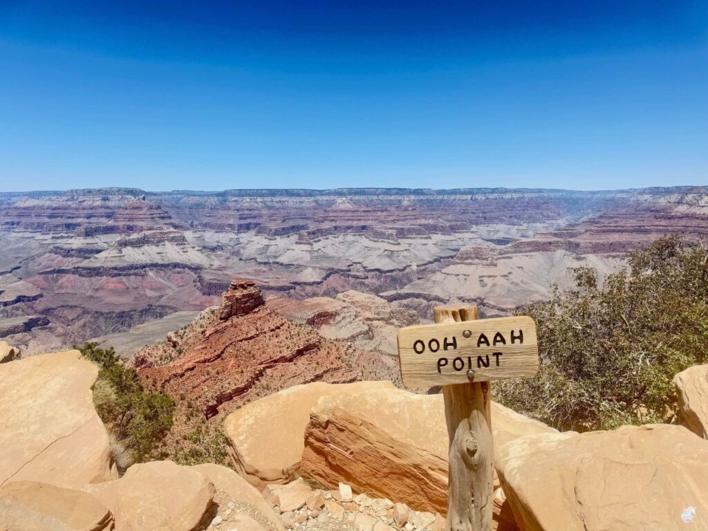
South Kaibab is not a casual walk. This is a real descent into the Grand Canyon with exposure, loose rock, no water on the trail, and steep drop-offs that don’t forgive mistakes. If you’re willing to respect what you’re doing, the trail delivers something rare: a direct, exposed view down into the canyon with the Colorado River visible far below from the upper switchbacks. The hike is hard. The reward is one of the better views in the American Southwest. It is not for everyone.
Quick Facts
Trail Name | South Kaibab Trail to Skeleton Point |
Location | Grand Canyon National Park, South Rim, Arizona |
Coordinates | |
Distance | 5.8 miles roundtrip |
Elevation Gain (Return) | 2,027 feet |
Difficulty | Hard |
Time | 5-7 hours |
Dogs Allowed | No |
Fee | $35 per vehicle (7-day pass); America the Beautiful Pass accepted |
How to Get There
The South Kaibab Trailhead is near the visitor center on the South Rim. Private vehicles are not allowed at the trailhead. You must take the park’s free Kaibab/Rim Shuttle (Orange Route) from the Grand Canyon Visitor Center or the Backcountry Information Center. The shuttle runs frequently throughout the day starting before sunrise.
From Flagstaff, take US-180 northwest about 80 miles to the South Rim entrance. Plan about 1.5 hours. From Williams, take AZ-64 north about 60 miles to the same entrance, about an hour. From Phoenix, allow 3.5-4 hours via I-17 north to Flagstaff and then US-180.
Park entry is $35 per vehicle for a 7-day pass. America the Beautiful Annual Pass covers Grand Canyon entry. Payment at entrance stations is credit card only.
Parking Information
Park at the Grand Canyon Visitor Center or the Backcountry Information Center and ride the shuttle to the South Kaibab Trailhead. Both lots fill during peak season; arrive before 7 a.m. on summer mornings or plan to wait. There is no parking at the trailhead itself.
Cell Service and Navigation
Cell coverage is patchy on the South Rim and drops to nothing on the trail below the rim. Download AllTrails offline before arriving. South Kaibab is well-marked and heavily trafficked, so route-finding is not the challenge. The challenge is the trail itself. Having the offline map active helps with pace planning, especially the turn-around decision.
What to Expect on South Kaibab Trail
The Descent
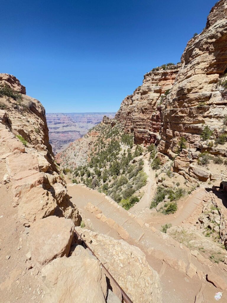
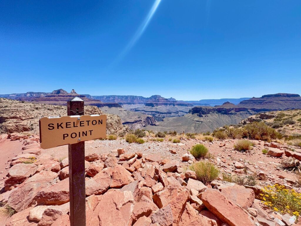
South Kaibab drops from the rim with no gradual acclimation. You’re exposed immediately. The trail cuts through red rock formations on rocky switchbacks with views at nearly every turn. The descent is steep, the gravel is loose in sections, and the drop-offs don’t forgive mistakes. No shade. No water sources on the trail. Cedar Ridge at about 1.5 miles in is the popular intermediate rest stop with a wide bench area and a view that anchors you. Skeleton Point at 2.9 miles in is the day-hiker’s turnaround point where you can see the Colorado River snaking far below.
The Exposure
This is the defining characteristic of South Kaibab. Unlike Bright Angel Trail with its rest houses and water, South Kaibab is direct and exposed. You’re descending through open canyon space with nothing between you and the view except the next switchback turn. The steepness is real. The exposure is constant. The light at sunrise on the red rock walls is one of the better photographic moments the park offers, but the sun also makes the trail hotter faster than visitors expect.
The Climb Back
The descent feels easy. Deceptively easy. The return is a different animal entirely. You’re climbing 2,000 feet back to the rim with no water available anywhere on the trail. The afternoon heat builds in summer to dangerous levels in the canyon. Your legs are already tired. Rangers are clear and they are correct: do not try to push further than Skeleton Point on a day hike. The people who ignore this advice sometimes need rescue, and rescues from below the rim are slow and difficult. This is not hyperbole.
Trail Difficulty and Length
South Kaibab to Skeleton Point is 5.8 miles roundtrip with 2,027 feet of elevation gain on the return. Hard is the accurate rating. This is not a casual hike. The descent is steep and exposed, the climb back is grueling, and there is no water on the trail. Expect 5-7 hours total at a moderate pace including stops at Cedar Ridge and Skeleton Point. Start before dawn. Be back on the rim before late afternoon. This is serious hiking that demands respect.
Dog Friendly?
No. Dogs are not allowed below the rim on any Grand Canyon trail, including South Kaibab. The steep, exposed terrain is unsafe for pets and there’s no water for them anywhere on the trail. The Grand Canyon Kennel near Maswik Lodge offers boarding. The Rim Trail is the dog-friendly alternative on the South Rim.

What to Bring
Water. A lot of it. At least 3 liters per person and more in summer. Electrolyte replacement is essential, not optional. Sturdy hiking boots with ankle support and aggressive tread for the loose gravel and exposed sections. Calorie-dense food: nuts, jerky, energy bars. The climb back uses everything you’ve got. Sunscreen, a hat, and sunglasses. Layers for temperature swings between rim air and the warmer canyon interior. A headlamp if you start before dawn. First aid kit. Trekking poles make the climb back significantly easier and are worth the weight.
Best Time to Hike South Kaibab Trail
Spring (March through May) and fall (September through November) are the only reasonable windows for day hikers. Summer canyon temperatures below the rim exceed 110°F regularly and have caused deaths. Winter is possible with caution for icy sections on the upper trail, particularly the first half mile below the rim. Start before sunrise year-round. You want to be off the exposed sections of the trail before the sun gets high.
Sunrise from the upper switchbacks of South Kaibab is one of the most photographed views in the park for good reason. The light on the canyon walls at first light is the reason to start early. The descent in pre-dawn cool air is also significantly easier than the same descent at midday.
Rules and Regulations
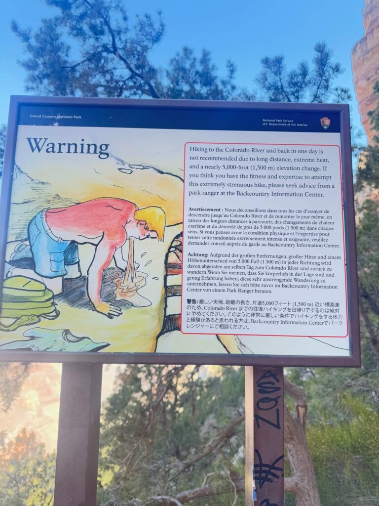
Stay on the designated trail. Pack out everything you pack in. Leave No Trace throughout. Rangers strongly advise against hiking to the Colorado River and back in a single day; the standard advice is do not attempt to descend more than half the elevation gain you can climb back up. Be honest with yourself about your fitness level. Many people overestimate what they can do at altitude and exposure. The $35 vehicle entry fee or America the Beautiful Pass is required. No drones anywhere in the park.
Where to Stay Near the Grand Canyon
Tusayan is the closest town just outside the park’s south entrance. Grand Canyon Village inside the park has the historic lodging options including El Tovar Hotel. Flagstaff, about 80 miles south, is the larger base with full lodging infrastructure.
Camping Nearby
Mather Campground and Desert View Campground both operate inside the park with basic amenities. Sites book up months in advance for peak season; reserve through recreation.gov. Outside the park, Kaibab National Forest has dispersed camping along forest service roads near the south entrance, free and primitive. Private campgrounds in Tusayan and Williams are the developed alternatives.
Nearby Adventures
The Rim Trail (Maricopa to Hopi Point) is the easy companion: 4.5 miles on the paved rim with three of the South Rim’s best viewpoints and no descent. Dog-friendly. The right recovery walk for the day after South Kaibab or the right warm-up for a multi-day Grand Canyon trip.
Bright Angel Trail is the other major South Rim descent and has rest houses with seasonal water sources, which makes it the safer day-hike option than South Kaibab if you want to drop below the rim again. Hermit Trail is less crowded but more technical and even more exposed. Guided mule rides offer canyon access without the hike for visitors who want the inside-canyon perspective without the physical commitment.
Off the trail, the Yavapai Geology Museum explains the rock layers you’ve been hiking through and is a short walk from the visitor center. Kolb Studio at the head of Bright Angel Trail has historic photography exhibits from the early Powell and Kolb expeditions. Desert View Drive runs 25 miles east of the village to the Desert View Watchtower, one of the most photographed structures in the park.
Plan This Hike
AllTrails has the South Kaibab to Skeleton Point route mapped with offline capability, current trail conditions, and recent hiker reports including water-fountain status (there isn’t any on this trail, but conditions at the rim helps with pre-hike planning). Plan your hike on AllTrails and download the offline map before entering the park.
Chase the Quiet
South Kaibab is one of those trails that stays with you. The exposure, the steepness, the silence of a canyon that’s been cutting itself deeper for millions of years. Descending into that kind of space, testing yourself against terrain that demands respect, clarifies something. About what you’re capable of. About what scale actually means. It is not easy. It is not casual. That’s the point. The trail is honest about what it costs and it pays back in equal measure.
Support the Adventure
To make your walls less boring, check out my photography portfolio and bring a piece of the wild and my story into your home.
If you’d like to fuel future adventures, you can donate a coffee on Ko-Fi. Every cup keeps me chasing sunrises and stories.
When you shop using my affiliate links, every click helps support this blog at no extra cost to you. It’s a small way to keep Unicorn Adventure alive and kicking while I keep exploring.
Subscribe to my mailing list for future updates, new stories, and behind-the-scenes adventures.
Stay connected with me on Instagram and Facebook for more photos and daily inspiration.
Thanks for being part of the journey, Unicorn Squadron!

Theo Maynard is a landscape photographer and adventure blogger based in Salt Lake City. He chases remote desert and mountain light across the American West, documents it all solo, and shares the journey through Unicorn Adventure. He’s on the autism spectrum, and that’s not a footnote, it’s the whole story. He creates to inspire others to get outside, chase what lights them up, and live their best possible life. Unapologetically himself.