

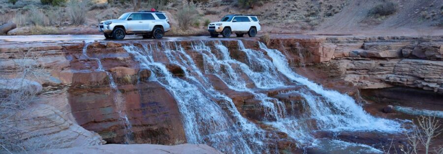
This was the weekend where I drove through a waterfall, lost sleep to a midnight rainstorm, hiked in sweatpants because my pants were still drenched from the day before, and crawled through clay slot canyons I’d been calling caves until someone corrected me. Four stops, three states of personal dignity, and one of the more memorable road trips in the Estes catalog. That’s St. George.
Yant Flats: Finally Checked Off
| Trail/Route | Yant Flats to Candy Cliffs and Yellow Top |
| Distance | 5.3 miles roundtrip |
| Elevation Gain | 800 feet |
| Difficulty | Moderate |
Yant Flats had been on the list for a while. The trail itself is manageable, mostly easy with some moderate scrambling toward Yellow Top, which meant the scenery got the full attention rather than the oxygen debt. And the scenery earns it. The Candy Cliffs section is wavy layers of yellow, orange, and red Navajo Sandstone that look like the desert was folded while it was still soft and then frozen in place. Running up and down those dune-shaped ridges would be overselling it. Frolicking is closer to accurate. I veered off-trail to summit a nearby peak for the elevated view of the full slickrock field. Worth it. Full guide: Yant Flats to Candy Cliffs and Yellow Top 
Toquerville Falls: Butt-Puckering and Beautiful
| Trail/Route | Toquerville Falls Road (OHV) |
| Distance | ~12 miles roundtrip |
| Elevation Gain | ~2,000 feet |
| Difficulty | Moderate (high-clearance 4WD required) |
I’d done enough homework to know Toquerville Falls wasn’t a casual drive. Deflated the tires, gave Estes a pep talk, and hit the gas on Toquerville Falls Road. Not 100 yards in, a guy coming the other way in a Jeep rolled down his window: ‘You doing alright?’ My answer out loud: ‘You betcha.’ My answer inside: something less confident. The first half-mile is rock garden territory, the kind of driving that activates muscles you forgot you had. Once it opens up, you’re cruising through desert terrain with waterfalls in sight. And then you drive through the waterfall. La Verkin Creek drops over the ledges and the road goes right through it. I stopped mid-crossing for photos, which is exactly as responsible as it sounds. There was a guy watching from the bank who also had a 4Runner. We compared builds. Took some photos. Parted ways. That’s car culture. Full guide: Toquerville Falls 
Camping by the Falls and the Midnight Pants Emergency
Found a camp spot 30 yards from the falls. Dinner under the stars with the waterfall as the background sound. Two drinks in, nothing to do but sit there and be in it. I hung my pants, soaked from the Yant Flats frolicking, on the roof rack to dry. 2 AM: full rainstorm. Not a polite one. The first thing I thought about was the pants. By morning they were still completely drenched and it was cold. I slept approximately nowhere near enough. But the morning light on the canyon walls above the falls was worth being awake to see it. Some things you don’t plan for end up being part of the trip anyway. 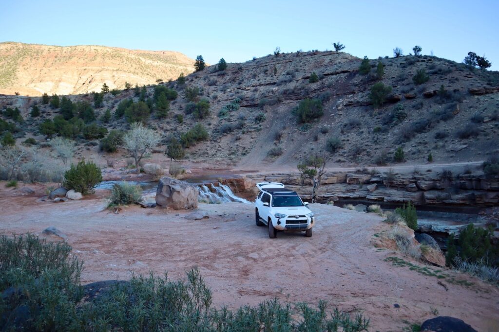
Juniper Draw: In Sweatpants. No Regrets.
| Trail/Route | Juniper Draw Loop Trail |
| Distance | 3.3 miles |
| Elevation Gain | 216 feet |
| Difficulty | Easy |
With the pants still not recovered, I drove from Nevada to Cathedral Gorge State Park in sweatpants and attacked the Juniper Draw Loop Trail in sweatpants. Some decisions you just commit to. Juniper Draw is the primary trail through Cathedral Gorge: 3.3 miles of clay spire formations, narrow canyon passages, and the particular silence of southeastern Nevada’s remote state park country. The spires are pale clay, not sandstone red, a completely different visual palette from Yant Flats and the St. George area. The slot sections of the loop narrow down to shoulder-width in places. It looked like a sci-fi landscape. It felt like hiking on another planet, which is exactly what I needed at hour 36 of a trip that had already included a midnight rainstorm and suboptimal pants choices. Full guide: Juniper Draw Loop Trail 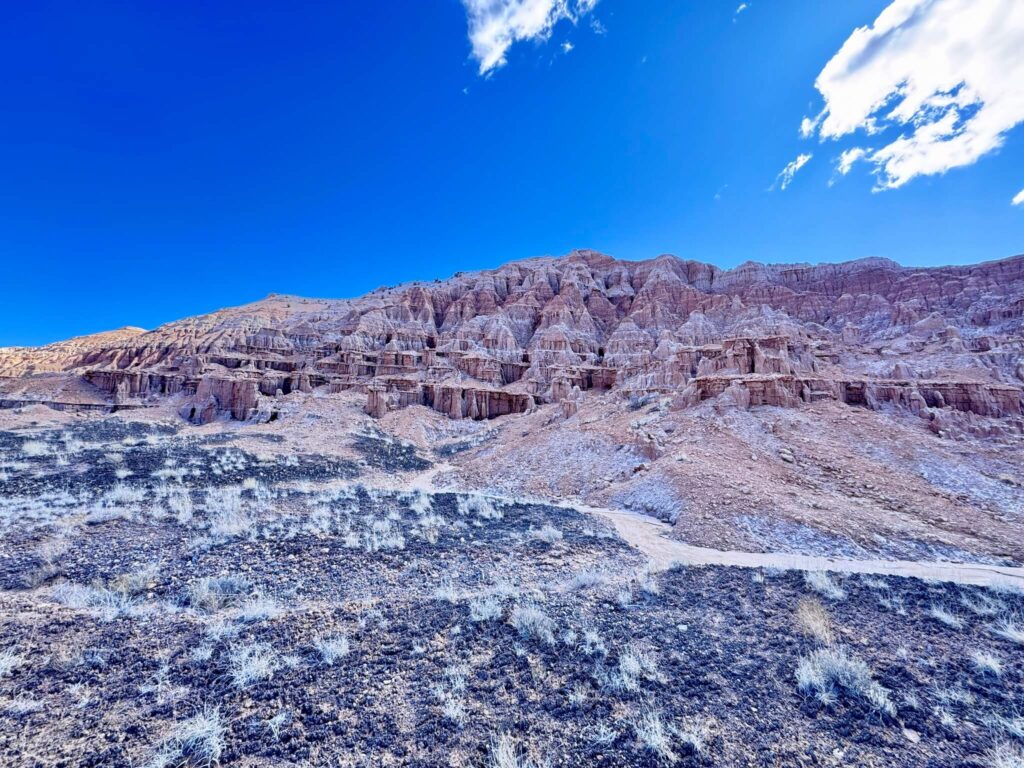
The Moon Caves: Not Caves, Still Great
| Trail/Route | Moon Caves |
| Distance | 0.2 miles (exploration) |
| Elevation Gain | 26 feet |
| Difficulty | Easy |
The Moon Caves are Cathedral Gorge’s most famous feature and the thing I had been calling caves. They are not caves. They are slot canyons formed in the soft clay formations, narrow, twisting, dark, and low enough in places that you’re ducking, crawling, and squeezing through sideways. The distinction between ‘cave’ and ‘slot canyon’ becomes academic when you’re crab-walking through a clay passage with your headlamp on. These are also not your standard desert slot canyons. The clay gives the walls a smoother texture than sandstone and the formations twist more unpredictably. I was crawling through sections I hadn’t planned on, ducking under protrusions I saw too late, climbing over clay ledges that weren’t on any map. Perfect chaotic ending to the weekend. Important note: the clay becomes extremely slippery when wet. Visit in dry weather only. Full guide: Moon Caves, Cathedral Gorge 
Wrapping It Up: Wet Pants, Full Heart
The St. George weekend delivered scraped knees, sleep deprivation, a midnight rainstorm, car bros bonding over 4Runners, one pair of pants that never fully dried, and a slot canyon I crawled through in my socks because my shoes were also wet. It also delivered the Candy Cliffs at golden hour, a waterfall campsite soundtrack, and clay formations that looked like another planet. The weird conversations, the surprise rainstorms, and the off-trail choices are what makes these trips stick. St. George and Cathedral Gorge delivered all three. I’d do it again immediately.
Planning a St. George Area Trip
Toquerville Falls Road requires high-clearance 4WD and dry conditions. Do not drive in wet weather. Check road conditions before heading out. The road is 8-8.5 miles one-way from pavement; budget 3-5 hours roundtrip with time at the falls. Cathedral Gorge State Park is about 3 hours from St. George on US-93 in southeastern Nevada. Juniper Draw Loop (3.3 miles) and Moon Caves (0.2 miles) are the primary visitor stops and pair well as a single day. The Moon Caves are only accessible in dry weather, wet clay is impassable and damaging to the formations.
Where to Stay in St. George
St. George has full chain hotel infrastructure. For points travelers, check available Marriott Bonvoy properties in St. George, IHG Rewards hotels in St. George, and Hilton Honors options in St. George. Cathedral Gorge State Park has a developed campground for anyone who wants to stay near the Moon Caves and Juniper Draw.
Chase the Quiet
Solo road trips in the desert have a specific rhythm. The driving, the quiet camp, the weird unexpected interactions (car bros at a desert waterfall, someone checking on you through a Jeep window), and the weather you didn’t plan for. This weekend had all of it. The pants were a casualty. The canyon was worth every wet step.
Support the Adventure
To make your walls less boring, check out my photography portfolio and bring a piece of the wild and my story into your home. If you’d like to fuel future adventures, you can donate a coffee on Ko-Fi. Every cup keeps me chasing sunrises and stories. When you shop using my affiliate links, every click helps support this blog at no extra cost to you. It’s a small way to keep Unicorn Adventure alive and kicking while I keep exploring. Subscribe to my mailing list for future updates, new stories, and behind-the-scenes adventures. Stay connected with me on Instagram and Facebook for more photos and daily inspiration. Thanks for being part of the journey, Unicorn Squadron! 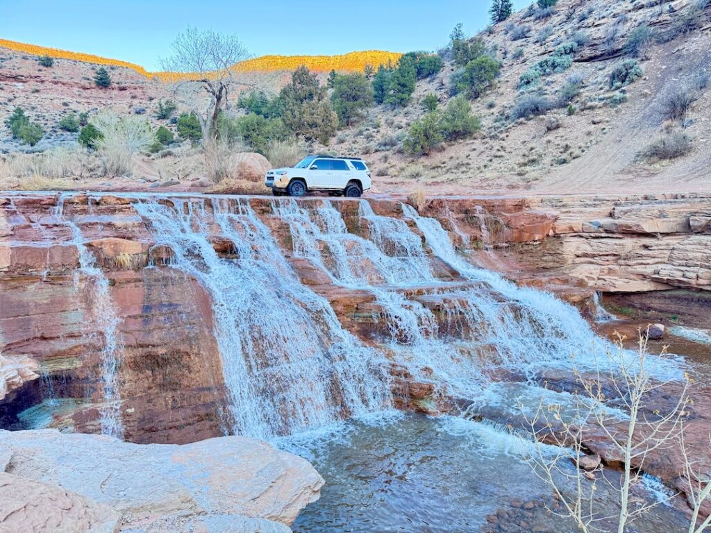

Theo Maynard is a landscape photographer and adventure blogger based in Salt Lake City. He chases remote desert and mountain light across the American West, documents it all solo, and shares the journey through Unicorn Adventure. He’s on the autism spectrum, and that’s not a footnote, it’s the whole story. He creates to inspire others to get outside, chase what lights them up, and live their best possible life. Unapologetically himself.