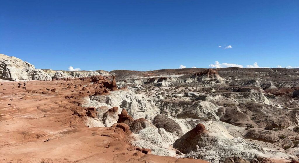
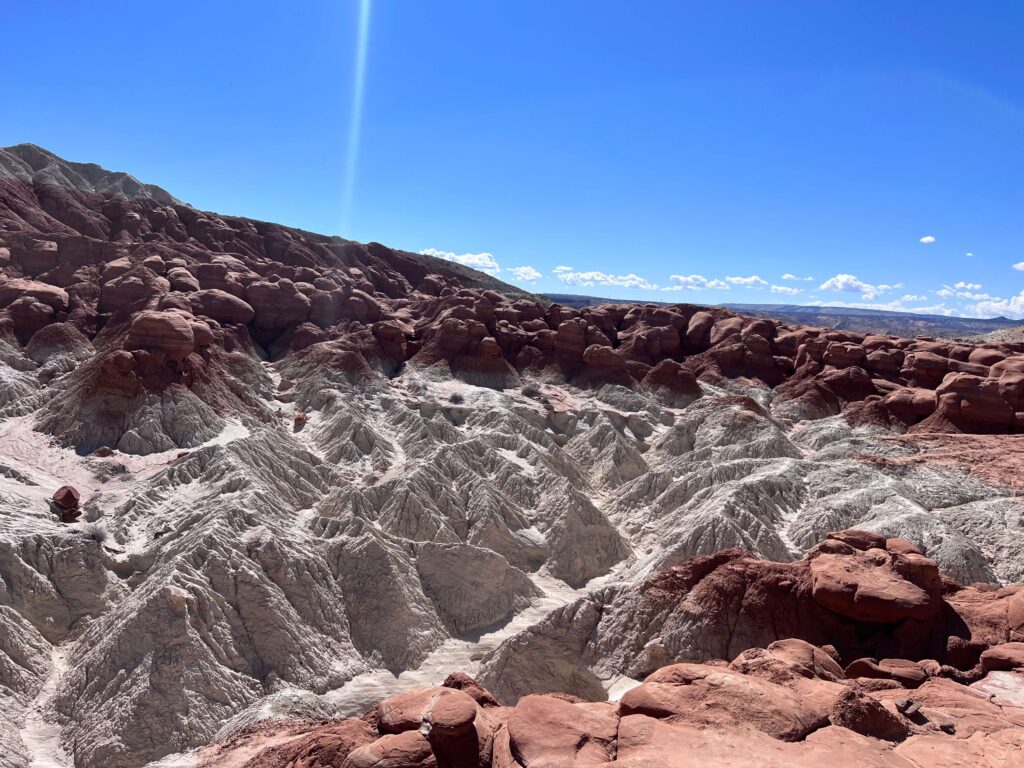
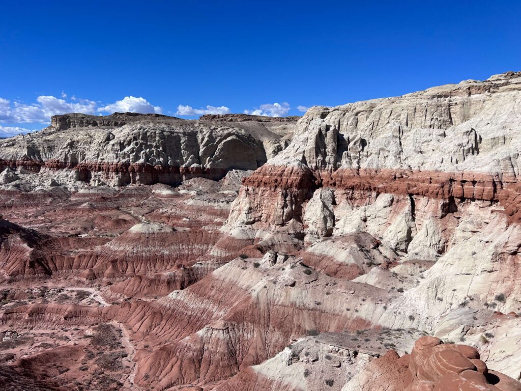
Escalante might be the most underrated hiking hub in the American West. The town itself is tiny. The monument surrounding it is enormous. And the trail variety is absurd, from 2-mile waterfall walks to 9-mile backcountry routes across trackless slickrock, slot canyons that require you to turn sideways to fit through, river corridors lined with cottonwoods, and natural formations that look like they were placed by something with a very specific artistic vision.
I’ve pushed Estes down Hole-in-the-Rock Road more times than I can count. I’ve hiked the easy ones and the ones that earn every step on the climb out. I do this solo, which means I spend a lot of time with the Grand Staircase and very little time with crowds. What I know is that this area rewards the people who show up prepared and stay curious.
Here are the best hikes near Escalante, ranked and reviewed with accurate stats from my own hikes. Every trail listed has its own full guide on this site. Click through for the complete breakdown before you go.
1. Lower Calf Creek Falls
|
Distance |
6.1 miles (round trip) |
|
Elevation Gain |
531 feet |
|
Difficulty |
Moderate |
|
Dogs Allowed |
Yes (on leash) |
|
Time |
3-4 hours |
The signature hike of the Escalante area and the one that earns its reputation. The trail follows Calf Creek through a narrow canyon past Fremont petroglyphs and cottonwood groves before arriving at a 126-foot waterfall dropping into a clear pool. It’s the most popular trail in the monument for good reason. Get there early on weekends.
Full guide: Lower Calf Creek Falls Trail Guide
2. Upper Calf Creek Falls
|
Distance |
2.0 miles (round trip) |
|
Elevation Gain |
557 feet |
|
Difficulty |
Moderate to Difficult |
|
Dogs Allowed |
Yes (on leash, with prep) |
|
Time |
1.5-2.5 hours |
Short, steep, and significantly quieter than the Lower Falls. The trail drops sharply off the canyon rim on slickrock, descends through desert terrain, and reaches an 88-foot waterfall with a pool below. The gain-to-distance ratio is honest and the climb back out demands respect. The trailhead is easy to miss on Highway 12 and the parking is minimal, which keeps the crowds down.
Full guide: Upper Calf Creek Falls Trail Guide
3. Escalante Natural Bridge
|
Distance |
4.4 miles (round trip) |
|
Elevation Gain |
291 feet |
|
Difficulty |
Easy to Moderate |
|
Dogs Allowed |
Yes (on leash) |
|
Time |
2-3 hours |
A riverside canyon hike that ends at a massive sandstone arch spanning the Escalante River. The trail winds through a riparian corridor of cottonwoods and willows between towering red and orange canyon walls. Multiple river crossings are required, so plan your footwear accordingly. Fremont petroglyphs appear on the canyon walls if you’re watching for them. One of the most accessible and visually rewarding hikes in the monument.
Full guide: Escalante Natural Bridge Trail Guide
4. Zebra and Tunnel Slot Canyons
|
Distance |
6.6 miles (round trip) |
|
Elevation Gain |
469 feet |
|
Difficulty |
Moderate |
|
Dogs Allowed |
No |
|
Time |
3-5 hours |
Accessed off Hole-in-the-Rock Road about 8 miles south of Highway 12. Zebra Canyon is the main draw, a slot with banded striped walls that narrow to shoulder width in sections. The contrast between the deep red, orange, and cream sandstone layers is genuinely striking. Tunnel Canyon adds a short tunnel-like passage and is worth doing if you’re already out there. High-clearance vehicle recommended for the approach road. The canyon system is off-limits for dogs.
Full guide: Zebra and Tunnel Slot Canyons Trail Guide
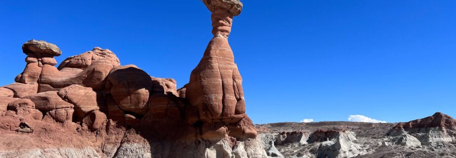
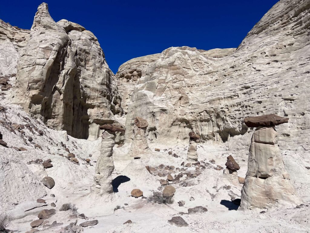
5. Devils Garden
|
Distance |
0.4 miles (round trip) |
|
Elevation Gain |
36 feet |
|
Difficulty |
Easy |
|
Dogs Allowed |
Yes (on leash) |
|
Time |
30-60 minutes |
A short interpretive loop through a cluster of sandstone hoodoos and arches off Hole-in-the-Rock Road. This is the easiest stop in the monument, accessible to almost anyone, and genuinely worth pulling over for on the drive in or out. The formations are bizarre and photogenic. Arrive at sunrise or sunset for the best light on the red rock. It’s a 10-minute detour that punches well above its mileage.
Hole-in-the-Rock Road, approximately 12 miles south of Highway 12.
Full guide: Devil’s Garden Trail Guide
6. Bighorn Canyon Trail
|
Distance |
6.0 miles (round trip) |
|
Elevation Gain |
390 feet |
|
Difficulty |
Moderate |
|
Dogs Allowed |
Yes (on leash) |
|
Time |
3-5 hours |
The deep-cut option on Hole-in-the-Rock Road, about 30 miles from Highway 12. Bighorn Canyon drops off the rim and narrows as you go, with towering sandstone walls rising in red, orange, and pink. It sees a fraction of the traffic that closer trailheads absorb, which means genuine solitude if that’s what you came for. Route-finding is involved. High-clearance vehicle strongly recommended for the long approach road.
Full guide: Bighorn Canyon Trail Guide
7. Cosmic Ashtray via Volcano Trail
|
Distance |
7.6 miles (round trip) |
|
Elevation Gain |
810 feet |
|
Difficulty |
Moderate |
|
Dogs Allowed |
Yes (on leash, with prep) |
|
Time |
4-6 hours |
East of Escalante off Spencer Flat Road, this route crosses open trackless slickrock to reach one of the strangest geological formations in the Southwest. The Cosmic Ashtray is a massive circular depression carved into the sandstone with a dramatic rock formation rising from the center. No formal trail, cairn-based navigation, zero shade, and spectacular desert solitude. This is the one for hikers who want something genuinely off the beaten path.
Full guide: Cosmic Ashtray via Volcano Trail Guide
8. Dry Fork Narrows: Peekaboo and Spooky Slot Canyons
|
Distance |
6.0 miles (round trip) |
|
Elevation Gain |
656 feet |
|
Difficulty |
Moderate to Difficult |
|
Dogs Allowed |
No |
|
Time |
3-5 hours |
Further down Hole-in-the-Rock Road than Zebra Canyon, Peekaboo and Spooky are the most technically demanding slot canyons in this guide. Spooky is narrow enough to require full body contortion in spots. Peekaboo has climbing moves and exposed sections. Together they cover 6.0 miles with 656 feet of gain and are worth the extra drive if you want the tight-canyon experience at its most extreme. Not suitable for dogs and not suitable for hikers with claustrophobia.
Hole-in-the-Rock Road, approximately 26 miles south of Highway 12.
Full guide: Dry Fork Narrows: Peekaboo and Spooky Slot Canyons Trail Guide
9. The Golden Cathedral (Neon Canyon)
|
Distance |
9.1 miles (round trip) |
|
Elevation Gain |
1,581 feet |
|
Difficulty |
Moderate to Difficult |
|
Dogs Allowed |
Yes (on leash, with prep) |
|
Time |
5-8 hours |
The biggest day hike on this list and one of the most spectacular destinations in the American Southwest. The Golden Cathedral sits at the end of Neon Canyon in Glen Canyon National Recreation Area, accessed from Egypt Trailhead off Hole-in-the-Rock Road. Three skylights punched through the ceiling of a red rock canyon, sunlight beaming down onto a pool below. The route involves river crossings, open slickrock navigation, and a steep canyon descent. This one demands preparation and a full day.
Full guide: The Golden Cathedral Trail Guide
Best Time to Hike Near Escalante
Spring (April through June) and fall (September through October) are the reliable windows for almost every trail on this list. Temperatures are manageable, water levels in the canyons are predictable, and the desert light is excellent. Summer brings heat that turns slickrock into a frying pan and elevates flash flood risk in the slot canyons. An early start is mandatory in summer, not optional. Winter is doable for some trails but canyon ice and cold river crossings add a layer of risk that most hikers don’t want to manage.
Flash flood risk is real in Grand Staircase-Escalante, particularly in slot canyons. Check the weather for the entire regional watershed, not just the local forecast. The Escalante Interagency Visitor Center in town has current conditions for every trail on this list. Stop in before you drive out.
Where to Stay Near Escalante
Escalante has solid in-town lodging. Entrada Escalante Lodge and Canyon Country Lodge are both good bases for multi-day trips. Boulder, about 30 minutes east on Highway 12, is worth considering if you’re splitting time between Escalante and Capitol Reef.
Camping Near Escalante
Dispersed BLM camping is one of the best options in the Grand Staircase area. Cedar Point, South Turkey, and Spencer Flat are all established dispersed sites in the monument. Hole-in-the-Rock Road has dispersed camping along its length, which puts you close to multiple trailheads. No hookups, no reservations, and the night sky out here is exceptional.
The Calf Creek Recreation Area campground on Highway 12 is a reservable option with restrooms, right at the Lower Calf Creek Falls trailhead. It’s small, it fills fast, and it books through recreation.gov.
Plan Your Escalante Trip
AllTrails has maps, recent conditions, and downloadable offline routes for every trail in this guide. In Grand Staircase-Escalante where cell service disappears well before most trailheads, downloading your maps in advance is not optional. Check recent user reports for current canyon conditions, water levels, and road access before you commit to a drive.
AllTrails Pro is worth it for a multi-day Escalante trip. Offline maps, GPS tracking without cell service, and the ability to monitor multiple trails at once make it the practical choice for canyon country.
Chase the Quiet
Escalante doesn’t give up its best places easily. The roads are rough. The distances are real. The heat in summer is a serious consideration. But every trail on this list delivers something that you can’t get from a viewpoint pullout or a paved interpretive loop. The monument is vast and it’s still quiet in the way that the most visited parks in Utah stopped being quiet years ago. Show up prepared and it rewards you.
Support the Adventure
To make your walls less boring, check out my photography portfolio and bring a piece of the wild and my story into your home.
If you’d like to fuel future adventures, you can donate a coffee on Ko-Fi. Every cup keeps me chasing sunrises and stories.
When you shop using my affiliate links, every click helps support this blog at no extra cost to you. It’s a small way to keep Unicorn Adventure alive and kicking while I keep exploring.
Subscribe to my mailing list for future updates, new stories, and behind-the-scenes adventures.
Stay connected with me on Instagram and Facebook for more photos and daily inspiration.
Thanks for being part of the journey, Unicorn Squadron!

Theo Maynard is a landscape photographer and adventure blogger based in Salt Lake City. He chases remote desert and mountain light across the American West, documents it all solo, and shares the journey through Unicorn Adventure. He’s on the autism spectrum, and that’s not a footnote, it’s the whole story. He creates to inspire others to get outside, chase what lights them up, and live their best possible life. Unapologetically himself.