Two miles. Five hundred and fifty-seven feet of gain. One waterfall that most people driving Highway 12 blow right past.
Upper Calf Creek Falls sits just off Highway 12 about 15 miles east of Escalante, a short drive from its more famous neighbor Lower Calf Creek Falls. The trailhead is easy to miss and the hike is harder than the mileage suggests. You drop steeply off the rim on slickrock, wind through desert canyon terrain, and reach an 88-foot waterfall dropping into a clear pool. The whole thing is quieter, harder, and less crowded than the Lower Falls. That combination suited me fine. The slickrock descent on the way back up earns every bit of the moderate-to-difficult rating, especially in the heat. Worth every step.
Quick Facts
| Trail Name | Upper Calf Creek Falls Trail |
| Location | Grand Staircase-Escalante NM, near Escalante, Utah |
| Coordinates | 37.8199° N, 111.4185° W |
| Distance | 2.0 miles (round trip) |
| Elevation Gain | 557 feet |
| Difficulty | Moderate to Difficult |
| Time | 1.5-2.5 hours |
| Dogs Allowed | Yes (on leash) |
| Fee | None |
| AllTrails | View on Alltrails |
How to Get There
From Escalante, head east on Highway 12 for approximately 15 miles. The trailhead is signed but small, on the north side of the highway. It sits close to the more-visited Lower Calf Creek Recreation Area turnoff but is a separate, easy-to-miss pull. Watch your mileage. Coming from Boulder to the east, drive west on Highway 12 about 11 miles. Download the coordinates (37.8199, -111.4185) and have them loaded before you leave because the sign is subtle and highway speed doesn’t give you much time to react.
Parking Information
A small dirt pull-off accommodates a handful of vehicles. No fee, no facilities, no restrooms. Handle everything in Escalante or at the Calf Creek Recreation Area a mile or so down the road before committing to the trailhead. On busy spring and fall weekends the lot fills. Arrive before 8 a.m. to be safe.

Cell Service and Navigation
Cell service along this stretch of Highway 12 is unreliable and drops to nothing on trail. Download your map offline through AllTrails or Gaia GPS before leaving town. Navigation is fairly direct but the initial slickrock descent can feel disorienting without a track to reference. The route isn’t complicated, but in desert heat on steep slickrock you don’t want to second-guess your line back up. GPS keeps you oriented.
What to Expect on Upper Calf Creek Falls Trail
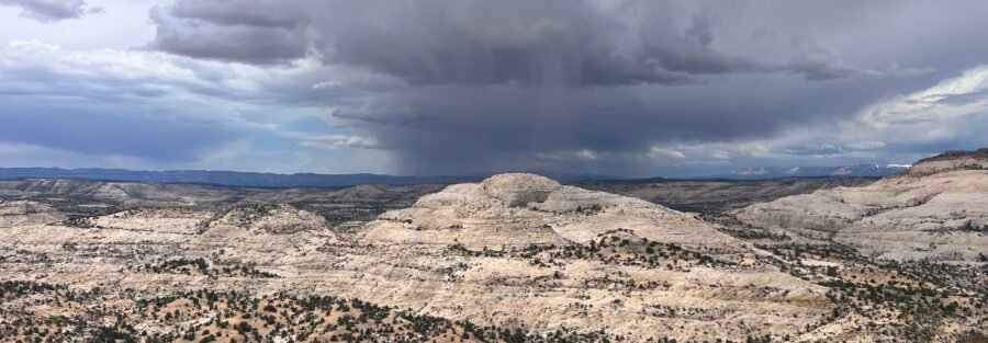
The trail starts with a steep slickrock descent off the canyon rim. Views open up immediately over the surrounding desert and canyonlands. Juniper and pinyon pine cling to the edges of the slickrock. The footing demands attention, especially in heat when the rock is hot and any moisture makes it slippery. Traction matters here. Take your time on the descent because the way back up is harder and fatigue compounds the technical demand.
Upper Calf Creek Falls drops 88 feet into a pool surrounded by lush, green vegetation that feels completely out of proportion with the surrounding desert. The contrast is dramatic. The pool is cold and clear and the spray keeps the immediate area cool even in summer heat. It’s a smaller, more intimate setting than Lower Calf Creek Falls, which means if you time it right you may have it to yourself. Sit at the base, eat your lunch, and take the extra time before the climb back out.

Trail Difficulty and Length
Upper Calf Creek Falls is 2.0 miles round trip with 557 feet of elevation gain. That gain-to-distance ratio earns the moderate-to-difficult rating. You’re losing and gaining elevation on slickrock, which is unforgiving on the knees and demands solid footing on the ascent. The short distance is deceptive. Budget 1.5 to 2.5 hours and treat the return climb with respect, particularly in heat. Good trail shoes with aggressive tread are not optional on this one. Approach it fresh and hydrated.
Dog Friendly?
Yes, dogs are allowed on leash, but the steep slickrock sections require careful management with a dog. Hot rock in summer is a real concern for paws. Bring booties if you’re hiking in warm weather, more water than you think you’ll need, and a willingness to help them navigate the steep sections. Smaller dogs may need a hand on the descent.

What to Bring
Trail shoes or hiking boots with solid grip are essential on the slickrock sections. At least 2 liters of water per person, more in summer. The hike is short but steep and the desert will drain you faster than you expect. Sunscreen, a hat, and sunglasses for the exposed sections. Trekking poles help significantly on the ascent if you use them. Snacks for the waterfall because you’ll want to stay. A camera with a wide-angle lens and a tripod if you’re serious about photographing the falls. The pool at the base is excellent for a long-exposure shot.
Best Time to Hike Upper Calf Creek Falls
Spring (April through June) and fall (September through October) are the best windows. Cooler temperatures make the slickrock descent and steep return climb manageable and the desert light on the canyon rim is excellent. Summer is doable but the slickrock heats up fast and the climb out in midday heat is genuinely hard. Start before 7 a.m. if you’re going in summer. Winter brings cold and potentially icy slickrock, which makes the descent hazardous without microspikes.
For photography, morning light catches the canyon rim above the trailhead and the surrounding desert in warm tones on the descent. The waterfall photographs best when the canyon walls aren’t casting harsh shadows across the pool, which depends on time of year and time of day. Mid-morning in spring or fall gives you the best balance. A neutral density filter smooths the falls nicely and a tripod is worth the extra weight.
Rules and Regulations
Upper Calf Creek Falls is managed by the BLM as part of Grand Staircase-Escalante National Monument. No permit required, no day-use fee. Leave No Trace applies fully. Stay on the established route, pack out all trash, and leave the rock surfaces undisturbed. The slickrock is fragile in ways that aren’t always visible. Don’t shortcut across unmarked terrain. Check current conditions with the Escalante Interagency Visitor Center before heading out, especially in spring when conditions change fast.
Where to Stay Near Escalante
Escalante has solid in-town lodging including Entrada Escalante Lodge and Canyon Country Lodge.
Camping Nearby
The Calf Creek Recreation Area campground, about a mile down Highway 12 toward Escalante, is a small reservable site right at the Lower Calf Creek Falls trailhead. Book through Recreation.gov. It fills fast on spring and fall weekends.
Dispersed BLM camping is available throughout Grand Staircase-Escalante. Cedar Point, South Turkey, and Spencer Flat are all in the area. No hookups, no reservations, serious sky.
Nearby Adventures
The obvious pairing is Lower Calf Creek Falls, about a mile down the highway. At 6.1 miles and 531 feet of gain it’s a longer, flatter hike to a bigger waterfall. Doing both on the same trip gives you two completely different canyon experiences in one day. Escalante Natural Bridge is 4.4 miles with 291 feet of gain along the Escalante River to a massive sandstone arch, an easy add for a multi-day visit.
Further into the monument, Zebra and Tunnel Slot Canyons (6.6 mi / 469 ft) and the Cosmic Ashtray via Volcano Trail (7.6 mi / 810 ft) both reward the extra drive. Bighorn Canyon Trail (6.0 mi / 390 ft) is the deep-cut option for hikers who want genuine solitude down Hole-in-the-Rock Road.
For drives, Moki Dugway is a short distance south and one of the most dramatic roads in Utah. The Burr Trail out of Boulder is another essential scenic route in the area.
Off the trail, the Anasazi State Park Museum in Boulder has real Ancestral Puebloan artifacts and a reconstructed village. The Escalante Petrified Forest State Park is an easy rest-day loop through fossilized wood and badlands just west of town.
Plan This Hike
AllTrails has the Upper Calf Creek Falls Trail with a downloadable map and recent user conditions. Given the short distance and steep terrain, checking recent reports about slickrock conditions and any water at the falls is worth the two minutes before you drive out.
AllTrails Pro is worth it for Grand Staircase trips where connectivity is unreliable. Offline maps and the ability to track your position on slickrock without a cell signal makes the whole experience less stressful.
Chase the Quiet
The thing about a short, hard trail is that it filters. The people who want a casual stroll to a waterfall go to Lower Calf Creek. The people who show up at the Upper Falls trailhead early, with good shoes and enough water, get the falls mostly to themselves. That trade-off is exactly right. The pool at the base of the 88-foot drop is as good as anything in southern Utah. The climb back out is honest. I’ll take it.
Support the Adventure
To make your walls less boring, check out my photography portfolio and bring a piece of the wild and my story into your home.
If you’d like to fuel future adventures, you can donate a coffee on Ko-Fi. Every cup keeps me chasing sunrises and stories.
When you shop using my affiliate links, every click helps support this blog at no extra cost to you. It’s a small way to keep Unicorn Adventure alive and kicking while I keep exploring.
Subscribe to my mailing list for future updates, new stories, and behind-the-scenes adventures.
Stay connected with me on Instagram and Facebook for more photos and daily inspiration.
Thanks for being part of the journey, Unicorn Squadron!

Theo Maynard is a landscape photographer and adventure blogger based in Salt Lake City. He chases remote desert and mountain light across the American West, documents it all solo, and shares the journey through Unicorn Adventure. He’s on the autism spectrum, and that’s not a footnote, it’s the whole story. He creates to inspire others to get outside, chase what lights them up, and live their best possible life. Unapologetically himself.