

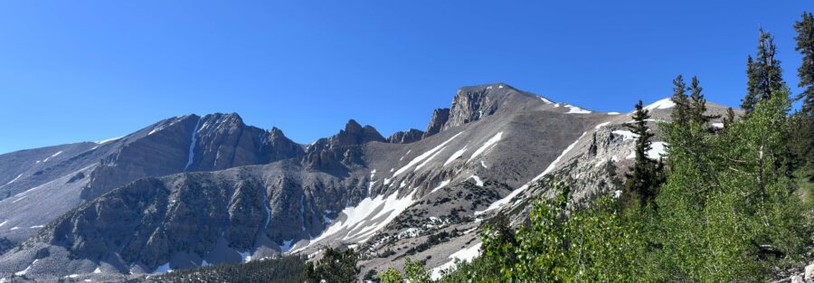
Wheeler Peak is 13,063 feet tall and sits in the Snake Range of eastern Nevada, which is not where most people expect to find a serious summit. Nevada has a reputation for flat. The truth is that the state has more mountain ranges than any other in the continental US, and Wheeler Peak is what happens when one of those ranges goes all the way. The Wheeler Peak Trail via Stella Lake Trail climbs 3,087 feet in 7.8 miles from the Summit Trailhead to the second-highest peak in Nevada, with bristlecone pines in the lower sections, an alpine lake at the midpoint, and nothing but exposed ridge and sky for the final push to the top.
This guide covers the Wheeler Peak Trail from the Summit Trailhead to the summit and back: what the route actually involves above Stella Lake, and everything you need to plan a safe day on Nevada’s second-highest peak.
Quick Facts
| Trail Name | Wheeler Peak Trail via Stella Lake Trail |
| Location | Great Basin National Park, near Baker, Nevada |
| Coordinates | 39.0105 N, 114.3073 W (Summit Trailhead) |
| Distance | 7.8 miles roundtrip |
| Elevation Gain | 3,087 feet |
| Difficulty | Hard |
| Time | 6-8 hours |
| Dogs Allowed | No |
| Fee | Free (no entry fee at Great Basin National Park) |
| View on AllTrails | |
How to Get There
Great Basin National Park sits near Baker, Nevada, on US-50 in eastern Nevada. From Baker, head south on NV-487 for about 5 miles to the park visitor center, then follow Wheeler Peak Scenic Drive for approximately 12 miles to the Wheeler Peak Campground and Summit Trailhead at the end of the road. The scenic drive climbs from the basin floor to roughly 10,000 feet; the drive itself takes 30-40 minutes and the views are worth going slowly.
From Salt Lake City, plan about 4 hours west via I-15 south and US-50 west. From Reno, roughly 5 hours east on US-50. From Las Vegas, about 4.5 hours north on I-15 and east on US-50. Great Basin is genuinely remote and rewards a trip planned specifically around it rather than tacked onto other itineraries.
No entry fee. No timed entry reservation. Wheeler Peak Scenic Drive closes in winter. The road typically reopens by late May or early June depending on snowpack. Check road status with the park before your visit if you’re planning a spring or late fall trip.
Parking Information
The Summit Trailhead parking lot at Wheeler Peak Campground is free and well-maintained. It’s the same lot used by hikers on the Bristlecone and Alpine Lakes Loop, so it can fill on summer mornings when both groups of hikers are starting early. Plan to be parked by 7 a.m. for a summit attempt. Later starts create timing problems with afternoon weather and extend the return in heat.
Restrooms are available at the trailhead. No water at the parking area. Fill at the visitor center or campground water station before driving up.
Cell Service and Navigation
Cell coverage is absent at the Summit Trailhead and on the trail above. Download AllTrails or the NPS Great Basin app offline at the visitor center or in Baker before driving the scenic drive. Having GPS active on the upper ridge sections is useful for tracking position relative to the summit and weather development overhead.
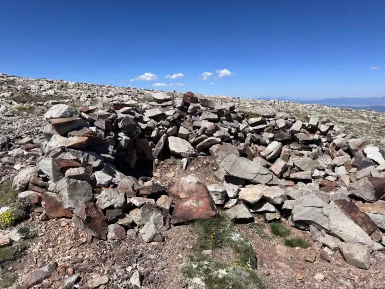
Navigation on this trail is mostly straightforward: follow the route from the trailhead through the bristlecone section, past Stella Lake, and up the ridge. The upper ridge section above tree line requires route-reading attention where the trail crosses exposed rock, but cairns mark the route. Mist and cloud can reduce visibility quickly at summit elevation. Know where you are before that happens.
What to Expect on the Wheeler Peak Trail
The Lower Trail: Bristlecone Section
The trail starts at 10,000 feet and enters the bristlecone grove within the first mile. These are the same trees that appear on the Bristlecone and Alpine Lakes Loop, some of the oldest living organisms on Earth. On a summit day, most hikers move through the grove relatively quickly, but it rewards slowing down. The gnarled forms and the sense of geological time they carry are worth a few minutes even when you have 3,000 feet ahead of you.
The lower trail through the grove and toward Stella Lake is the most forgiving section of the day: moderate grade, good footing, treeline for wind protection. Use this section to settle your breathing, establish your pace, and confirm you’re moving well at altitude before the steeper terrain arrives.
Stella Lake
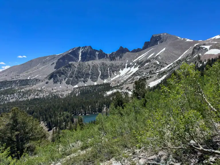
Stella Lake appears at roughly the midpoint elevation of the hike, nestled below the Wheeler Peak ridgeline with the peak itself framed above. It’s a natural stopping point: fill water here if you have filtration, eat something, check how you’re feeling at altitude before committing to the summit push. The lake is beautiful in morning light with the eastern cirque walls catching direct sun.
From Stella Lake, the trail changes character. The grade increases, the terrain becomes rockier, and the treeline retreats. What’s ahead is sustained climbing on exposed terrain with no bailout options other than turning around.
The Summit Ridge
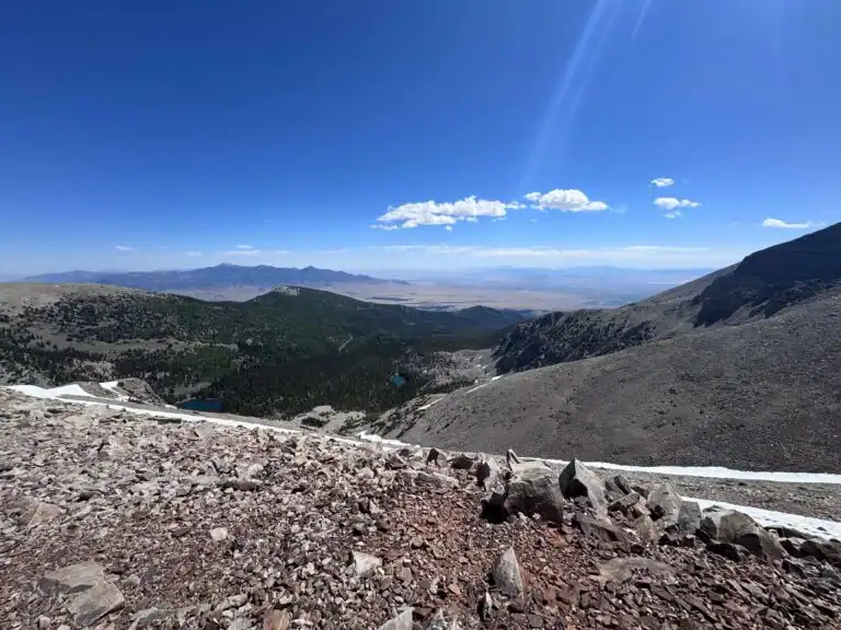
Above Stella Lake, the trail climbs the Wheeler Peak ridge through open rock. The footing on loose talus and scree requires attention and slows the pace relative to the lower trail. The views open dramatically as you gain the ridge, with the Great Basin spreading west in all directions and the Snake Range falling away on both sides.
The final push to the 13,063-foot summit is the hardest section: steep, exposed, at elevation where the air has less oxygen than most people are accustomed to. Altitude sickness symptoms (headache, nausea, unusual fatigue) at this elevation are real and require honest assessment. If you feel genuinely unwell, turn around. The summit will be there on another day. A bad situation at 13,000 feet in Great Basin’s remote setting is a serious situation.
The summit view on a clear day spans Nevada and into Utah in multiple directions. Wheeler Peak is the dominant high point in this section of the Great Basin, and the 360-degree perspective from the summit makes the elevation gain evident in every direction.
Trail Difficulty and Length
Hard is the correct rating. This trail is 7.8 miles roundtrip with 3,087 feet of elevation gain.
The difficulty comes from three compounding factors: the sustained elevation gain, the high starting altitude (10,000 feet at the trailhead), and the summit altitude (13,063 feet) where oxygen is measurably thin. Fit hikers who regularly do big days at lower elevation should expect more effort per mile than they’re used to. Budget 6-8 hours for the full roundtrip at a realistic pace.
This is a serious mountain day. It’s not technical climbing, no ropes or special equipment required, but it demands real fitness, appropriate gear, weather awareness, and a willingness to turn around. The remoteness of Great Basin means emergency response is slow. Make good decisions early rather than tough decisions late.
Dog Friendly?
No. Great Basin National Park prohibits pets on all trails. Dogs are permitted in parking areas, campgrounds, and paved roads but not on any unpaved trail surface. For the Wheeler Peak summit, this is also a practical consideration: the upper ridge is genuine exposed mountain terrain that’s hard on dogs even where permitted. Leave them in camp for this one.
What to Bring
Water: minimum 3 liters per person. The trail is long, the elevation gain is significant, and altitude accelerates dehydration. Stella Lake is a refill option with treatment. Don’t count on it as your primary strategy.
Food: a full day’s worth of calories plus extra. High altitude burns calories faster and appetite suppressant effects of altitude are real but deceptive. Eat before you’re hungry.
Layers: the summit at 13,063 feet can see wind and cold at any time of year. Bring a down or synthetic mid-layer, a waterproof shell, and warm gloves. Morning temperatures at the summit can be 30-40 degrees cooler than in Baker. Weather moves fast on the Snake Range ridgeline.
Boots with solid ankle support and grip on loose rock. Trekking poles for the talus sections and the descent. Sun protection for the exposed upper ridge where UV intensity increases with altitude. A headlamp in case your timing slips.
Best Time to Hike Wheeler Peak
July through September is the reliable summit window. The trail is typically snow-free from July onward in most years, and the road stays open through October. June is possible but the upper sections often carry late snow patches that require microspikes or careful route-finding.
July and August offer the longest daylight and the best window for summit views, but afternoon thunderstorms are the primary safety variable. On the Wheeler Peak ridgeline, a storm at 13,000 feet is a serious lightning exposure risk. Start the hike no later than 6 a.m. and plan to be at or past the summit before noon. If you’re not at the top by noon and the sky is building, turn around without exception.
September is the best overall month. Afternoon storm frequency drops significantly, temperatures are comfortable for the climb, and the bristlecone grove below the summit is at its fall-color best. The summit view on a clear September morning with snow on the distant ranges is one of the better landscape photography opportunities in Nevada.
For photography: sunrise from the summit requires a pre-dawn start and ascending in darkness. The views from the summit at first light, looking west over the Great Basin with the shadow of Wheeler Peak stretching across the desert below, are exceptional. If you’re not doing a pre-dawn start, aim to summit by mid-morning and descend before afternoon clouds build.
Rules and Regulations
Stay on the designated trail through the bristlecone grove. The root systems of ancient trees are easily damaged by off-trail foot traffic. On the upper ridge above tree line, walk on rock surfaces rather than soil or sparse alpine vegetation.
Do not attempt the summit if afternoon storms are actively building. Lightning on an exposed 13,000-foot ridge is a fatal risk. The NPS and experienced mountaineers are consistent on this: turn around before the storm arrives, not after it starts.
Pack out all trash including food scraps. No pets on the trail. Leave No Trace principles apply throughout. No entry fee to the park. No drones without a special use permit.
Where to Stay Near Baker
Camping at Wheeler Peak Campground is the best logistical option for a summit attempt. Being at the trailhead the night before allows a pre-dawn start, which is important for both weather window management and summit timing. Reserve at recreation.gov well in advance for summer dates.
Baker, Nevada, has limited lodging including the Border Inn on the Utah state line. For more options, Ely is about 70 miles west on US-50 with multiple chain hotels.
Camping Nearby
Wheeler Peak Campground is the summit hiker’s camp, at 9,886 feet at the end of Wheeler Peak Scenic Drive. Reservations through recreation.gov during peak season. Sites fill quickly for summer weekends. The proximity to the Summit Trailhead is the primary advantage: walk from your tent to the trailhead in five minutes.
Lower Lehman Creek and Upper Lehman Creek Campgrounds sit lower on the scenic drive at more moderate elevation, better for acclimatization days before a summit attempt. All Great Basin campgrounds operate seasonally and require reservations during peak season.
Nearby Adventures
The Bristlecone and Alpine Lakes Loop from the same trailhead is the natural recovery-day hike after a Wheeler Peak summit. At 5.3 miles and 1,020 feet of gain, it revisits the bristlecone grove and Stella and Teresa Lakes without the summit commitment.
Baker Lake Trail is a 3.6-mile roundtrip with 872 feet of gain to a backcountry lake on the south side of the park. A different character from the Summit Trailhead routes and worth a day if you’re spending multiple nights at Great Basin.
Lehman Caves is the park’s signature non-hiking attraction. Guided tours run year-round and cover a limestone cave system with formations not seen in most accessible caves in the American West. Book through recreation.gov in advance during summer. The park’s dark sky status makes evening stargazing from the campground worth planning around: Great Basin has some of the darkest measurable skies in the continental US.
Plan This Hike
AllTrails has the Wheeler Peak Trail mapped with offline capability, GPS tracking, and elevation profiles. Download it before you lose signal on Wheeler Peak Scenic Drive. The elevation profile is particularly useful for pacing: knowing exactly where Stella Lake falls relative to the summit helps with turnaround decision-making. Plan your hike on AllTrails and pull the offline map while you’ve still got signal in Baker or at the visitor center.
Chase the Quiet
The summit of Wheeler Peak looks out over the Great Basin in a way that makes you understand what the name means. Not a basin in the domestic sense, but a geological basin, a region where water doesn’t drain to the ocean, just collects and evaporates in place. You can see the shape of it from 13,063 feet, the ranges running north-south like corrugations, the valleys between them flat and pale and enormous. Nevada from the ground looks like obstacle. From Wheeler Peak, it looks like a system. That’s worth climbing 3,000 feet to see.
Support the Adventure
To make your walls less boring, check out my photography portfolio and bring a piece of the wild and my story into your home.
If you’d like to fuel future adventures, you can donate a coffee on Ko-Fi. Every cup keeps me chasing sunrises and stories.
When you shop using my affiliate links, every click helps support this blog at no extra cost to you. It’s a small way to keep Unicorn Adventure alive and kicking while I keep exploring.
Subscribe to my mailing list for future updates, new stories, and behind-the-scenes adventures.
Stay connected with me on Instagram and Facebook for more photos and daily inspiration.
Thanks for being part of the journey, Unicorn Squadron!

Theo Maynard is a landscape photographer and adventure blogger based in Salt Lake City. He chases remote desert and mountain light across the American West, documents it all solo, and shares the journey through Unicorn Adventure. He’s on the autism spectrum, and that’s not a footnote, it’s the whole story. He creates to inspire others to get outside, chase what lights them up, and live their best possible life. Unapologetically himself.