

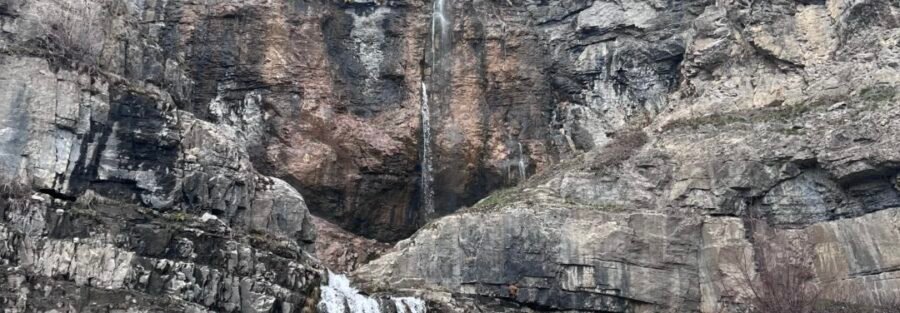
Stewart Falls is a 200-foot two-tiered waterfall in the Mount Timpanogos Wilderness, accessible from the Aspen Grove Trailhead on the Alpine Loop Scenic Byway. The 3.5-mile roundtrip with 650 feet of gain makes it one of the more accessible significant waterfalls in the Wasatch Mountains, and the setting under Mount Timpanogos gives it a mountain backdrop that most shorter waterfall hikes don’t have. Stewart Falls sits in the Mount Timpanogos Wilderness alongside the Mount Timpanogos Trail (13.9 miles / 4,875 feet gain) and several other serious routes from the Aspen Grove Trailhead. Stewart Falls is the accessible option in a cluster that gets much harder from there. The Aspen Grove parking area serves both the 3.5-mile waterfall hike and the 13.9-mile summit route, which says something about the range of commitment that trailhead offers.
Quick Facts
| Trail Name | Stewart Falls Trail |
| Location | Mount Timpanogos Wilderness, near Aspen Grove, Utah |
| Coordinates | 40.4042 N, 111.6054 W (Aspen Grove Trailhead) |
| Distance | 3.5 miles roundtrip |
| Elevation Gain | ~650 feet |
| Difficulty | Moderate |
| Time | 2-3 hours |
| Dogs Allowed | Yes, on leash |
| Fee | Parking fee at Aspen Grove; pay at self-serve kiosk |
| View on AllTrails | |
How to Get There
From I-15, take Exit 272 (800 North/Orem) and head east on 800 North, which becomes UT-189 into Provo Canyon. Follow UT-189 for about 7 miles, then turn left onto the Alpine Loop Scenic Byway (UT-92). Follow UT-92 approximately 6 miles to the Aspen Grove parking area on the left. The Stewart Falls trailhead is at the west end of the parking lot. From Salt Lake City, plan about 50-60 minutes. From Provo, about 25-30 minutes. The Alpine Loop Scenic Byway is itself worth the unhurried approach: the byway climbs from Provo Canyon through aspen groves and delivers views of Timpanogos’ east face that change as you gain elevation on the road. UT-92 (Alpine Loop) closes approximately November 1st and reopens around Memorial Day weekend depending on snowpack. The Stewart Falls Trailhead at Aspen Grove is inaccessible when the road is closed. Check USFS road status before any visit between October and June.
Parking Information
The Aspen Grove parking area is a large lot that serves the Stewart Falls trail, the Mount Timpanogos Trail, and other routes from this trailhead cluster. A parking fee applies; pay at the self-serve kiosk at the lot entrance. The lot fills quickly on summer and early-fall weekends. Arrive before 8 a.m. on peak days. Restrooms are available at the trailhead. 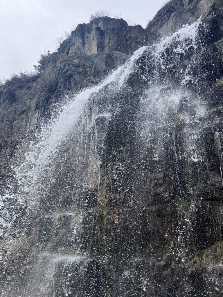
Cell Service and Navigation
Cell coverage is limited on UT-92 past the Provo Canyon junction and at the Aspen Grove trailhead. Download AllTrails offline before leaving the valley. The Stewart Falls trail is well-marked and straightforward with no route-finding required. Navigation isn’t the challenge; knowing you’re on the Stewart Falls trail rather than the Timpanogos Trail is the main thing to confirm at the trailhead junction.
What to Expect on the Stewart Falls Trail
The Alpine Approach
The trail from the Aspen Grove parking area moves through dense aspen forest on a well-maintained path. The aspen groves above the parking area are among the more mature and dense stands accessible from a short hike in the Wasatch, and the light through the canopy in morning hours is worth the early arrival. Small stream crossings and meadow sections with wildflowers through July characterize the middle portions of the approach. Mount Timpanogos is visible above the trail as you approach the falls, its north face and the distinctive Timp silhouette framing the upper canyon. For anyone who has hiked or plans to hike the full Timpanogos summit, Stewart Falls gives a ground-level preview of the mountain’s scale before the full commitment of the summit route.
Stewart Falls
Stewart Falls drops approximately 200 feet in two tiers over the cliff face, with the upper tier narrower and the lower tier spreading wider as it falls to the pool at the base. The two-tiered structure creates visual interest that a single-drop fall doesn’t have: the transition between tiers and the way the water changes character between the upper and lower sections. The base of the falls is shaded and cool from the spray, and the surrounding rock and vegetation creates a contained, enclosed atmosphere that’s different from the open approach trail. The volume is highest in late May and June from snowmelt off Timpanogos above; by late summer the flow is reduced but the setting remains worth visiting. For photography: the falls face roughly east and catch morning light best. Wide-angle for the full two-tiered cascade and the cliff face behind it, mid-range for the water and rock texture, a tripod for slow-shutter work to render the cascade as smooth rather than frozen. The aspen approach in fall color with the Timpanogos backdrop is the premium photography window for this trail. 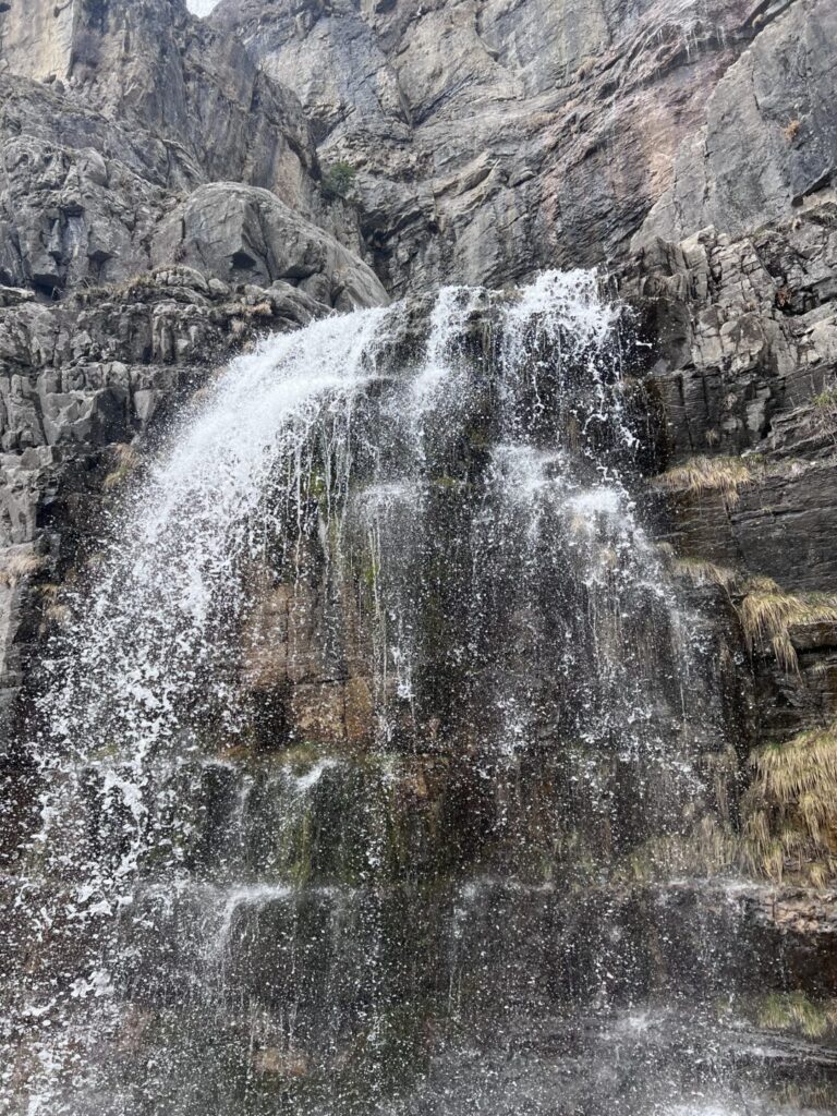
Trail Difficulty and Length
Moderate is accurate: the trail gains elevation steadily with some rocky sections near the falls, but the distance is manageable for most hikers including families with older children. Budget 2-3 hours for the roundtrip with time at the falls.
Dog Friendly?
Yes. Mount Timpanogos Wilderness allows leashed dogs. The aspen and meadow sections are comfortable for most dogs. The rocky terrain near the falls requires dogs to be confident on uneven ground with some water splash. Keep dogs leashed at all times and away from the slippery rock surfaces near the base pool.
What to Bring
Water: 2 liters for a moderate 3.5-mile hike in mountain terrain. Layers for the falls base where the spray creates a cool microclimate even on warm days. Sun protection for the open meadow sections. Comfortable trail shoes or hiking boots. For photography: wide-angle and mid-range, tripod for falls work, timing for the morning light window. Fall visits add the aspen color component; mid-September is the early edge of fall color in these aspen groves. 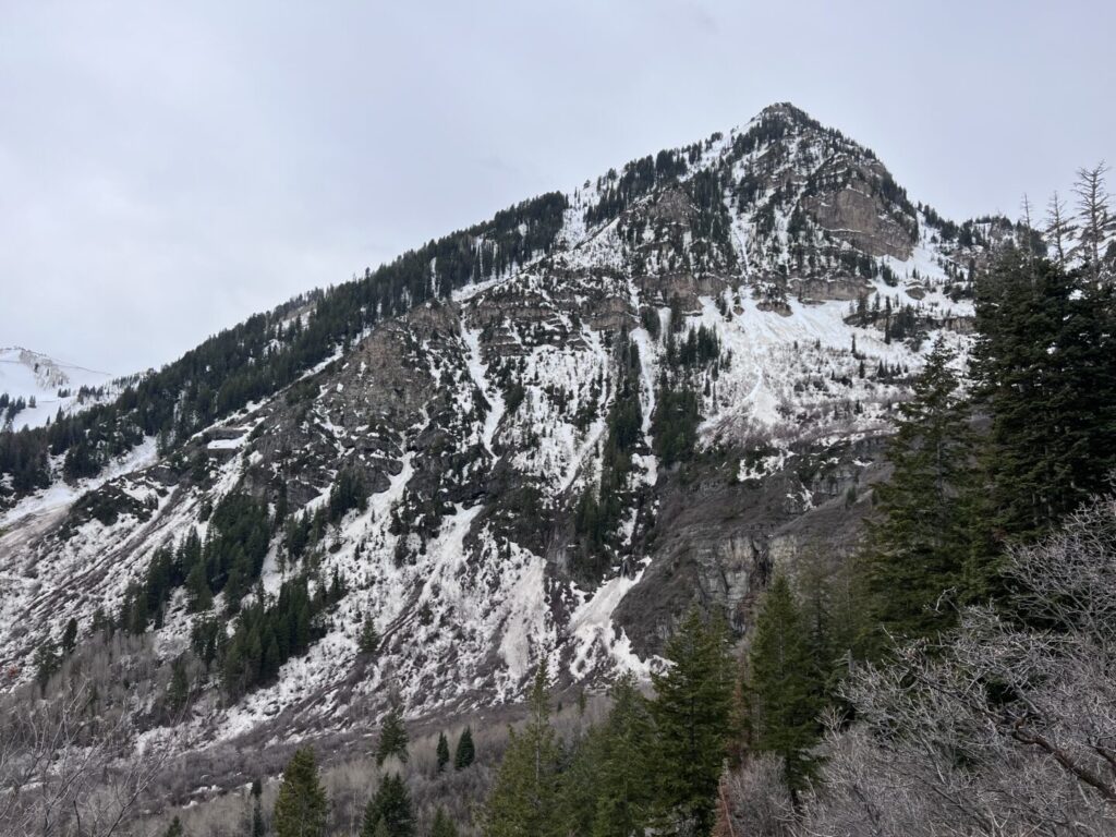
Best Time to Hike Stewart Falls
Late May through October when UT-92 is open. Peak flow is in late May and June from Timpanogos snowmelt. July and August are the busiest months and the Aspen Grove lot can be full by 8 a.m. on weekends. Arrive early or plan a weekday visit in summer. September and early October are the best overall months. The aspen groves above the parking area and on the approach trail begin their color change in mid-September, and by the last week of September the fall color is typically at peak in this elevation zone. The combination of fall color, cooler temperatures, and reduced crowds makes late September the premium Stewart Falls visit window. Winter access requires backcountry travel from below the UT-92 closure point and is not practical for a day trip to the falls. Plan visits within the road-open window.
Rules and Regulations
Leave No Trace principles apply throughout the Mount Timpanogos Wilderness. Stay on designated trails. No swimming in the falls pool. Pack out all trash. Parking fee required at Aspen Grove. Dogs on leash. No fires in the Wilderness area.
Where to Stay Near Provo Canyon
Sundance Mountain Resort on UT-92 about 3 miles from the Aspen Grove trailhead is the closest lodging option in the canyon itself. Provo and Orem, 25-30 minutes west on UT-189 and I-15, have full city lodging infrastructure. For points travelers, check available Marriott Bonvoy properties in Provo, IHG Rewards hotels in Provo, and Hilton Honors options in Provo.
Camping Nearby
Aspen Grove Campground is adjacent to the trailhead parking area and is the obvious base for an early start on Stewart Falls or the Timpanogos summit route. Reservations through recreation.gov, fills quickly for summer weekends. American Fork Canyon campgrounds on UT-92 west of Aspen Grove are additional options on the Alpine Loop.
Nearby Adventures
The Mount Timpanogos Trail from Aspen Grove is 13.9 miles / 4,875 feet of gain to the full summit, one of the most iconic hard hikes in the Wasatch. Stewart Falls as a reconnaissance trip before committing to the full summit route is a natural progression. Roberts Horn Loop (10.9 miles / 4,288 ft) and Elk Point (10.4 miles / 3,937 ft) also leave from Aspen Grove, both serious hard routes. Aspen Grove as a trailhead cluster serves hikers across a wide difficulty range with Stewart Falls at the accessible end. Bridal Veil Falls in lower Provo Canyon (607 feet, 1.5 miles) is the other major Provo Canyon waterfall, accessible without the Alpine Loop drive. Together with Stewart Falls, they define the two primary waterfall destinations accessible from Provo Canyon.
Plan This Hike
AllTrails has Stewart Falls mapped with offline capability, condition reports, and the distinction between the Stewart Falls trail and the Timpanogos summit trail from the same parking area. Download before you lose signal on UT-92. Plan your hike on AllTrails and pull the offline map while you’ve got signal in Provo Canyon.
Chase the Quiet
The Aspen Grove trailhead has two trails on the board: one that goes 3.5 miles to a 200-foot waterfall, and one that goes 13.9 miles to the summit of one of Utah’s most iconic peaks. The parking lot serves both. The fall color in the aspen groves above the lot comes in mid-September and lasts about two weeks before the leaves drop. That window, on a weekday morning, with the waterfall trail rather than the summit trail on the agenda, is one of the better two-hour Wasatch Mountain investments available from the Utah Valley.
Support the Adventure
To make your walls less boring, check out my photography portfolio and bring a piece of the wild and my story into your home. If you’d like to fuel future adventures, you can donate a coffee on Ko-Fi. Every cup keeps me chasing sunrises and stories. When you shop using my affiliate links, every click helps support this blog at no extra cost to you. It’s a small way to keep Unicorn Adventure alive and kicking while I keep exploring. Subscribe to my mailing list for future updates, new stories, and behind-the-scenes adventures. Stay connected with me on Instagram and Facebook for more photos and daily inspiration. Thanks for being part of the journey, Unicorn Squadron!

Theo Maynard is a landscape photographer and adventure blogger based in Salt Lake City. He chases remote desert and mountain light across the American West, documents it all solo, and shares the journey through Unicorn Adventure. He’s on the autism spectrum, and that’s not a footnote, it’s the whole story. He creates to inspire others to get outside, chase what lights them up, and live their best possible life. Unapologetically himself.