Ritter Island sits in the Snake River at Thousand Springs State Park in southern Idaho, about 30 miles west of Twin Falls. The 1.8-mile loop trail circles the island past natural springs, a waterfall, historic farm structures from the early 20th century, and continuous Snake River views. The terrain is flat, the path is maintained, and the experience is genuinely restorative in the way that moving water and green vegetation do for people who spend most of their hiking time in the high desert of Utah and the Wasatch Front. Two trails sit on Ritter Island: the 1.8-mile loop covered here and the 0.5-mile Minnie Miller Springs access, both reached from the same parking area.
Quick Facts
| Trail Name | Ritter Island Loop |
| Location | Thousand Springs State Park, near Hagerman, Idaho |
| Coordinates | 42.7438° N, 114.8446° W |
| Distance | 1.8 miles (loop) |
| Elevation Gain | 29 feet |
| Difficulty | Easy |
| Time | 45-75 minutes |
| Dogs Allowed | Yes, on leash |
| Fee | $7 per vehicle; Idaho State Parks Passport ($10/year) covers all Idaho state parks |
| AllTrails | View on AllTrails |
How to Get There
From Twin Falls, Idaho, take I-84 west and exit at Exit 141 for Wendell/Buhl. Head south on Highway 30 toward Buhl. Turn onto 1500 E Road and follow the signs to Thousand Springs State Park, then to Ritter Island. The drive from Twin Falls takes about 30-35 minutes. The access road to Ritter Island is paved and clearly marked. From Boise, take I-84 east to the Hagerman / Thousand Springs exits, about 90 minutes. Thousand Springs State Park is on US-30 along the Snake River canyon between Hagerman and Buhl. From Salt Lake City, plan about 3.5-4 hours north on I-15 and I-84.
Parking and Entry Information
Parking is available at the trailhead near the Ritter Island entrance. The parking area is adequate for most visit volumes. The $7 entry fee is paid at the park entrance. The Idaho State Parks Passport at $10 annually covers entry to all Idaho state parks and is worth purchasing if you’re visiting more than one Idaho state park in a year. Cash and card both accepted at most park kiosks. 
Cell Service and Navigation
Cell coverage is variable in the Snake River canyon area but generally functional in the Hagerman corridor. Download AllTrails offline before arriving. The loop trail is well-marked and simple to follow; navigation is not a challenge on this route.
What to Expect on the Ritter Island Loop
The Springs and Waterfall
Thousand Springs takes its name from the springs that emerge from the canyon walls above the Snake River, water that percolated through the Snake River Plain aquifer for decades before emerging here. The springs at Ritter Island are visible along the trail as natural outflows from the canyon walls and the island’s perimeter. The waterfall visible from the trail is fed by these springs. Moving water is the consistent sensory backdrop throughout the loop, which changes the character of the hike from most southern Idaho terrain.
Historic Farm Structures
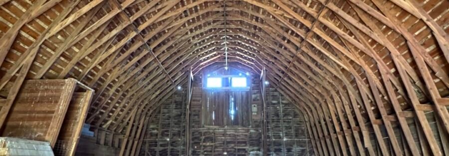
Ritter Island was developed as a model farm in the early 20th century by Harriet Ritter and her family, using the spring water for irrigation. Several historic farm structures remain on the island as preserved elements of the Idaho state park property. The combination of the working spring-fed farm history and the natural spring landscape makes Ritter Island a more layered stop than a typical short nature walk.
The Snake River Views
The loop circles the island with the Snake River visible from multiple vantage points. The canyon walls above the opposite bank, the spring water feeding into the river, and the vegetation density on the island compared to the surrounding high desert plain create a visual contrast that makes Ritter Island feel like a different environment entirely from the arid landscape you drove through to reach it. For photography: the waterfalls and springs are the primary subjects. Early morning provides the most consistent soft light in the canyon and the best conditions for waterfall long exposures without harsh shadows. The farm structures alongside the spring landscape offer a historical context angle. Wide-angle for the canyon wall context, mid-range for the waterfall and spring detail.
Minnie Miller Springs Trail
The Minnie Miller Springs access is a separate short 0.5-mile walk from the loop that leads to the spring outflow: one of the named spring sources on the island. Worth adding to the Ritter Island visit as a companion to the main loop, adding minimal distance and time while visiting a specific named feature. Total distance with both trails is approximately 2.3 miles. 
Trail Difficulty and Length
Easy is accurate without qualification. The flat maintained path makes this accessible to all visitors regardless of fitness level. Budget 45-75 minutes for the loop at a comfortable walking pace with stops at the springs and farm structures.
Dog Friendly?
Yes. Dogs are welcome on leash throughout the Ritter Island trails. The island terrain is comfortable for dogs. The spring water access points and river proximity are appreciated by most dogs, but keep dogs on leash near the water. Swimming in the springs and the river is prohibited for visitors; the same should apply to dogs to preserve water quality. Bring drinking water for dogs; the spring water is not safe for dogs to drink without treatment.
What to Bring
Water: the spring water is not potable without treatment. Bring your own supply. Comfortable walking shoes; no special footwear required. Sun protection for the open sections between the canyon and the island vegetation. A camera for the waterfall and spring photography. Benches and picnic areas are available along the trail for anyone who wants to sit with the moving water.
Best Time to Visit
Late spring through early fall is the most comfortable window. May and June offer the highest spring water flows and the best waterfall volume. Summer visits work with an early morning start to avoid the midday heat in the Snake River canyon. Fall brings cooler temperatures and the changing vegetation on the island. Winter is possible with lighter crowds; the springs continue to flow year-round, though ice may be present on the trail in cold snaps.
Rules and Regulations
Idaho State Parks rules apply. Stay on designated trails. Swimming in the springs and Snake River is prohibited. Do not disturb the historic structures. Pack out all trash; no trash bins on the trail. Dogs on leash. $7 entry fee or Idaho State Parks Passport.
Where to Stay Near Thousand Springs
Hagerman, Idaho, is the nearest town with limited lodging and dining. Twin Falls, about 30-35 miles east, has full chain hotel infrastructure. For points travelers, check available Marriott Bonvoy properties, IHG Rewards hotels, and Hilton Honors options in Twin Falls.
Camping Nearby
Thousand Springs State Park has developed camping available at some of its units. The Hagerman area has developed campgrounds and RV parks along US-30 near the Snake River. The Bruneau Dunes State Park, about 60 miles northwest, has developed camping in a distinctive sand dune environment for anyone doing a multi-day Snake River Plain adventure.
Nearby Adventures
The full Twin Falls / Thousand Springs cluster: Snake River Canyon Rim Trail (12.3 miles / 872 ft), Malad Gorge West Rim (2.0 miles / 262 ft), Box Canyon Springs Trail (4.3 miles / 396 ft), Auger Falls Park Loop (4.0 miles / 376 ft), Lemmon Falls, Niagara Springs, and Minnie Miller Springs on Ritter Island itself. The Thousand Springs SP cluster alone represents a full day or more of hiking across multiple distinct Snake River canyon environments. Hagerman Fossil Beds National Monument is adjacent to the Hagerman area: NPS land protecting one of the most significant vertebrate fossil sites in North America, including the type specimens of the Hagerman Horse (Equus simplicidens), a Pliocene-era horse. The visitor center and trail system are worth time for anyone interested in paleontology or natural history. Twin Falls’ Perrine Bridge (486 feet above the Snake River) and the Shoshone Falls (taller than Niagara at peak flow) are the most iconic Snake River canyon landmarks in the area, both accessible from the Snake River Canyon Rim Trail.
Plan This Hike
AllTrails has the Ritter Island Loop mapped with offline capability and current condition reports. Plan your visit on AllTrails and download before arriving.
Chase the Quiet
The Snake River Plain aquifer is one of the largest freshwater aquifers in the United States. The springs at Thousand Springs are where decades of that underground water emerge into daylight. Walking around Ritter Island, you’re essentially walking the perimeter of one of the aquifer’s primary surface exits. The moving water, the greenery, and the canyon walls that frame the island from above are all downstream consequences of that slow underground movement. That’s what makes Thousand Springs feel different from most Snake River landscape: the water comes from somewhere specific, and it’s been traveling toward this spot for a long time.
Support the Adventure
To make your walls less boring, check out my photography portfolio and bring a piece of the wild and my story into your home. If you’d like to fuel future adventures, you can donate a coffee on Ko-Fi. Every cup keeps me chasing sunrises and stories. When you shop using my affiliate links, every click helps support this blog at no extra cost to you. It’s a small way to keep Unicorn Adventure alive and kicking while I keep exploring. Subscribe to my mailing list for future updates, new stories, and behind-the-scenes adventures. Stay connected with me on Instagram and Facebook for more photos and daily inspiration. Thanks for being part of the journey, Unicorn Squadron!

Theo Maynard is a landscape photographer and adventure blogger based in Salt Lake City. He chases remote desert and mountain light across the American West, documents it all solo, and shares the journey through Unicorn Adventure. He’s on the autism spectrum, and that’s not a footnote, it’s the whole story. He creates to inspire others to get outside, chase what lights them up, and live their best possible life. Unapologetically himself.