

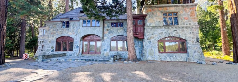
Hiking the Vikingsholm Trail in Emerald Bay State Park: Tahoe’s Most Scenic Descent The Vikingsholm Trail is a mile and a quarter straight down, dropping 500 feet from the Highway 89 overlook parking area to the shore of Emerald Bay. What’s at the bottom: the most turquoise water in Lake Tahoe, a 1920s Scandinavian-style mansion built by a wealthy socialite who wanted her own private estate on the bay, a seasonal waterfall, and direct views of Fannette Island, the only island in the lake. Then you hike back up. That’s the whole trail, and it earns every bit of its reputation. Emerald Bay is one of the places I return to specifically for the visual quality of the water. The bay’s color at midday, that specific turquoise where the shallow granite bottom and the depth combine, is unlike anywhere else in the Tahoe Basin. The trail gives you 2.5 miles round trip and the full picture from the descent through the return climb.
Quick Facts
| Trail Name | Vikingsholm Trail |
| Location | Emerald Bay State Park, South Lake Tahoe, California |
| Coordinates | 38.9543, -120.1104 (Emerald Bay parking area) |
| Distance | 2.5 miles (out and back) |
| Elevation Gain | 500 ft |
| Difficulty | Moderate |
| Time | 1.5–2.5 hours |
| Dogs Allowed | No. Dogs not permitted in Emerald Bay State Park. |
| Fee | ~$10 day-use parking fee; verify current rate at park entrance |
| Plan This Hike on AllTrails | |
How to Get There
Emerald Bay State Park is on Highway 89, about 12 miles northwest of South Lake Tahoe on the western shore. Drive north from South Lake Tahoe on US-50 and turn left on Highway 89. Follow it along the lake shoreline past several Emerald Bay viewpoints until you see the signed parking area for the Vikingsholm Trail on the left. The overlook at the parking area gives you the first bay view before you even start. From the north shore, follow Highway 89 south through Tahoe City and along the western shoreline.
Parking Information
The Emerald Bay State Park parking area at the Vikingsholm Trailhead charges a day-use fee, around $10 per vehicle. Verify the current rate at the entrance. The lot fills fast in summer, particularly on weekends. Arrive before 9 a.m. to secure a spot. Highway 89 shoulder parking is occasionally available but the road is narrow and pedestrian access to the lot from the shoulder is awkward. Midweek visits are significantly less competitive for parking. 
Cell Service and Navigation
Cell coverage is limited along the Highway 89 corridor near Emerald Bay. Signal drops in the canyon sections. Download the AllTrails map before leaving South Lake Tahoe. The Vikingsholm Trail is well-marked and impossible to lose, a single path descending to the bay and returning the same way. Navigation is not a challenge on this trail. The GPS track is more useful for timing the descent to the Vikingsholm tour schedule if you plan to do a guided mansion tour at the bottom.
What to Expect on the Vikingsholm Trail
The Descent
The trail drops from the parking area overlook to the bay shore in a series of wide, well-maintained switchbacks through pine and cedar forest. The grade is consistent and the surface is a mix of packed dirt and granite slabs with some loose rock. Emerald Bay becomes increasingly visible through the trees as you descend, the turquoise water deepening in color as the angle changes. The descent takes 20 to 30 minutes at a relaxed pace. The view improves with every hundred feet of elevation you give up.
Vikingsholm
Vikingsholm sits at the bay shore at the base of the trail, a 38-room Scandinavian-style mansion built in 1929 by Lora Josephine Knight. It is one of the finest examples of Scandinavian architecture in North America, designed to resemble an ancient Norse fortress and built with sod roofs and hand-carved details specific to different Scandinavian regional traditions. The exterior is worth the descent on its own. Guided tours of the interior are available during summer months for a small additional fee. The docents are good and the interior detail is worth the extra stop if you have the time.
The Bay and Fannette Island
From the Vikingsholm shore, Emerald Bay spreads before you with Fannette Island visible in the middle of the bay. Fannette is the only island in Lake Tahoe, a small granite outcrop with the ruins of a stone tea house built by Lora Knight in the 1920s. The water around the island is the most vivid turquoise in the basin, a product of the shallow granite bottom, the depth transitions at the island base, and the bay’s protected position from the main lake. The waterfall visible on the north face of the bay above Vikingsholm is seasonal, strongest in spring and early summer when snowmelt runs through the drainage. By late summer it often reduces to a trickle or stops entirely. 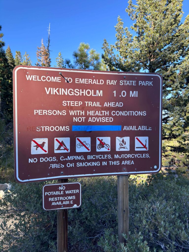
Trail Difficulty and Length
The Vikingsholm Trail is 2.5 miles out and back with 500 feet of elevation change. The descent is easy. The return climb is the moderate section and what most people underestimate. Gaining 500 feet after spending time at the bay in summer heat is more demanding than it sounds. Bring more water than you expect to need. Sturdy shoes with grip handle the granite sections on the descent. Trekking poles help on the return climb. Allow extra time if hiking with children or at altitude.
Dog Friendly?
Dogs are not allowed on the Vikingsholm Trail or anywhere in Emerald Bay State Park. California State Parks policy prohibits pets on trails throughout the park system. If you’re traveling with a dog, plan for them to stay in the vehicle or at a dog-friendly area while you hike. The Cascade Falls Trail at Bayview Campground a short drive away is dog-friendly and gives you the Emerald Bay corridor experience from a different angle. 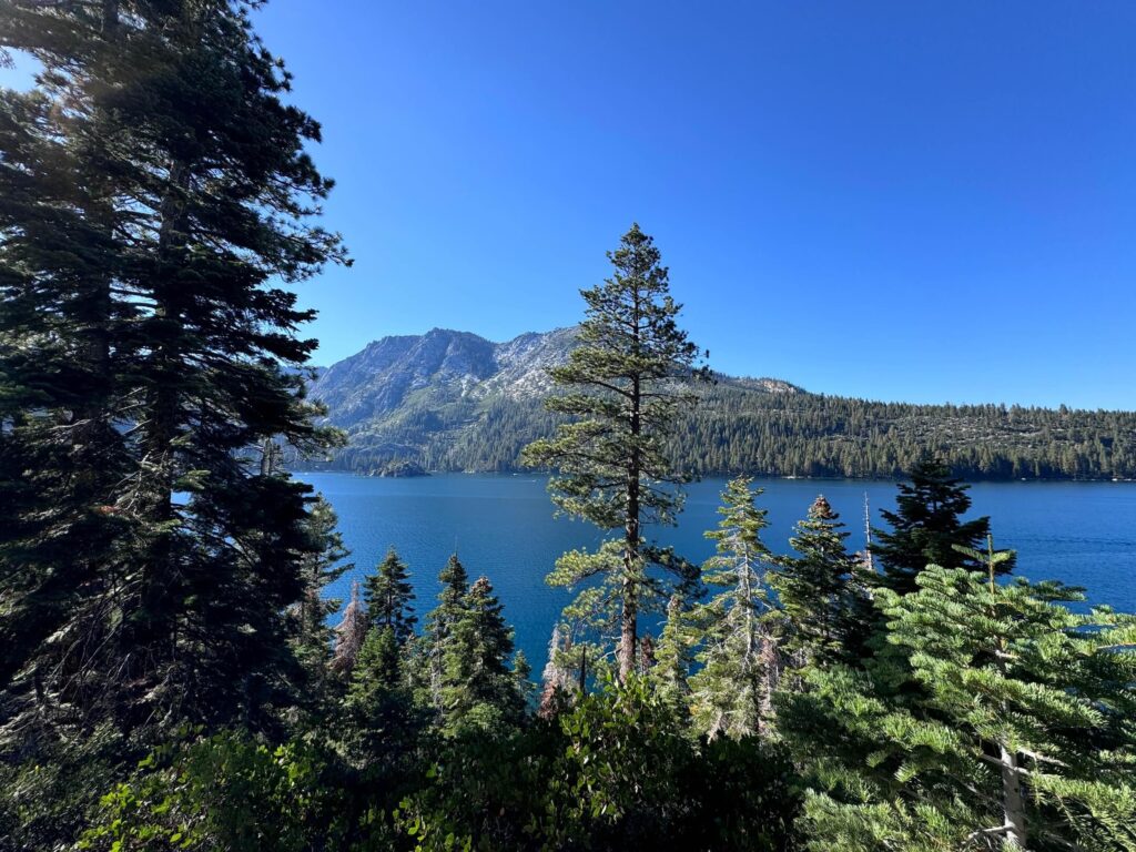
What to Bring
At least 1.5 liters of water per person. The return climb earns it. Sunscreen and a hat for the exposed bay shore sections. Sturdy shoes for the granite descent. Trekking poles for the climb back. A camera. The bay color from the Vikingsholm shore at midday, when the sun is high and the water is brightest, is the primary photography moment. A wide lens for the bay panorama, a telephoto for Fannette Island detail. If you plan to do the Vikingsholm mansion tour, check current tour times online before you leave and budget an additional 45 minutes at the bottom.
Best Time to Hike the Vikingsholm Trail
Late spring through early fall is the accessible window. The waterfall above the bay is strongest in May and June when snowmelt is at peak. Summer brings the most visitors and the hottest conditions for the return climb. Start before 9 a.m. on summer days. The bay color is at its best in full midday sun when the angle brings out the turquoise most intensely. Sunset from the parking area overlook is one of the more photographed views on the western shore and worth timing even if you don’t descend. Highway 89 through Emerald Bay closes seasonally in winter, typically November through May, check current road status before planning a visit outside the summer window. 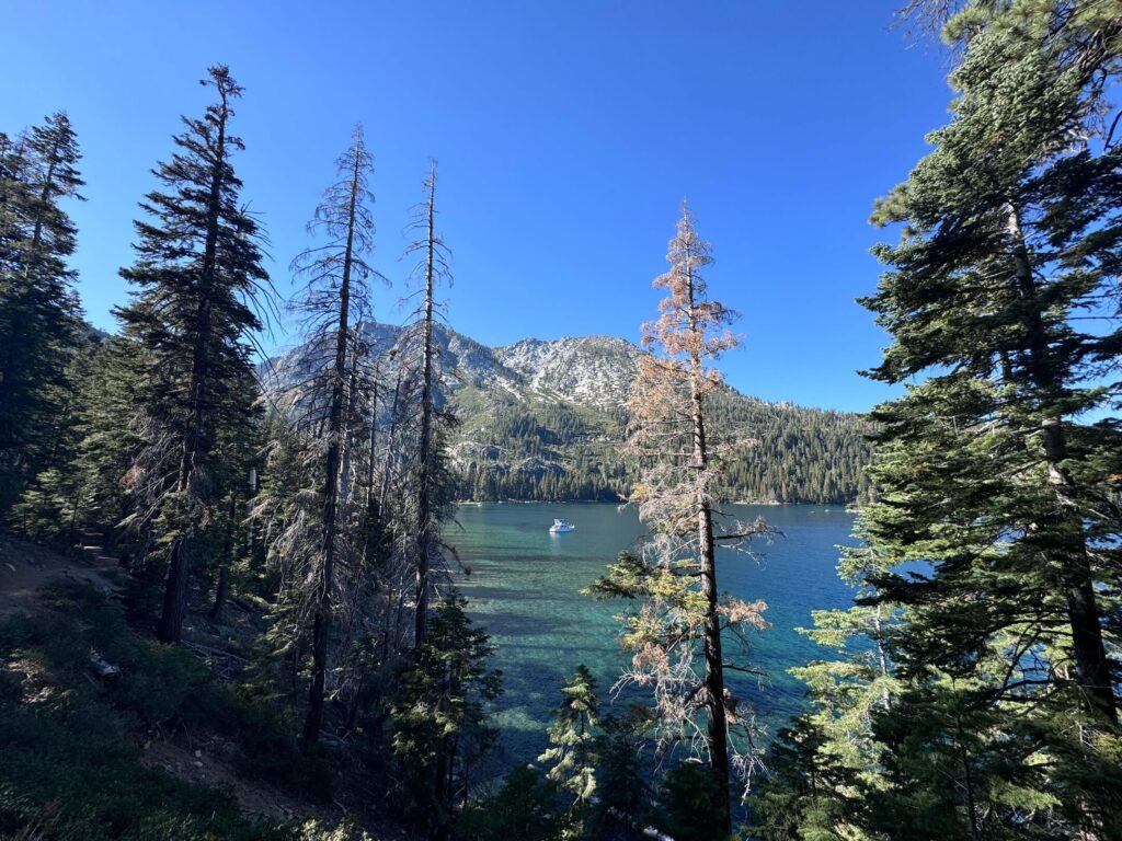
Rules and Regulations
The Vikingsholm Trail is within Emerald Bay State Park under California State Parks management. Stay on designated trails. No dogs. No campfires. No camping directly in Emerald Bay without a boat-in permit through California State Parks. Vikingsholm is a protected historic structure. Do not touch or climb on the exterior. Interior tours are guided only. Pack out all waste. Leave No Trace throughout. Day-use parking fee required.
Where to Stay Near South Lake Tahoe
South Lake Tahoe has the broadest lodging options in the basin, about 12 miles from Emerald Bay. Marriott Bonvoy covers properties in the South Lake Tahoe area. Hilton Honors has options in the South Shore corridor. Emerald Bay State Park has boat-in camping on the bay shore accessible from the water, one of the more unusual camping options in California State Parks, worth researching if you have kayak or boat access.
Camping Nearby
Emerald Bay State Park has boat-in campsites on the bay shore, bookable through ReserveCalifornia. Bayview Campground on Highway 89 a short drive from Emerald Bay has developed sites with trailhead access to Cascade Falls and Desolation Wilderness. Camp Richardson on the South Shore is the broadest developed campground in the area with tent and RV sites. D.L. Bliss State Park immediately north of Emerald Bay on Highway 89 has developed camping with beach access.
Nearby Adventures
The Cascade Falls Trail at Bayview Campground is 1.5 miles and 200 feet of gain to a seasonal waterfall above Cascade Lake, dog-friendly, and accessible from the same Highway 89 corridor. The Granite Lake and Maggie’s Peak hike from Bayview continues into Desolation Wilderness at 4 miles and 1,800 feet of gain for the best high-elevation Lake Tahoe summit view in the basin. Eagle Lake Trail from the Eagle Falls Trailhead just up Highway 89 from Vikingsholm is a popular under-a-mile alpine lake hike. Kayaking Emerald Bay from the boat launch at the bay shore is the best on-water experience of the same landscape. The Sand Harbor Clear Kayak Tour on the Nevada north shore, about 35 minutes away, is the other water experience worth combining with an Emerald Bay visit.
Plan This Hike
AllTrails has Vikingsholm Trail documented with GPS track and current condition notes including parking situation reports from recent visitors. Download the offline map before leaving South Lake Tahoe. If you plan to tour Vikingsholm, check current tour schedules and fees through California State Parks before your visit. Plan your hike on AllTrails here.
Chase the Quiet
The Vikingsholm shore at 8 a.m. before the summer boat traffic starts. The bay completely still, Emerald Bay’s turquoise reflecting the granite cliffs above, Fannette Island in the middle of the frame. The mansion at your back. Nobody else on the trail yet. That’s the version of one of the most visited spots in Lake Tahoe that most visitors never find. The trail opens at first light and the parking lot fills by 10 a.m. The math on showing up early is straightforward.
Support the Adventure
To make your walls less boring, check out my photography portfolio and bring a piece of the wild and my story into your home. If you’d like to fuel future adventures, you can donate a coffee on Ko-Fi. Every cup keeps me chasing sunrises and stories. When you shop using my affiliate links, every click helps support this blog at no extra cost to you. It’s a small way to keep Unicorn Adventure alive and kicking while I keep exploring. Subscribe to my mailing list for future updates, new stories, and behind-the-scenes adventures. Stay connected with me on Instagram and Facebook for more photos and daily inspiration. Thanks for being part of the journey, Unicorn Squadron!

Theo Maynard is a landscape photographer and adventure blogger based in Salt Lake City. He chases remote desert and mountain light across the American West, documents it all solo, and shares the journey through Unicorn Adventure. He’s on the autism spectrum, and that’s not a footnote, it’s the whole story. He creates to inspire others to get outside, chase what lights them up, and live their best possible life. Unapologetically himself.