

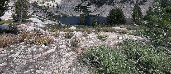
Elko, Nevada, sits on I-80 and gets treated like a gas stop. It isn’t. Within 30-50 miles of downtown, the Ruby Mountains and East Humboldt Range hold four legitimate alpine hiking destinations, including granite cirque lakes, wildflower meadows, and creek canyon terrain that has nothing to do with the Great Basin flats you drove through to get here. These trails are well-maintained, largely uncrowded by western standards, and accessible to most hikers without permits, entry fees, or timed entry windows. This guide covers four Elko-area hikes: Island Lake, Liberty Lake, and Thomas Creek in the Ruby Mountains, and Smith Lake via Angel Lake in the East Humboldt Range near Wells. Planning note: all four trails are on Humboldt-Toiyabe National Forest land. No America the Beautiful Pass required, no timed entry. Angel Lake Road to the Smith Lake trailhead may charge a day use fee seasonally at the campground parking area. Check current rates before your visit.
1. Island Lake Trail
| Distance | 3.5 miles roundtrip |
| Elevation Gain | ~900 feet |
| Difficulty | Moderate |
| Dogs Allowed | Yes, on leash |
| Best Time | Late June through September; morning for best lake reflection |
The shortest and most accessible of the Lamoille Canyon lakes. The trail shares a trailhead with Liberty Lake at the end of Lamoille Canyon Road and branches at a signed junction roughly halfway in. Island Lake sits in a granite cirque at the back of the canyon, enclosed on three sides with a more intimate scale than Liberty Lake. The approach is consistent moderate hiking with no talus scrambling or steep final push. The lake reflection in morning light is excellent. Full guide: Island Lake Trail 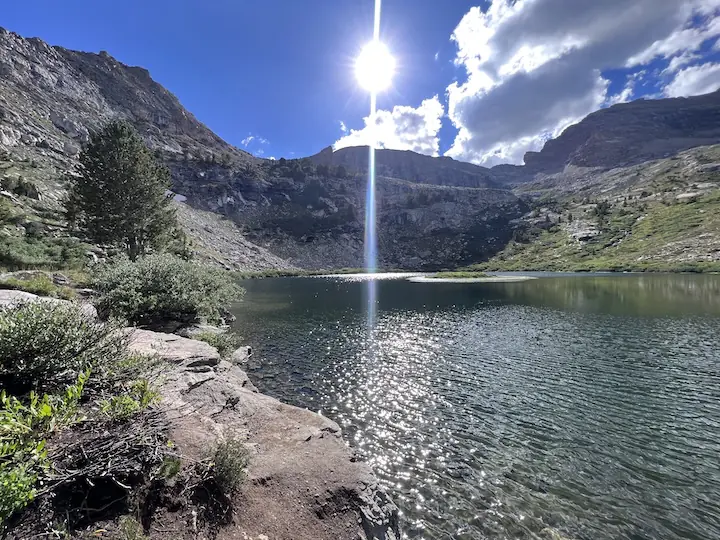
2. Liberty Lake Trail
| Distance | 6.0 miles roundtrip |
| Elevation Gain | ~1,500 feet |
| Difficulty | Moderate |
| Dogs Allowed | Yes, on leash |
| Best Time | Late June through September; morning for cirque light; September for fall color + reduced crowds |
The bigger, harder, more exposed Ruby Mountains lake hike from the same Lamoille Canyon trailhead. Liberty Lake sits in a larger granite cirque at nearly 10,000 feet, reached by 6 miles roundtrip with 1,500 feet of gain including a steep talus push to the lake rim. The views from the rim and the lake basin are expansive rather than enclosed. Snow lingers on the upper sections into late June or early July most years. The full day commitment here is real and worth it. Full guide: Liberty Lake Trail 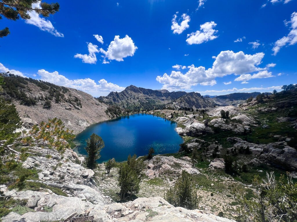
3. Thomas Creek Trail
| Distance | 4.5 miles roundtrip |
| Elevation Gain | ~1,200 feet |
| Difficulty | Moderate |
| Dogs Allowed | Yes, on leash |
| Best Time | Late May through September; early season option when Lamoille routes still carry snow; September for aspen color |
The creek canyon alternative to the Lamoille Canyon lake routes. Thomas Creek Trail accesses the Ruby Mountains via a separate approach on Thomas Creek Road off NV-227, arriving at a quieter trailhead with lower traffic than the Lamoille Canyon end-of-road lot. The trail follows Thomas Creek upstream through aspen and conifer forest, across open meadows, and into the upper canyon with Ruby Mountain views. The creek is present throughout the hike rather than only at the destination. Snow-free earlier in the season than the Lamoille Canyon routes due to the lower starting elevation. Full guide: Thomas Creek Trail 
4. Smith Lake via Angel Lake Trail
| Distance | 2.5 miles roundtrip |
| Elevation Gain | ~800 feet |
| Difficulty | Moderate |
| Dogs Allowed | Yes, on leash |
| Best Time | Late June through September; morning for Angel Lake reflection and Smith Lake cirque light |
The East Humboldt Range option, near Wells rather than Elko, but worth including in any Nevada mountain hiking itinerary. Angel Lake Road climbs 12 miles from I-80 Exit 352 to a drive-up alpine lake at 8,500 feet. The Smith Lake Trail starts at the Angel Lake parking area and climbs 800 feet in 1.25 miles to a higher, quieter cirque lake above. The talus section above Angel Lake is the technical crux. Two lakes in 2.5 miles roundtrip, and Angel Lake itself is worth the drive even without hiking to Smith Lake. Full guide: Smith Lake via Angel Lake Trail 
Choosing the Right Elko Area Hike
If you want the most accessible alpine lake with the least technical terrain, Island Lake is the answer. It’s the shortest, has no talus, and the cirque setting delivers a full alpine experience. If you want the biggest views and don’t mind a harder day, Liberty Lake is the correct choice. The additional gain and the talus push are rewarded with a lake basin and ridge views that outscale Island Lake. If you want lower traffic and a creek-canyon hiking experience rather than a lake destination, Thomas Creek delivers that. It’s also the best early-season option when the Lamoille Canyon routes are still snowed in. If you’re near Wells on I-80 and want the fastest entry point to a genuine alpine experience, Smith Lake via Angel Lake is the most accessible alpine two-lake hike in Nevada relative to the highway. Drive up to Angel Lake, hike to Smith Lake, be back on I-80 in four hours.
Planning Your Elko Area Hiking Days
All four trailheads require driving south from Elko on NV-227. Lamoille Canyon Road branches right before Lamoille for the Ruby Mountains routes. Thomas Creek Road branches left earlier on NV-227. Angel Lake Road near Wells is a separate approach from I-80 Exit 352, about 50 miles east of Elko. Cell service drops on NV-227 south of Elko and is absent at all four trailheads. Download AllTrails maps offline before leaving Elko or Wells. Plan your hike on AllTrails and pull offline maps with signal in town. No national park entry fees or timed entry reservations apply to any of these trails. They’re National Forest land and accessible without advance booking for day hiking. Afternoon thunderstorms build in the Ruby Mountains and East Humboldt Range in July and August. Start early and plan to be off exposed terrain by noon during storm season.
Chase the Quiet
Most people driving I-80 through Elko see the Ruby Mountains from the highway and don’t stop. The mountains are right there, visible to the south, and most people are going somewhere else. That’s fine. It keeps the trailheads manageable. These four hikes are for the people who turn south on NV-227 and find out what Nevada has been hiding behind its high desert reputation. The answer is granite. And alpine lakes. And creek canyons lined with aspens. And enough solitude that you remember what quiet actually sounds like.
Support the Adventure
To make your walls less boring, check out my photography portfolio and bring a piece of the wild and my story into your home. If you’d like to fuel future adventures, you can donate a coffee on Ko-Fi. Every cup keeps me chasing sunrises and stories. When you shop using my affiliate links, every click helps support this blog at no extra cost to you. It’s a small way to keep Unicorn Adventure alive and kicking while I keep exploring. Subscribe to my mailing list for future updates, new stories, and behind-the-scenes adventures. Stay connected with me on Instagram and Facebook for more photos and daily inspiration. Thanks for being part of the journey, Unicorn Squadron!

Theo Maynard is a landscape photographer and adventure blogger based in Salt Lake City. He chases remote desert and mountain light across the American West, documents it all solo, and shares the journey through Unicorn Adventure. He’s on the autism spectrum, and that’s not a footnote, it’s the whole story. He creates to inspire others to get outside, chase what lights them up, and live their best possible life. Unapologetically himself.