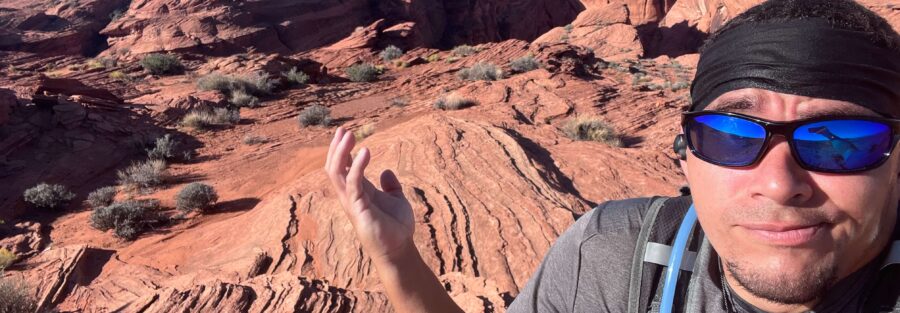
Horseshoe Bend gets the crowds. Nine Mile Draw Trail gets everyone else. They share a parking lot: the Horseshoe Bend trailhead doubles as the starting point for Nine Mile Draw, so on any given morning you can watch a stream of visitors head 0.75 miles to the famous overlook while the 4.5-mile desert route in the other direction goes largely uncrowded. Nine Mile Draw takes you through dry washes and open mesa terrain with views of the surrounding cliffs and the Vermilion Cliffs in the distance. It’s the same landscape, the same light, and a fraction of the foot traffic.
Quick Facts
|
Trail Name |
Nine Mile Draw Trail |
|
Location |
Glen Canyon National Recreation Area, near Page, Arizona |
|
Coordinates |
36.8770° N, 111.5039° W (shared with Horseshoe Bend Trailhead) |
|
Distance |
4.5 miles roundtrip |
|
Elevation Gain |
~700 feet |
|
Difficulty |
Moderate |
|
Time |
2.5-4 hours |
|
Dogs Allowed |
Yes, on leash |
|
Fee |
$15 parking fee (shared with Horseshoe Bend lot); America the Beautiful Pass accepted |
|
AllTrails |
How to Get There
From Page, Arizona, head south on US-89 for approximately 5 miles. Watch for the clearly marked Horseshoe Bend parking area turnoff on the right. The Nine Mile Draw Trail departs from the same trailhead area as Horseshoe Bend. At the trailhead junction, the Horseshoe Bend Trail goes one direction; Nine Mile Draw goes the other. The parking lot, the $15 fee, and the arrival logistics are identical to the Horseshoe Bend visit.
From Salt Lake City, Page is about 4.5-5 hours south via I-15 and US-89 through Kanab. From Las Vegas, about 4 hours northeast. From Flagstaff, about 2 hours north. From Grand Canyon South Rim, about 2.5 hours north.
Parking Information
The Horseshoe Bend parking lot serves both trails. The $15 parking fee applies; America the Beautiful Annual Pass accepted. The lot fills mid-morning during peak season. Arrive before 8 a.m. on busy days. Since the lot traffic is primarily Horseshoe Bend visitors, the early morning window works particularly well for Nine Mile Draw: you get a parking spot before the Horseshoe Bend crowds arrive and the Nine Mile Draw trail to yourself in the first light.
Cell Service and Navigation
Cell coverage is reasonable at the trailhead given the proximity to Page. Signal decreases as you move away from the highway on Nine Mile Draw. Download AllTrails offline before leaving Page. The trail follows dry washes and open terrain where the established path can be less obvious than in forested environments. GPS tracking is useful throughout the route to stay on the established trail in the sandy wash sections.
What to Expect on Nine Mile Draw Trail
The Trail Character
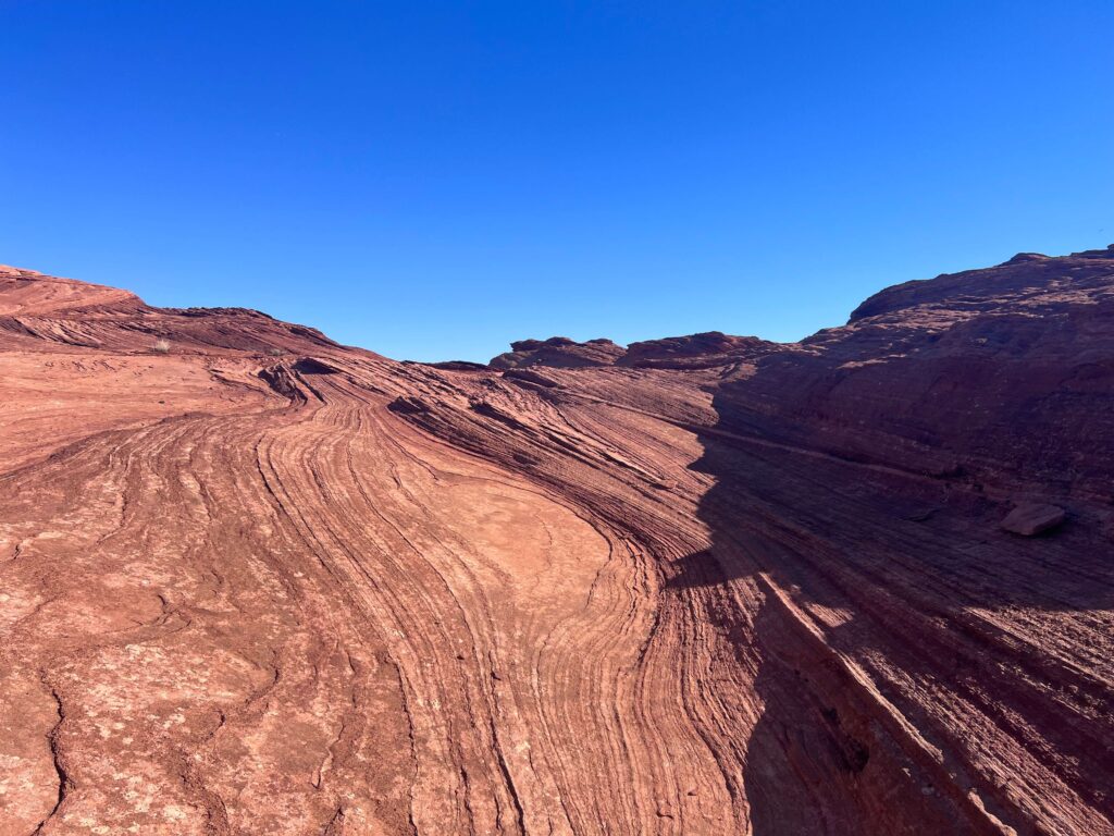
Nine Mile Draw is desert wash and mesa hiking: sandy dry washes, open plateau terrain, sagebrush, juniper, and the red-orange sandstone formations of the Glen Canyon area surrounding you. The trail surface varies between packed sand and loose sand in the wash sections, which makes the 4.5 miles feel slightly longer than the distance suggests. Sandy footing increases the effort per step compared to packed trail.
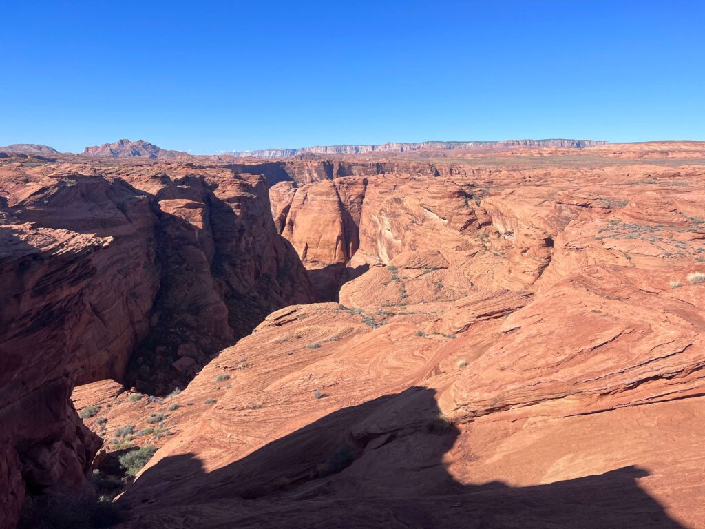
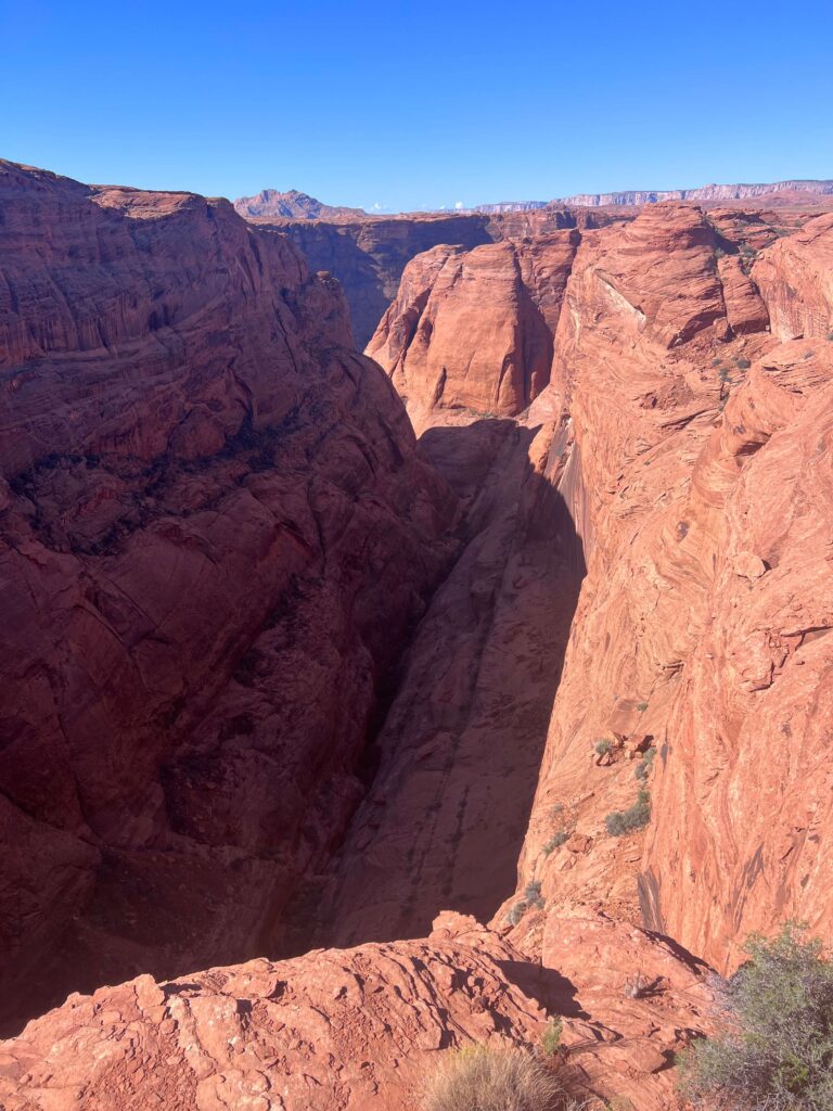
The views develop as you move deeper into the draw. The Vermilion Cliffs are visible in the distance to the northwest. The surrounding mesas and the cliff edges of the Page area are visible from the high points on the route. The trail is genuinely quiet: few hikers come here when Horseshoe Bend is a hundred yards in the other direction. That solitude is the trail’s specific value.
The Desert Environment
The Nine Mile Draw landscape is representative of the Navajo Sandstone and desert mesa environment of the Glen Canyon area. No shade except in the draws themselves where the canyon walls provide brief shadow. No water. The high desert heat is the primary trail variable: what feels like a moderate 4.5-mile hike in spring or fall becomes a serious undertaking at 105°F in July. Temperature management is the trail’s main challenge, not terrain or navigation.
For photography: the open mesa and wash terrain gives a different visual character from the famous overlook views at Horseshoe Bend. The desert texture, the sandstone formations, and the distant cliff walls are the subjects. Morning light on the canyon walls works well; mid-afternoon creates harsh shadows in the washes. Golden hour before sunset illuminates the sandstone warmly from the west.
Trail Difficulty and Length
The trail is 4.5 miles with 700 feet of gain. Moderate is accurate for the terrain and distance in comfortable conditions. The sandy trail surface adds effort and the desert heat can raise the effective difficulty significantly in summer. Budget 2.5-4 hours for the full roundtrip at a desert-appropriate pace, meaning deliberately slower than your normal trail pace with more frequent water stops.
Dog Friendly?
Yes. Dogs are welcome on leash. The desert terrain in summer is the primary dog consideration: no shade, sand that heats quickly, and significant distance from water. Bring at least a liter of water for dogs in addition to your own supply. Paw protection (booties or early morning timing) is worth considering in summer when the sand and rock surfaces reach temperatures that burn. Low foot traffic makes this a pleasant route for dogs that are well-behaved on leash in open terrain.
What to Bring
Water: minimum 3 liters for a 4.5-mile moderate desert hike. The desert environment dehydrates faster than mountain terrain at similar distances, and Nine Mile Draw has no water access on the route. More is better in summer. Carry enough water to abort the hike and walk back to the parking lot comfortably if conditions deteriorate.
Sun protection is mandatory: hat, sunscreen, long sleeves in summer. Early morning start is more important on this trail than on most; the desert heat builds fast after 9 a.m. in summer. Comfortable trail runners or hiking shoes for the sandy wash sections.
For photography: wide-angle for the mesa views and canyon wall frames, mid-range for the desert texture and sandstone detail, golden hour timing for the warmest light on the formations.
Best Time to Hike Nine Mile Draw
Summer is possible with a 5 a.m. start and a strict turnaround time that gets you back at the parking lot before 10 a.m. The Horseshoe Bend lot being shared works in your favor: you can start Nine Mile Draw before the lot fills with Horseshoe Bend visitors, get several miles of desert trail in the cool of early morning, and be back before the heat peaks.
Winter is excellent for low crowds and manageable temperatures. The desert here rarely freezes and the trail is accessible year-round in most years.
Rules and Regulations
Leave No Trace principles apply. Stay on established trail through the wash sections. No new route creation across the desert crust; cryptobiotic soil crust is visible as dark bumpy surface and takes decades to recover from foot traffic. Pack out all waste. Dogs on leash. $15 parking fee or America the Beautiful Pass.
Where to Stay in Page
Page has full chain hotel infrastructure near US-89 and Lake Powell Boulevard. For points travelers, check available Marriott Bonvoy properties in Page, IHG Rewards hotels in Page, and Hilton Honors options in Page. Spring and fall availability moves fast in this small-town gateway market. Book early.
Nearby Adventures
The Page, AZ trail cluster from the same area: Horseshoe Bend Trail (1.5 miles, the famous overlook), Dam Overlook Trail (0.5 miles, direct dam view), Glen Canyon Bridge (1-mile paved bridge walk), Hanging Garden Trail (1.2 miles / 62 ft gain), and Colorado River via Lees Ferry (2.5 miles / 101 ft gain). The Nine Mile Draw departure from the Horseshoe Bend lot makes it natural to do a quick Horseshoe Bend visit on the same morning, either before or after the longer desert route.
Antelope Canyon guided tours are a few miles east of Page. Book in advance. The slot canyon experience is completely different from Nine Mile Draw’s open desert terrain and worth doing on the same Page trip.
Plan This Hike
AllTrails has Nine Mile Draw Trail mapped with offline GPS tracking and condition reports. Download before leaving Page and have the GPS track active since the sandy wash sections can be less obvious to follow. Plan your hike on AllTrails and pull the offline map while you’ve got signal in Page.
Chase the Quiet
The same parking lot. One trail goes 0.75 miles to one of the most photographed spots in America. The other goes 4.5 miles through the same desert landscape and sees a fraction of the visitors. The desert at Nine Mile Draw sounds like wind and the occasional bird. The canyon walls are the same Navajo Sandstone. The light is the same light. The only variable is the number of other people experiencing it with you. Sometimes that variable is everything.
Support the Adventure
To make your walls less boring, check out my photography portfolio and bring a piece of the wild and my story into your home.
If you’d like to fuel future adventures, you can donate a coffee on Ko-Fi. Every cup keeps me chasing sunrises and stories.
When you shop using my affiliate links, every click helps support this blog at no extra cost to you. It’s a small way to keep Unicorn Adventure alive and kicking while I keep exploring.
Subscribe to my mailing list for future updates, new stories, and behind-the-scenes adventures.
Stay connected with me on Instagram and Facebook for more photos and daily inspiration.
Thanks for being part of the journey, Unicorn Squadron!

Theo Maynard is a landscape photographer and adventure blogger based in Salt Lake City. He chases remote desert and mountain light across the American West, documents it all solo, and shares the journey through Unicorn Adventure. He’s on the autism spectrum, and that’s not a footnote, it’s the whole story. He creates to inspire others to get outside, chase what lights them up, and live their best possible life. Unapologetically himself.