

Drive Toquerville Falls Road near Toquerville, Utah: ~8.5 miles of rough 4WD to a two-tiered La Verkin Creek waterfall and swimming hole in the southern Utah desert. Moderate, dog-friendly.
Quick Facts
| Route Name | Toquerville Falls Road |
| Location | Near Toquerville, Utah |
| Coordinates | 37.2987° N, 113.2469° W |
| Distance | ~12 miles roundtrip (~8–8.5 miles one-way from pavement) |
| Elevation Gain | ~2,000 feet (cumulative over the road) |
| Drive Difficulty | Moderate |
| Dogs Allowed | Yes, on leash; bring extra water for dogs |
| Fee | Free (public land) |
| AllTrails | View on AllTrails |
How to Get There
From St. George, Utah, take I-15 northeast and exit toward Toquerville. Follow Spring Drive northeast from Toquerville until it becomes Toquerville Falls Road (the road becomes dirt where the paved section ends). Continue on Toquerville Falls Road approximately 8-8.5 miles to the falls. The total drive from St. George is about 45 minutes to the trailhead, plus the off-road drive time. From Las Vegas: I-15 north approximately 2 hours to the Toquerville / Hurricane area, then northeast on Spring Drive / Toquerville Falls Road. From Zion National Park south entrance: US-9 west approximately 20-25 minutes to Toquerville, then northeast on Spring Drive. Check weather before the drive. The road becomes impassable in wet conditions and for hours to days after rain. High-clearance 4WD is required for the full road to Toquerville Falls. The road is rocky, steep in sections, and has sections of loose material that demand ground clearance. In dry conditions a capable high-clearance truck or SUV handles it; after rain the ruts and mud make the road significantly more difficult regardless of vehicle capability. Air down tires to 20-25 PSI for sandy sections of the approach. Recovery gear: tow straps, traction boards, shovel, full-size spare. The road sees enough traffic that other vehicles may be able to assist if you get stuck, but self-sufficiency is the right approach for any backcountry road this far from services.
Cell Service and Navigation
Cell coverage is present in Toquerville town and on the paved section of Spring Drive. It decreases and may be absent on Toquerville Falls Road. Download AllTrails offline and have the GPS coordinates loaded before leaving cell coverage. The road is direct but long; having the distance to the falls tracked helps with turnaround timing. 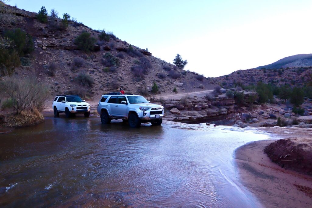
What to Expect at Toquerville Falls
The Drive
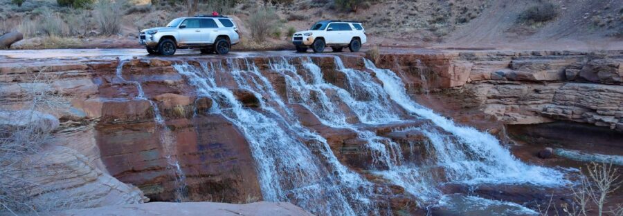
Toquerville Falls Road runs through the high desert terrain northeast of Toquerville. The landscape is classic southern Utah: red rock cliffs, sandy washes, juniper trees, and the wide sky of the Colorado Plateau. The road climbs and drops through this terrain, with views of the surrounding desert valleys and cliff faces as you gain elevation. The drive is part of the experience, not just transportation to the falls. La Verkin Creek drops over smooth rock ledges in two tiers at Toquerville Falls, forming shallow pools below the falls that are accessible for wading and swimming. The water flows year-round from La Verkin Creek, with the highest volume in spring and early summer from snowmelt. In late summer and fall the flow decreases but the falls remain active. The creek crossing on the road near the falls requires checking the water level before driving through; deep crossings are serious in high-flow conditions. The landscape immediately at the falls contrasts with the dusty desert road: the creek vegetation, the smooth water-carved rock, and the sound of falling water in a canyon that is otherwise completely silent. Walking behind the waterfall in high-flow conditions delivers the cool mist experience that makes desert waterfalls particularly rewarding in summer heat. For photography: the falls face roughly south and east, making morning the priority window. The two-tier structure creates layered composition opportunities: upper falls in background, lower falls and pool in foreground. The contrast between the red rock canyon walls and the white water is the defining visual. Wide-angle for the full falls and canyon context, mid-range for the cascade detail and the pool reflection. Toquerville Falls Road is approximately 12 miles roundtrip with 2,000 feet of cumulative gain. Moderate is accurate for a capable 4WD vehicle in dry conditions. Wet conditions move this to hard and may make the route impassable. Budget 3-5 hours for the roundtrip at a careful pace with time at the falls. 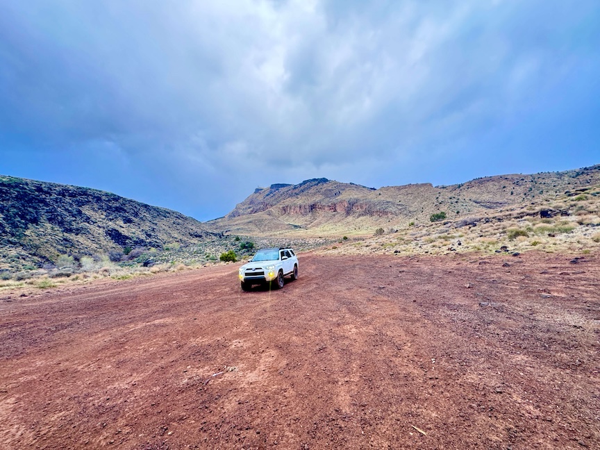
Dog Friendly?
Yes. Dogs are permitted and the shallow pools are excellent for dogs to cool off. The road surface and distance require dogs that handle long vehicle rides. Bring at least a liter of water for dogs independent of creek access; creek water quality for dogs should be treated. Keep dogs leashed at the falls given the slippery rock surfaces and the creek current in high-flow conditions.
What to Bring
Vehicle recovery gear: tow straps, traction boards, shovel, full-size spare. Water: 3+ liters per person for a 3-5 hour remote desert excursion. Snacks and food for the duration. Sun protection for the road walk if you choose to hike any section. Swimming gear if the pool is a priority. Satellite communicator for the remote road.
Best Time to Visit Toquerville Falls
Spring (March through May) is the best combination of accessible road conditions and maximum water flow. The creek volume is highest from snowmelt through June. Fall (September through November) offers comfortable temperatures with reduced flow but still active falls. Summer: the desert heat on the 8.5-mile road is extreme by midday; early morning departure from Toquerville (before 7 a.m.) is the practical summer approach. The falls and the pool are most rewarding in summer heat, the cold water contrast is the payoff. Never drive in wet conditions or within 24-48 hours of rain. The road is BLM managed dirt and becomes deeply rutted mud that can trap any vehicle when wet. 
Rules and Regulations
Public land rules apply. Stay on designated roads. Pack out all trash; no facilities at the falls. Dogs on leash. No fee. Creek crossing: check water level before vehicle crossing. The road is shared with ATVs, dirt bikes, and mountain bikes; drive carefully and respect others on the road.
Where to Stay Near Toquerville
St. George, about 45 minutes southwest, has full city hotel infrastructure. For points travelers, check available Marriott Bonvoy properties in St. George, IHG Rewards hotels in St. George, and Hilton Honors options in St. George. Hurricane, about 10-15 minutes southwest, has additional lodging.
Nearby Adventures
The full St. George area trail catalog: Snow Canyon SP (Lava Tube Trail, Petrified Sand Dunes, Butterfly Trail, Jenny’s Canyon), Red Cliffs NCA, Babylon Arch, Quail Creek SP Overlook, and Red Reef Trailhead. Each warrants a standalone post. Zion National Park is about 30-40 minutes east via US-9. La Verkin Creek Trail in Zion follows the same La Verkin Creek that feeds Toquerville Falls upstream into the park, giving the creek a specific geographic continuity as a through-line between the backcountry falls and the Kolob Terrace section of Zion. AllTrails has Toquerville Falls Road mapped with GPS track and offline capability. Download before leaving Toquerville. Plan your drive on AllTrails and check current condition reports for road status before heading out. 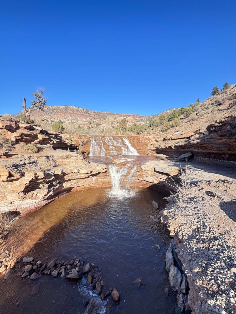
Chase the Quiet
La Verkin Creek runs from the Zion backcountry through the high desert outside Toquerville and drops over the falls at the end of an 8.5-mile dirt road. The water doesn’t know the road is rough or that Zion is 30 miles upstream. It’s just the creek doing what it does, flowing through the canyon and falling over the ledge and pooling at the bottom. The drive earns you a version of that creek that most people don’t reach. The cold water in the desert heat is the specific reward. That’s a good trade.
Support the Adventure
To make your walls less boring, check out my photography portfolio and bring a piece of the wild and my story into your home. If you’d like to fuel future adventures, you can donate a coffee on Ko-Fi. Every cup keeps me chasing sunrises and stories. When you shop using my affiliate links, every click helps support this blog at no extra cost to you. It’s a small way to keep Unicorn Adventure alive and kicking while I keep exploring. Subscribe to my mailing list for future updates, new stories, and behind-the-scenes adventures. Stay connected with me on Instagram and Facebook for more photos and daily inspiration. Thanks for being part of the journey, Unicorn Squadron! 

Theo Maynard is a landscape photographer and adventure blogger based in Salt Lake City. He chases remote desert and mountain light across the American West, documents it all solo, and shares the journey through Unicorn Adventure. He’s on the autism spectrum, and that’s not a footnote, it’s the whole story. He creates to inspire others to get outside, chase what lights them up, and live their best possible life. Unapologetically himself.
1 Comment
Quail State Park Overlook Guide in Quail Creek State Park Utah
[…] St. George area trail catalog: Snow Canyon SP, Butterfly Trail, Red Cliffs NCA, Babylon Arch, Toquerville Falls, Quail Creek SP, Quail State Park Overlook (this post), and Red Reef Trailhead in Cottonwood Forest […]