

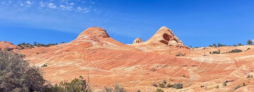
Yant Flats is a plateau in Dixie National Forest above Leeds, Utah, accessed via a rough dirt road from Silver Reef Road. The 5.3-mile roundtrip to Candy Cliffs and Yellow Top walks through pine and juniper forest before the terrain opens onto rolling Navajo Sandstone slickrock in shades of orange, pink, and red, the Candy Cliffs section. Yellow Top is the high point above the cliffs, reached by a short steep scramble. This is among the more accessible substantial slickrock experiences near St. George, accessible by most vehicles in dry conditions rather than requiring full high-clearance 4WD. The trailhead road is rough but manageable. High-clearance is recommended after rain.
Quick Facts
| Trail Name | Yant Flats to Candy Cliffs and Yellow Top |
| Location | Dixie National Forest, near Washington / Leeds, Utah |
| Coordinates | 37.2347° N, 113.4771° W |
| Distance | 5.3 miles roundtrip |
| Elevation Gain | 800 feet |
| Difficulty | Moderate |
| Time | 2.5–4 hours |
| Dogs Allowed | Yes, on leash |
| Fee | Free (Dixie National Forest / BLM land) |
| AllTrails | View on AllTrails |
How to Get There
From St. George or I-15, take Exit 22 (Leeds) and follow Silver Reef Road. The road eventually transitions to FR-031, a rough dirt road that climbs into the Dixie National Forest / Pine Valley Mountain area toward Yant Flats. The road ends at the small dirt parking area. The drive from St. George takes about 40 minutes, including the dirt road section. High-clearance vehicles are recommended, especially after rain. Most careful drivers in standard vehicles can make it in dry conditions; the road is rough but not technically demanding in dry weather. Cell service decreases on the approach; download AllTrails offline and have the GPS coordinates loaded before leaving Silver Reef Road.
Parking Information
Small dirt parking area at the trailhead. It fills on weekends and peak season (spring and fall) when the Candy Cliffs slickrock attracts photographers and hikers from St. George. No facilities, no water, no fee. Arrive before 8 a.m. on busy days for a parking spot. 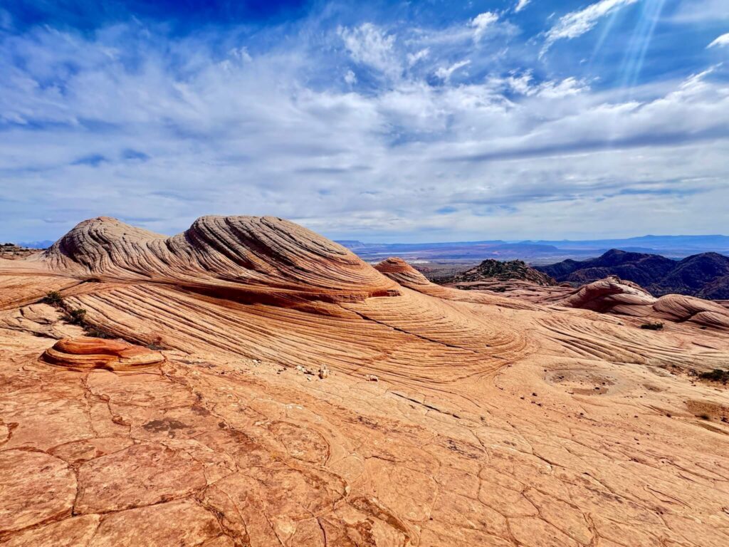
Cell Service and Navigation
Cell coverage decreases on the approach road and may be absent at the trailhead. Download AllTrails offline with the GPS track before leaving the paved road. The trail begins on an established path through the forest and then transitions to open slickrock where the route is marked by cairns and worn rock surfaces rather than a formal trail. Having the GPS track active through the slickrock section is useful for confirming the route toward the cliff edge and Yellow Top.
What to Expect on the Yant Flats Trail
The first mile of the trail walks through a pine and juniper forest on a sandy path with minimal elevation gain. The forest section is the deceiver: the trail feels easy and the environment is relatively enclosed, which doesn’t prepare you for what opens up on the other side. Enjoy the shade; there’s none after this section. The forest ends and the slickrock begins. The Candy Cliffs section is open Navajo Sandstone in the warm oranges, pinks, and reds that give the area its name. The slickrock rolls and dips across a broad plateau with deep cracks, domed formations, and wave-like ridges. The trail is marked by cairns and worn rock, but the slickrock environment invites wandering beyond the marked route. The cliff edge provides views of the desert below extending toward Arizona. Slickrock hiking requires grip: smooth-soled shoes are a hazard on any slickrock surface, particularly on the sloped sections near the cliff edge and on wet rock. Sturdy trail runners or hiking boots with sticky rubber soles are the appropriate footwear. Yellow Top is the sandstone peak above the Candy Cliffs that provides the elevated perspective on the full slickrock plateau and the desert beyond. The climb is short, adding about 0.3 miles to the route, but steep with scrambling on the rocky summit approach. The view from Yellow Top encompasses the full Candy Cliffs formation below and the desert panorama out to Arizona. For photography: the Candy Cliffs slickrock is the primary photography destination throughout the day. The color saturation on the sandstone is highest in soft morning and late afternoon light. The cliff edge for the desert panorama works well from afternoon onward when the sun is west of overhead. Yellow Top for the plateau overview. Wide-angle for the full slickrock context and cliff views, mid-range for the rock formation and color detail.
Trail Difficulty and Length
The trail is 5.3 miles with 800 feet of gain. Moderate is accurate: the slickrock navigation, the scrambling on Yellow Top, and the fully exposed terrain in summer heat all contribute to the moderate rating. Budget 2.5-4 hours for the full route with time at the cliff edge and Yellow Top. 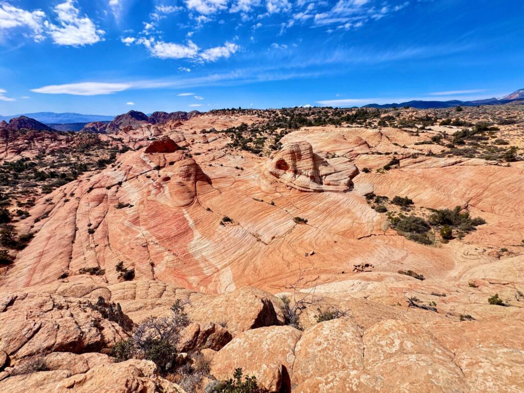
Dog Friendly?
Yes. Dogs are permitted on leash. The sandstone surface heats quickly in summer; check paw temperature throughout the slickrock section and the approach during midday summer visits. The cliff edges require tight leash management. No water on the trail; bring at least a liter for dogs.
What to Bring
Water: 2-3 liters for a 5.3-mile moderate exposed slickrock hike. Sun protection is mandatory; there’s no shade after the forest section. Sturdy shoes with grip for slickrock navigation and Yellow Top scrambling. Trekking poles help on Yellow Top’s steep approach. A camera with wide-angle and mid-range capability for the slickrock panoramas.
Best Time to Hike Yant Flats
Spring (March through May) and fall (September through November) are the prime windows: comfortable temperatures, soft lighting on the sandstone, and the best color saturation. The Candy Cliffs in October morning light are worth specifically planning for. Summer is possible with very early starts (before 7 a.m.) and a turnaround before the exposed slickrock reaches midday heat. No shade after the forest means summer midday is genuinely dangerous for extended slickrock exposure. Winter visits are quiet with possible snow on the sandstone; icy slickrock requires extreme caution near the cliff edge. 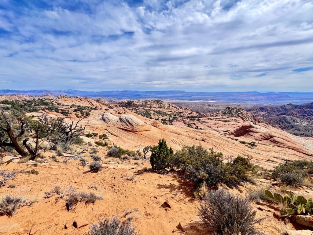
Rules and Regulations
Stay on durable surfaces (rock, established dirt trail) to avoid damaging desert soil crust and vegetation. Do not carve or mark the sandstone. Dogs on leash. Pack out all trash. No facilities on trail. No fee. Be cautious near cliff edges; the drops are real and there are no guardrails.
Where to Stay Near St. George
St. George has full city hotel infrastructure. For points travelers, check available Marriott Bonvoy properties in St. George, IHG Rewards hotels in St. George, and Hilton Honors options in St. George.
Nearby Adventures
The St. George area trail catalog: Snow Canyon SP (Lava Tube Trail, Petrified Sand Dunes, Butterfly Trail, Jenny’s Canyon), Red Cliffs NCA, Babylon Arch, Quail Creek SP Overlook, Red Reef Trailhead, and Toquerville Falls. Yant Flats is the slickrock and cliff-edge hike in a catalog that also includes volcanic features (Snow Canyon), spring canyons (Red Reef), and desert waterfalls (Toquerville Falls). The St. George area catalog as a whole reflects the geographic diversity of the Colorado Plateau’s southwestern edge. Zion National Park is about 1 hour east. The Angels Landing and The Narrows are the standard Zion options; Yant Flats’s slickrock character is different from both and worth treating as a separate rather than a substitute experience. 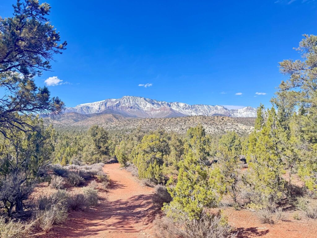
Plan This Hike
AllTrails has Yant Flats to Candy Cliffs mapped with GPS track and offline capability. The GPS track is important for navigating the open slickrock section. Plan your hike on AllTrails and download before leaving the paved road.
Chase the Quiet
The Candy Cliffs section of Yant Flats is the kind of place that gets shared a lot on social media and less visited than it looks in those images. The access road’s rough surface and the lack of facilities keep the crowd volume lower than the viewpoint photographs suggest. Standing on the slickrock above the Candy Cliffs looking out at the Arizona desert with the orange and pink sandstone below you and the whole Colorado Plateau extending in every direction, the photography makes more sense than it does from a screen. The color is real. The scale is real. That’s always the difference.
Support the Adventure
To make your walls less boring, check out my photography portfolio and bring a piece of the wild and my story into your home. If you’d like to fuel future adventures, you can donate a coffee on Ko-Fi. Every cup keeps me chasing sunrises and stories. When you shop using my affiliate links, every click helps support this blog at no extra cost to you. It’s a small way to keep Unicorn Adventure alive and kicking while I keep exploring. Subscribe to my mailing list for future updates, new stories, and behind-the-scenes adventures. Stay connected with me on Instagram and Facebook for more photos and daily inspiration. Thanks for being part of the journey, Unicorn Squadron! 

Theo Maynard is a landscape photographer and adventure blogger based in Salt Lake City. He chases remote desert and mountain light across the American West, documents it all solo, and shares the journey through Unicorn Adventure. He’s on the autism spectrum, and that’s not a footnote, it’s the whole story. He creates to inspire others to get outside, chase what lights them up, and live their best possible life. Unapologetically himself.