Wiregrass Canyon is in Grand Staircase-Escalante National Monument about 7 miles off US-89 on Smoky Mountain Road near Big Water, Utah. The 5.4-mile roundtrip leads through a desert wash that narrows into twisting sandstone corridors with walls ranging from smooth and polished to raw and jagged, in shades of peach, gold, and dusty pink depending on the light and the hour. It draws a fraction of the visitors that Antelope Canyon and Horseshoe Bend attract on the same US-89 corridor, which makes the experience of being inside it genuinely different from the commercial slot canyon tours a few miles east.
The trail is 5.4 miles with 400 feet of elevation gain. The access road (Smoky Mountain Road) requires a high-clearance vehicle and becomes impassable in wet conditions. Flash flood risk in the canyon is the primary safety variable.
Quick Facts
|
Trail Name |
Wiregrass Canyon Trail |
|
Location |
Grand Staircase-Escalante National Monument, near Big Water, Utah |
|
Coordinates |
|
|
Distance |
5.4 miles roundtrip |
|
Elevation Gain |
400 feet |
|
Difficulty |
Moderate |
|
Time |
3-5 hours |
|
Dogs Allowed |
Yes, on leash |
|
Fee |
None |
|
AllTrails |
How to Get There
From Big Water, Utah (on US-89 about 15 miles west of Page, Arizona), turn north onto Smoky Mountain Road. Follow Smoky Mountain Road approximately 7 miles to the Wiregrass Canyon pullout on the right. There is no official sign; use the GPS coordinates and AllTrails offline map to confirm the pullout. Smoky Mountain Road is rough dirt and requires a high-clearance vehicle; after rain, the road becomes impassable mud. Check weather before heading out.
From Page, Arizona: US-89 west about 15 miles to Big Water, then north on Smoky Mountain Road. From Kanab, Utah: US-89 east about 30 miles to Big Water, then north on Smoky Mountain Road.
Flash flood warning: Wiregrass Canyon is a drainage system. A storm anywhere upstream can produce a flash flood in the canyon without rain at the trailhead. Check weather.gov for the full drainage area before every visit. Do not enter the canyon if storms are forecast for any part of the region.
Parking Information
Informal dirt pullout off Smoky Mountain Road. No facilities, no fee, no signage. Park fully off the road surface. Cell coverage is absent; check navigation before you leave Big Water.
Cell Service and Navigation
Cell coverage drops on Smoky Mountain Road and is absent at the trailhead and in the canyon. Download AllTrails offline with the GPS track before leaving Big Water. The canyon route is self-guiding for most of its length, the walls direct you, but the approach from the pullout to the canyon entrance can be less obvious. GPS confirmation of the correct wash entrance is useful before you lose the ability to reference a map.
What to Expect in Wiregrass Canyon
The Approach
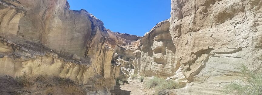
From the pullout, the trail leads through open desert scrub to the wash that feeds Wiregrass Canyon. The initial section is the standard Big Water corridor desert: wide sky, distant canyon walls, sagebrush, and silence. The canyon entrance appears as the walls start to close in and the wash narrows from the open desert scale to the slot dimensions below.
The Canyon
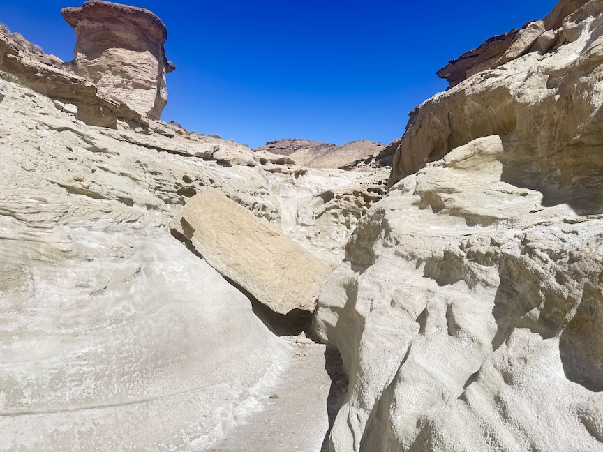
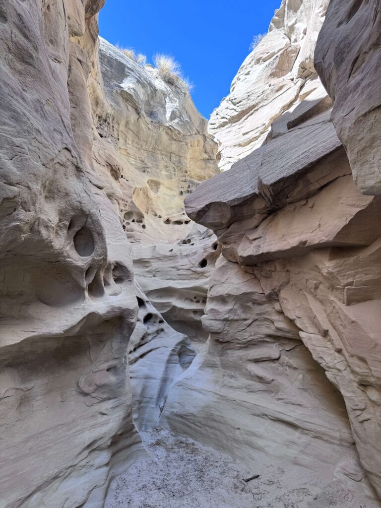
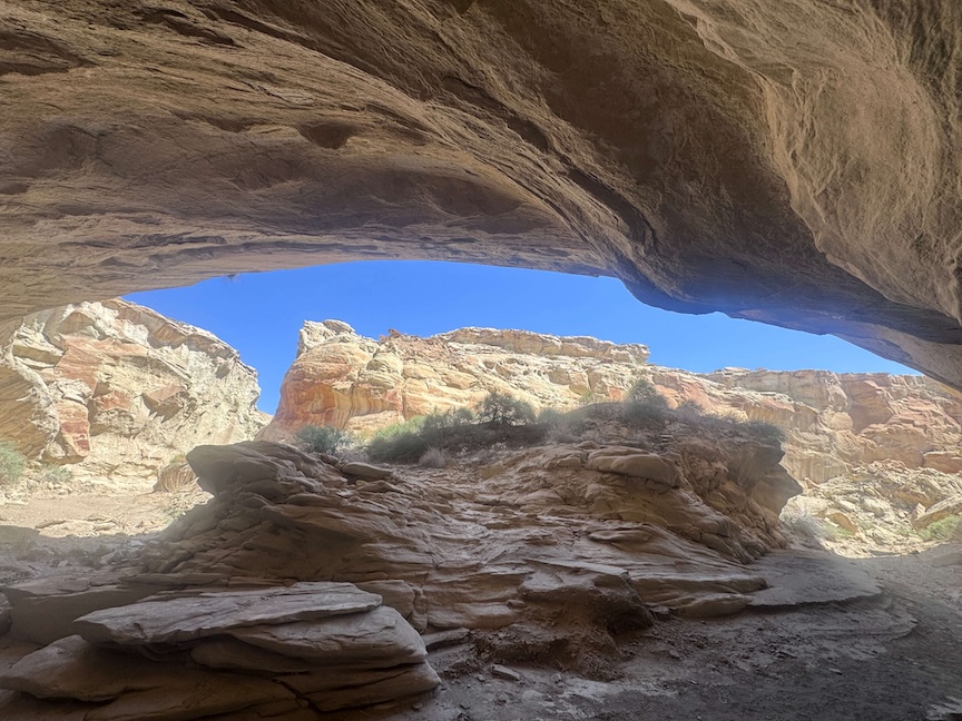
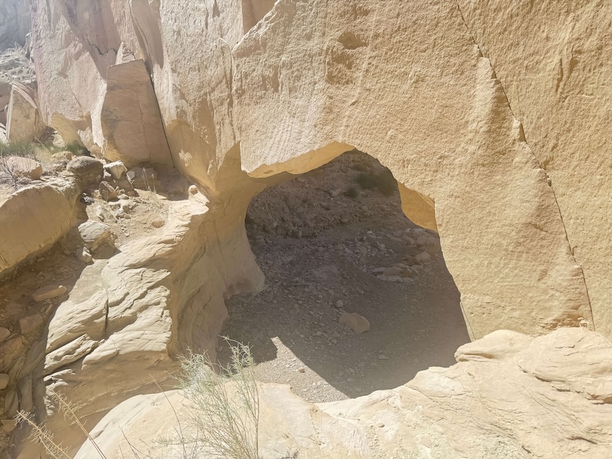
Wiregrass Canyon is a sandstone slot with walls that vary throughout the route from smooth and polished in the water-worn sections to raw and jagged where recent rockfall has exposed fresh surfaces. The color range, peach, gold, dusty pink, ochre, shifts with the light angle throughout the day. Morning light from the east illuminates the upper canyon walls while the floor is still in shadow; midday overhead light reaches the floor directly; late afternoon produces the most saturated warm tones on the west-facing walls.
The narrow sections require some scrambling: over boulders, under ledges, through tight turns. Nothing technically demanding in dry conditions, but the combination of sandy footing and occasional boulder moves earns the moderate rating. The canyon is deep enough in sections that shade is present even midday, which makes it cooler than the open desert approach.
For photography: the narrow canyon sections create dramatic light and shadow contrasts. Wide-angle for the full wall height and the sky strip above, mid-range for the rock texture and color variation. Morning and late afternoon are the priority windows for the best color saturation on the walls.
Trail Difficulty and Length
Wiregrass Canyon is 5.4 miles with 400 feet of elevation gain. Moderate is accurate for the terrain: the canyon scrambling and the sandy approach combine to make the effective effort higher than the elevation profile alone suggests. Budget 3-5 hours for the full roundtrip with time in the canyon.
Dog Friendly?
Yes. Grand Staircase-Escalante NM allows leashed dogs. The canyon’s tighter sections may require dogs to be lifted or guided through. Bring water independent of any creek access in the canyon; treatment or filtration is required for any canyon water. Keep dogs close in the narrower sections and out of any water flowing in the wash.
What to Bring
Water: 2-3 liters for a 5.4-mile moderate desert canyon hike. Sun protection for the open desert approach. Sturdy footwear with grip for boulder scrambling. Layers for the shaded canyon sections which can be significantly cooler than the open desert. A headlamp in case the canyon exit takes longer than expected.
For photography: wide-angle, mid-range, and a tripod or gorilla pod for low-light work in the deeper canyon sections.
Best Time to Hike Wiregrass Canyon
Spring (March through May) and fall (September through early November) are the comfortable windows. Summer is possible with early morning starts; the canyon shade makes the interior more manageable than exposed desert hikes, but the access road approach in July heat is brutal before you reach the canyon entrance.
Morning visits for the best light in the canyon and the coolest temperatures on the desert approach. Avoid any visit when rain is forecast for the region.
Rules and Regulations
Grand Staircase-Escalante NM rules apply. No drones without a BLM special use permit. No camping inside the canyon. Pack out all trash. Dogs on leash. Leave No Trace throughout. Flash flood weather awareness is the hiker’s responsibility; do not enter the canyon in any questionable weather window.
Where to Stay Near Big Water
Big Water has minimal services. Page, Arizona, 15 miles east, has full chain hotel infrastructure. Kanab, Utah, about 30 miles west. For points travelers, check available Marriott Bonvoy properties in Page, IHG Rewards hotels in Page, and Hilton Honors options near Kanab.
Nearby Adventures
Cathedral Wash Trail is in the same Glen Canyon NRA corridor north of US-89A near Marble Canyon. A harder canyon hike that also ends at the Colorado River, with its own specific flash flood risk profile. Different character from Wiregrass but the same general category of desert wash canyon hiking.
Wahweap Hoodoos Trail is also accessed from the Smoky Mountain Road / Big Water corridor at 10.4 miles. The two trails can be done on successive days from a Big Water or Page base for a concentrated view of the Grand Staircase-Escalante canyon country north of US-89.
The Page, AZ cluster is 15-30 miles east: Horseshoe Bend, Beehive / New Wave, Dam Overlook, Glen Canyon Bridge. Wiregrass Canyon paired with a Page morning makes a full day of desert exploration.
Plan This Hike
AllTrails has Wiregrass Canyon mapped with GPS track and offline capability. Download before leaving Big Water; the pullout location and the canyon entrance both benefit from GPS confirmation in an unmarked desert setting. Plan your hike on AllTrails and pull the offline map while you’ve got signal.
Chase the Quiet
The canyon entrance is 7 miles down a BLM dirt road that requires a capable vehicle. That’s the entire barrier. Seven miles of rough road separates Wiregrass Canyon from a highway that carries millions of tourists a year to Horseshoe Bend and Antelope Canyon a few exits east. Inside the canyon, you get the twisting sandstone walls and the changing light and the silence that makes slot canyon hiking worth doing. You don’t get a tour group narrating it. That trade is worth seven miles of rough road every time.
Support the Adventure
To make your walls less boring, check out my photography portfolio and bring a piece of the wild and my story into your home.
If you’d like to fuel future adventures, you can donate a coffee on Ko-Fi. Every cup keeps me chasing sunrises and stories.
When you shop using my affiliate links, every click helps support this blog at no extra cost to you. It’s a small way to keep Unicorn Adventure alive and kicking while I keep exploring.
Subscribe to my mailing list for future updates, new stories, and behind-the-scenes adventures.
Stay connected with me on Instagram and Facebook for more photos and daily inspiration.
Thanks for being part of the journey, Unicorn Squadron!

Theo Maynard is a landscape photographer and adventure blogger based in Salt Lake City. He chases remote desert and mountain light across the American West, documents it all solo, and shares the journey through Unicorn Adventure. He’s on the autism spectrum, and that’s not a footnote, it’s the whole story. He creates to inspire others to get outside, chase what lights them up, and live their best possible life. Unapologetically himself.