

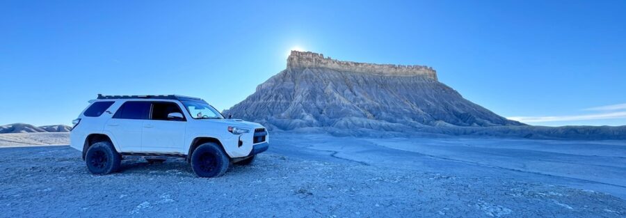
Hanksville is a small town on US-24 that most people drive through on the way to somewhere else. That’s a mistake. The landscape surrounding Hanksville, stretching into the San Rafael Swell to the north and west and connecting to the Escalante and Capitol Reef corridors in every other direction, is one of the most concentrated collections of genuinely strange and beautiful terrain in the American West.
I’ve driven Estes through Hanksville more times than I can count on solo desert trips. Every time I stop, the area delivers. Here are the destinations and trails worth your time, with accurate stats and links to full individual guides where available.
1. Little Wild Horse Canyon
| Distance | 8.0 miles (full loop) |
| Elevation Gain | 787 feet |
| Difficulty | Moderate |
| Dogs Allowed | Yes (with caveats for tight sections) |
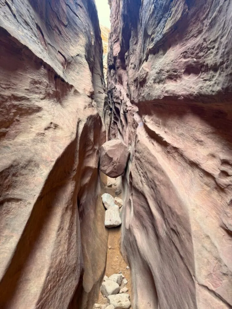
The best slot canyon loop in the San Rafael Swell and one of the best in Utah. Little Wild Horse Canyon combines with Bell Canyon for 8 miles of twisting sandstone walls, color bands shifting from red to orange to pink, and narrow sections that press close enough to force you sideways. Accessible for families with older children. Start early to beat the crowd at this popular trailhead. Flash flood risk is real, check the full regional forecast before entering.
Full guide: Little Wild Horse Canyon Trail Guide
2. Goblin’s Lair Trail
| Distance | 3.0 miles (round trip) |
| Elevation Gain | 300 feet |
| Difficulty | Moderate |
| Dogs Allowed | Yes (on leash) |
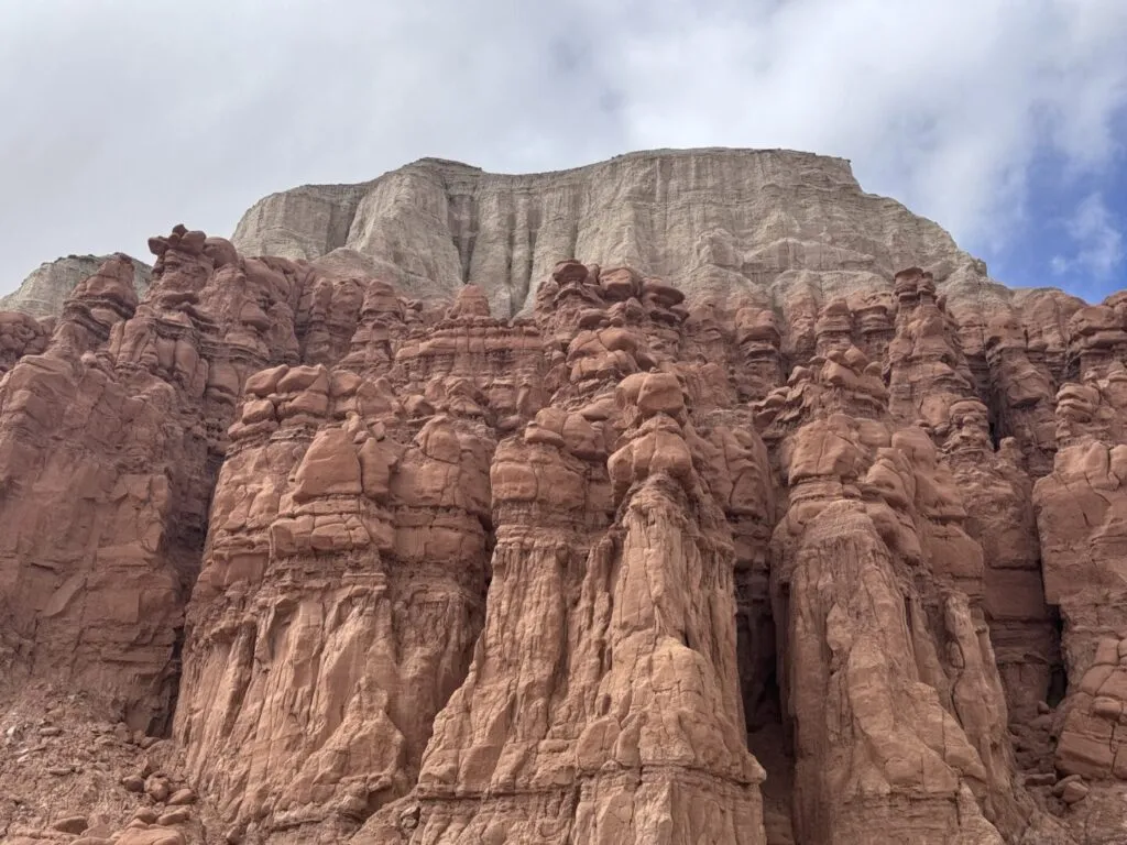
Goblin Valley State Park’s best-kept secret. The trail starts at the main valley parking lot, winds through the hoodoo field, and climbs into the rocky terrain beyond to reach a collapsed sandstone dome cavern. Light filters through the dome openings in shafts that shift through the morning. The combination of valley floor exploration and the Lair makes this the best full-day objective in the park. Park entry fee ($20/vehicle) applies.
Full guide: Goblin’s Lair Trail Guide
3. Valley of the Goblins
| Distance | Open exploration, typically 1-3 miles |
| Elevation Gain | Minimal |
| Difficulty | Easy |
| Dogs Allowed | Yes (on leash) |
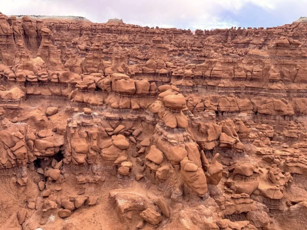
An open formation field of thousands of Entrada sandstone hoodoos with no formal trails and no rules about where you walk. The Valley of the Goblins is the primary draw of Goblin Valley State Park: alien, accessible, and endlessly photogenic at sunrise and sunset when the formations cast long shadows across each other. Park entry fee ($20/vehicle) applies.
Full guide: Valley of the Goblins Guide
4. Leprechaun Canyon
| Distance | 2.2 miles (round trip) |
| Elevation Gain | 147 feet |
| Difficulty | Moderate |
| Dogs Allowed | Not recommended (technical terrain) |
A slot canyon off Highway 95, about 25 miles south of Hanksville, that most people drive past without stopping. The lower section is accessible. The upper section narrows to body-width passages and requires scrambling. The sandstone walls band in vivid layers. No formal trail. The parking pulloff is small and easy to miss at highway speed. Load the coordinates before you reach it. Flash flood risk applies.
Full guide: Leprechaun Canyon Trail Guide
5. Carmel Canyon Trail
| Distance | ~3.5 miles (loop) |
| Elevation Gain | Moderate |
| Difficulty | Moderate |
| Dogs Allowed | Yes (on leash) |
A loop trail within Goblin Valley State Park that circuits the canyon surrounding the main formation field, offering views of the park’s geology from a different elevation and angle than the valley floor. Less visited than the Valley of the Goblins and a good add-on for visitors who want more structured hiking than the open formation exploration. Park entry fee applies.
Location: Goblin Valley State Park, accessed from the main parking area.
6. Moonscape Overlook
| Distance | Roadside viewpoint |
| Elevation Gain | Minimal |
| Difficulty | Easy (with high-clearance vehicle) |
| Dogs Allowed | Yes (on leash) |
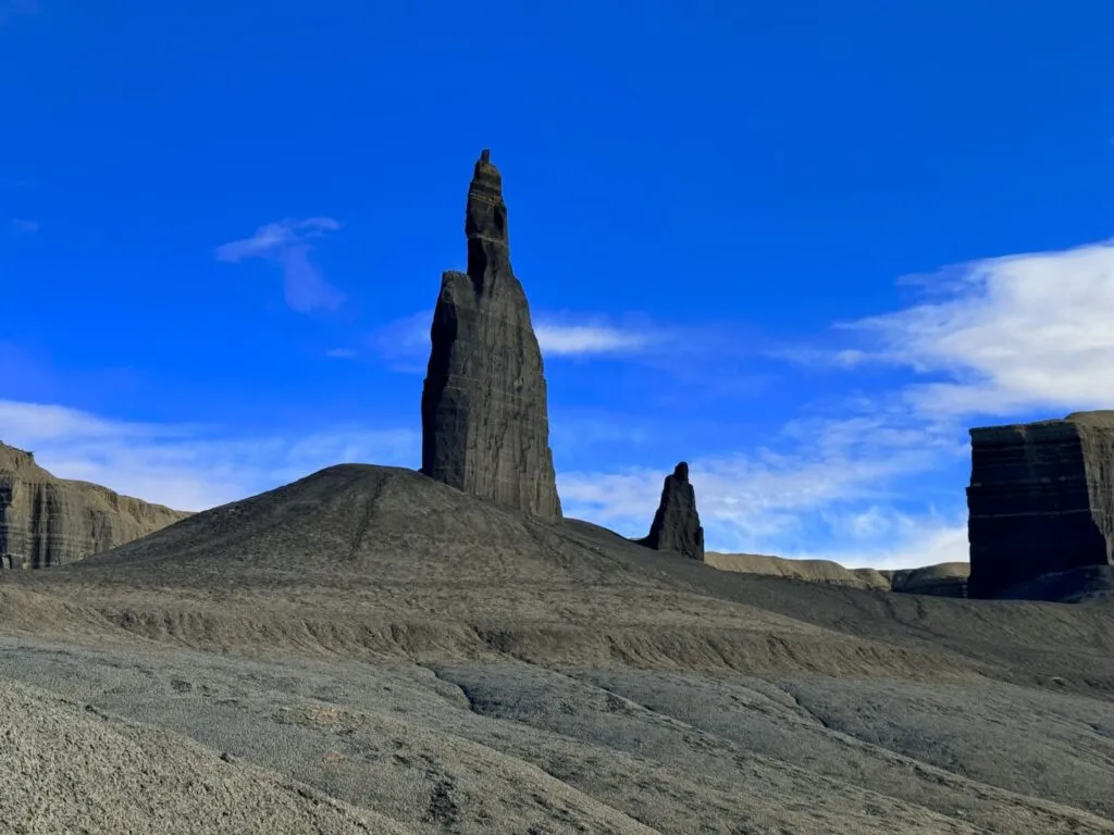
A remote BLM viewpoint north of Hanksville accessible via Factory Butte Road, offering a panoramic view of gray and blue badlands terrain that looks genuinely lunar. No formal trail. High-clearance vehicle required on dry dirt roads. Never attempt access after rain. The muted color palette is a complete contrast to the vivid red sandstone of most nearby destinations. Sunrise and sunset are the strongest photography windows.
Full guide: Moonscape Overlook Guide

7. Factory Butte
| Distance | Open exploration, OHV area |
| Elevation Gain | Under 100 feet at base |
| Difficulty | Easy to Moderate |
| Dogs Allowed | Yes (on leash, watch for OHVs) |
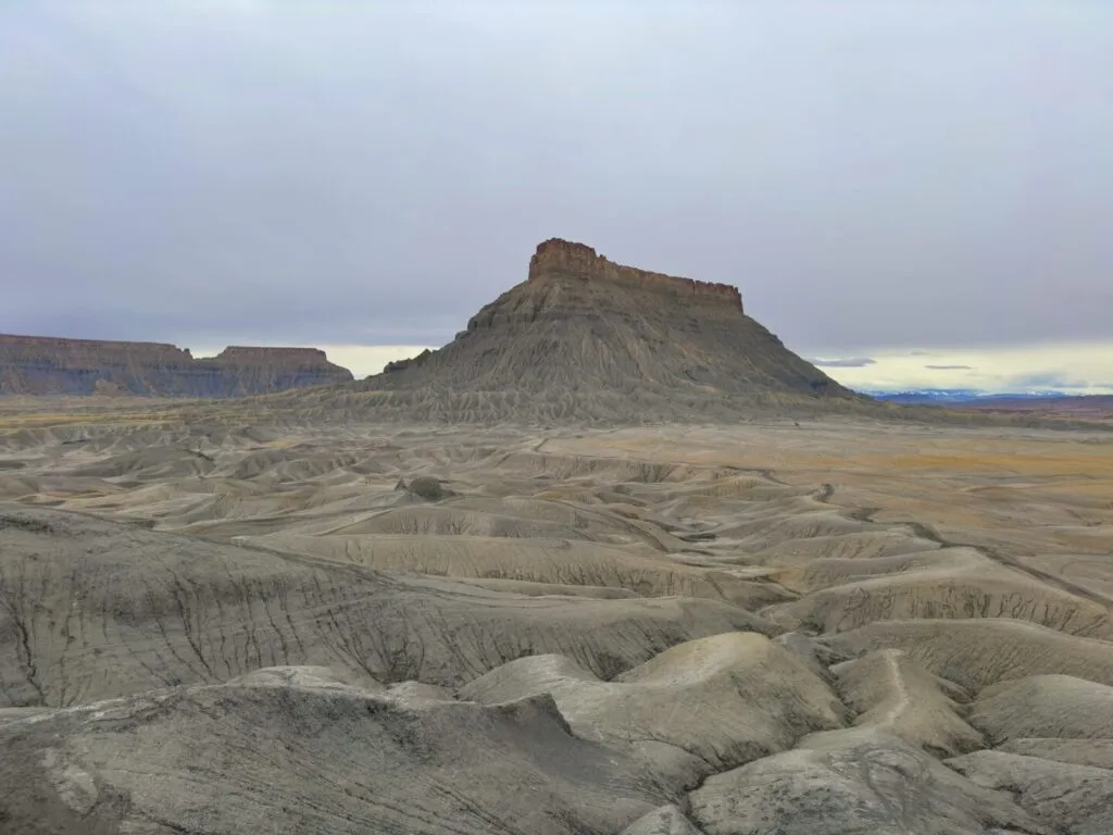
An isolated mesa rising abruptly from the desert floor about 15 miles west of Hanksville. The surrounding area is a BLM OHV open play zone. Hikers can explore the mesa base on foot while staying aware of vehicle traffic. The two-coordinate approach from UT-24 is the most navigable route. The mesa photographs as well from 3 miles away on the highway as it does from the base. High-clearance recommended. Wet conditions: don’t attempt.
Full guide: Factory Butte Guide
8. Bentonite Hills
| Distance | Open exploration, under 1 mile typically |
| Elevation Gain | 100-300 feet |
| Difficulty | Easy |
| Dogs Allowed | Yes (on leash) |
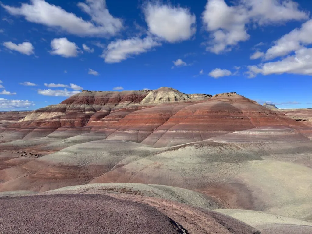
Vivid bands of red, blue, purple, and gray clay hills off Cow Dung Road west of Hanksville. No formal trails. The colors come from different mineral compositions in the bentonite clay. Sunrise is the strongest photography window. The clay surface is extremely slick when wet, the wet condition access warning here is not optional. High-clearance recommended for the approach road. The color palette looks genuinely unreal in the right light.
Full guide: Bentonite Hills Guide
9. Mars Desert Research Station
| Distance | Roadside viewpoint |
| Elevation Gain | None |
| Difficulty | Easy (with high-clearance vehicle) |
| Dogs Allowed | Yes (on leash) |
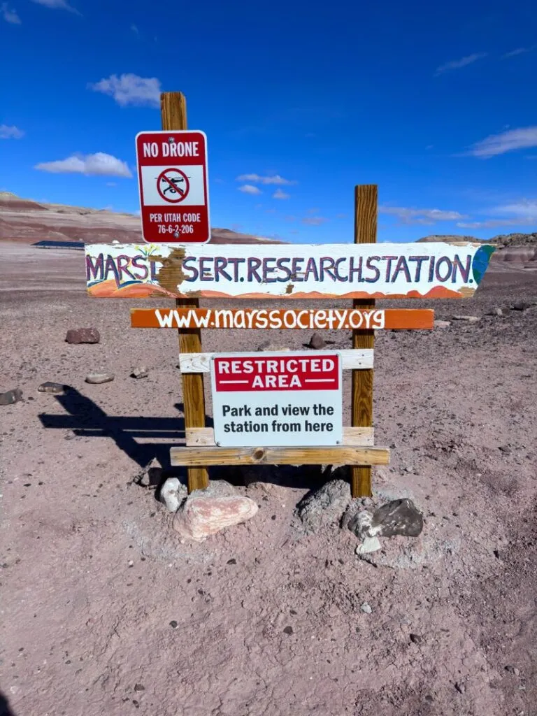
A working Mars simulation facility on Cow Dung Road, viewable from outside the perimeter. The facility is not open to the public. The draw is the combination of the habitat modules and satellite dishes against the red-orange San Rafael Swell landscape. This is a photography stop and curiosity destination, not a hiking trail. Pairs naturally with the Bentonite Hills on the same Cow Dung Road run. Dry conditions only on access road.
Full guide: Mars Desert Research Station Guide
Best Time to Visit the Hanksville Area
Spring (March through May) and fall (September through November) are the reliable windows for almost every destination on this list. Temperatures are manageable, the light is excellent, and the access roads are most consistently dry. Summer exceeds 100°F on the exposed desert terrain and monsoon season peaks from July through September with serious flash flood risk in all slot canyon destinations. An early start is mandatory in summer. Winter is quiet and some destinations look exceptional with snow, but wet or frozen clay access roads create vehicle-trapping conditions that close some of these destinations effectively until conditions dry out.
Flash flood risk applies to every canyon and slot canyon on this list. Check regional weather forecasts, not just the local Hanksville forecast. Upstream weather matters more than what’s overhead at the trailhead. The Escalante Interagency Visitor Center and the BLM Price Field Office both have current conditions for the area.
Where to Stay Near Hanksville
Hanksville has basic motel lodging, gas stations, and a small number of restaurants that serve as a practical base for all the destinations on this list. For more amenities, Moab is about 2 hours east and Green River is about 1.5 hours north on I-70. Goblin Valley State Park has a campground with hookups reservable through Utah State Parks, the best-positioned established site for the Goblin Valley and San Rafael Swell cluster.
Chase the Quiet
Hanksville doesn’t have the name recognition of Moab or Zion. That’s what makes it work. The San Rafael Swell surrounding it holds the same quality of landscape with significantly fewer people competing for the same spots. Show up prepared, drive carefully on the dirt roads, respect the flash flood warnings, and every destination on this list will deliver.
Support the Adventure
To make your walls less boring, check out my photography portfolio and bring a piece of the wild and my story into your home.
If you’d like to fuel future adventures, you can donate a coffee on Ko-Fi. Every cup keeps me chasing sunrises and stories.
When you shop using my affiliate links, every click helps support this blog at no extra cost to you. It’s a small way to keep Unicorn Adventure alive and kicking while I keep exploring.
Subscribe to my mailing list for future updates, new stories, and behind-the-scenes adventures.
Stay connected with me on Instagram and Facebook for more photos and daily inspiration.
Thanks for being part of the journey, Unicorn Squadron!

Theo Maynard is a landscape photographer and adventure blogger based in Salt Lake City. He chases remote desert and mountain light across the American West, documents it all solo, and shares the journey through Unicorn Adventure. He’s on the autism spectrum, and that’s not a footnote, it’s the whole story. He creates to inspire others to get outside, chase what lights them up, and live their best possible life. Unapologetically himself.