

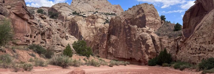
The Grand Wash Trail runs through one of Capitol Reef National Park’s most dramatic canyon corridors: a dry wash that cuts through towering Navajo Sandstone walls that rise hundreds of feet on both sides. The trail has two access points, one off the Scenic Drive (eastern, near Cassidy Arch Trailhead) and one off UT-24 (western), making it accessible as a point-to-point hike with shuttle logistics or as an out-and-back from either end.
Cassidy Arch Trail shares the eastern Grand Wash Trailhead. Both the arch hike (which goes up the canyon wall) and the Grand Wash canyon floor route start from the same point, giving the Scenic Drive trailhead significant flexibility for trail combinations.
Quick Facts
| Trail Name | Grand Wash Trail |
| Location | Capitol Reef National Park, near Torrey, Utah |
| Coordinates | 38.2784° N, 111.1922° W (eastern trailhead near Scenic Drive) |
| Distance | ~4.5 miles (one-way point-to-point; or out-and-back from either end) |
| Elevation Gain | ~350 feet |
| Difficulty | Easy |
| Time | 2-3 hours one-way; 4-5 hours out-and-back from eastern end |
| Dogs Allowed | No |
| Fee | $20 per vehicle (7-day pass); America the Beautiful Pass accepted |
| AllTrails | View on AllTrails |
How to Get There
Capitol Reef National Park is on UT-24, about 11 miles east of Torrey, Utah. There are two access points for the Grand Wash Trail:
Eastern Trailhead (Scenic Drive): Turn south onto the Capitol Reef Scenic Drive from the main park road near the visitor center. Follow the Scenic Drive approximately 4.3 miles to the Grand Wash / Cassidy Arch Trailhead. This is the primary access point and has more parking.
Western Trailhead (UT-24): Off Utah Route 24, approximately 5 miles east of the Scenic Drive turnoff. Parking is more limited at this trailhead.
A $10 Scenic Drive fee applies (on top of the $20 park entry) for the driving section of the Scenic Drive. Confirm current Scenic Drive access and fees at nps.gov/care before your visit; the Scenic Drive and its fees may change seasonally.
From Salt Lake City: I-15 south to US-50 east to UT-24 east into the park. Plan 3.5 hours. From Moab: US-191 north to UT-24 west. Plan 2.5 hours. From Bryce Canyon: UT-12 east to Torrey, UT-24 east. Plan 1.5-2 hours.
Parking Information
The eastern trailhead (Scenic Drive) has the larger parking area and is the primary access. It fills during peak spring and fall morning hours. Arrive before 8 a.m. on busy days. The western trailhead (UT-24 side) has limited parking and is best for hikers doing a one-way hike with a shuttle vehicle at each end. $20 vehicle park entry; $10 additional Scenic Drive fee for the Scenic Drive section.
Cell Service and Navigation
Cell coverage is limited in Capitol Reef. Download AllTrails offline before leaving Torrey. The trail follows the wash canyon for its full length; navigation is self-guiding, the canyon walls direct you. Having the GPS track is most useful for confirming the route at the canyon entry and at the western UT-24 trailhead end.
What to Expect on the Grand Wash Trail
The Narrows
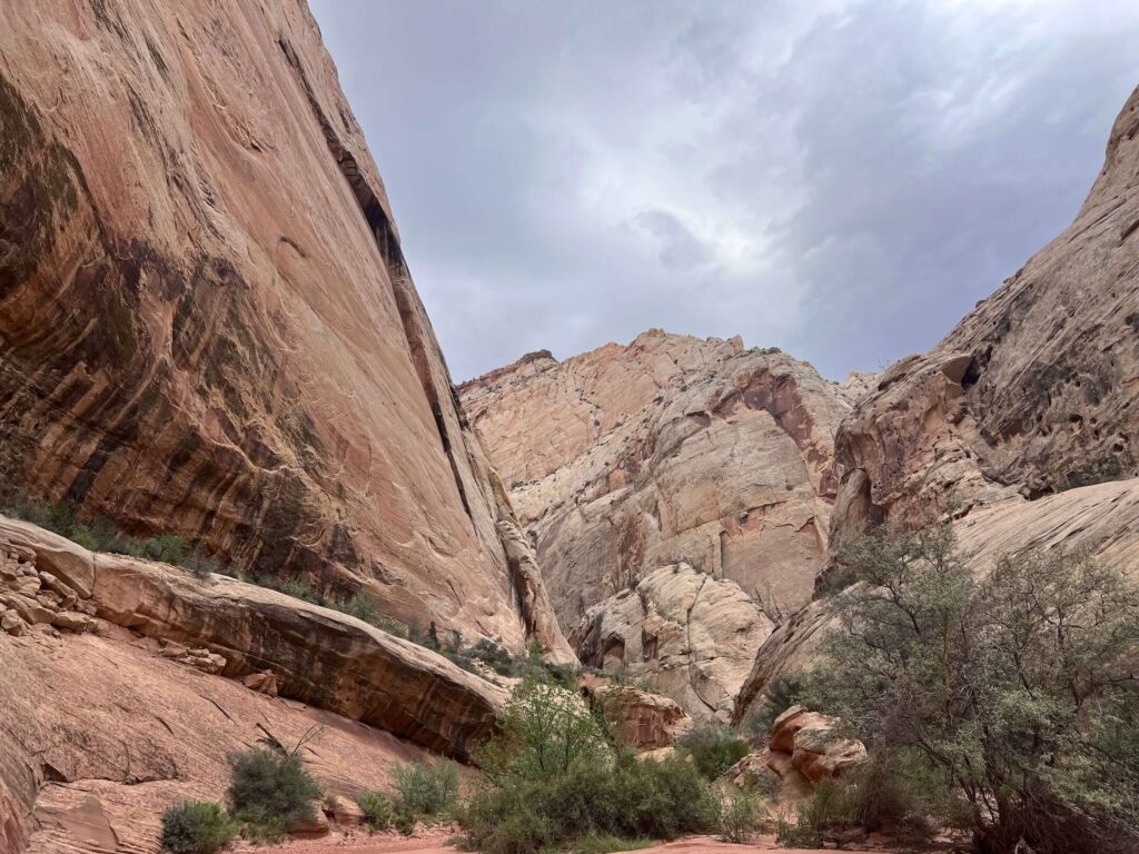
The trail enters the Grand Wash canyon from the eastern trailhead and immediately begins to narrow. The Navajo Sandstone walls rise hundreds of feet on both sides, and the canyon floor is a dry wash, sand and rock carried through by seasonal water flow. The walls display the characteristic cross-bedded layering of Navajo Sandstone: the preserved record of ancient sand dunes frozen in rock and then carved apart by the wash over time.
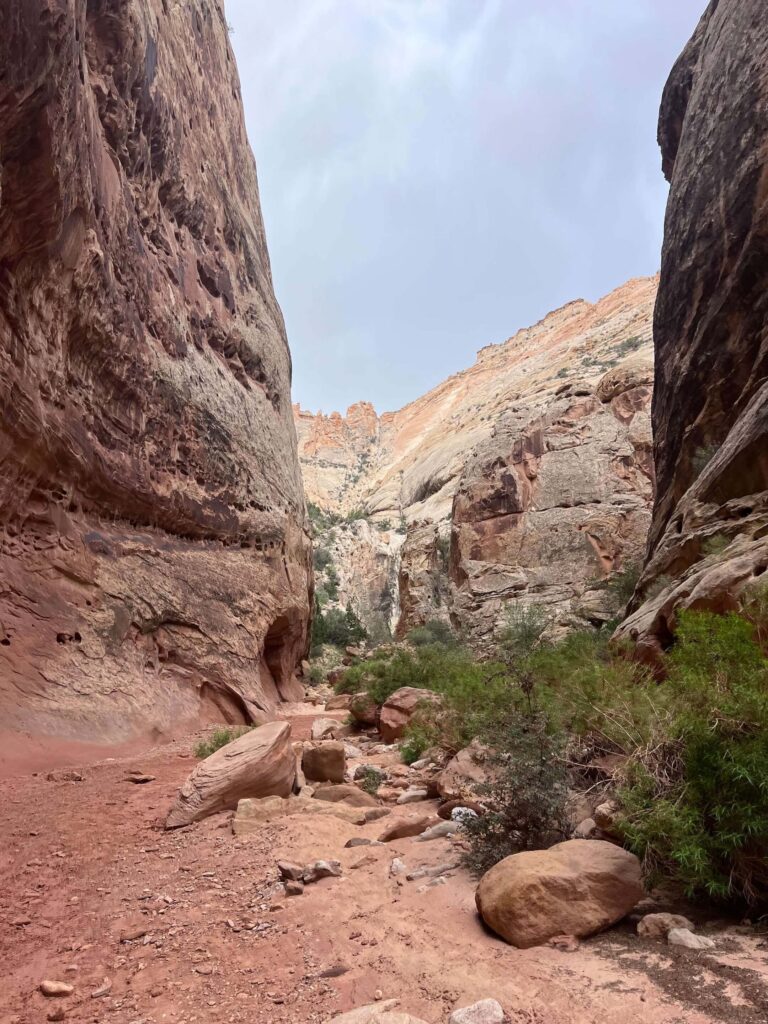
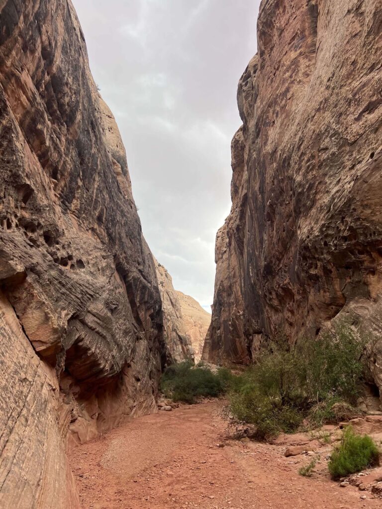
The ‘narrows’ section, where the canyon walls close in most tightly, is the most dramatic section of the trail and one of the more enclosed canyon environments in the Capitol Reef catalog. The scale is impressive: looking up from the canyon floor, the visible sky narrows to a strip and the walls dominate in every direction.
Canyon to UT-24
The trail follows the wash through the narrows and then opens as it approaches the western end. The canyon perspective from inside looking toward the UT-24 exit provides a different reading of the same Navajo Sandstone formations visible from the rim overlooks above. Out-and-back hikers get the full canyon character on both legs; point-to-point hikers need a vehicle shuttle or a ride between trailheads.
For photography: the narrows section is the primary photography destination. The canyon orientation determines light windows: morning and late afternoon when the sun angle reaches the canyon walls; midday overhead light flattens the narrows significantly. Wide-angle for the full wall height and the canyon corridor character, mid-range for the rock texture and cross-bedding detail.
Flash Flood Safety
The Grand Wash is a flash flood drainage. A storm anywhere upstream, including storms not visible from the canyon floor, can send a flash flood through the wash with minimal warning. Check weather.gov for the full Grand Wash drainage area before entering the canyon. Do not hike the Grand Wash if any storm is forecast for the region. The National Park Service posts current flash flood warnings at the visitor center; check on arrival.
Flash floods in desert wash canyons are not always preceded by rain at the trail location. Water can travel miles through dry terrain before reaching the canyon. Exit the canyon if you hear rushing water, see the water level rise in any pool, or see the sky darkening upstream. Move to the highest accessible point on the canyon wall immediately.
Trail Difficulty and Length
The trail is approximately 4.5 miles with 350 feet of gain. Easy is accurate for the terrain itself: the wash is flat and the route is self-guided. The flash flood risk is the primary safety variable rather than physical difficulty. Budget 2-3 hours for the one-way walk at a comfortable pace; 4-5 hours for out-and-back from the eastern trailhead.
No Dogs Allowed
Dogs are not permitted on the Grand Wash Trail or most Capitol Reef unpaved trails. Plan dog logistics before the park visit.
What to Bring
Water: 2-3 liters for a 4.5-mile easy canyon hike. Sun protection for the trailhead areas and any open sections of the wash. Sturdy hiking shoes for the rocky wash floor. Flash flood contingency: know your exit routes at all times in the canyon. Emergency communication device (Garmin inReach or equivalent) given the limited cell coverage. Confirm current park info at nps.gov/care.
Best Time to Hike Grand Wash
Spring (April through June) and fall (September through October) are the most comfortable windows. The narrows are cooler than the surrounding open desert, which makes summer hiking more manageable in the canyon interior. Summer afternoon thunderstorm season (July through September) is also the highest flash flood risk period; morning starts and strict weather monitoring are required for summer Grand Wash visits.
The narrows’ east-west orientation creates specific light windows: morning and afternoon are better than midday overhead light. Spring and fall morning visits combine the best temperature, the best canyon light, and the lowest flash flood risk of any season.
Rules and Regulations
No dogs. Stay in the wash on the established trail. Flash flood weather awareness is the hiker’s responsibility. No collecting rocks or plants. Leave No Trace throughout. $20 park entry plus $10 Scenic Drive fee from the eastern trailhead (confirm current fees at nps.gov/care). Pack out all trash.
Where to Stay Near Capitol Reef
Torrey, Utah, 11 miles west of the park, is the primary gateway. Moab, about 2.5 hours east, has full resort town lodging. For points travelers, check available Marriott Bonvoy properties, IHG Rewards hotels, and Hilton Honors options in Salt Lake City, Moab, or Cedar City along your route.
Camping Nearby
Fruita Campground inside Capitol Reef on the main park road offers developed sites, first-come first-served with some reservable through recreation.gov. Camping inside the park enables early morning Grand Wash starts before flash flood weather develops and before peak trailhead traffic. BLM dispersed camping is available outside the park boundaries on the surrounding public land.
Nearby Adventures
Cassidy Arch Trail shares the eastern Grand Wash Trailhead: it climbs up the Navajo Sandstone wall above the canyon to a natural arch, giving the canyon floor and the canyon rim perspective on the same Grand Wash area from the same parking lot. The two trails together are a natural full day at the Scenic Drive trailhead.
Goosenecks and Sunset Point, Chimney Rock Loop, Hickman Bridge, Cohan Canyon (3.0 miles / 793 ft), Capitol Gorge to Tanks (2.2 miles / 396 ft), Rim Overlook (4.1 miles / 1,053 ft), and Fremont River (2.1 miles / 410 ft).
Plan This Hike
AllTrails has the Grand Wash Trail mapped with offline capability and current condition reports including flash flood warnings from recent visitors. Download before entering the park. Plan your hike on AllTrails and check the condition reports for current weather and flash flood status before your visit.
Chase the Quiet
The Grand Wash Trail takes you inside the geology rather than above it. From the rim overlooks at Goosenecks and Sunset Point, the canyon is the thing you’re looking at. From the canyon floor on the Grand Wash, the canyon is the thing you’re inside. The Navajo Sandstone walls are within reach. The cross-bedding patterns in the rock face are at eye level. The sky is the strip overhead. That change of position is everything in canyon hiking: the landscape reads differently from within than from above, and the Grand Wash is one of the more accessible ways to have the inside version of Capitol Reef without technical terrain. It’s worth both viewpoints.
Support the Adventure
To make your walls less boring, check out my photography portfolio and bring a piece of the wild and my story into your home.
If you’d like to fuel future adventures, you can donate a coffee on Ko-Fi. Every cup keeps me chasing sunrises and stories.
When you shop using my affiliate links, every click helps support this blog at no extra cost to you. It’s a small way to keep Unicorn Adventure alive and kicking while I keep exploring.
Subscribe to my mailing list for future updates, new stories, and behind-the-scenes adventures.
Stay connected with me on Instagram and Facebook for more photos and daily inspiration.
Thanks for being part of the journey, Unicorn Squadron!

Theo Maynard is a landscape photographer and adventure blogger based in Salt Lake City. He chases remote desert and mountain light across the American West, documents it all solo, and shares the journey through Unicorn Adventure. He’s on the autism spectrum, and that’s not a footnote, it’s the whole story. He creates to inspire others to get outside, chase what lights them up, and live their best possible life. Unapologetically himself.