

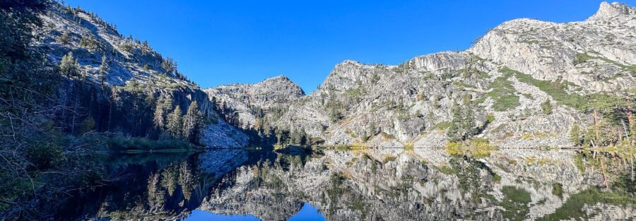
The Eagle Falls Trailhead on Highway 89 is one of the busiest in the Tahoe Basin, and for good reason. Two miles round trip through a forest of pine and fir, past Eagle Falls cascading down from the Desolation Wilderness, to Eagle Lake, a pristine alpine lake set in a granite bowl with views of the surrounding peaks. The lake is small and perfect. Cold water, clear granite bottom, reflected cliffs on all sides. You can be there and back in under two hours and still feel like you’ve been somewhere real. The Eagle Lake trail is the kind of compressed-payoff hike I use as a model for what short trails should do. The falls are on the way in, the lake is the destination, and the whole route is under a mile from the parking lot. From the same trailhead you can continue into Desolation Wilderness toward Velma Lakes and beyond if the day allows more. Eagle Lake works as a standalone or as a gateway.
Quick Facts
| Trail Name | Eagle Lake Trail via Eagle Falls Trailhead |
| Location | Desolation Wilderness, South Lake Tahoe, California |
| Coordinates | 38.9520, -120.1132 (Eagle Falls Trailhead) |
| Distance | 2 miles (out and back) |
| Elevation Gain | 400 ft |
| Difficulty | Moderate |
| Time | 1.5 hours |
| Dogs Allowed | Yes, on leash |
| Fee | Parking fee at Eagle Falls lot (verify current rate); Desolation Wilderness free day-use permit required, self-issue at trailhead |
| Plan This Hike on AllTrails | |
How to Get There
The Eagle Falls Trailhead is on Highway 89, about 9 miles north of South Lake Tahoe in the Emerald Bay corridor. Drive northwest from South Lake Tahoe on US-50 and turn north on Highway 89. Follow the lake’s western shore past Inspiration Point and Emerald Bay to the Eagle Falls parking area on the left. The lot is signed and easy to spot. From Tahoe City, follow Highway 89 south along the western shore until you reach the Eagle Falls area just north of Emerald Bay.
Parking Information
The Eagle Falls parking lot is a paid USDA Forest Service facility. Verify the current rate at the lot entrance before visiting. America the Beautiful and Tahoe Basin annual passes are accepted, display on your dashboard. The lot fills by 9 a.m. on summer weekends. Arrive before 8 a.m. or plan for limited highway shoulder parking. A free Desolation Wilderness day-use permit is required for hiking beyond the falls to Eagle Lake. Self-issue at the trailhead kiosk before starting. 
Cell Service and Navigation
Cell coverage drops along the Highway 89 canyon corridor near Emerald Bay. Download the AllTrails map before leaving South Lake Tahoe. The Eagle Lake Trail is well-marked from the Eagle Falls parking area and the route is clear throughout. The GPS track is useful for confirming the lake-side path when the trail surface becomes less defined on the granite around the lake shore.
What to Expect on Eagle Lake Trail
Eagle Falls
Eagle Falls appears within the first quarter mile, a multi-tiered cascade dropping through granite slabs visible from both the trail and the Highway 89 bridge over the creek. The falls are strongest in spring and early summer when snowmelt runs through the Eagle Creek drainage at peak volume. By late summer the flow drops significantly. The trail crosses above the main falls on a footbridge and continues up the drainage through the rocky forest section that follows. The falls are a strong photography stop on the way in and even better on the way back when you have more time and the light has shifted.
The Climb
Above the falls, the trail climbs steadily through mixed pine and fir forest on granite-dominant terrain. The surface shifts between packed dirt and exposed rock slabs. The grade is moderate and consistent without any single punishing pitch. Emerald Bay is visible through the trees looking south at certain points on the climb, the turquoise water briefly visible before the forest closes back in. The trail is well-worn and clear throughout, no route-finding challenges.
Eagle Lake
Eagle Lake arrives at the top of the climb, a compact alpine lake set in a granite bowl. The surrounding peaks reflect in the lake surface when the water is calm. The granite shoreline gives you access around most of the lake perimeter and several flat slabs make ideal rest spots with the lake below and the peaks above. The water stays cold year-round and the lake sits in the shallow end of the Desolation Wilderness elevation band. From Eagle Lake, trails continue deeper into the wilderness toward Velma Lakes and Dicks Pass for hikers looking for more. 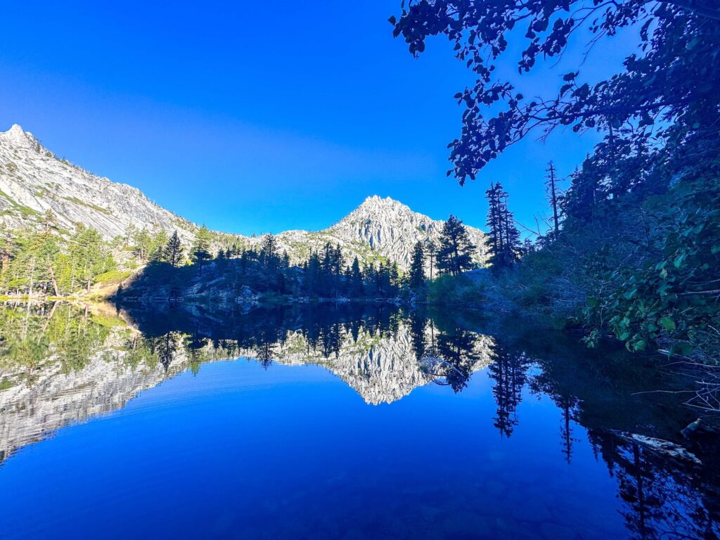
Trail Difficulty and Length
Eagle Lake Trail is 2 miles out and back with 400 feet of elevation gain. The moderate rating is accurate. The falls section in the first quarter mile is the most technically rocky section, requiring careful footing on wet granite near the cascade. The forest climb above is straightforward. Hiking shoes with grip handle the granite sections comfortably. The lake shore granite is often wet near the water edge, watch footing there. The round trip is manageable in 1 to 1.5 hours at a relaxed pace. Plenty of time to sit at the lake before returning.
Dog Friendly?
Dogs are allowed in Desolation Wilderness and on Eagle Lake Trail on leash. The falls section and granite lake shore are the two areas where dogs need more attention for slipping. Water is available at the lake for dogs, though filtering is recommended. Bring water from the trailhead regardless. No reliable water on the climb section. Pack out all waste. 
What to Bring
At least a liter of water per person. A water filter if you plan to refill at Eagle Lake. Sunscreen for the exposed lake shore and the Emerald Bay views on the descent. Trail shoes with grip for the granite sections near the falls and at the lake. A camera. The falls and the lake are both worth setting up for. The lake reflection at dawn or when the afternoon light catches the peaks above the granite bowl is the best photography moment.
Best Time to Hike Eagle Lake
Late spring (May through June) for Eagle Falls at peak flow. The snowmelt fills Eagle Creek and the falls are impressive and loud. Wildflowers along the trail approach their peak in this window as well. Summer is the most popular season and the most crowded. Start before 8 a.m. on weekends to beat the parking and the trail traffic. Fall is excellent, thinner crowds, cooler temperatures, and the Emerald Bay views through the trees on the descent taking on fall color. Check current snow conditions before late May or October visits when the upper trail can still have snow on the granite. The Desolation Wilderness day-use permit requires a trailhead start, no permit reservation needed.
Rules and Regulations
Eagle Lake Trail enters Desolation Wilderness, managed by the USDA Forest Service. A free day-use wilderness permit is required for all visitors. Self-issue at the trailhead kiosk. Overnight permits require advance reservation and a fee through recreation.gov. No campfires anywhere in Desolation Wilderness. Camping prohibited within 100 feet of Eagle Lake and all other lakes and streams. Dogs must be leashed at all times. Pack out all waste. Leave No Trace throughout. Bears are active in the Emerald Bay corridor, do not leave food in your vehicle at the trailhead.
Where to Stay Near South Lake Tahoe
South Lake Tahoe is about 9 miles from the Eagle Falls Trailhead with a full range of lodging. Marriott Bonvoy covers Lake Tahoe area properties. Hilton Honors has options in South Lake Tahoe. The Bayview Campground directly at the Desolation Wilderness trailhead 5 minutes south is the closest option to Eagle Falls for early-morning starts before the parking fills.
Camping Nearby
Bayview Campground on Highway 89 south of Eagle Falls Trailhead is the most convenient overnight option for early lake access. Camp Richardson on the South Shore is the broadest developed campground near South Lake Tahoe with tent and RV sites. Emerald Bay State Park has boat-in camping on the bay shore through ReserveCalifornia. For wilderness camping, overnight Desolation Wilderness permits allow camping at designated sites throughout the wilderness with the 100-foot lake setback and no-campfire rules in effect. Book overnight permits through recreation.gov well in advance for summer.
Nearby Adventures
The Cascade Falls Trail is 5 minutes south at Bayview Campground, 1.5 miles to a seasonal waterfall above Cascade Lake with views of Lake Tahoe. The Granite Lake and Maggie’s Peak hike also starts from Bayview Campground and continues into Desolation Wilderness at 4 miles and 1,800 feet of gain for the best high-elevation summit view. The Vikingsholm Trail at Emerald Bay State Park is 2.5 miles and 500 feet to a 1920s Scandinavian mansion and the bay shore, a short drive south. Eagle Falls itself, just below the trailhead bridge on Highway 89, is worth a stop at the picnic area viewpoint even if you’re not hiking. The Sand Harbor Clear Kayak Tour on the Nevada shore is about 35 minutes north, the best water experience near the South Lake Tahoe area.
Plan This Hike
AllTrails has Eagle Lake Trail documented with GPS track, current condition notes from recent hikers, and permit information. Download the offline map before leaving South Lake Tahoe. Pick up your Desolation Wilderness day-use permit at the trailhead kiosk before starting. Plan your hike on AllTrails here.
Chase the Quiet
Eagle Lake at 7:30 a.m. on a Tuesday in September. The surface still, the granite peaks reflected in the water, the falls audible somewhere below but far enough that the lake itself is quiet. Nobody else on the shore. Two miles from the parking lot. That’s the version of one of the most popular short hikes in the Tahoe Basin that almost no one gets. The trail opens at first light and the parking fills by 9. Get there first.
Support the Adventure
To make your walls less boring, check out my photography portfolio and bring a piece of the wild and my story into your home. If you’d like to fuel future adventures, you can donate a coffee on Ko-Fi. Every cup keeps me chasing sunrises and stories. When you shop using my affiliate links, every click helps support this blog at no extra cost to you. It’s a small way to keep Unicorn Adventure alive and kicking while I keep exploring. Subscribe to my mailing list for future updates, new stories, and behind-the-scenes adventures. Stay connected with me on Instagram and Facebook for more photos and daily inspiration. Thanks for being part of the journey, Unicorn Squadron!

Theo Maynard is a landscape photographer and adventure blogger based in Salt Lake City. He chases remote desert and mountain light across the American West, documents it all solo, and shares the journey through Unicorn Adventure. He’s on the autism spectrum, and that’s not a footnote, it’s the whole story. He creates to inspire others to get outside, chase what lights them up, and live their best possible life. Unapologetically himself.