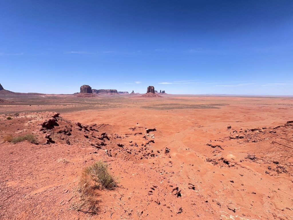
You’ve seen Monument Valley a thousand times before you ever get there. Every western. Every car commercial. Every desktop wallpaper from the early 2000s. But none of it prepares you for the real thing. The scale is absurd. Buttes the size of city blocks rise straight out of the desert floor, casting shadows that stretch for miles. The Monument Valley Scenic Drive puts you in the middle of all of it on a 13.4-mile dirt loop that feels less like a road and more like driving through a painting.
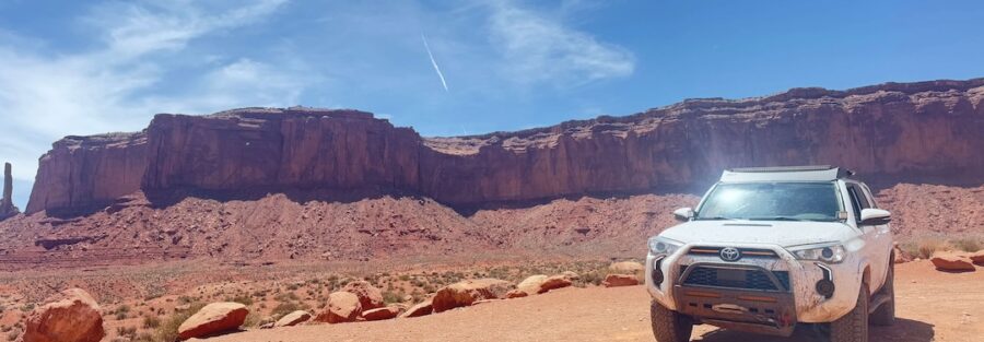
I drove this loop in Estes on a solo trip through the Navajo Nation. Windows down. No music. Just tires on dirt and silence between the formations. The Valley has a weight to it. A stillness that gets into your chest and stays there. I pulled over at John Ford’s Point, sat on the tailgate, and just watched the light move across the Mittens for twenty minutes. The place hit different. It wasn’t just beautiful. It was the kind of place that quiets everything down.
Quick Facts
Route | Monument Valley Scenic Drive |
Location | Monument Valley Navajo Tribal Park, Utah / Arizona border |
Coordinates | |
Distance | 13.4 miles (loop) |
Difficulty | Easy (rough dirt road, high clearance recommended) |
Time | 2 to 3 hours |
Dogs Allowed | Yes (leashed) |
Fee | $8 per person |
AllTrails |
How to Get There
Monument Valley Navajo Tribal Park sits on the Utah-Arizona border, about 25 minutes north of Kayenta, Arizona on US-163. From the highway, follow the signs to the park entrance. The road is paved and well-marked. If your GPS is being difficult, search for The View Hotel. It’ll drop you right at the visitor center.
From Bluff, Utah, head south on US-163 for about 45 miles. From Mexican Hat, it’s roughly 20 miles south. The approach from either direction is one of the most iconic stretches of highway in the country. That long, straight road with the buttes rising in the distance is real, and it looks even better in person.
Parking Information
The main parking area is at the visitor center, next to The View Hotel. It’s large and handles cars, trucks, RVs, and trailers. There’s a $8 per person entry fee payable at the gate. Kids under 5 are free.
Restrooms are available at the visitor center. There are no facilities along the scenic drive itself. Use the restroom before you start the loop.
Cell Service and Navigation
Cell service is spotty at best inside the park. You might get a weak signal near the visitor center, but once you drop into the valley floor, expect nothing. Download your maps, route, and any AllTrails data before you leave town.
The scenic drive is a marked, one-way loop with 11 numbered stops. You won’t get lost. But if you’re planning to connect to other routes after (Moki Dugway, Valley of the Gods, Goosenecks), have those directions saved offline.
What to Expect on the Monument Valley Scenic Drive
The Road
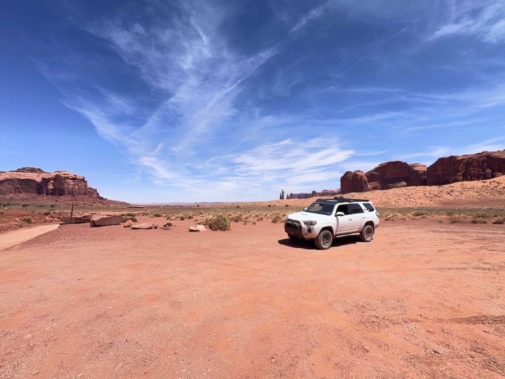
This is a rough dirt road. Not technical. Not dangerous. But rough. Deep ruts, loose gravel, washboard sections, and steep grades in a few spots. High-clearance vehicles are recommended. A 4Runner, Tacoma, Jeep, or any truck will handle it without issue. Sedans and low-clearance cars can struggle, especially on the steeper descents and after rain.
Take it slow. 10 to 15 mph on the rough sections. The road rewards patience. You’ll cover 13.4 miles on the loop and hit 11 marked viewpoints along the way. Plan 2 to 3 hours for the full drive, more if you’re stopping to shoot at every pullout. You will want to stop at every pullout.
The Formations
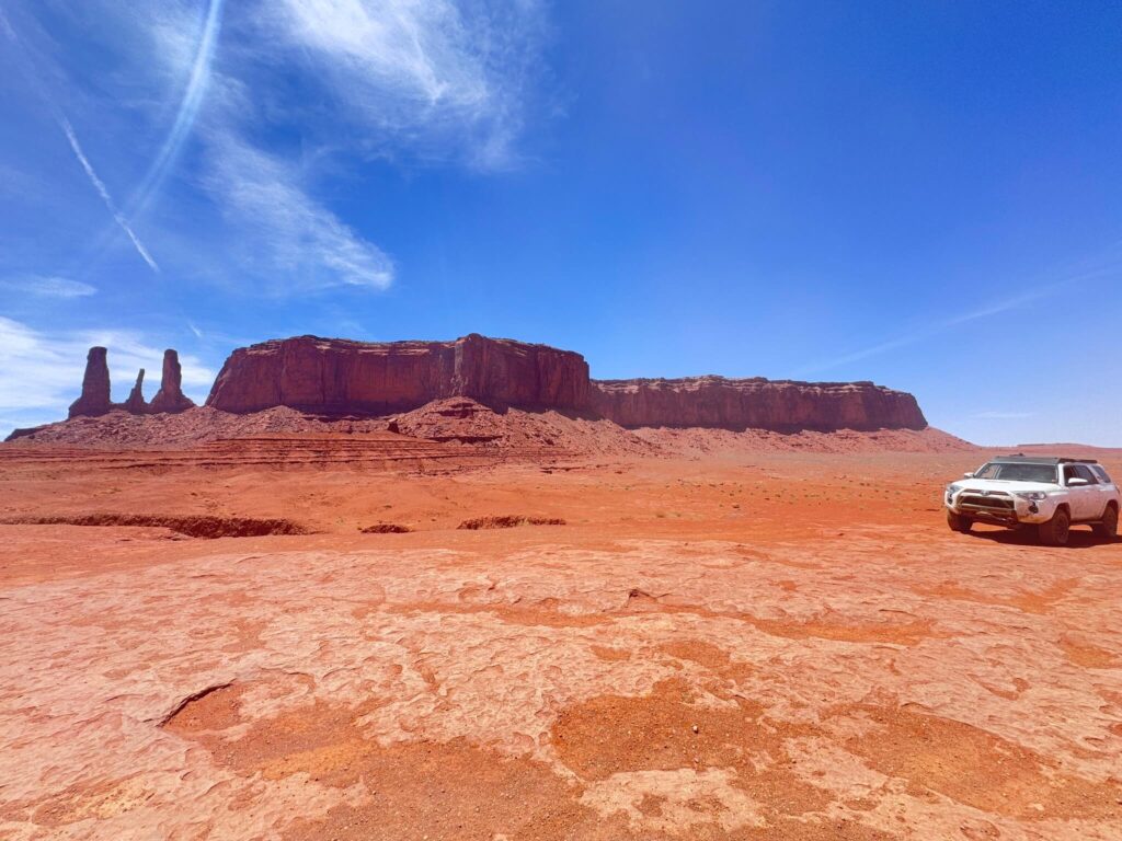
The Mittens are the headliners. West Mitten and East Mitten Butte frame the valley like gatekeepers. Merrick Butte stands opposite, equally massive. These three dominate the first stretch of the drive and set the tone for everything that follows.
John Ford’s Point is the most famous stop on the loop. Named for the director who filmed classic westerns here, the viewpoint offers a sweeping panorama of the valley floor with buttes stacked to the horizon. Navajo vendors sell jewelry and crafts here, and you can pay for a horseback photo op at the cliff edge.
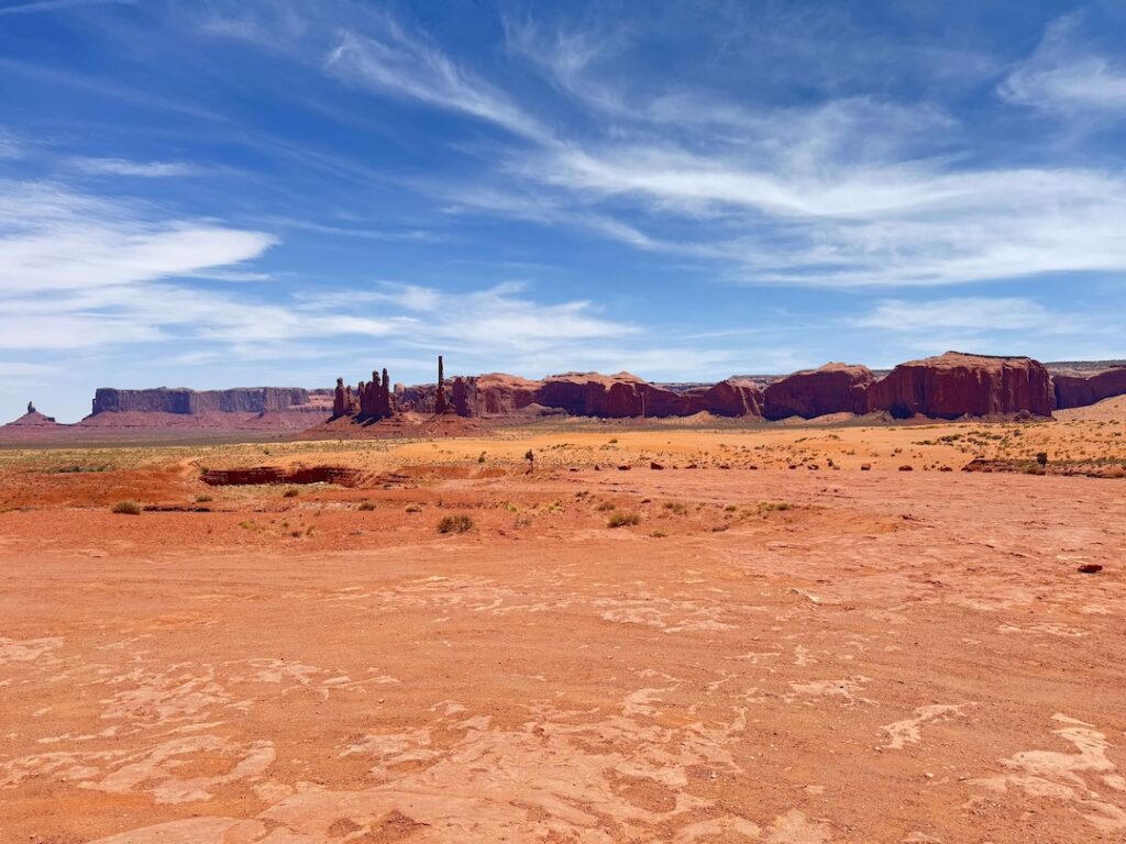
Artist’s Point gives you a wide, elevated perspective of the formations from a different angle. The Totem Pole and Yei Bi Chei are narrow, spire-like formations deeper in the valley. Each stop reveals a different composition. The landscape changes constantly depending on light, cloud cover, and time of day.
The Light
This is a photographer’s landscape. Sunrise casts a warm, soft glow across the east-facing formations. Sunset turns everything deep orange and red, with long shadows stretching across the valley floor. Midday light is harsh and flat. If you’re here for photos, plan your drive around golden hour.
I drove the loop in late morning and wished I’d started earlier. The formations are so massive that the light shifts constantly, and you’ll see things at 7 AM that vanish by 10. If you’re staying at The View Hotel, sunrise from the hotel terrace alone is worth the room.
Drive Difficulty and Length
The Monument Valley Scenic Drive covers 13.4 miles on a rough dirt loop road. It’s classified as easy, but the surface is uneven and demands attention. High-clearance vehicles are recommended. Four-wheel drive helps after rain but isn’t necessary in dry conditions.
The loop has 11 marked stops. Some require short walks from the pullout to the viewpoint. None are more than a few hundred feet. The steepest section is the initial descent from the visitor center into the valley. Take it slow and you’ll be fine.
Dog Friendly?
Yes. Dogs are allowed on the scenic drive and at the viewpoints but must be kept on a leash at all times. The desert floor gets extremely hot during the day. Don’t let your dog walk on bare sand or rock in the heat. Bring plenty of water. There are no water sources along the route.
What to Bring
Water. At least two liters per person, more in summer. The drive has no facilities, no shade, and no water. Bring snacks. A cooler in the truck is smart if you’re making a day of the area.
Camera gear is obvious. A telephoto lens (70-200mm or longer) lets you compress the buttes and isolate formations. A wide-angle captures the full sweep. A polarizing filter cuts haze and deepens the sky. Bring a lens cloth. Dust is constant.
Sunscreen, hat, sunglasses. Even from the car, the UV out here is intense. If you’re stopping at viewpoints (you will), you’re fully exposed.
Best Time to Drive Monument Valley Scenic Drive
Spring (March through May) and fall (September through November) are ideal. Temps in the 60s and 70s. Good light. Manageable crowds.
Summer is scorching. Highs regularly exceed 100°F. If you visit in summer, start the loop at sunrise. By midday the heat and the light are both working against you.
Winter brings cooler weather and fewer visitors. Snow on the buttes is rare but spectacular. Some sections of the road may be impassable after snow or heavy rain. Check conditions at the visitor center before heading out.
For photography, sunrise and sunset are non-negotiable. The golden light on red sandstone is the reason this valley is famous. Plan your drive around it.
Rules and Regulations
Monument Valley Navajo Tribal Park is located on Navajo Nation land. Respect the land, the culture, and the people.
Stay on designated roads. Do not drive off-road or wander into restricted areas. Climbing on the rock formations is prohibited. These are sacred sites.
Photography for personal use is encouraged. Drones are not allowed. Professional photography and commercial filming require special permits from the Navajo Nation Parks and Recreation.
Guided tours led by Navajo locals are available for backcountry areas not accessible by private vehicle. Mystery Valley, Hunts Mesa, and lower canyon routes are only reachable with a guide. If you want to go deeper, book a tour.
Where to Stay Near Monument Valley
The View Hotel sits right at the park entrance with rooms facing the valley. I stayed here. Waking up to that view is something else. It’s the only hotel inside the park and books up fast in peak season. Goulding’s Lodge, just outside the park on the Utah side, has rooms, a campground, and a small museum dedicated to John Wayne movies filmed in the valley. Good fallback if The View is full. Mexican Hat and Bluff to the north have motels and more dining options. Kayenta to the south has chain hotels and gas stations. For points travelers, check available Marriott Bonvoy properties, IHG Rewards hotels, and Hilton Honors options in the broader Four Corners area.
Camping Nearby
Muley Point is the move. Dispersed camping right on the rim overlooking the San Juan River, Monument Valley, and Valley of the Gods. No fee. No facilities. Just one of the best free campsites in the American West. It’s about 30 miles north of the park via US-163 and UT-261.
Valley of the Gods Road has dispersed pull-offs for camping along the 16.3-mile dirt loop. Free, no reservations. You wake up surrounded by sandstone towers with nobody else in sight.
The View Hotel campground and Goulding’s both offer sites with hookups if you want something more established.
Nearby Adventures
If you’re in Monument Valley, you’re at the hub of some of the best adventure in the Four Corners region.
The Wildcat Trail is the only self-guided hike in the park. It loops 3.9 miles around West Mitten Butte with 390 feet of gain. You get up close to the base of the formation in a way the drive can’t match. It’s flat, exposed, and best done early morning or late afternoon.
The Moki Dugway is about 30 miles north. A gravel switchback carved into a sheer cliff face that drops 1,100 feet. One of the most dramatic stretches of road in Utah.
Valley of the Gods is a 16.3-mile dirt loop that feels like a quieter, free version of Monument Valley. Smaller formations, more solitude, zero entrance fee.
Goosenecks State Park is a quick stop with one of the most photographed river bends in the state. Five minutes off UT-261.
House on Fire in Mule Canyon is one of the most photographed ruins in Utah. Easy 1.9-mile hike with 72 feet of gain. The fire effect on the sandstone is worth the drive.
Butler Wash Interpretive Trail is a 0.9-mile walk to ancient cliff dwellings in Bears Ears. Quick stop on the way to or from Natural Bridges.
The Natural Bridges Loop covers 8.1 miles with 1,082 feet of gain. Three massive natural bridges, canyon bottom solitude, and Ancestral Puebloan ruins. One of the best hikes in southern Utah.
For a cultural stop, Goulding’s Lodge museum covers the history of filmmaking in the valley. The Edge of the Cedars State Park Museum in Blanding is worth the drive if you’re heading north.
Plan This Drive
Ready to hit the road? Download the route map, check current conditions, and log your drive on AllTrails.
AllTrails gives you offline maps, GPS tracking, and real-time trail conditions. It’s the first app I open before every adventure.
Chase the Quiet
Monument Valley is one of those places that lives up to its own legend. Every angle has been photographed a million times, and somehow it still stops you cold when you see it for real. The buttes are bigger than your brain expects. The silence is heavier. The light does things to red sandstone that no screen can replicate.
I sat on Estes’ tailgate at John Ford’s Point and watched the shadows move. No agenda. No timeline. Just a man, a truck, and a valley that’s been here for 250 million years. That’s the kind of perspective I chase.
Support the Adventure
To make your walls less boring, check out my photography portfolio and bring a piece of the wild and my story into your home.
If you’d like to fuel future adventures, you can donate a coffee on Ko-Fi. Every cup keeps me chasing sunrises and stories.
When you shop using my affiliate links, every click helps support this blog at no extra cost to you. It’s a small way to keep Unicorn Adventure alive and kicking while I keep exploring.
Subscribe to my mailing list for future updates, new stories, and behind-the-scenes adventures.
Stay connected with me on Instagram and Facebook for more photos and daily inspiration.
Thanks for being part of the journey, Unicorn Squadron!

Theo Maynard is a landscape photographer and adventure blogger based in Salt Lake City. He chases remote desert and mountain light across the American West, documents it all solo, and shares the journey through Unicorn Adventure. He’s on the autism spectrum, and that’s not a footnote, it’s the whole story. He creates to inspire others to get outside, chase what lights them up, and live their best possible life. Unapologetically himself.