

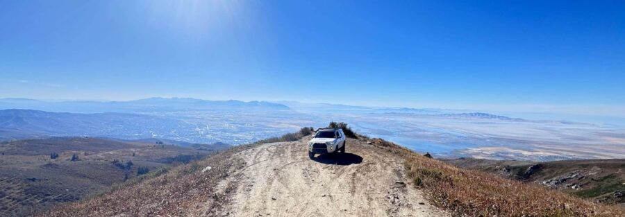
The Wasatch Skyline Drive OHV Trail runs along the crest of the mountains right above Farmington and Bountiful, and it might be the best backcountry drive this close to Salt Lake City. Twenty minutes from the freeway, you’re climbing through aspen and pine with the Great Salt Lake, Antelope Island, and the whole valley spread out below you.
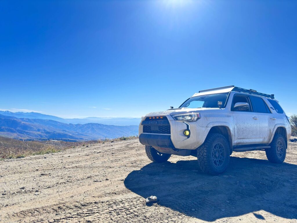
I drive this one in Estes, my 4Runner, whenever I need a quick escape without a long road trip. As an autistic guy, city noise and crowds wear me down fast. Skyline Drive fixes that in under an hour. Big views, cool air, and a dirt road that asks you to slow down and breathe.
Quick Facts
| Route | Wasatch Skyline Drive, Farmington Canyon to Bountiful |
| Location | Uinta-Wasatch-Cache National Forest, Davis County, Utah |
| Coordinates | Farmington start: 40.9970, -111.8834 Bountiful start: 40.8966, -111.8461 |
| Distance | About 24 miles (point to point) |
| Elevation Gain | About 4,700 feet |
| Difficulty | Easy (high clearance recommended) |
| Time | 3 to 5 hours |
| Dogs Allowed | Yes, on leash |
| Fee | Free |
| AllTrails | View on AllTrails |
How to Get There
From Salt Lake City, head north on I-15 and take the Farmington exit. Head east through town toward the mountains and follow signs for Farmington Canyon. The road starts climbing right away. That’s the smoother way up. For the Bountiful end, head to the Ward Canyon staging area on the east bench, below the big Bountiful “B” on the hillside. That approach runs rougher. Fill your tank in Farmington or Bountiful before you start.
Parking Information
On the Farmington side, you’ll find improved parking near Farmington Pond at the base of the canyon, handy if you’re unloading ATVs or UTVs. On the Bountiful side, the Ward Canyon staging area has a large lot. Along the route, pull-offs let you stop for views. Bountiful Peak Campground near the top has vault toilets. Bring your own water.
Cell Service and Navigation
Service is surprisingly decent for a mountain road, since you’re right above the Wasatch Front. You’ll find dead spots in the canyons and on the east side of the ridge. GPS works throughout. Download offline maps anyway, because several spur roads branch off, including the road to Francis Peak and the Parish Loop.
What to Expect on Skyline Drive
The Road
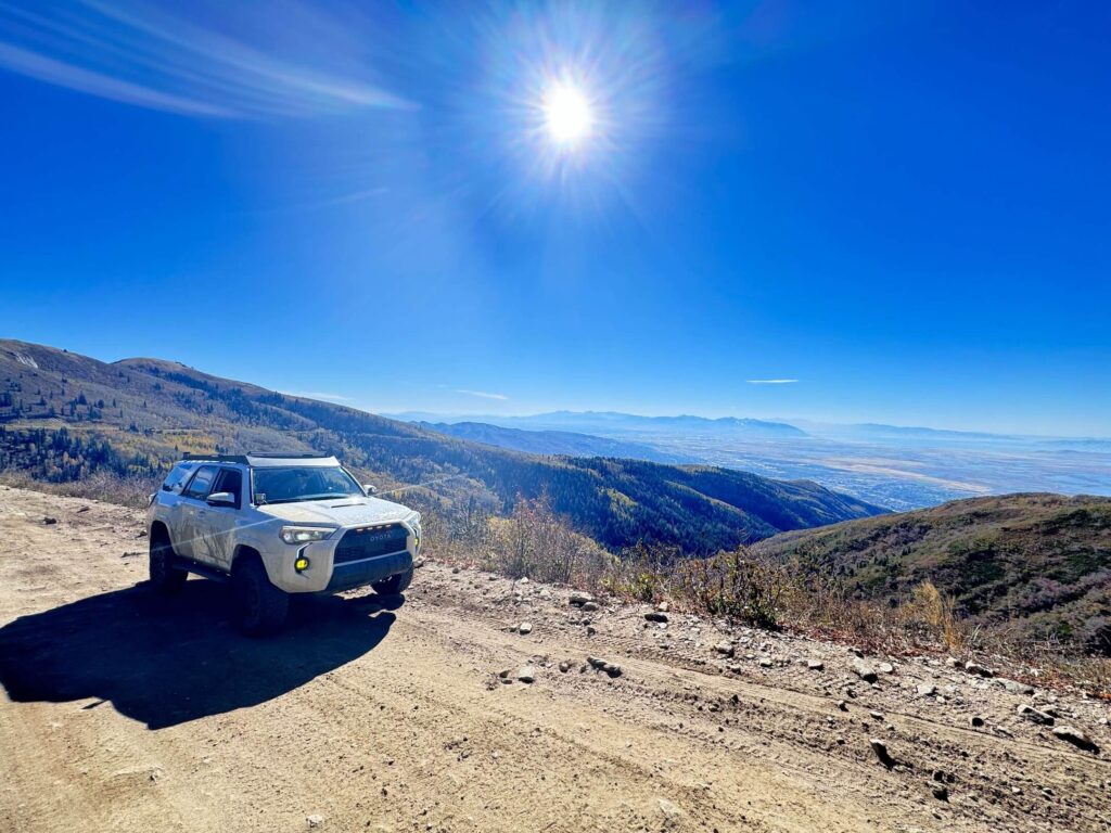
The Civilian Conservation Corps built this route, and it opened to the public in 1939. Today it’s a mostly graded dirt road with rocky patches, washboard, steep grades, and tight switchbacks. Farmington Canyon climbs on a smoother track. The Ward Canyon side gets rockier and rougher. High clearance helps, especially after rain when the dirt turns slick. Watch for mountain bikers and side-by-sides coming around blind corners.
The Views
Skyline Drive serves up views on both sides of the ridge. Look west and you’ll see the Great Salt Lake, Antelope Island, and the entire Wasatch Front. Look east and you’ll gaze down into Morgan Valley. Up high, you’ll roll through aspen groves, pine, and meadows full of wildflowers in early summer. Deer, moose, and hawks show up often.
Francis Peak and the Lakes
A spur road climbs north to Francis Peak at 9,547 feet, home to the big white FAA radar domes you can see from all over Davis County. North of the domes, the Smith Creek Lakes make a great picnic stop, and the third lake is worth the extra effort for a swim on a hot day.
The Light
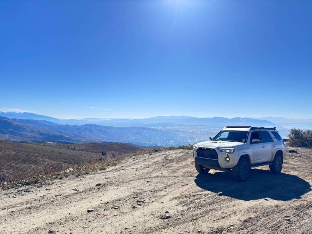
Sunset is the move here. The sun drops over the Great Salt Lake and lights up Antelope Island, and the valley lights flicker on below you. Just give yourself enough daylight to drive down safely. Morning light works great on the east side of the ridge looking into Morgan Valley.
Drive Difficulty and Length
The full route covers about 24 miles point to point with roughly 4,700 feet of elevation gain. It’s friendly as far as off-roading goes, but you’ll hit rocky patches, steep climbs, and some narrow sections with drop-offs. Most high-clearance vehicles handle it fine in dry weather. Short on time? Drive the first 10 to 15 miles up Farmington Canyon and back for a solid taste of the views.
Dog Friendly?
Yes. Dogs are welcome in the national forest. Keep them leashed around other vehicles, bikes, and wildlife. The Smith Creek Lakes make a nice spot for a pup to cool off. Bring plenty of water, clean up after them, and pack it out.
What to Bring
Pack water, snacks, sunscreen, and a jacket. The ridge runs much cooler than the valley and gets windy. Throw a swimsuit in the rig if you plan to hit the Smith Creek Lakes. For the vehicle, carry a spare tire, a tire repair kit, a portable air compressor, and basic recovery gear. A headlamp helps if you stay for sunset.
Best Time to Drive Skyline Drive
Plan your trip from late spring through early fall, roughly May through October, once the snow melts off the ridge. Early summer brings wildflowers. Late September and early October light up the aspens and maples in gold and red. Snow closes the high country in winter. For photos, go at sunset for golden light over the Great Salt Lake and Antelope Island.
Rules and Regulations
Skyline Drive runs through Uinta-Wasatch-Cache National Forest. Stay on designated roads and OHV routes. Off-route driving damages the mountainside and gets you a ticket. ATVs and UTVs need current Utah OHV registration. Pack out all trash. Parts of the route close seasonally for snow, so check conditions with the Salt Lake Ranger District before you go. Large groups or organized events may need a permit from the Forest Service.
Where to Stay Near Farmington
Salt Lake City sits just 20 minutes south with tons of lodging. The Hyatt Regency Salt Lake City brings modern rooms, mountain views, and a downtown location near City Creek. The Hilton Salt Lake City Center keeps you close to restaurants, shows, and the mountains. For more points options, check Marriott Bonvoy properties, IHG Rewards hotels, and Hilton Honors options around Salt Lake City, Farmington, and Layton.
Camping Nearby
Bountiful Peak Campground sits right along Skyline Drive near the top. It’s primitive, with vault toilets, picnic tables, and fire pits, plus cool nights and big views. Sunset Campground in lower Farmington Canyon offers another option closer to town. Both fill up on summer weekends. Check fire restrictions before you light anything.
Nearby Adventures
The Wasatch Front is packed with adventure. For more off-roading, the Inspiration Point OHV Route near Mantua climbs to one of the best viewpoints in northern Utah. Out on the Great Salt Lake, Antelope Island State Park offers bison, sunsets, and easy hikes like Buffalo Point, Lady Finger, and the bigger climb up Frary Peak. Up north in Ogden, hike Waterfall Canyon. Closer to Salt Lake, check out Ensign Peak for a quick city view, or browse my top waterfalls near Salt Lake City.
Back in Farmington, Lagoon Amusement Park brings rides and roller coasters for the whole crew. Station Park has plenty of dining and shopping for a post-trail meal.
Plan This Drive
Ready to go? Check current conditions, download the map, and log your trip on AllTrails before you leave.
AllTrails gives you offline maps, GPS tracking, and recent trip reports from other visitors. Several spur roads split off along the ridge, so an offline map helps you find Francis Peak, the Smith Creek Lakes, and the right way down.
Chase the Quiet
Skyline Drive proves you don’t need a long road trip to find quiet. Twenty minutes from the freeway, I was up above everything, watching the sun sink into the Great Salt Lake. The city hummed below. Up on the ridge, it was just me, Estes, and the wind.
That’s what I chase. That’s what Unicorn Adventure is about. Getting out there solo, finding the places that still feel wild, and bringing back stories that remind you the world is bigger than your screen.
To make your walls less boring, check out my photography portfolio and bring a piece of the wild into your home. If you’d like to fuel future adventures, you can donate a coffee on Ko-Fi. Every cup keeps me chasing sunrises and stories.
When you shop using my affiliate links, every click helps support this blog at no extra cost to you. It’s a small way to keep Unicorn Adventure alive and kicking while I keep exploring.
Subscribe to my mailing list for future updates, new stories, and behind-the-scenes adventures. Stay connected with me on Instagram and Facebook for more photos and daily inspiration.
Thanks for being part of the journey, Unicorn Squadron.
Theo Maynard is a landscape photographer and adventure blogger based in Salt Lake City. He chases remote desert and mountain light across America, documents it all solo, and shares the journey through Unicorn Adventure. He’s on the autism spectrum, and that’s not a footnote, it’s the whole story. He creates to inspire others to get outside, chase what lights them up, and live their best possible life. Unapologetically himself.

Theo Maynard is a landscape photographer and adventure blogger based in Salt Lake City. He chases remote desert and mountain light across the American West, documents it all solo, and shares the journey through Unicorn Adventure. He’s on the autism spectrum, and that’s not a footnote, it’s the whole story. He creates to inspire others to get outside, chase what lights them up, and live their best possible life. Unapologetically himself.