

Twin Falls sits above the Snake River Canyon in southern Idaho, and the canyon and its tributaries deliver a concentrated hiking catalog within a short drive radius. These ten trails cover the full range: easy canyon rim walks and short waterfall stops to moderate 4-mile canyon descents and the longest canyon rim hike in the region. Stats verified across the catalog.
Choosing the Right Hike
For the first-time Twin Falls visitor: Shoshone Falls (spring visit) plus the Snake River Canyon Rim Trail (any section). For the full canyon catalog: add Auger Falls Park Loop and Perrine Coulee Falls in a canyon floor and rim combination day. For the aquifer-fed spring experience: Box Canyon Springs Trail is the most immersive. For history and remoteness: Cauldron Linn in Jerome County is in a different category from the rest.
1. Shoshone Falls
| Trail | Shoshone Falls Observation Deck Trail |
| Distance | Less than 1 mile |
| Elevation Gain | ~150 feet |
| Difficulty | Easy |
| Dogs | Yes, on leash |
| Fee | $5 seasonal (Mar 1–Sep 30); $25 season pass |
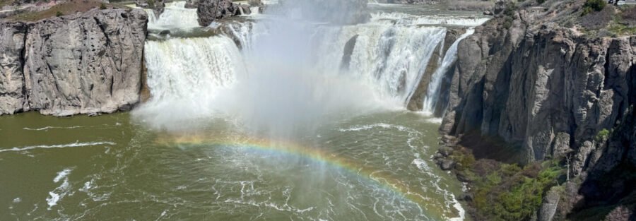
The ‘Niagara of the West’, 212 feet into the Snake River, taller than Niagara at peak spring flow. The observation deck walk is short and accessible; the falls are most dramatic from March through May when the Snake River is at full snowmelt volume. By late summer, irrigation draws reduce the flow significantly. Two companion trails in the same state park: Dierkes Lake Trail and Perrine Coulee Falls. Full Shoshone Falls guide 
2. Snake River Canyon Rim Trail
| Trail | Snake River Canyon Rim Trail |
| Distance | 12.3 miles one-way |
| Elevation Gain | 872 feet cumulative |
| Difficulty | Moderate |
| Dogs | Yes, on leash |
| Fee | Free |
Twin Falls’s long canyon rim trail runs from the Visitor Center area east through the Perrine Bridge / Centennial Waterfront Park section to Shoshone Falls. Paved in the urban Twin Falls sections, more rugged toward Shoshone Falls. Most visitors hike a 2-5 mile section rather than the full 12.3 miles. The Perrine Bridge section with 486-foot drops to the Snake River is the most dramatic. The Rim Trail and the Auger Falls Park Loop together give you both the canyon rim and the canyon floor. Full Snake River Canyon Rim Trail guide 
3. Auger Falls Park Loop
| Trail | Auger Falls Park Loop |
| Distance | 4.0 miles |
| Elevation Gain | 376 feet |
| Difficulty | Easy |
| Dogs | Yes, on leash |
| Fee | Free |
The canyon floor companion to the Rim Trail: drops into the Snake River Canyon via Canyon Springs Road and follows the river past basalt outcrops and the Auger Falls cascades. The canyon floor at Auger Falls Park is 500 feet below Twin Falls city level; the separation from the city is complete once you’re below the rim. Lush riparian zone, raptors on the canyon walls, moving water throughout the route. Full Auger Falls Park Loop guide 
4. Box Canyon Springs Trail
| Trail | Box Canyon Springs Trail |
| Distance | 4.3 miles |
| Elevation Gain | 396 feet |
| Difficulty | Moderate |
| Dogs | Yes, on leash |
| Fee | $7 or Idaho State Parks Passport |
The most immersive aquifer-fed spring trail in the Twin Falls catalog. The canyon descent reveals turquoise Snake River Plain aquifer water against dark basalt walls, one of the more visually striking combinations in southern Idaho. Swimming prohibited to preserve the aquifer water quality. The 396-foot gain is concentrated on the descent and return climb; the canyon floor is flat. Aquifer springs flow year-round at consistent volume. Full Box Canyon Springs Trail guide 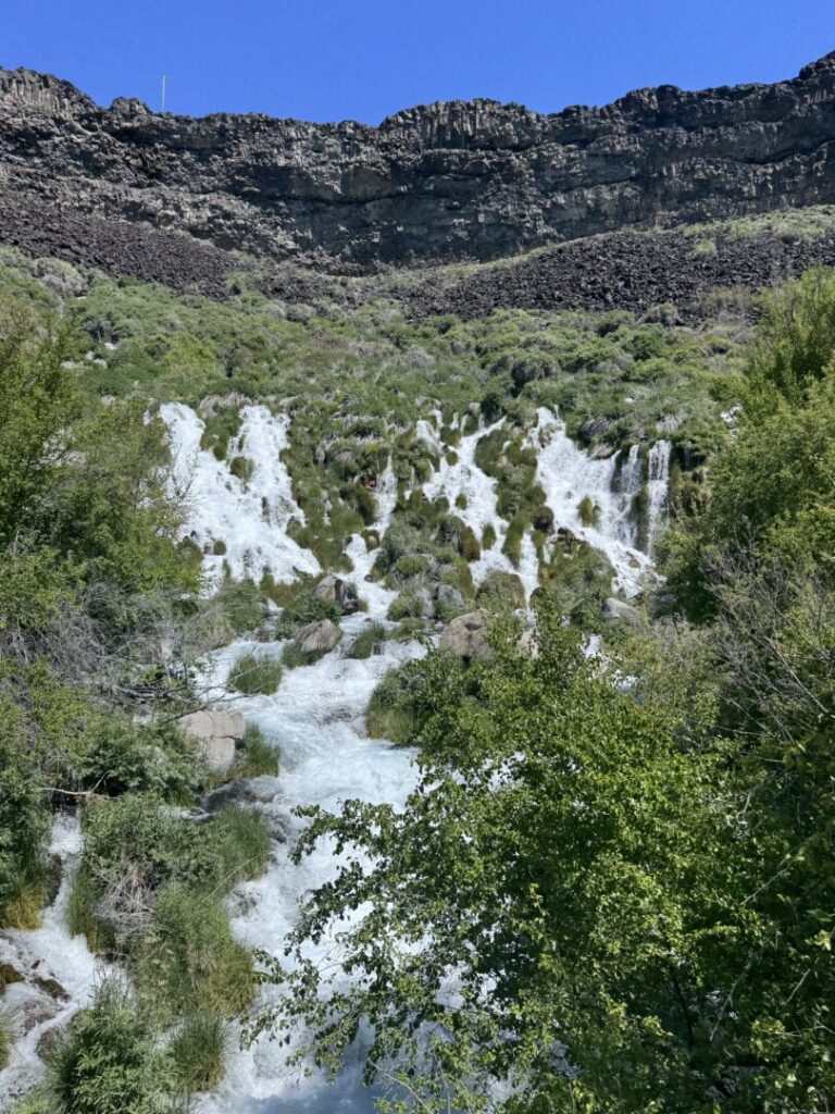
5. Malad Gorge West Rim Trail
| Trail | Malad Gorge West Rim Trail |
| Distance | 2.0 miles |
| Elevation Gain | 262 feet |
| Difficulty | Moderate |
| Dogs | Yes, on leash |
| Fee | $7 or Idaho State Parks Passport |
The Malad River cuts through a narrow basalt gorge at Malad Gorge State Park, with the dramatic Devil’s Washbowl waterfall visible from the West Rim overlooks. Most I-84 accessible of the Thousand Springs State Park units (Exit 147). The arid canyon-top and lush river-bottom contrast is the defining visual. Most dramatic in spring at high water. Full Malad Gorge West Rim Trail guide 
6. Ritter Island Loop
| Trail | Ritter Island Loop |
| Distance | 1.8 miles |
| Elevation Gain | 29 feet |
| Difficulty | Easy |
| Dogs | Yes, on leash |
| Fee | $7 or Idaho State Parks Passport |
A flat loop around Ritter Island in Thousand Springs State Park, past natural spring outflows, a waterfall, and historic early 20th-century farm structures. The moving water is constant and the vegetation is lush in contrast to the surrounding high desert. The Minnie Miller Springs access (0.5 miles) is on the same island and worth combining for a full Ritter Island visit. Full Ritter Island Loop guide 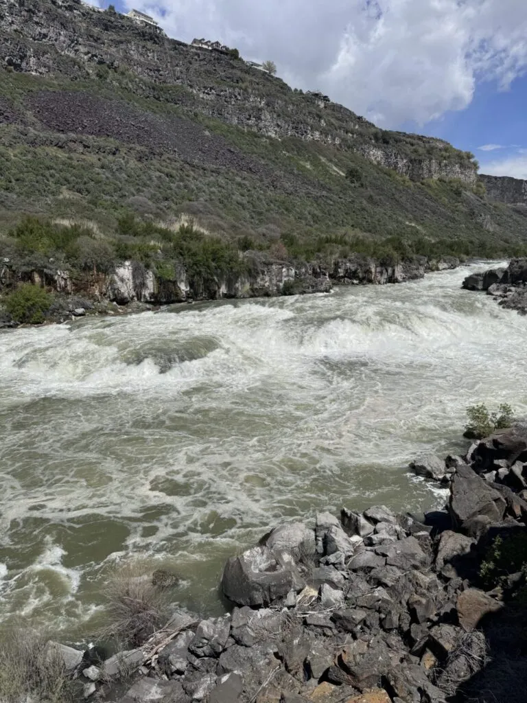
7. Niagara Springs
| Trail | Niagara Springs |
| Distance | Roadside viewpoint |
| Elevation Gain | Minimal |
| Difficulty | Easy |
| Dogs | Yes, on leash |
| Fee | $7 or Idaho State Parks Passport |
One of the most vivid examples of aquifer emergence in the Snake River Plain: powerful spring outflows from the canyon wall produce water in a striking blue-green color visible from the viewing area. Year-round flow at consistent volume, not snowmelt dependent. A polarizing filter dramatically enhances the color in photography. Most effective visited alongside Ritter Island and Lemmon Falls on the same Thousand Springs day. Full Niagara Springs guide 
8. Perrine Coulee Falls
| Trail | Perrine Coulee Falls |
| Distance | Less than 1 mile (GPS pending) |
| Elevation Gain | Less than 25 feet |
| Difficulty | Easy |
| Dogs | Yes, on leash |
| Fee | Free |
A 200-foot aquifer-fed waterfall near Centennial Waterfront Park that flows year-round regardless of the Snake River’s flow volume. The key distinction from Shoshone Falls: aquifer-fed means it doesn’t diminish in late summer when irrigation draws down the river. The consistent year-round flow makes this the reliable Twin Falls waterfall for fall and winter visits. Pairs naturally with a Shoshone Falls stop on the same day. Full Perrine Coulee Falls guide 
9. Lemmon Falls
| Trail | Lemmon Falls |
| Distance | ~1 mile roundtrip (GPS pending) |
| Elevation Gain | ~25 feet |
| Difficulty | Easy |
| Dogs | Yes, on leash |
| Fee | $7 or Idaho State Parks Passport |
Lemmon Falls is an aquifer-fed spring waterfall in Thousand Springs State Park on the US-30 corridor near Wendell. Short and easy with a year-round flow consistent with the rest of the Thousand Springs catalog. Full Lemmon Falls guide 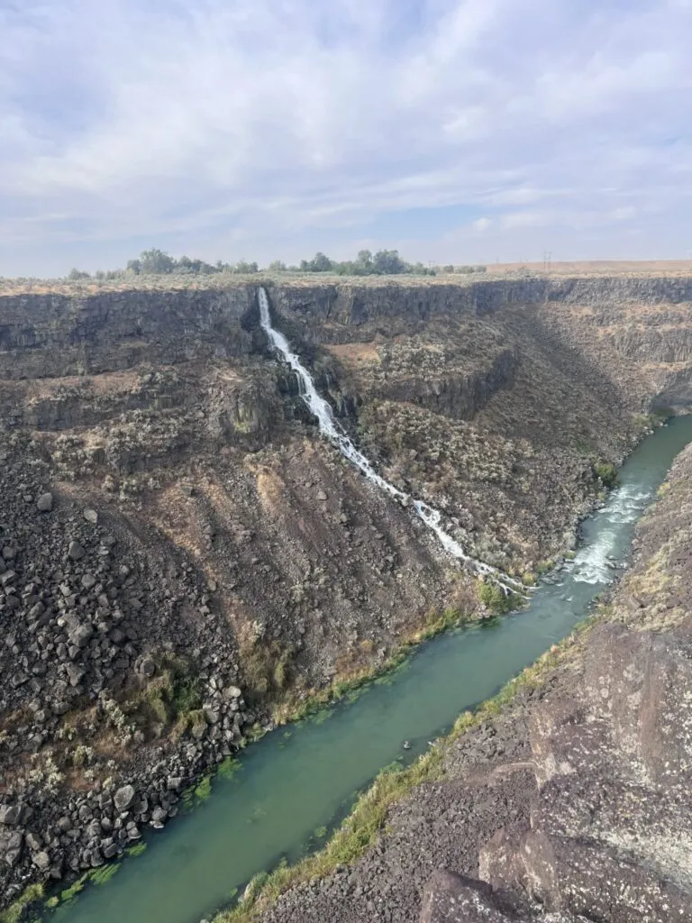
10. Cauldron Linn
| Trail | Cauldron Linn |
| Distance | Less than 1 mile (GPS pending) |
| Elevation Gain | ~25 feet |
| Difficulty | Easy |
| Dogs | Yes, on leash |
| Fee | Free |
The most remote and historically specific stop in the Twin Falls catalog. Cauldron Linn is a dramatic Snake River gorge in Jerome County where the river churns through a narrow basalt slot. The Wilson Price Hunt / Astorian Expedition reached this site in October 1811, recognized the falls couldn’t be navigated, and abandoned river travel, a pivotal moment in American exploration history. 30-40 miles east of Twin Falls on rural gravel roads. Worth the detour for the history alone. Full Cauldron Linn guide 
Honorable Mention: Dierkes Lake Trail
| Trail | Dierkes Lake Trail |
| Distance | ~2 miles (GPS pending) |
| Elevation Gain | ~200 feet |
| Difficulty | Moderate |
| Dogs | Yes, on leash |
| Fee | $5 seasonal (shared with Shoshone Falls) |
The canyon lake loop within the Shoshone Falls State Park system. Swimming permitted in designated areas, the only designated swimming lake in the Snake River Canyon. The basalt rock formations and canyon wall views give it more character than a simple lake loop. Pairs naturally with Shoshone Falls on the same park entry fee. Full Dierkes Lake Trail guide
Planning Your Twin Falls Hiking Day
For AllTrails planning and offline maps: Twin Falls hiking on AllTrails. Download offline maps before leaving cell coverage on the rural Thousand Springs roads.
Chase the Quiet
The Snake River Canyon cuts 500 feet through the Snake River Plain and then the landscape just continues flat on both sides as if nothing happened. The falls and the gorges and the springs are all consequences of that cut: the river at the bottom, the aquifer emerging at the walls, the basalt exposed in cross-section. Ten trails, all within 40 miles of each other, all reading a different page of the same geological story. That’s what Twin Falls gives you: a concentrated canyon country catalog accessible from a chain hotel in a city of 50,000 people. Bring the truck and use the time well.
Support the Adventure
To make your walls less boring, check out my photography portfolio and bring a piece of the wild and my story into your home. If you’d like to fuel future adventures, you can donate a coffee on Ko-Fi. Every cup keeps me chasing sunrises and stories. When you shop using my affiliate links, every click helps support this blog at no extra cost to you. It’s a small way to keep Unicorn Adventure alive and kicking while I keep exploring. Subscribe to my mailing list for future updates, new stories, and behind-the-scenes adventures. Stay connected with me on Instagram and Facebook for more photos and daily inspiration. Thanks for being part of the journey, Unicorn Squadron!

Theo Maynard is a landscape photographer and adventure blogger based in Salt Lake City. He chases remote desert and mountain light across the American West, documents it all solo, and shares the journey through Unicorn Adventure. He’s on the autism spectrum, and that’s not a footnote, it’s the whole story. He creates to inspire others to get outside, chase what lights them up, and live their best possible life. Unapologetically himself.