

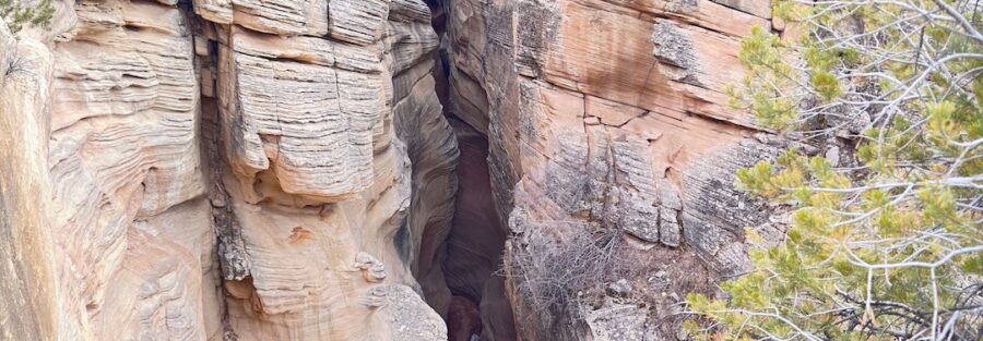
Skutumpah Road cuts through the quiet western edge of Grand Staircase-Escalante National Monument, far from the tour buses and crowded viewpoints. This dirt backroad near Cannonville strings together slot canyons, sagebrush flats, juniper hills, and sweeping views of the Grand Staircase cliffs. It’s the kind of drive where you might not see another rig for an hour.
I took Estes, my 4Runner, down Skutumpah with no real plan beyond stopping wherever looked good. That’s my favorite way to explore. As an autistic adventurer, open space and silence help me reset in a way nothing else does. Out here, the road does the talking, and the slot canyons do the rest.
Quick Facts
| Route | Skutumpah Road (BLM Road 500) |
| Location | Grand Staircase-Escalante National Monument, near Cannonville, Utah |
| Coordinates | 37.5310, -112.0499 |
| Distance | About 15 miles |
| Elevation Gain | About 2,000 feet |
| Difficulty | Easy (high clearance recommended, impassable when wet) |
| Time | 2 to 4 hours, plus hiking stops |
| Dogs Allowed | Yes, on leash |
| Fee | Free |
| AllTrails | View on AllTrails |
How to Get There
From Highway 12 in Cannonville, turn south onto Kodachrome Road. Drive about three miles and turn right onto Skutumpah Road, signed as BLM Road 500. The pavement ends and the dirt begins. Grab fuel and snacks in Tropic or Cannonville before you go. There’s nothing out here but road and rock. The full road keeps going south for more than 30 miles to Johnson Canyon Road near Kanab, so you can turn it into a one-way traverse if you want.
Parking Information
There’s no single trailhead for the drive itself. Small dirt lots sit at the Willis Creek, Bull Valley Gorge, and Lick Wash trailheads, and those make natural stopping points. Pull fully off the road anywhere else. No restrooms, no water, and no trash cans along the route. Pack it in and pack it out.
Cell Service and Navigation
Expect little to no signal once you leave Cannonville. Most of Skutumpah Road is a dead zone. GPS still works, so download offline maps before you head out. Signs at the main trailheads help, but side roads branch off in several spots, and you don’t want to guess out here.
What to Expect on Skutumpah Road
The Road
Skutumpah Road is graded dirt with rocky patches, washboard stretches, and a few short, steep grades where it dips in and out of drainages. In dry weather, it drives easy with high clearance. After rain, the clay turns into slick, sticky mud that can stop even a good 4×4 in its tracks. If storms roll through, wait it out.
The Slot Canyons
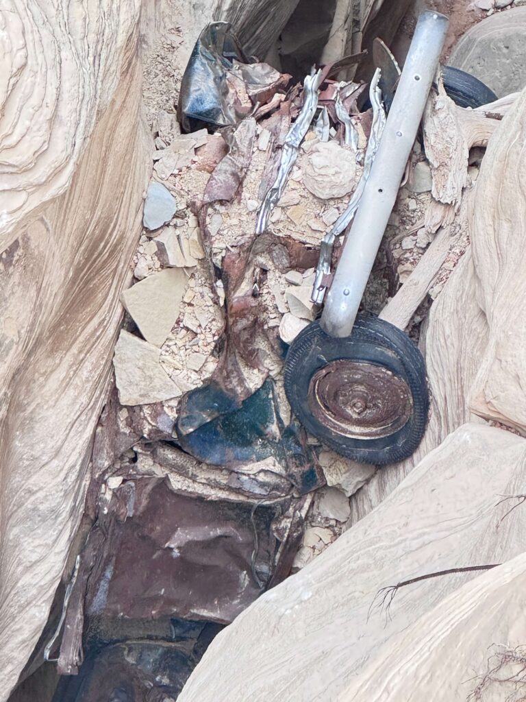
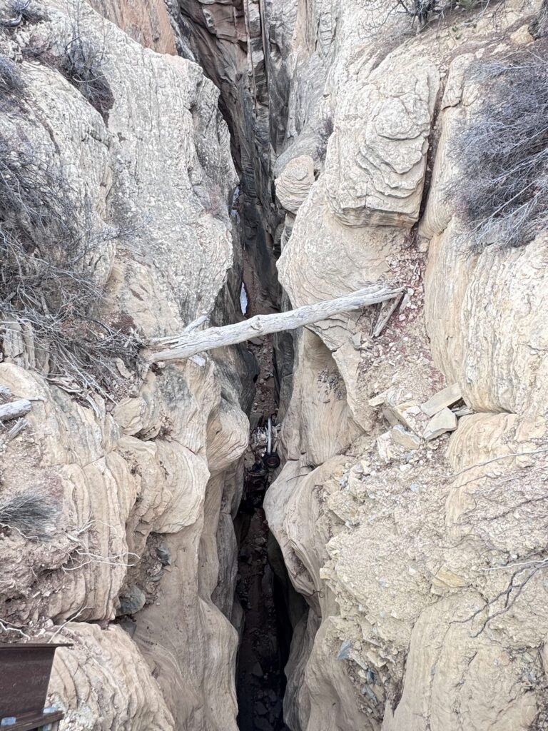
This road is a slot canyon buffet. Willis Creek Narrows comes first, a friendly walk through twisting sandstone walls with a shallow stream underfoot. My Destination Log clocks the full route at 5.8 miles with 1,227 feet of gain. Bull Valley Gorge is next, a deep, sheer crack in the earth spanned by a road bridge. Look down and you’ll spot a 1950s pickup still wedged between the walls. Farther south, Lick Wash offers a quieter, lesser-known slot with a peaceful canyon floor.
The Light
Morning and late afternoon paint the sagebrush flats and cliffs in warm tones. Inside the slots, midday actually works best. That’s when reflected light bounces off the walls and makes them glow orange and gold. Plan your hikes for the middle of the day and your driving for the golden hours.
Drive Difficulty and Length
Plan on about 15 miles of dirt with roughly 2,000 feet of elevation change along the way. The drive isn’t technical, but it’s not a casual cruise either. Uneven surfaces, loose gravel, and short steep grades keep you paying attention. High clearance helps. Four-wheel drive gives you insurance if conditions turn. Wet weather makes sections impassable, so always check the forecast first.
Dog Friendly?
Yes. Skutumpah Road and the slot canyons along it welcome dogs. Willis Creek makes a great pup-friendly hike. Keep dogs leashed, bring plenty of water, and watch the hot sand and rock in summer. Paws burn fast out here.
What to Bring
Bring plenty of water, snacks, sun protection, and sturdy shoes that can get wet for the slot canyons. A full-size spare tire matters on this road. So does a tire repair kit and a reliable air compressor. Toss in a shovel and traction boards in case you catch soft sand or mud. Check out my hiking safety gear list before you hit the slots.
Best Time to Drive Skutumpah Road
Spring and fall bring the best weather and the most comfortable hiking. Summer heat hits hard, and monsoon storms from July through September bring both mud and flash flood danger in the slots. Winter can deliver a gorgeous dusting of snow on red rock, but icy and muddy sections make the road tricky. For photography, shoot the cliffs and flats at sunrise or sunset, and save the slot canyons for midday glow.
Rules and Regulations
Skutumpah Road sits inside Grand Staircase-Escalante National Monument, managed by the BLM. Stay on the road and use designated parking areas. Don’t carve, chalk, or climb on sandstone walls. Pack out everything, including toilet paper. Never enter a slot canyon when rain threatens anywhere upstream. Flash floods can arrive under blue skies. Check fire restrictions and road conditions at the visitor center in Cannonville or Escalante before you go.
Where to Stay Near Cannonville
Tropic and Cannonville have small motels and cabins close to both Skutumpah Road and Bryce Canyon. In Escalante, Canyon Country Lodge brings spacious rooms, an indoor pool, and a solid on-site restaurant. I’ve stayed there and loved it. Entrada Escalante Lodge makes another great base. For a budget-friendly option, Circle D Motel keeps it simple and clean. If you’re tacking this onto a bigger road trip through St. George or Salt Lake, check Marriott Bonvoy properties, IHG Rewards hotels, and Hilton Honors options along the way. And grab a coffee at Kiva Koffeehouse on Highway 12. The view alone is worth the stop.
Camping Nearby
Kodachrome Basin State Park sits just a few miles away and offers developed campsites surrounded by wild sandstone chimneys. You’ll also find dispersed camping on BLM land throughout the monument. Stick to previously used sites and follow Leave No Trace. East of Escalante, some of my favorite spots include Spencer Flat, Cedar Point, and South Turkey.
Nearby Adventures
Kodachrome Basin State Park is right next door. Hike Angel’s Palace Trail for 1.5 miles and 223 feet of gain, or tackle the Panorama Trail Long Loop at 5.8 miles and 574 feet of gain. The Grand Parade Trail and Kodachrome Nature Trail make easy leg stretchers. Bryce Canyon sits just up the road. Try the Navajo Loop and Queen’s Garden at 3.0 miles, or go big on Wall Street, Queens Garden, and Peekaboo Loop at 6.3 miles. For more backroads, drive Hells Backbone or the Burr Trail. Craving more slots? Check out my favorite hikes near Escalante.
Off the trail, Tropic and Cannonville offer small-town diners and general stores for a hot meal and supplies. Stay after dark. The night skies here rank among the darkest in the country, and the Milky Way over the Grand Staircase will wreck you in the best way.
Plan This Drive
Ready to go? Check current conditions, download the map, and log your trip on AllTrails before you leave.
AllTrails gives you offline maps, GPS tracking, and recent trip reports from other visitors. With no signal on Skutumpah Road, that offline map helps you find each slot canyon trailhead without guessing.
Chase the Quiet
Skutumpah Road felt like a secret someone forgot to tell the rest of the world. Long miles of dust, then a crack in the earth opens up and swallows you into cool, curving stone. I left with sand in everything and a head that felt clear for the first time in weeks.
That’s what I chase. That’s what Unicorn Adventure is about. Getting out there solo, finding the places that still feel wild, and bringing back stories that remind you the world is bigger than your screen.
To make your walls less boring, check out my photography portfolio and bring a piece of the wild into your home. If you’d like to fuel future adventures, you can donate a coffee on Ko-Fi. Every cup keeps me chasing sunrises and stories.
When you shop using my affiliate links, every click helps support this blog at no extra cost to you. It’s a small way to keep Unicorn Adventure alive and kicking while I keep exploring.
Subscribe to my mailing list for future updates, new stories, and behind-the-scenes adventures. Stay connected with me on Instagram and Facebook for more photos and daily inspiration.
Thanks for being part of the journey, Unicorn Squadron.
Theo Maynard is a landscape photographer and adventure blogger based in Salt Lake City. He chases remote desert and mountain light across America, documents it all solo, and shares the journey through Unicorn Adventure. He’s on the autism spectrum, and that’s not a footnote, it’s the whole story. He creates to inspire others to get outside, chase what lights them up, and live their best possible life. Unapologetically himself.

Theo Maynard is a landscape photographer and adventure blogger based in Salt Lake City. He chases remote desert and mountain light across the American West, documents it all solo, and shares the journey through Unicorn Adventure. He’s on the autism spectrum, and that’s not a footnote, it’s the whole story. He creates to inspire others to get outside, chase what lights them up, and live their best possible life. Unapologetically himself.