

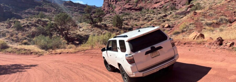
Onion Creek Trail might be the most fun you can have near Moab without white-knuckling a slickrock ledge. This off-road route follows Onion Creek up a narrow canyon of red, purple, and green rock, splashing through creek crossing after creek crossing on the way to Fisher Valley. It’s easy on your rig and huge on scenery.
I ran it in Estes, my 4Runner, and grinned the whole way up. As an autistic guy who needs space to decompress, I love a trail that keeps my hands busy and my brain quiet. Onion Creek does exactly that. Every bend opens a new wall of color, and every crossing throws a little water on the doors. Freedom never looked so muddy.
Quick Facts
| Route | Onion Creek Road to Fisher Valley |
| Location | Near Moab, Utah, off UT-128 |
| Coordinates | 38.7205, -109.3435 |
| Distance | About 20 miles (out and back) |
| Elevation Gain | About 2,000 feet |
| Difficulty | Easy to moderate (high clearance recommended, 4×4 for the upper climb) |
| Time | 2 to 5 hours |
| Dogs Allowed | Yes, on leash |
| Fee | Free |
| AllTrails | View on AllTrails |
How to Get There
From Moab, head north on US-191 for about two miles and turn right onto UT-128, the Upper Colorado River Scenic Byway. Follow the river east for roughly 20 miles. The canyon walls on this drive alone are worth the trip. Look for the Fisher Valley Ranch sign and turn right onto Onion Creek Road, about a mile before the Fisher Towers turnoff. The dirt starts right there.
Parking Information
You won’t find a formal trailhead lot. Most people air down near Upper Onion Creek Campground, about 0.7 miles off UT-128, then drive straight in. Pull-offs along the route let you stop for photos. Keep them short and stay off the vegetation. There’s a vault toilet at the campground, but no water anywhere on this route.
Cell Service and Navigation
Service fades fast along UT-128 once you leave Moab, and it drops out almost completely inside Onion Creek Canyon. GPS works fine, but don’t count on live maps. Download offline maps before you leave town. The main road stays easy to follow, but side spurs up top in Fisher Valley can send you the wrong way.
What to Expect on Onion Creek Trail
The Road
The route follows the creek bed through a tight canyon, crossing Onion Creek somewhere between 17 and 27 times depending on the season and who’s counting. Most crossings run shallow, just enough to splash. The surface mixes gravel, packed dirt, and rocky streambed. Near the top, the road climbs steadily out of the canyon toward Fisher Valley, and that’s where low range comes in handy. Watch for cows. The upper stretch runs through ranch land.
The Formations
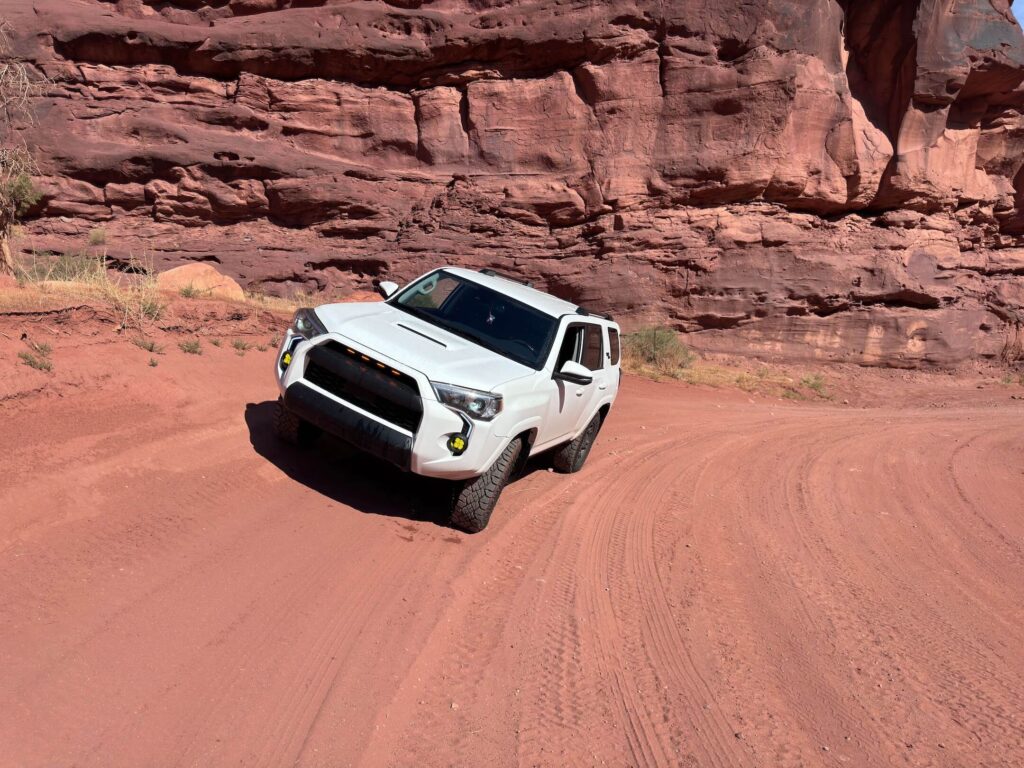
This is where Onion Creek shows off. The canyon walls stack up in bands of deep red, orange, purple, and even pale green. Hoodoos and fins stand along the rim. Keep an eye out for the looming spires of the Fisher Towers on the skyline, plus big views of the La Sal Mountains as you climb. The geology looks almost fake. It isn’t.
The Light
The canyon runs narrow, so direct sun only hits the walls for part of the day. Mid-morning lights up the east side and makes the reds glow. Late afternoon sets the upper canyon and the Fisher Towers on fire. Shoot the crossings with a low angle when the sun catches the water.
Drive Difficulty and Length
Plan on about 20 miles round trip with roughly 2,000 feet of elevation gain. Technically, this trail sits on the easy side. The creek crossings stay mellow in normal conditions, and the rocky spots don’t demand fancy lines. The upper climb gets steeper and looser, so high clearance matters and 4×4 makes life easier. Beginners do fine here in dry weather. After rain, everything changes. More on that below.
Dog Friendly?
Yes. Dogs are welcome on BLM land. Keep them leashed around other vehicles, cattle, and campers. Don’t let them drink from Onion Creek. The water carries heavy natural minerals and isn’t safe to drink for people or pets. Bring plenty of fresh water for your pup, especially in warm months.
What to Bring
Pack more water than you think you’ll need. There’s none out here you can use. Bring snacks or lunch, sun protection, and a light layer for the wind up top. For the vehicle, carry a tire repair kit, a solid air compressor to air back up, a shovel, and basic recovery gear. A towel for wet boots doesn’t hurt. And bring your camera. You’ll use it a lot.
Best Time to Drive Onion Creek Trail
Spring and fall win here. April through May and September through October bring mild temps and softer light. Spring can add wildflowers along the creek. Fall brings cooler air and fewer people. Summer heat often tops 100°F, and monsoon storms bring flash flood risk from July through September. For photography, plan your drive for mid-morning or late afternoon when the canyon walls light up.
Rules and Regulations
Onion Creek runs through BLM land managed by the Moab Field Office. Stay on the road. Driving off route damages fragile soil and plants that take decades to recover. Along the UT-128 corridor, camp only in designated campgrounds. Pack out all trash. Respect private property and gates near Fisher Valley Ranch, and leave gates the way you found them. Check fire restrictions before you go. Most importantly, check the weather. Onion Creek Canyon floods fast, and a sunny sky overhead means nothing if storms hit upstream. If rain threatens, skip it.
Where to Stay Near Moab
Moab has lodging for every style. My favorite spot near this trail is Red Cliffs Lodge, right on UT-128 along the Colorado River, just minutes from Onion Creek. In town, Hoodoo Moab, Curio Collection by Hilton brings a gorgeous pool and a walkable location near Main Street. Element Moab offers kitchenettes, free breakfast, and quick access to Arches. For points travelers, check Marriott Bonvoy properties, IHG Rewards hotels, and Hilton Honors options around Moab.
Camping Nearby
Upper Onion Creek Campground sits at the start of the trail, 0.7 miles off UT-128. It has 14 first-come, first-served sites at $20 per night, plus reservable group sites, vault toilets, and no water. The other BLM campgrounds along UT-128 fill fast in spring and fall, so arrive early. Closer to town, my go-to camping areas include Sand Flats, the Gemini Bridges area, and Porcupine Rim. Camp only in designated sites along the river corridor.
Nearby Adventures
Moab never runs out of trails. Right next door, the Fisher Towers Trail covers 4.1 miles with 1,469 feet of gain beneath some of the wildest spires in Utah. For more off-roading, try the Gemini Bridges OHV Trail, Long Canyon OHV Route, Hurrah Pass, or the Mineral Bottom OHV Route. Inside Arches, Eye of the Whale offers a sandy 4×4 adventure. Want to stretch your legs? Hike to Delicate Arch, Corona Arch, or Mill Creek Waterfall. My top hikes in Moab guide covers even more.
Off the trail, the Moab Museum digs into the area’s geology, history, and Indigenous heritage. The Colorado River offers rafting and paddleboarding right along UT-128. For food, grab a quick bite from Quesadilla Mobilia or refuel with a pie at Canyon Pizza. Downtown Moab has galleries and shops for a slow evening after a dusty day.
Plan This Drive
Ready to go? Check current conditions, download the map, and log your trip on AllTrails before you leave.
AllTrails gives you offline maps, GPS tracking, and recent trip reports from other visitors. Inside Onion Creek Canyon, with no signal, that offline map keeps you on track if you explore the side roads in Fisher Valley.
Chase the Quiet
Onion Creek reminded me that adventure doesn’t always need danger to feel alive. Splashing through those crossings, windows down, canyon walls glowing every color at once, I felt like a kid again. Easy trail. Big joy. Sometimes that’s the whole point.
That’s what I chase. That’s what Unicorn Adventure is about. Getting out there solo, finding the places that still feel wild, and bringing back stories that remind you the world is bigger than your screen.
To make your walls less boring, check out my photography portfolio and bring a piece of the wild into your home. If you’d like to fuel future adventures, you can donate a coffee on Ko-Fi. Every cup keeps me chasing sunrises and stories.
When you shop using my affiliate links, every click helps support this blog at no extra cost to you. It’s a small way to keep Unicorn Adventure alive and kicking while I keep exploring.
Subscribe to my mailing list for future updates, new stories, and behind-the-scenes adventures. Stay connected with me on Instagram and Facebook for more photos and daily inspiration.
Thanks for being part of the journey, Unicorn Squadron.
Theo Maynard is a landscape photographer and adventure blogger based in Salt Lake City. He chases remote desert and mountain light across America, documents it all solo, and shares the journey through Unicorn Adventure. He’s on the autism spectrum, and that’s not a footnote, it’s the whole story. He creates to inspire others to get outside, chase what lights them up, and live their best possible life. Unapologetically himself.

Theo Maynard is a landscape photographer and adventure blogger based in Salt Lake City. He chases remote desert and mountain light across the American West, documents it all solo, and shares the journey through Unicorn Adventure. He’s on the autism spectrum, and that’s not a footnote, it’s the whole story. He creates to inspire others to get outside, chase what lights them up, and live their best possible life. Unapologetically himself.