Sedona is not a single hike. It’s a full terrain library, easy canyon walks, technical mesa scrambles, cliffside ledge trails, and off-road routes that climb from red rock desert into ponderosa pine forest. The red rock formations change character every mile of AZ-89A and AZ-179. The crowds cluster at the famous spots and thin out fast once you go a quarter mile in any direction from the main trailheads.
Below is every Sedona trail guide on Unicorn Adventure, organized by type, with the quick stats you need to decide which one fits your day. Click through to the full guides for parking, navigation, affiliate links, and the whole story.
Sedona Hiking Trails
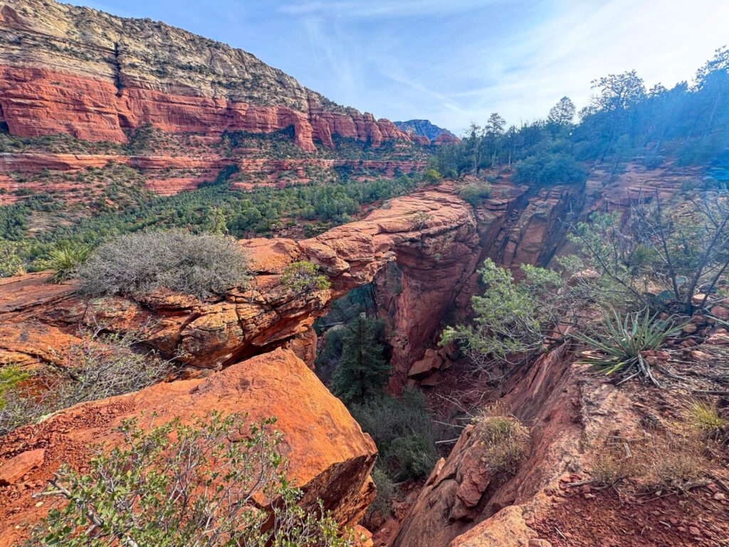
Devil’s Bridge Trail
3.9 miles, 521 ft gain. Moderate. The largest natural sandstone arch in Sedona, period. The approach along the Dry Creek Vista dirt road is easy walking, the final stone staircase to the arch is steep and exposed, and then you’re standing on a 54-foot sandstone bridge above a canyon with the whole Sedona basin in front of you. Get there before the Sedona Shuttle starts running on weekends or you’ll be sharing the arch with a crowd.
Full guide: Hiking Devil’s Bridge in Sedona.
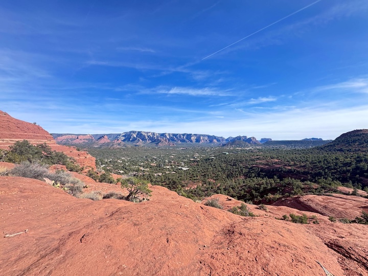
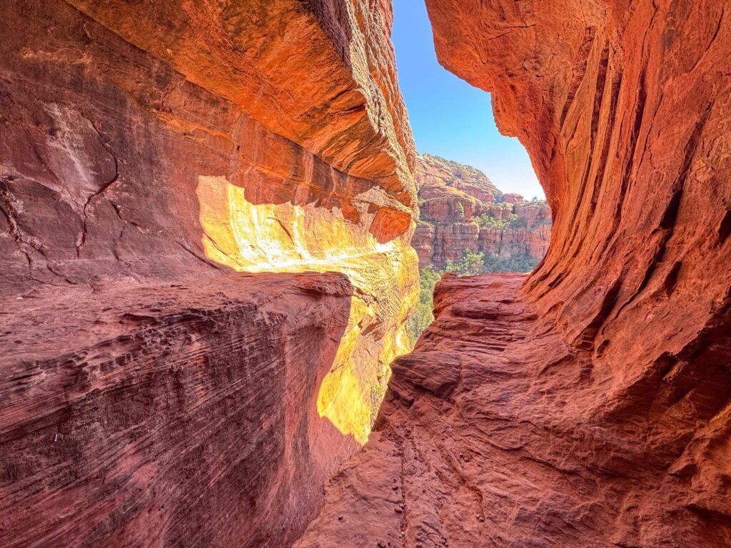
Boynton Canyon Trail
6.5 miles, 918 ft gain. Moderate. The full package: a vortex site, the Subway Cave (a natural alcove that earns its name), and ancient ruins at the canyon end that require a short but steep scramble to reach. The canyon walls build the whole way in and the forest canopy keeps it cooler than most exposed Sedona trails. One of the best full-day hikes in the area.
Full guide: Hiking Boynton Canyon in Sedona.
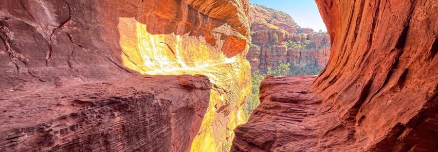
Munds Wagon, Cow Pies, and Hangover Loop
8.2 miles, 1,181 ft gain. Moderate to Strenuous. The most dramatic loop in Sedona’s trail system. The Munds Wagon Road section is historical and gradual. The Cow Pies plateau opens up a 360-degree view of the red rock basin. The Hangover Trail runs along a narrow ledge carved into the cliff face with the canyon dropping several hundred feet off your shoulder. Not for hikers with a serious fear of heights. The best views per mile of anything on this list.
Full guide: Hiking Munds Wagon, Cow Pies, and Hangover Loop.
Fay Canyon Trail
2.4 miles, 298 ft gain. Easy. Sedona’s best-kept short secret. Sits 200 yards from the Boynton Canyon Trailhead and has a fraction of the traffic. The canyon corridor is shaded, the walls are dramatic, and the hidden arch halfway in is easy to walk past if you’re not watching for it. Pairs well with Boynton Canyon or Doe Mountain for a full Boynton Pass Road day.
Full guide: Hiking Fay Canyon in Sedona.
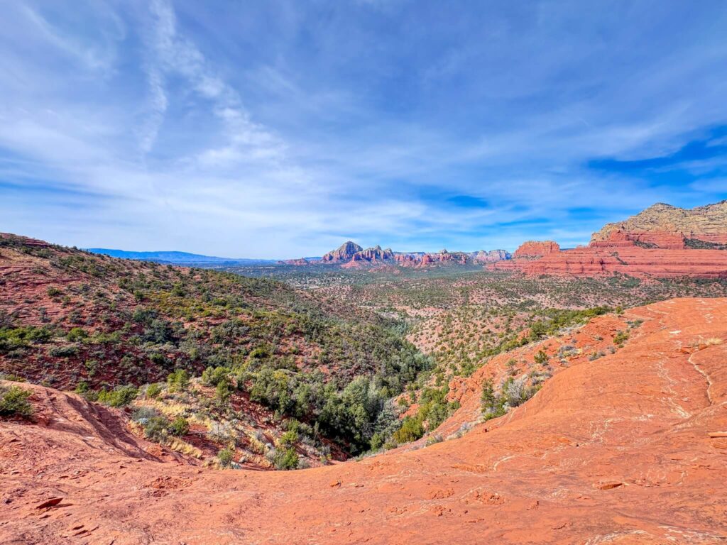
Doe Mountain Loop
2.4 miles, 620 ft gain. Moderate. Short but vertical. The switchbacks and cliff scramble near the top earn the elevation quickly, and then the mesa opens into a flat plateau with 360-degree views of the full Boynton Canyon corridor, Bear Mountain, and the Verde Valley. One of the best payoff-to-effort ratios in Sedona. Combine with Fay Canyon or Boynton Canyon for a solid day.
Full guide: Hiking Doe Mountain Loop in Sedona.
Teacup Trail to Coffeepot Rock
2.6 miles, 269 ft gain. Easy. A neighborhood trailhead north of Uptown Sedona with a relaxed desert walk to one of Sedona’s most recognizable landmarks. Coffeepot Rock earns its name from every angle on the approach. Minimal trail effort, strong photography payoff at golden hour when the sandstone goes full orange. The Sugarloaf Trailhead fills fast on weekends.
Full guide: Hiking Teacup Trail to Coffeepot Rock in Sedona.
Bell Rock Trail
0.8 miles, 203 ft gain (base loop). Easy to Moderate. Sedona’s most iconic vortex formation, visible from AZ-179 five miles south of town. The base loop circles the formation in under an hour. The real draw is the scramble up the sandstone face, no defined summit trail, you pick your line based on comfort and ability. The higher you go, the better the Verde Valley panorama. Sunrise on the east face is exceptional.
Full guide: Hiking Bell Rock Trail in Sedona.
Birthing Cave Trail
2 miles, 250 ft gain. Moderate. The trail’s main challenge is finding it: an unmarked spur off Long Canyon Trail that most hikers walk past. Once you find the junction and scramble up the steep red rock face, you step into a wide sandstone alcove that holds cultural significance for Native communities in the region. Arrive with that awareness. Quiet, low-traffic, worth finding.
Full guide: Hiking the Birthing Cave Trail in Sedona.
Raven Caves Trail
0.5 miles, 55 ft gain. Easy to Moderate. Half a mile off AZ-89A west of Sedona, accessed from an unmarked dirt pull-off that most people miss. The trail climbs quickly to a cluster of shallow sandstone alcoves with desert views from the cave openings. One of the shortest and most peaceful hikes in the Sedona area. Load the GPS coordinates before you drive out.
Full guide: Hiking Raven Caves Trail Near Sedona.
Sedona Off-Road and OHV Routes
Schnebly Hill Road OHV Route
~12 miles one way, ~2,600 ft gain. Moderate. The best off-road drive in the Sedona area. Forest Road 231 off AZ-179 climbs 2,600 feet from red rock canyon through juniper desert to the Mogollon Rim, with the Schnebly Hill Vista overlook providing the best vehicle-accessible panorama of the Verde Valley and Sedona’s red rock basin. High-clearance 4WD required. Closes in winter and gets muddy and serious after monsoon rain.
Full guide: Off-Roading Schnebly Hill Road in Sedona.
Broken Arrow OHV Route
~3.5 miles round trip, ~400 ft gain. Moderate to Difficult. Sedona’s most technical and most photogenic short OHV route. Submarine Rock, tight slickrock ledges, and Chicken Point, a broad sandstone overlook perched above the canyon with panoramic views of the red rock basin. Permit and access management applies. Check current status with Coconino National Forest before going. High-clearance 4WD or capable ATV/UTV required.
Full guide: Off-Roading Broken Arrow OHV Route in Sedona.
Edge of the World Drive (Coconino National Forest)
~55 miles round trip, ~3,400 ft gain. Moderate. Forest Road 231 out of Flagstaff climbs through dense ponderosa pine to the Mogollon Rim edge with unobstructed views of the Verde Valley and Sedona’s red rock formations on the horizon. No sign marks the destination. Download GPS coordinates before leaving Flagstaff. High-clearance required. Cell service drops out within the first mile.
Full guide: Off-Roading Edge of the World Drive Near Sedona.
Planning a Sedona Trip
Sedona parking fills fast at every major trailhead by 9 a.m. on weekends. The Sedona Shuttle runs Thursday through Sunday from multiple park-and-ride locations and reaches several popular trailheads including Devil’s Bridge. A Red Rock Pass ($5/day or $15/week) is required at most Coconino National Forest trailhead parking areas. The America the Beautiful Annual Pass covers it at no additional cost. Download offline maps for every trail before you leave, cell service is inconsistent on most routes once you leave the main corridors.
Spring (March through April) and fall (October through November) are the best hiking seasons. Summer works with early starts before 8 a.m. Winter is quiet and clear most years, with occasional icy conditions on exposed rock scrambles. The off-road routes, especially Schnebly Hill and Broken Arrow, become significantly more demanding after rain.
Chase the Quiet
Sedona’s most crowded trailheads and its most remote pull-offs are sometimes within a mile of each other. Devil’s Bridge and Fay Canyon share a corridor on Boynton Pass Road. Munds Wagon and Schnebly Hill Road start from the same dirt road. The difference between a crowded Sedona experience and a quiet one is often just knowing where to look and what time to show up. That’s what this collection is for.
Support the Adventure
To make your walls less boring, check out my photography portfolio and bring a piece of the wild and my story into your home.
If you’d like to fuel future adventures, you can donate a coffee on Ko-Fi. Every cup keeps me chasing sunrises and stories.
When you shop using my affiliate links, every click helps support this blog at no extra cost to you. It’s a small way to keep Unicorn Adventure alive and kicking while I keep exploring.
Subscribe to my mailing list for future updates, new stories, and behind-the-scenes adventures.
Stay connected with me on Instagram and Facebook for more photos and daily inspiration.
Thanks for being part of the journey, Unicorn Squadron!

Theo Maynard is a landscape photographer and adventure blogger based in Salt Lake City. He chases remote desert and mountain light across the American West, documents it all solo, and shares the journey through Unicorn Adventure. He’s on the autism spectrum, and that’s not a footnote, it’s the whole story. He creates to inspire others to get outside, chase what lights them up, and live their best possible life. Unapologetically himself.