

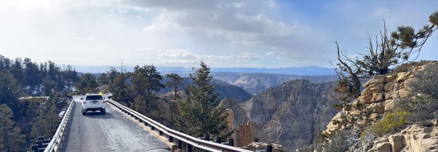
Hells Backbone Trail climbs out of Escalante into Dixie National Forest and delivers one of the most jaw-dropping backroads in Utah. Pine forest, aspen groves, high plateaus, and then the main event: a narrow bridge perched on a razor-thin ridge with a sheer drop into Box-Death Hollow on both sides. Your stomach will notice.
I drove it in Estes, my 4Runner, and stopped more times than I can count. I’m autistic, and I process the world best in wide-open, quiet places. Hells Backbone gives you plenty of both. Hours of dirt, cool mountain air, and views that make every worry feel tiny. This one sticks with you.
Quick Facts
| Route | Hells Backbone Road (Forest Road 153) |
| Location | Dixie National Forest, near Escalante, Utah |
| Coordinates | 37.9254, -111.6721 |
| Distance | About 25 miles |
| Elevation Gain | About 3,000 feet |
| Difficulty | Easy to moderate (high clearance recommended) |
| Time | 2 to 4 hours one way |
| Dogs Allowed | Yes, on leash |
| Fee | Free |
| AllTrails | View on AllTrails |
How to Get There
From Highway 12 in Escalante, head north on Pine Creek Road. The pavement soon gives way to dirt as the road climbs into Dixie National Forest and becomes Hells Backbone Road, Forest Road 153. The road eventually curves east and drops down to Highway 12 in Boulder. Drive it as a one-way traverse, or loop back to Escalante on Highway 12 across the Hogback for one of the best days of driving in the state. Fill your tank in Escalante first.
Parking Information
You won’t need a trailhead. Pull-offs along the road let you stop for photos, and there’s room to park safely on either side of the Hells Backbone Bridge. Don’t stop on the bridge itself. Posey Lake makes a great spot to park and stretch your legs with a picnic area near the water. Vault toilets exist at the forest campgrounds, but plan to bring your own water.
Cell Service and Navigation
Service disappears shortly after you leave Escalante and stays gone until you reach Boulder. GPS works fine, but live maps won’t load. Download offline maps before you go. Several forest roads branch off FR 153, especially around Posey Lake, so offline navigation keeps you on the right track.
What to Expect on Hells Backbone Trail
The Road
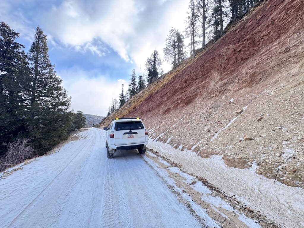
Hells Backbone Road is graded dirt with rocky stretches, washboard, steep grades, and tight switchbacks. The Forest Service keeps it in decent shape, but conditions change with weather. Most sections drive fine with high clearance. The narrow spots near the bridge demand patience and courtesy when you meet oncoming traffic. Take your time. The views reward slow driving anyway.
The Bridge
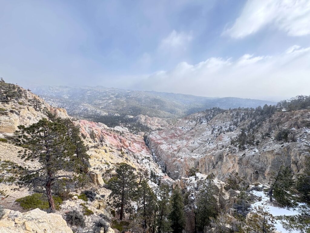
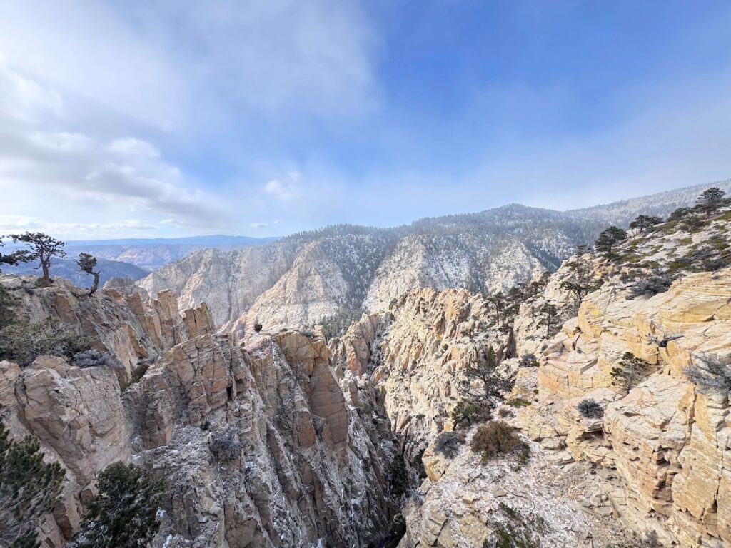
The Hells Backbone Bridge is the crown jewel. It spans a gap in a narrow ridge, with Box-Death Hollow and Sand Creek canyons dropping away on either side, roughly 1,000 feet down. The Civilian Conservation Corps built the original route and bridge in the 1930s, and today a sturdier modern bridge carries the road. Park nearby, walk out to the edges, and look down. Thrilling and terrifying in equal measure.
The Forest and the Views
Beyond the bridge, the route rolls through ponderosa pine, thick aspen groves, and open high desert plateaus. Posey Lake adds a calm, glassy stop in the trees. As you drop toward Boulder, the views open up across layers of red, orange, and white slickrock stretching toward Capitol Reef. It’s a full-course meal of Utah landscapes in one drive.
The Light
Late afternoon throws warm light and long shadows into Box-Death Hollow, making the canyons below the bridge look impossibly deep. Morning light glows through the aspens up high. Fall turns the whole forest gold. If you can time it right, catch sunset from the ridges near the bridge.
Drive Difficulty and Length
Plan on about 25 miles of dirt with roughly 3,000 feet of elevation gain. The rating sits at easy to moderate. You’ll deal with steep inclines, tight switchbacks, rocky stretches, and a long drop-off next to the road in spots. Experienced drivers won’t break a sweat. Beginners might feel nervous near the bridge and the exposed ridges, but careful driving handles it. High clearance helps. After rain or snow, conditions get sketchy fast.
Dog Friendly?
Yes. Dogs are welcome in Dixie National Forest. Keep them leashed at stops, especially near the bridge and its big drop-offs. Bring plenty of water and give them breaks to sniff around at Posey Lake or the pull-offs. Pups who handle bumpy car rides will love this one.
What to Bring
Pack water, snacks or lunch, and layers. Temperatures up top run much cooler than in Escalante, and afternoon storms build quickly in summer. Sunscreen and sunglasses matter at altitude. For the vehicle, carry a full-size spare, a tire repair kit, a good air compressor, and basic recovery gear. A camping fridge keeps lunch cold for a picnic at Posey Lake.
Best Time to Drive Hells Backbone Trail
The road typically opens from early summer into fall, once the snow melts off the high country. Late September and early October win for photography, when the aspens turn gold against the red rock. Summer works well too, since elevation keeps it cooler than the desert below. Start early to beat afternoon thunderstorms. Winter snow closes the road. Always check conditions with the Escalante Ranger District before you go.
Rules and Regulations
Hells Backbone Road runs through Dixie National Forest and borders the Box-Death Hollow Wilderness. Stay on the road. Motor vehicles aren’t allowed in the wilderness area. Don’t park on the bridge, and keep photo stops short near narrow sections. Pack out everything, check fire restrictions before building a campfire, and camp only in established campgrounds or previously used dispersed sites.
Where to Stay Near Escalante
Escalante makes a perfect basecamp. Canyon Country Lodge offers spacious rooms, an indoor pool, and a solid restaurant. I’ve stayed there and loved it. Entrada Escalante Lodge makes another great pick. For a budget option, Circle D Motel keeps it simple and clean. Boulder, at the other end of the road, has a few small lodges too. Chain hotels are scarce this deep in the backcountry, so if you’re stopping in St. George or Salt Lake on the way, check Marriott Bonvoy properties, IHG Rewards hotels, and Hilton Honors options there.
Camping Nearby
Posey Lake Campground and Blue Spring Campground sit right along the route in Dixie National Forest, with cool nights and pine forest all around. Dispersed camping is available on forest land too. Down in the desert east of Escalante, some of my favorite spots include Spencer Flat, Cedar Point, and South Turkey. Stick to previously used sites and follow fire restrictions.
Nearby Adventures
Escalante is loaded with things to do. For more backroads, drive the Burr Trail out of Boulder, Skutumpah Road near Cannonville, or Smoky Mountain Road. For hikes, Lower Calf Creek Falls covers 6.1 miles with 531 feet of gain to a stunning waterfall. Upper Calf Creek Falls packs 557 feet of gain into just 2.0 miles. The Escalante Natural Bridge runs 4.4 miles with 291 feet of gain along the river. Slot lovers should hit Zebra and Tunnel Slots at 6.6 miles. For something wild, try the Cosmic Ashtray at 7.6 miles or the Golden Cathedral at 9.1 miles. Quick and easy? Devils Garden takes just minutes.
Off the trail, stop by the Grand Staircase-Escalante visitor center in Escalante to learn the region’s geology and history. In Boulder, the Anasazi State Park Museum shows off an ancient village site. Grab a meal at Hell’s Backbone Grill in Boulder, or a coffee with a view at Kiva Koffeehouse on Highway 12. At night, the dark skies here put on a show.
Plan This Drive
Ready to go? Check current conditions, download the map, and log your trip on AllTrails before you leave.
AllTrails gives you offline maps, GPS tracking, and recent trip reports from other visitors. With zero signal between Escalante and Boulder, that offline map keeps you from taking the wrong forest road near Posey Lake.
Chase the Quiet
Standing on the Hells Backbone Bridge, looking down a thousand feet on both sides, I felt small in the best way. My brain usually runs a hundred miles an hour. Up there, it just stopped. Only the wind, the drop, and the ridge holding me up. That moment made the whole drive.
That’s what I chase. That’s what Unicorn Adventure is about. Getting out there solo, finding the places that still feel wild, and bringing back stories that remind you the world is bigger than your screen.
To make your walls less boring, check out my photography portfolio and bring a piece of the wild into your home. If you’d like to fuel future adventures, you can donate a coffee on Ko-Fi. Every cup keeps me chasing sunrises and stories.
When you shop using my affiliate links, every click helps support this blog at no extra cost to you. It’s a small way to keep Unicorn Adventure alive and kicking while I keep exploring.
Subscribe to my mailing list for future updates, new stories, and behind-the-scenes adventures. Stay connected with me on Instagram and Facebook for more photos and daily inspiration.
Thanks for being part of the journey, Unicorn Squadron.
Theo Maynard is a landscape photographer and adventure blogger based in Salt Lake City. He chases remote desert and mountain light across America, documents it all solo, and shares the journey through Unicorn Adventure. He’s on the autism spectrum, and that’s not a footnote, it’s the whole story. He creates to inspire others to get outside, chase what lights them up, and live their best possible life. Unapologetically himself.

Theo Maynard is a landscape photographer and adventure blogger based in Salt Lake City. He chases remote desert and mountain light across the American West, documents it all solo, and shares the journey through Unicorn Adventure. He’s on the autism spectrum, and that’s not a footnote, it’s the whole story. He creates to inspire others to get outside, chase what lights them up, and live their best possible life. Unapologetically himself.